Auchmuty

Settlement in Fife

Scotland

Auchmuty

Beaufort Drive, Glenrothes
Beaufort Drive, Glenrothes Credit: Steven Brown

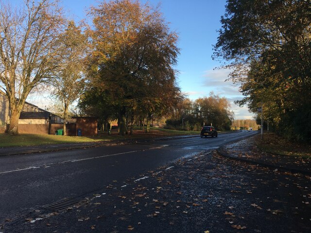
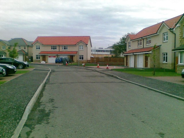
Auchmuty is a small village located in the Kingdom of Fife, Scotland. Situated approximately 3 miles west of Glenrothes town center, Auchmuty is part of the larger Glenrothes area. The village is bordered by the A92 road to the east, which provides easy access to nearby towns and cities.

Auchmuty is a primarily residential area, with a mix of housing types including detached houses, semi-detached houses, and some apartment buildings. The village offers a peaceful and quiet atmosphere, making it an attractive place for families and individuals looking for a suburban lifestyle.

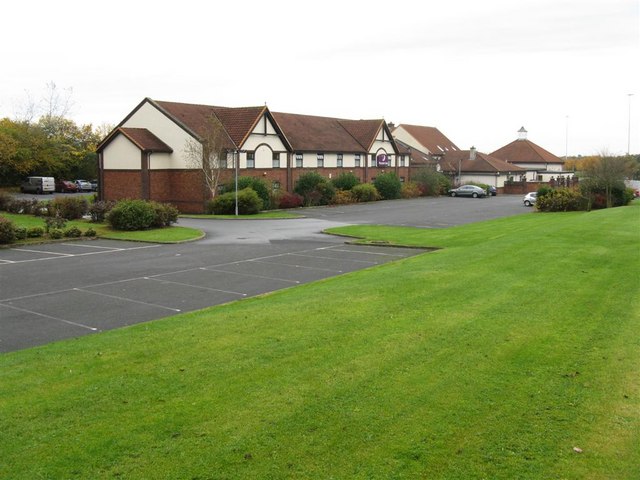
The village has a few amenities to cater to its residents' needs. There is a local convenience store for daily essentials, along with a post office and a pharmacy. For recreational activities, Auchmuty has a community center that hosts various events and activities throughout the year, including fitness classes and social gatherings. Additionally, there are several green spaces and parks nearby, providing opportunities for outdoor activities and leisurely walks.

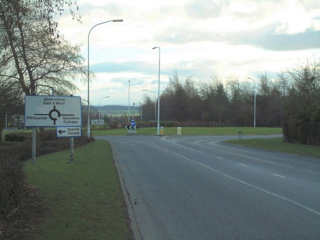
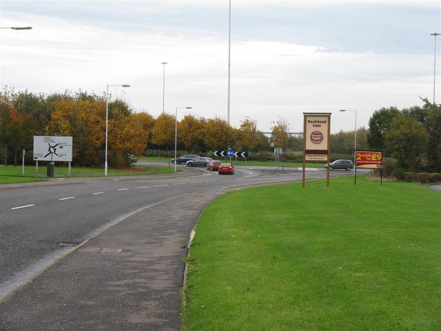
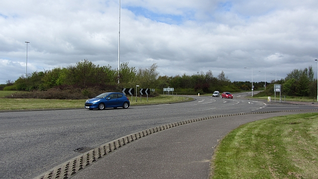
Transportation in Auchmuty is convenient, with regular bus services connecting the village to Glenrothes and other nearby towns. The A92 road also allows for easy access to major cities like Edinburgh and Dundee.

Overall, Auchmuty offers a tranquil and family-friendly environment, with its close proximity to amenities and good transportation links making it an appealing place to live.

If you have any feedback on the listing, please let us know in the comments section below.
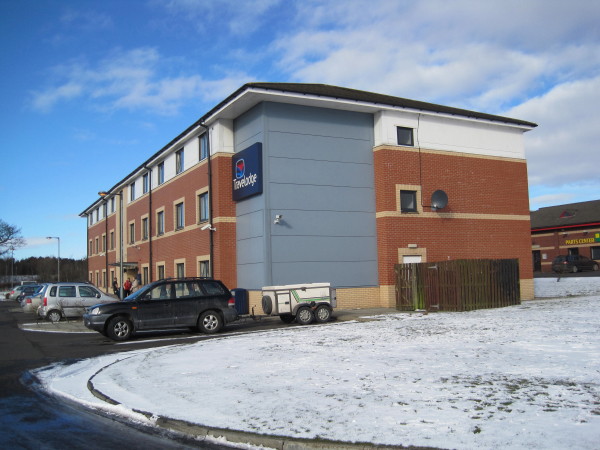
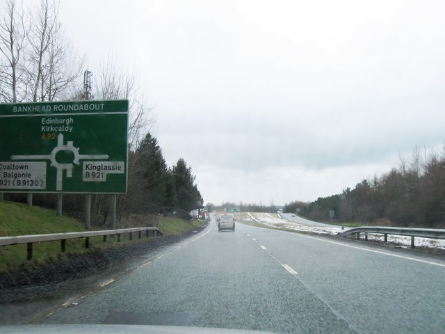
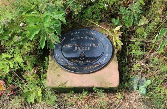
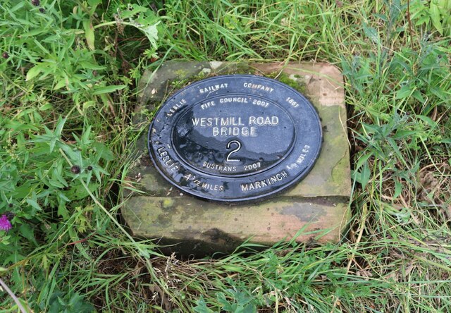
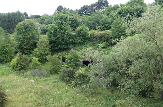
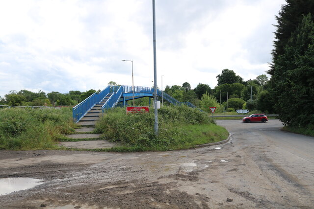
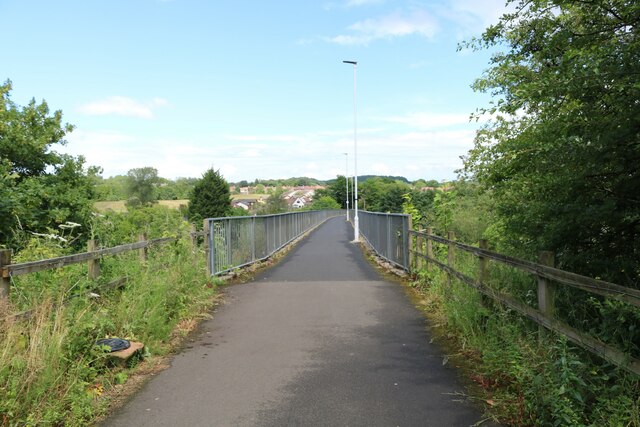
Auchmuty Images

Images are sourced within 2km of 56.194887/-3.166106 or Grid Reference NO2700. Thanks to Geograph Open Source API. All images are credited.

Beaufort Drive, Glenrothes
Glamis roundabout On the south west edge of the Pitteuchar area of Glenrothes
Glamis roundabout
On the south west edge of the Pitteuchar area of Glenrothes
Premier Inn, Bankhead Gate
Bankhead Roundabout, Glenrothes A major junction on the A92 at Glenrothes.
Bankhead Roundabout, Glenrothes
A major junction on the A92 at Glenrothes.
New houses, south of Viewfield Glenrothes
Bankhead roundabout A notorious obstacle at the end of the newish A92 dual carriageway. It has the plan of a split-level junction without the split-level. Best appreciated from the pavement (a Sustrans route).
Bankhead roundabout
A notorious obstacle at the end of the newish A92 dual carriageway. It has the plan of a split-level junction without the split-level. Best appreciated from the pavement (a Sustrans route).
Eastfield Business Park Andrew Davie, timber framed homes (big user of Sitka spruce) on Woodside Way.
Eastfield Business Park
Andrew Davie, timber framed homes (big user of Sitka spruce) on Woodside Way.
Overstenton Park Home of Glenrothes Strollers F.C.  Unlike Livingston and Cumbernauld, Glenrothes has not tempted a local big city, wee team to set up home in the new town.
Overstenton Park
Home of Glenrothes Strollers F.C. Unlike Livingston and Cumbernauld, Glenrothes has not tempted a local big city, wee team to set up home in the new town.
Travelodge, Glenrothes
A92 southbound
A92 southbound
A92 southbound
A92 southbound
Glamis Avenue
Glamis Avenue
Covid-19 vaccine centre In the Kingdom Centre shopping mall, Glenrothes. There is more than one vaccine centre in this shopping mall.
Covid-19 vaccine centre
In the Kingdom Centre shopping mall, Glenrothes. There is more than one vaccine centre in this shopping mall.
Leslie Railway Company marker From 1861 the Leslie Railway Company was responsible for a short section of railway connecting the town of Leslie to the Edinburgh, Perth and Dundee railway. In 1872 the company and the line became part of the North British Railway <span class="nowrap"><a title="https://www.scripoworld.com/records/united-kingdom/scotland/leslie-railway-company/" rel="nofollow ugc noopener" href="https://www.scripoworld.com/records/united-kingdom/scotland/leslie-railway-company/">Link</a><img style="margin-left:2px;" alt="External link" title="External link - shift click to open in new window" src="https://s1.geograph.org.uk/img/external.png" width="10" height="10"/></span>
This marker is at one end of Balbirnie Railway Viaduct which is a 'B' listed structure <span class="nowrap"><a title="http://www.forgottenrelics.co.uk/bridges/gallery/balbirnie.html" rel="nofollow ugc noopener" href="http://www.forgottenrelics.co.uk/bridges/gallery/balbirnie.html">Link</a><img style="margin-left:2px;" alt="External link" title="External link - shift click to open in new window" src="https://s1.geograph.org.uk/img/external.png" width="10" height="10"/></span>
Leslie Railway Company marker
From 1861 the Leslie Railway Company was responsible for a short section of railway connecting the town of Leslie to the Edinburgh, Perth and Dundee railway. In 1872 the company and the line became part of the North British Railway LinkExternal link This marker is at one end of Balbirnie Railway Viaduct which is a 'B' listed structure LinkExternal link
Leslie Railway Company marker From 1861 the Leslie Railway Company was responsible for a short section of railway connecting the town of Leslie to the Edinburgh, Perth and Dundee railway. In 1872 the company and the line became part of the North British Railway <span class="nowrap"><a title="https://www.scripoworld.com/records/united-kingdom/scotland/leslie-railway-company/" rel="nofollow ugc noopener" href="https://www.scripoworld.com/records/united-kingdom/scotland/leslie-railway-company/">Link</a><img style="margin-left:2px;" alt="External link" title="External link - shift click to open in new window" src="https://s1.geograph.org.uk/img/external.png" width="10" height="10"/></span>
This marker is at one end of West Mill road bridge which is now part of a footpath/cycleway running from Markinch to Glenrothes.
Leslie Railway Company marker
From 1861 the Leslie Railway Company was responsible for a short section of railway connecting the town of Leslie to the Edinburgh, Perth and Dundee railway. In 1872 the company and the line became part of the North British Railway LinkExternal link This marker is at one end of West Mill road bridge which is now part of a footpath/cycleway running from Markinch to Glenrothes.
Mill Lade This heavily overgrown tunnel carries the Mill Lade under the A911 Glenrothes to Leven road. The Mill Lade was originally the water source for several mills along its length but it is now long-disused and broken up into several sections.
Note: 'Mill Lade' (or 'Mill Leat') was the term given to the water source used to power a watermill. They were a man-made channel taking water from a suitable river.
Mill Lade
This heavily overgrown tunnel carries the Mill Lade under the A911 Glenrothes to Leven road. The Mill Lade was originally the water source for several mills along its length but it is now long-disused and broken up into several sections. Note: 'Mill Lade' (or 'Mill Leat') was the term given to the water source used to power a watermill. They were a man-made channel taking water from a suitable river.
Footbridge over A911 This footbridge crosses the A911 from Sappi Road (also known as West Mill Road). It leads to private properties on the other side of the road and to the training field of the Kingdom of Fife Dog Agility club.
Footbridge over A911
This footbridge crosses the A911 from Sappi Road (also known as West Mill Road). It leads to private properties on the other side of the road and to the training field of the Kingdom of Fife Dog Agility club.
Balbirnie Railway Viaduct This disused railway viaduct is now part of a footpath/cycleway connecting Glenrothes with Markinch. At the bottom left of the image is something interesting! <a href="https://www.geograph.org.uk/photo/7215434">NO2801 : Leslie Railway Company marker</a>
Balbirnie Railway Viaduct
This disused railway viaduct is now part of a footpath/cycleway connecting Glenrothes with Markinch. At the bottom left of the image is something interesting! NO2801 : Leslie Railway Company marker
Show me another place!

Auchmuty is located at Grid Ref: NO2700 (Lat: 56.194887, Lng: -3.166106)

Unitary Authority: Fife

Police Authority: Fife

What 3 Words

///activism.hotel.degree. Near Glenrothes, Fife

Related Wikis

Kingdom Shopping Centre

The Kingdom Centre is the main shopping destination in Glenrothes, located in the town centre. It is the largest indoor shopping centre in Fife and is...

Glenrothes (UK Parliament constituency)

Glenrothes () is a constituency in Scotland represented in the House of Commons of the UK Parliament since 2005. The seat has been held since the 2015...

Auchmuty High School

Auchmuty School is a state secondary school in the town of Glenrothes in the Fife council area of Scotland. Opened in 1957, it was the first school for...
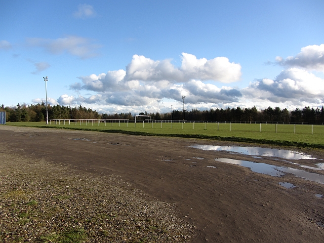
Glenrothes F.C.

Glenrothes Football Club is a Scottish football club based in the new town of Glenrothes, Fife. The club play home games at Warout Stadium, and currently...

Cadham

Cadham is a precinct in the former new town of Glenrothes in Fife, Scotland. The oldest part of Cadham was once a hamlet and was established to house workers...

Fife House, Glenrothes

Fife House, formerly Glenrothes House, is a large office development on North Street in Glenrothes, Fife, Scotland. It was built for Glenrothes Development...

Glenrothes

Glenrothes (; , glen-ROTH-iss; Scots: Glenrothes; Scottish Gaelic: Gleann Rathais) is a town situated in the heart of Fife, in east-central Scotland. It...

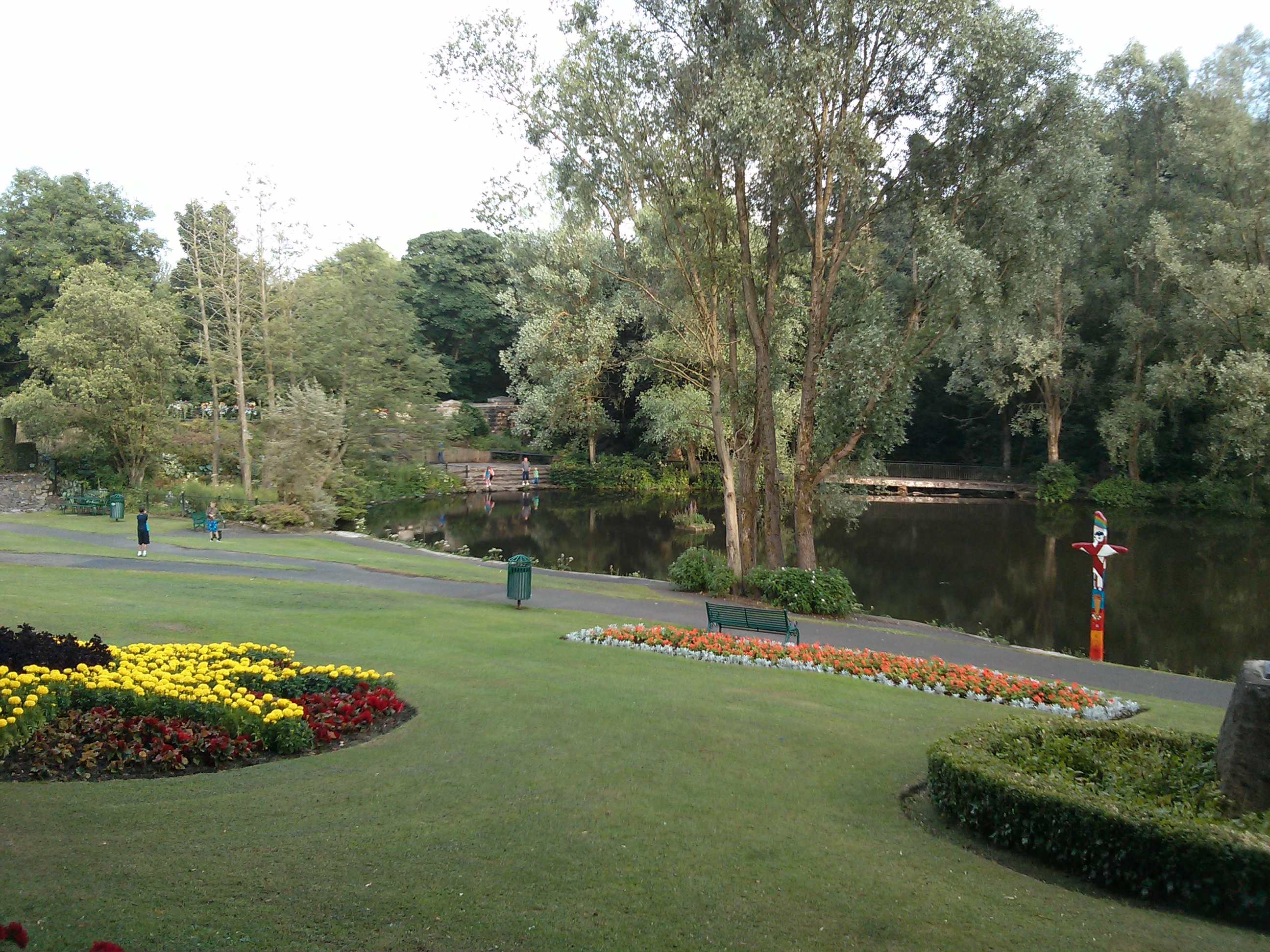
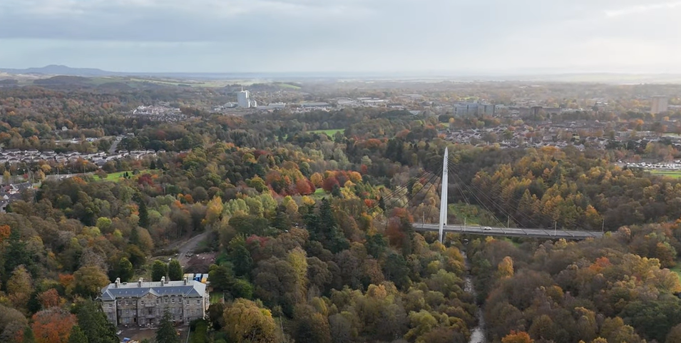
Riverside Park, Glenrothes

Riverside Park is a town park situated in the town of Glenrothes, Fife. The park has pleasant woodland walks, floral gardens, a pond and recently an Arboretum...

Nearby Amenities

Located within 500m of 56.194887,-3.166106
Crossing
Crossing: unmarked
Crossing Island: yes
Tactile Paving: yes
Lat/Long: 56.1982376/-3.1626174
Crossing
Button Operated: yes
Crossing: traffic_signals
Tactile Paving: yes
Traffic Signals Sound: no
Traffic Signals Vibration: yes
Lat/Long: 56.1962595/-3.1665682
Glenrothes
Is In: Fife,Scotland,UK
Name En: Glenrothes
Name Ga: Gleann RĂ¡thais
Name Gd: Gleann RĂ thais
Place: town
Population: 39277
Wikidata: Q943351
Wikipedia: en:Glenrothes
Lat/Long: 56.1961905/-3.1716324
Crossing
Crossing: traffic_signals
Crossing Island: no
Kerb: lowered
Tactile Paving: yes
Lat/Long: 56.195195/-3.167834
Fuel
Shell
Addr Postcode: KY7 5PS
Brand: Shell
Brand Wikidata: Q110716465
Opening Hours: 24/7
Phone: +44 1592 750151
Ref Navads: NVDS353_10019478
Website: https://find.shell.com/gb/fuel/10019478-leslie-road
Lat/Long: 56.1974883/-3.1696326
Crossing
Crossing: marked
Crossing Island: no
Tactile Paving: yes
Lat/Long: 56.1969773/-3.1711366
Traffic Calming: cushion
Lat/Long: 56.1933555/-3.1688952
Crossing
Crossing: unmarked
Crossing Island: no
Kerb: lowered
Tactile Paving: no
Lat/Long: 56.194277/-3.1703323
Traffic Calming: cushion
Lat/Long: 56.1932564/-3.1664972
Mini Roundabout
Direction: clockwise
Lat/Long: 56.1945779/-3.1610135
Crossing
Crossing: marked
Lat/Long: 56.1964282/-3.1733387
Access: yes
Entrance: yes
Lat/Long: 56.1955886/-3.1725722
Entrance: yes
Lat/Long: 56.1958431/-3.1707704
Access: yes
Entrance: yes
Lat/Long: 56.196777/-3.1702498
Noexit: yes
Lat/Long: 56.1990263/-3.1646531
Crossing
Crossing: marked
Crossing Island: no
Kerb: flush
Source: Survey Feb 2019
Tactile Paving: yes
Lat/Long: 56.1971108/-3.1721731
Crossing
Crossing: uncontrolled
Crossing Island: no
Kerb: lowered
Tactile Paving: yes
Lat/Long: 56.1945549/-3.1596698
Crossing
Crossing: marked
Tactile Paving: no
Lat/Long: 56.1951312/-3.1726332
Crossing
Button Operated: yes
Crossing: traffic_signals
Crossing Island: no
Kerb: lowered
Tactile Paving: yes
Traffic Signals Sound: yes
Lat/Long: 56.1948747/-3.1725655
Crossing
Crossing: unmarked
Crossing Island: no
Kerb: lowered
Tactile Paving: no
Lat/Long: 56.1941485/-3.1723411
Taxi
Lat/Long: 56.1956075/-3.1688675
Trimmers
Shop: hairdresser
Lat/Long: 56.1957566/-3.1697063
Auchmuty
Place: suburb
Source: OS 7th series
Lat/Long: 56.1931067/-3.1666304
Crossing
Crossing: traffic_signals
Crossing Island: no
Kerb: lowered
Tactile Paving: yes
Lat/Long: 56.1952115/-3.1701382
Access: yes
Entrance: yes
Lat/Long: 56.1967592/-3.1695433
Access: yes
Entrance: yes
Lat/Long: 56.1961238/-3.1704338
Access: yes
Entrance: yes
Lat/Long: 56.1955044/-3.1717033
Access: yes
Entrance: yes
Lat/Long: 56.1961898/-3.1732253
Access: yes
Entrance: yes
Lat/Long: 56.1965798/-3.1721622
Access: yes
Entrance: yes
Lat/Long: 56.196407/-3.1695411
Post Box
Brand: Royal Mail
Brand Wikidata: Q638098
Collection Times: Mo-Fr 17:00; Sa 12:00
Note: This is the downstairs box. Location approx
Operator: Royal Mail
Operator Wikidata: Q638098
Ref: KY7 401
Royal Cypher: no
Source: Survey Feb 2014
Lat/Long: 56.1957402/-3.1738372
Post Box
Check Date Collection Times: 2023-04-11
Collection Times: Mo-Fr 17:00; Sa 12:00
Note: This is the upstairs box. Location approx
Operator: Royal Mail
Operator Wikidata: Q638098
Ref: KY7 400
Royal Cypher: no
Source: Survey Feb 2014
Lat/Long: 56.1957294/-3.1737623
Post Box
Collection Times: Mo-Fr 16:00; Sa 10:30
Operator: Royal Mail
Ref: KY7 119
Royal Cypher: GVIR
Royal Cypher Wikidata: Q33102169
Source: Survey Feb 2014
Lat/Long: 56.1963834/-3.1678684
Post Box
Brand: Royal Mail
Brand Wikidata: Q638098
Brand Wikipedia: en:Royal Mail
Collection Times: Mo-Fr 16:30; Sa 11:30
Operator: Royal Mail
Operator Wikidata: Q638098
Post Box Type: indoor_pillar
Ref: KY7 441
Royal Cypher: scottish_crown
Source: survey
Lat/Long: 56.1974472/-3.1625765
Atm
Lat/Long: 56.1975555/-3.1626581
Post Box
Collection Times: Mo-Fr 16:00; Sa 10:30
Operator: Royal Mail
Ref: KY7 423
Royal Cypher: scottish_crown
Source: survey
Lat/Long: 56.1911395/-3.1644925
Post Box
Collection Times: Mo-Fr 09:00; Sa 07:00
Operator: Royal Mail
Ref: KY7 131
Royal Cypher: scottish_crown
Source: Survey Feb 2014
Lat/Long: 56.1924541/-3.1728003
Post Box
Collection Times: Mo-Fr 09:00; Sa 07:00
Operator: Royal Mail
Ref: KY7 124
Royal Cypher: scottish_crown
Source: survey
Lat/Long: 56.1938379/-3.1648389
Atm
Cash In: yes
Check Date: 2023-04-11
Indoor: yes
Operator: Bank of Scotland
Lat/Long: 56.1960682/-3.1720874
Pub
The Phoenix
Lat/Long: 56.1956089/-3.1726903
Bank
TSB
Atm: yes
Brand: TSB
Brand Wikidata: Q7671560
Brand Wikipedia: en:TSB Bank (United Kingdom)
Drive Through: no
Opening Hours: Mo,Tu,Th,Fr 09:00-17:00; We 10:00-17:00; Sa 09:00-13:00
Website: https://branches.tsb.co.uk/glenrothes/glenrothes.html
Lat/Long: 56.196093/-3.1705492
Ladbrokes
Brand: Ladbrokes
Brand Wikidata: Q1799875
Brand Wikipedia: en:Ladbrokes Coral
Opening Hours: Mo-Sa 08:30-22:00; Su 09:00-22:00
Shop: bookmaker
Lat/Long: 56.1959269/-3.170565
The Salvation Army
Brand: The Salvation Army
Brand Wikidata: Q188307
Brand Wikipedia: en:The Salvation Army
Opening Hours: Mo-Sa 09:00-17:00
Shop: charity
Lat/Long: 56.1958917/-3.1706856
Bayne's
Opening Hours: Mo-Fr 06:30-17:00; Sa 07:00-17:00
Shop: bakery
Lat/Long: 56.1957707/-3.1703673
Star
Addr City: Glenrothes
Addr Housenumber: 6-8
Addr Postcode: KY7 5LH
Addr Street: Postgate
Fixme: Needs a survey.
Shop: convenience
Lat/Long: 56.1958851/-3.1703673
Threads
Addr City: Glenrothes
Addr Postcode: KY7 5LH
Craft: dressmaker
Email: gilliangalbraith11@yahoo.co.uk
Opening Hours: Mo-Fr 09:00-17:00; Sa 09:00-14:00
Phone: +441592 758 756
Shop: tailor
Website: https://threadsbygillian.co.uk/
Lat/Long: 56.195686/-3.1703594
Ring a Roses
Shop: florist
Lat/Long: 56.1956816/-3.1702289
Cheque Centre
Shop: money_lender
Lat/Long: 56.1956805/-3.1701083
Toilets
Access: yes
Fee: yes
Operator: Fife Council
Toilets Disposal: flush
Lat/Long: 56.1957009/-3.169987
Toilets
Access: yes
Lat/Long: 56.1966546/-3.1696223
Abertan
Shop: beauty
Lat/Long: 56.1961062/-3.1692111
McKenna's Law Practice
Office: lawyer
Lat/Long: 56.196023/-3.1694928
Acorn Accounting
Office: accountant
Lat/Long: 56.1960252/-3.1692891
Gleeson McCafferty Law
Office: lawyer
Lat/Long: 56.1960285/-3.1689846
Social Facility
DAPL
Social Facility For: drug_addicted
Lat/Long: 56.1960311/-3.1687445
Fast Food
Fast 'N' Fresh
Cuisine: sandwich
Lat/Long: 56.1957374/-3.1688548
Baird & Co
Office: lawyer
Lat/Long: 56.1968967/-3.1678562
Rollos
Office: lawyer
Lat/Long: 56.1967926/-3.167873
Kingdom Kilts
Shop: clothes
Lat/Long: 56.1966243/-3.1679258
Innes Johnston
Office: lawyer
Lat/Long: 56.1963628/-3.167459
Slater Hogg & Howison
Office: estate_agent
Lat/Long: 56.1967391/-3.1683099
Your Move
Brand: Your Move
Brand Wikidata: Q81078416
Office: estate_agent
Lat/Long: 56.1964215/-3.1679073
Polish Shop Gosia
Addr City: Glenrothes
Addr Housenumber: 24
Addr Postcode: KY7 5NA
Addr Street: North Street
Fixme: McColls store closed. Needs a survey.
Shop: deli
Lat/Long: 56.1963705/-3.1677913
Paterson Boyd & Co.
Office: lawyer
Lat/Long: 56.1963679/-3.1676896
John W Gilbertson
Office: lawyer
Lat/Long: 56.1963638/-3.1675832
Fast Food
Spice of Life
Cuisine: indian
Lat/Long: 56.1963565/-3.1673078
William Hill
Brand: William Hill
Brand Wikidata: Q4053147
Brand Wikipedia: en:William Hill (bookmaker)
Shop: bookmaker
Lat/Long: 56.1963541/-3.1671897
Fast Food
Gary's Chinese Takeaway
Cuisine: chinese
Lat/Long: 56.1963524/-3.1670775
Fast Food
Mayflower
Cuisine: chinese
Lat/Long: 56.1965219/-3.166703
Fast Food
Danny's Fried Chicken
Lat/Long: 56.1964051/-3.1667102
Fast Food
Kismet
Cuisine: kebab
Lat/Long: 56.1964603/-3.1667073
Kirsty keenan
Shop: hairdresser
Lat/Long: 56.1965852/-3.1666986
WHSmith
Brand: WHSmith
Brand Wikidata: Q1548712
Brand Wikipedia: en:WHSmith
Shop: newsagent
Lat/Long: 56.1959559/-3.1738307
Cafe
BB's Coffee & Muffins
Lat/Long: 56.1961162/-3.1734562
Barrhead Travel
Brand: Barrhead Travel
Brand Wikidata: Q114292485
Shop: travel_agency
Website: https://www.barrheadtravel.co.uk/storelocator/glenrothes
Lat/Long: 56.1961178/-3.1736388
Harvey Willis
Shop: clothes
Lat/Long: 56.1960954/-3.1738765
VIP Electronic Cigarette
Shop: e-cigarette
Lat/Long: 56.1960916/-3.173762
JD Sports
Brand: JD Sports
Brand Wikidata: Q6108019
Brand Wikipedia: en:JD Sports
Shop: sports
Lat/Long: 56.1958532/-3.1733476
Timpson
Brand: Timpson
Brand Wikidata: Q7807658
Opening Hours: Mo-Sa 09:00-17:30
Shop: locksmith
Lat/Long: 56.1958529/-3.1732008
TUI
Brand: TUI
Brand Wikidata: Q7795876
Opening Hours: Mo-Sa 09:00-17:30; Su 10:00-16:00
Shop: travel_agency
Lat/Long: 56.1958546/-3.1731045
Fast Food
Subway
Brand: Subway
Brand Wikidata: Q244457
Brand Wikipedia: en:Subway (restaurant)
Contact Website: https://restaurants.subway.com/united-kingdom/sc/glenrothes/1-unicorn-way-kingdom-centre
Cuisine: sandwich
Opening Hours: Mo-Sa 09:00-18:00; Su 10:00-17:00
Takeaway: yes
Lat/Long: 56.1958436/-3.1726116
claire's
Brand: claire's
Brand Wikidata: Q2974996
Brand Wikipedia: en:Claire's
Contact Website: https://stores.claires.com/gb-fif/glenrothes/180.html
Shop: fashion_accessories
Lat/Long: 56.195989/-3.1730731
Hays Travel
Opening Hours: Mo-Sa 09:15-17:30; Su 11:00-18:00
Shop: travel_agency
Lat/Long: 56.1959861/-3.172957
Natural Doctor
Healthcare: alternative
Healthcare Speciality: traditional_chinese_medicine
Phone: +441592 611866
Website: https://www.tcmdoctor.co.uk/
Lat/Long: 56.1959836/-3.1728535
Remax
Brand: RE/MAX
Brand Wikidata: Q965845
Office: estate_agent
Lat/Long: 56.1959808/-3.1727379
Bayne's
Opening Hours: Mo-Fr 07:30-17:00; Sa 07:30-16:45; Su 10:00-15:00
Shop: bakery
Lat/Long: 56.1959781/-3.1726288
Max Spielmann
Brand: Max Spielmann
Brand Wikidata: Q76221051
Shop: photo
Lat/Long: 56.1959732/-3.1724265
Bank
Bank of Scotland
Addr Country: GB
Atm: yes
Brand: Bank of Scotland
Brand Wikidata: Q627381
Brand Wikipedia: en:Bank of Scotland
Contact Website: https://branches.bankofscotland.co.uk/glenrothes/9-falkland-gate
Opening Hours: Mo-Fr 09:00-17:00; Sa 09:00-15:00
Lat/Long: 56.1960636/-3.1719977
Home Bargains
Brand: Home Bargains
Brand Wikidata: Q5888229
Brand Wikipedia: en:Home Bargains
Contact Website: https://storelocator.homebargains.co.uk/store/A236/Falkland+Gate,+Glenrothes
Opening Hours: Mo-Sa 08:00-18:00; Su 10:00-17:00
Shop: variety_store
Lat/Long: 56.1962942/-3.1724198
Fast Food
Greggs
Brand: Greggs
Brand Wikidata: Q3403981
Brand Wikipedia: en:Greggs
Contact Website: https://www.greggs.co.uk/shop-finder?shop-code=3498
Cuisine: sandwich;bakery
Opening Hours: Mo-Fr 06:30-18:00; Sa 07:00-16:00; Su 09:00-17:00
Smoking: no
Takeaway: yes
Lat/Long: 56.1963223/-3.1720761
Iceland
Brand: Iceland
Brand Wikidata: Q721810
Brand Wikipedia: en:Iceland (supermarket)
Contact Website: https://www.iceland.co.uk/store-finder/store?StoreID=693&StoreName=GLENROTHES
Opening Hours: Mo-Sa 08:30-18:00; Su 11:00-17:00
Shop: frozen_food
Lat/Long: 56.1965263/-3.172324
Disused Shop: yes
Lat/Long: 56.1964535/-3.1723255
Superdrug
Brand: Superdrug
Brand Wikidata: Q7643261
Opening Hours: Mo-Sa 09:00-17:30; Su 10:30-16:30
Shop: chemist
Lat/Long: 56.1964013/-3.1723265
Vodafone
Brand: Vodafone
Brand Wikidata: Q122141
Brand Wikipedia: en:Vodafone
Shop: mobile_phone
Lat/Long: 56.19632/-3.1719458
VapeStore
Brand: VapeStore
Brand Wikidata: Q116710778
Shop: e-cigarette
Lat/Long: 56.1963167/-3.1718332
Game
Brand: Game
Brand Wikidata: Q5519813
Brand Wikipedia: en:Game (retailer)
Opening Hours: Mo-Sa 09:00-18:00; Su 11:00-17:00
Shop: video_games
Lat/Long: 56.196367/-3.1716933
Poundland
Brand: Poundland
Brand Wikidata: Q1434528
Brand Wikipedia: en:Poundland
Opening Hours: Mo-Sa 08:00-18:00; Su 10:00-17:00
Shop: variety_store
Lat/Long: 56.1963666/-3.171407
Ramsdens
Brand: Ramsdens
Brand Wikidata: Q99938502
Opening Hours: Mo-Fr 09:00-17:00; Sa 09:00-16:00
Shop: pawnbroker
Lat/Long: 56.196366/-3.1710223
The Works
Brand: The Works
Brand Wikidata: Q7775853
Brand Wikipedia: en:The Works (retailer)
Opening Hours: Mo-Sa 09:00-17:30; Su 12:00-16:00
Shop: books
Website: https://www.theworks.co.uk/Store?storeId=0146
Lat/Long: 56.1963225/-3.1708687
H.Samuel
Brand: H.Samuel
Brand Wikidata: Q5628558
Brand Wikipedia: en:H. Samuel
Opening Hours: Tu-Sa 09:00-17:00
Shop: jewelry
Website: https://www.hsamuel.co.uk/store/HS4116-Glenrothes
Lat/Long: 56.1963181/-3.170703
Paddy Power
Brand: Paddy Power
Brand Wikidata: Q3888718
Brand Wikipedia: en:Paddy Power
Opening Hours: Mo-Su 08:30-22:00
Shop: bookmaker
Lat/Long: 56.1963146/-3.1705663
Cafe
Costa
Addr Housenumber: 38
Addr Postcode: KY7 5NN
Addr Street: Lyon Way
Brand: Costa
Brand Wikidata: Q608845
Brand Wikipedia: en:Costa Coffee
Cuisine: coffee_shop
Fhrs Id: 852271
Opening Hours: Mo-Fr 08:00-17:30; Sa 08:00-17:00; Su 09:30-16:30
Smoking: no
Takeaway: yes
Lat/Long: 56.1965329/-3.1720857
Specsavers
Brand: Specsavers
Brand Wikidata: Q2000610
Brand Wikipedia: en:Specsavers
Contact Website: https://www.specsavers.co.uk/stores/glenrothes
Shop: optician
Lat/Long: 56.1964875/-3.1717014
Disused Shop: yes
Lat/Long: 56.1964855/-3.1715754
Jessop
Shop: jewelry
Lat/Long: 56.1964837/-3.1714593
Disused Shop: yes
Lat/Long: 56.1964815/-3.171321
Holland & Barrett
Brand: Holland & Barrett
Brand Wikidata: Q5880870
Brand Wikipedia: en:Holland & Barrett
Opening Hours: Mo-Sa 09:00-17:30; Su 10:30-16:30
Shop: health_food
Lat/Long: 56.1964789/-3.1711531
M&Co
Brand: M&Co
Brand Wikidata: Q6711808
Brand Wikipedia: en:M&Co.
Shop: clothes
Lat/Long: 56.1964772/-3.171047
Caledonian Kilts
Opening Hours: Mo,Tu,Th-Sa 09:30-16:00
Shop: clothes
Lat/Long: 56.1965011/-3.1709318
Boots
Brand: Boots Opticians
Brand Wikidata: Q4944037
Opening Hours: Mo-Sa 09:00-17:30; Su 11:00-16:00
Shop: optician
Short Name: Boots
Lat/Long: 56.1964952/-3.1707085
Fife Butchers
Shop: butcher
Lat/Long: 56.1964924/-3.1706024
Pharmacy
Boots
Brand: Boots
Brand Wikidata: Q6123139
Brand Wikipedia: en:Boots UK
Healthcare: pharmacy
Opening Hours: Mo-Sa 08:45-13:00,14:00-17:30
Website: https://www.boots.com/stores/6002-glenrothes-lyon-square-ky7-5nr
Lat/Long: 56.196486/-3.1703563
Bank
Nationwide
Atm: yes
Brand: Nationwide
Brand Wikidata: Q846735
Brand Wikipedia: en:Nationwide Building Society
Contact Website: https://locations.nationwidebranches.co.uk/glenrothes/10-lyon-square
Opening Hours: Mo,Tu,Th,Fr 09:00-16:30; We 10:00-16:30; Sa 09:00-12:00
Lat/Long: 56.1964798/-3.1701181
Rach Optometrist
Opening Hours: Mo-Fr 09:00-17:30; Sa 09:00-17:00
Shop: optician
Lat/Long: 56.1964769/-3.1700088
PDSA
Brand: PDSA
Brand Wikidata: Q7165541
Brand Wikipedia: en:People's Dispensary for Sick Animals
Shop: charity
Lat/Long: 56.1961365/-3.1698403
Home DIYs
Shop: doityourself
Lat/Long: 56.1961345/-3.1697356
Bank
RBS
Atm: yes
Brand: RBS
Brand Wikidata: Q160126
Brand Wikipedia: en:Royal Bank of Scotland
Official Name: Royal Bank of Scotland
Opening Hours: Mo-Fr 09:00-16:30
Lat/Long: 56.1969577/-3.172018
Bank
Virgin Money
Atm: yes
Brand: Virgin Money
Brand Wikidata: Q2527746
Brand Wikipedia: en:Clydesdale Bank
Lat/Long: 56.1967788/-3.172016
Crossing
Crossing: zebra
Crossing Island: no
Tactile Paving: yes
Lat/Long: 56.194296/-3.1641521
Crossing
Crossing: unmarked
Crossing Island: no
Kerb: lowered
Tactile Paving: no
Lat/Long: 56.1941496/-3.1642779
Crossing
Crossing: unmarked
Crossing Island: no
Kerb: lowered
Tactile Paving: no
Lat/Long: 56.1936335/-3.1651398
Crossing
Crossing: unmarked
Crossing Island: no
Kerb: lowered
Tactile Paving: no
Lat/Long: 56.1934278/-3.1666054
Kerb: raised
Lat/Long: 56.1932898/-3.1635627
Gambling
Club 3000 Bingo
Check Date: 2024-02-16
Gambling: bingo
Lat/Long: 56.1954949/-3.1727026
Cinema
Kino Cinema
Addr City: Glenrothes
Addr Street: Church Street
Lat/Long: 56.1954047/-3.1728825
Restaurant
Rara Tal
Cuisine: indian
Opening Hours: Mo-Th 12:00-15:00,16:30-21:00; Fr,Sa 12:00-21:30; Su 15:00-21:00
Lat/Long: 56.1953464/-3.1730723
Crossing
Crossing: unmarked
Crossing Island: yes
Tactile Paving: no
Lat/Long: 56.1984488/-3.1653699
Bus Stop
Bus: yes
Naptan AtcoCode: 6500K0767
Naptan NaptanCode: 34328743
Public Transport: platform
Lat/Long: 56.1928766/-3.1608361
Bus Stop
Bench: yes
Bin: no
Bus: yes
Lit: no
Public Transport: platform
Shelter: yes
Lat/Long: 56.1927966/-3.1610106
Bus Stop
Thane Road
Bench: no
Bin: no
Bus: yes
Lit: yes
Public Transport: platform
Shelter: no
Tactile Paving: no
Lat/Long: 56.1945071/-3.1648425
Bus Stop
Thane Road
Bench: no
Bin: no
Bus: yes
Lit: yes
Public Transport: platform
Shelter: no
Tactile Paving: no
Lat/Long: 56.1944835/-3.1652601
Bus Stop
Flemington Road
Bench: no
Bin: no
Bus: yes
Lit: yes
Public Transport: platform
Shelter: no
Tactile Paving: no
Lat/Long: 56.1981931/-3.1614377
Bus Stop
Morissons Supermarket
Bench: yes
Bin: yes
Bus: yes
Lit: yes
Naptan AtcoCode: 6500K0699
Naptan Bearing: E
Naptan CommonName: Morrisons Supermarket
Naptan Indicator: adj
Naptan NaptanCode: 34329273
Naptan Street: Queensway
Public Transport: platform
Shelter: yes
Tactile Paving: no
Lat/Long: 56.1973465/-3.1639293
Bus Stop
Auchmuty High school
Bench: yes
Bin: no
Bus: yes
Lit: no
Naptan AtcoCode: 6500K0700
Naptan Bearing: NW
Naptan CommonName: Auchmuty High School
Naptan Indicator: adj
Naptan NaptanCode: 34329262
Naptan Street: Queensway
Public Transport: platform
Shelter: yes
Tactile Paving: no
Lat/Long: 56.1969566/-3.1619474
Bus Stop
Auchmuty High School
Bench: yes
Bin: no
Bus: yes
Lit: no
Naptan AtcoCode: 6500K0701
Naptan Bearing: E
Naptan CommonName: Auchmuty High School
Naptan Indicator: opp
Naptan NaptanCode: 34329265
Naptan Street: Queensway
Public Transport: platform
Shelter: yes
Tactile Paving: no
Lat/Long: 56.1970241/-3.1603133
Bus Stop
St Paul's Church
Bench: yes
Bin: no
Bus: yes
Lit: yes
Public Transport: platform
Shelter: yes
Tactile Paving: no
Lat/Long: 56.1913682/-3.1613103
Bus Stop
Taylor Drive
Bench: no
Bin: no
Bus: yes
Lit: no
Naptan AtcoCode: 6500K0760
Naptan NaptanCode: 34328674
Public Transport: platform
Shelter: no
Tactile Paving: no
Lat/Long: 56.1912934/-3.1640426
Bus Stop
Taylor Drive
Bench: no
Bin: no
Bus: yes
Lit: yes
Public Transport: platform
Shelter: no
Tactile Paving: no
Lat/Long: 56.1914233/-3.1648141
Bus Stop
Warout Brae
Bench: no
Bus: yes
Lit: yes
Public Transport: platform
Shelter: no
Tactile Paving: no
Lat/Long: 56.1910255/-3.1681905
Bus Stop
Warout Brae
Bench: no
Bin: no
Bus: yes
Lit: no
Public Transport: platform
Shelter: no
Tactile Paving: no
Lat/Long: 56.1912658/-3.1678649
Cafe
The Wee Diner
Addr City: Glenrothes
Addr Street: Glenrothes Bus Station
Lat/Long: 56.1956703/-3.1706212
Crossing
Button Operated: yes
Crossing: traffic_signals
Kerb: lowered
Tactile Paving: yes
Traffic Signals Sound: no
Traffic Signals Vibration: yes
Lat/Long: 56.1987961/-3.1656827
Bus Stop
Auchmuty Road
Bench: yes
Bin: no
Bus: yes
Lit: no
Naptan AtcoCode: 6500K0702
Naptan NaptanCode: 34329252
Public Transport: platform
Shelter: yes
Tactile Paving: no
Lat/Long: 56.1965514/-3.166492
Crossing
Crossing: traffic_signals
Lat/Long: 56.195731/-3.1673369
Crossing
Crossing: traffic_signals
Tactile Paving: yes
Lat/Long: 56.1957538/-3.1671439
Crossing
Button Operated: yes
Crossing: traffic_signals
Kerb: lowered
Tactile Paving: yes
Traffic Signals Sound: no
Traffic Signals Vibration: yes
Lat/Long: 56.1988174/-3.165547
Traffic Calming: cushion
Lat/Long: 56.1946287/-3.1612347
Crossing
Button Operated: yes
Crossing: traffic_signals
Tactile Paving: yes
Traffic Signals Sound: no
Traffic Signals Vibration: yes
Lat/Long: 56.1980059/-3.1658439
Crossing
Button Operated: yes
Crossing: traffic_signals
Tactile Paving: yes
Traffic Signals Sound: no
Traffic Signals Vibration: yes
Lat/Long: 56.1979671/-3.1659995
Crossing
Button Operated: yes
Crossing: traffic_signals
Crossing Island: no
Tactile Paving: yes
Traffic Signals Sound: yes
Traffic Signals Vibration: yes
Lat/Long: 56.1975306/-3.1677833
Crossing
Crossing: marked
Crossing Island: no
Tactile Paving: no
Lat/Long: 56.1969324/-3.1695152
Crossing
Crossing: marked
Lat/Long: 56.1958668/-3.1696093
Bicycle Parking
Access: yes
Bicycle Parking: stands
Capacity: 12
Covered: yes
Fee: no
Lat/Long: 56.1955032/-3.1712373
Crossing
Crossing: unmarked
Crossing Island: no
Kerb: lowered
Tactile Paving: no
Lat/Long: 56.1912735/-3.1616812
Barrier: bollard
Bollard: fixed
Lat/Long: 56.1969136/-3.1617733
Crossing
Crossing: traffic_signals
Tactile Paving: yes
Lat/Long: 56.1972154/-3.1643729
Crossing
Crossing: traffic_signals
Tactile Paving: yes
Lat/Long: 56.1973165/-3.1644992
Crossing
Crossing: traffic_signals
Crossing Island: no
Tactile Paving: yes
Lat/Long: 56.1963346/-3.1681543
Crossing
Crossing: marked
Crossing Island: no
Tactile Paving: yes
Lat/Long: 56.1955125/-3.1713822
Crossing
Crossing: unmarked
Tactile Paving: no
Lat/Long: 56.1968932/-3.1662476
Crossing
Crossing: unmarked
Tactile Paving: no
Lat/Long: 56.1968807/-3.1661155
Crossing
Crossing: unmarked
Crossing Island: no
Kerb: lowered
Tactile Paving: no
Lat/Long: 56.195019/-3.1663332
Crossing
Crossing: unmarked
Crossing Island: no
Kerb: lowered
Tactile Paving: no
Lat/Long: 56.1944045/-3.1643076
Crossing
Crossing: unmarked
Crossing Island: no
Kerb: lowered
Tactile Paving: no
Lat/Long: 56.1932527/-3.1616952
Crossing
Crossing: marked
Lat/Long: 56.1955883/-3.1686578
Crossing
Crossing: marked
Lat/Long: 56.1958548/-3.1686636
Crossing
Crossing: marked
Crossing Island: no
Tactile Paving: no
Lat/Long: 56.1969494/-3.1702373
Crossing
Crossing: marked
Tactile Paving: yes
Lat/Long: 56.1968878/-3.1712493
Crossing
Crossing: marked
Tactile Paving: no
Lat/Long: 56.1969375/-3.1712378
Entrance: yes
Lat/Long: 56.1974553/-3.1626845
Crossing
Crossing: marked
Tactile Paving: no
Lat/Long: 56.1976573/-3.1649312
Crossing
Crossing: marked
Tactile Paving: yes
Lat/Long: 56.1976865/-3.1639976
Crossing
Crossing: marked
Tactile Paving: yes
Lat/Long: 56.1977379/-3.1646601
Crossing
Crossing: marked
Tactile Paving: yes
Lat/Long: 56.1975987/-3.162837
Crossing
Crossing: marked
Tactile Paving: yes
Lat/Long: 56.1975974/-3.1639302
Crossing
Crossing: marked
Tactile Paving: yes
Lat/Long: 56.197465/-3.1639642
Crossing
Crossing: uncontrolled
Crossing Island: no
Tactile Paving: no
Lat/Long: 56.1991722/-3.166372
Barrier: lift_gate
Lat/Long: 56.1983037/-3.1667314
Crossing
Crossing: unmarked
Crossing Island: no
Kerb: lowered
Tactile Paving: no
Lat/Long: 56.1911948/-3.1643771
Crossing
Crossing: unmarked
Crossing Island: no
Kerb: lowered
Tactile Paving: no
Lat/Long: 56.1908806/-3.1695505
Crossing
Crossing: unmarked
Crossing Island: no
Kerb: lowered
Tactile Paving: no
Lat/Long: 56.1913785/-3.1628218
Crossing
Crossing: unmarked
Crossing Island: yes
Tactile Paving: yes
Lat/Long: 56.1983291/-3.1637273
Crossing
Crossing: marked
Crossing Ref: zebra
Tactile Paving: yes
Lat/Long: 56.1985922/-3.165129
Bus Stop
Flemington Road
Bench: yes
Bin: no
Bus: yes
Lit: yes
Naptan AtcoCode: 6500K1468
Naptan NaptanCode: 34358579
Public Transport: platform
Shelter: yes
Tactile Paving: no
Lat/Long: 56.1981335/-3.1623552
Crossing
Crossing: marked
Tactile Paving: no
Lat/Long: 56.1968323/-3.1702507
Crossing
Crossing: unmarked
Kerb: flush
Tactile Paving: no
Lat/Long: 56.1970806/-3.1731212
Barrier: bollard
Bollard: fixed
Lat/Long: 56.1965432/-3.1614733
Barrier: bollard
Bollard: fixed
Lat/Long: 56.1966193/-3.1622752
Car Wash
Shell
Automated: yes
Brand: Shell
Brand Wikidata: Q110716465
Operator: Shell
Self Service: no
Lat/Long: 56.1974101/-3.1691307
Little Thistle Gift Shop
Shop: gift
Lat/Long: 56.196117/-3.1735474
Wild Glen Florist
Shop: florist
Lat/Long: 56.1958555/-3.1729403
Istanbul Hair Salon
Male: yes
Shop: hairdresser
Lat/Long: 56.1959752/-3.1725101
Trespass
Brand: Trespass
Brand Wikidata: Q17035733
Brand Wikipedia: en:Trespass (clothing)
Opening Hours: Mo-Sa 09:00-17:00; Su 11:00-16:00
Shop: outdoor
Lat/Long: 56.1965308/-3.1719536
Card World
Shop: gift
Lat/Long: 56.1965291/-3.1718438
Debra Charity Shop
Brand: Debra
Brand Wikidata: Q104535435
Opening Hours: Mo-Sa 09:00-17:00; Su 11:00-17:00
Shop: charity
Lat/Long: 56.1964899/-3.1705039
Admiral
Brand: Admiral
Brand Wikidata: Q25205850
Contact Website: https://www.admiralslots.co.uk/venues/glenrothes/
Gambling: slot_machines
Leisure: adult_gaming_centre
Opening Hours: Mo-Fr 09:00-19:00; Sa 09:00-18:00; Su 11:00-17:00
Lat/Long: 56.1964688/-3.1696972
Warren James
Brand: Warren James
Brand Wikidata: Q19604616
Brand Wikipedia: en:Warren James Jewellers
Shop: jewelry
Lat/Long: 56.196369/-3.1711471
CeX
Brand: CeX
Brand Wikidata: Q5055676
Opening Hours: Mo-Sa 09:00-17:30; Su 11:00-16:30
Operator: CeX (UK)
Shop: electronics
Website: https://uk.webuy.com/site/storeDetail/?branchId=3084
Lat/Long: 56.1959707/-3.1723242
Ex Terra Vis
Artist Name: Benno Shottz
Artwork Type: sculpture
Source: Fife Council
Tourism: artwork
Lat/Long: 56.1953405/-3.1702842
The Dream
Artist Name: Malcolm Robertson
Artwork Type: sculpture
Source: Fife Council
Tourism: artwork
Lat/Long: 56.1947426/-3.1726986
Access: yes
Entrance: yes
Lat/Long: 56.196189/-3.1696338
Bicycle Parking
Bicycle Parking: stands
Capacity: 6
Covered: yes
Lat/Long: 56.1969107/-3.1708848
Blair's
Opening Hours: Mo-Sa 08:30-17:00
Shop: greengrocer
Lat/Long: 56.1958508/-3.1730163
Crossing
Crossing: unmarked
Crossing Island: no
Kerb: lowered
Tactile Paving: no
Lat/Long: 56.1968118/-3.168137
Entrance: yes
Lat/Long: 56.1971972/-3.1720332
Traffic Calming: cushion
Lat/Long: 56.1927131/-3.170429
First For Homes
Office: estate_agent
Lat/Long: 56.1965569/-3.1679281
Crossing
Button Operated: yes
Crossing: traffic_signals
Crossing Island: no
Tactile Paving: yes
Traffic Signals Sound: yes
Traffic Signals Vibration: yes
Lat/Long: 56.1948824/-3.1662546
The Food Warehouse
Brand: The Food Warehouse
Brand Wikidata: Q87263899
Operator: Iceland
Shop: supermarket
Source: Survey Feb 2019
Website: https://www.thefoodwarehouse.com/store-locator/glenrothes
Lat/Long: 56.1973004/-3.1727959
Crossing
Crossing: marked
Crossing Island: no
Kerb: flush
Source: Survey Feb 2019
Tactile Paving: no
Lat/Long: 56.1971232/-3.1726997
Charging Station
Capacity: 4
Motorcar: yes
Operator: Ensto
Source: Survey May 2019
Lat/Long: 56.1969157/-3.1710335
Charging Station
Capacity: 2
Motorcar: yes
Operator: InstaVolt
Source: Survey May 2019
Lat/Long: 56.197374/-3.1699058
Generator Method: photovoltaic
Generator Output Electricity: yes
Generator Source: solar
Generator Type: solar_photovoltaic_panel
Power: generator
Lat/Long: 56.1935157/-3.1601325
Generator Method: photovoltaic
Generator Output Electricity: yes
Generator Source: solar
Generator Type: solar_photovoltaic_panel
Power: generator
Lat/Long: 56.1928626/-3.1588939
Generator Method: photovoltaic
Generator Output Electricity: yes
Generator Source: solar
Generator Type: solar_photovoltaic_panel
Power: generator
Lat/Long: 56.1921052/-3.1607564
Generator Method: photovoltaic
Generator Output Electricity: yes
Generator Source: solar
Generator Type: solar_photovoltaic_panel
Power: generator
Lat/Long: 56.192106/-3.16068
Traffic Calming: cushion
Lat/Long: 56.194274/-3.1704308
Traffic Calming: cushion
Lat/Long: 56.1920754/-3.1677315
Traffic Calming: cushion
Lat/Long: 56.1921049/-3.1654412
Traffic Calming: cushion
Lat/Long: 56.1939838/-3.1647645
Traffic Calming: cushion
Lat/Long: 56.1944098/-3.1654471
Generator Method: photovoltaic
Generator Output Electricity: yes
Generator Source: solar
Generator Type: solar_photovoltaic_panel
Power: generator
Lat/Long: 56.195663/-3.1632294
Generator Method: photovoltaic
Generator Output Electricity: yes
Generator Source: solar
Generator Type: solar_photovoltaic_panel
Power: generator
Lat/Long: 56.1956645/-3.1631691
Generator Method: photovoltaic
Generator Output Electricity: yes
Generator Source: solar
Generator Type: solar_photovoltaic_panel
Power: generator
Lat/Long: 56.1962973/-3.1637693
Generator Method: photovoltaic
Generator Output Electricity: yes
Generator Source: solar
Generator Type: solar_photovoltaic_panel
Power: generator
Lat/Long: 56.1946086/-3.1622306
Generator Method: photovoltaic
Generator Output Electricity: yes
Generator Source: solar
Generator Type: solar_photovoltaic_panel
Power: generator
Lat/Long: 56.1946103/-3.1621659
Generator Method: photovoltaic
Generator Output Electricity: yes
Generator Source: solar
Generator Type: solar_photovoltaic_panel
Power: generator
Lat/Long: 56.191201/-3.1684702
Generator Method: photovoltaic
Generator Output Electricity: yes
Generator Source: solar
Generator Type: solar_photovoltaic_panel
Power: generator
Lat/Long: 56.1914705/-3.1635768
Addr Housenumber: 4-6
Addr Postcode: KY7 5NR
Addr Street: Lyon Square
Disused Shop: yes
Lat/Long: 56.196473/-3.1698571
Grit Bin
Lat/Long: 56.1945105/-3.1635491
Traffic Calming: cushion
Lat/Long: 56.194571/-3.1635616
Traffic Calming: cushion
Lat/Long: 56.1962098/-3.1640804
Traffic Calming: cushion
Lat/Long: 56.1963444/-3.1656911
Traffic Calming: cushion
Lat/Long: 56.1958401/-3.1658656
Traffic Calming: cushion
Lat/Long: 56.1932954/-3.1590653
Generator Method: photovoltaic
Generator Output Electricity: yes
Generator Source: solar
Generator Type: solar_photovoltaic_panel
Power: generator
Lat/Long: 56.1927549/-3.1593688
Generator Method: photovoltaic
Generator Output Electricity: yes
Generator Source: solar
Generator Type: solar_photovoltaic_panel
Power: generator
Lat/Long: 56.1945612/-3.1621863
Generator Method: photovoltaic
Generator Output Electricity: yes
Generator Source: solar
Generator Type: solar_photovoltaic_panel
Power: generator
Lat/Long: 56.1945595/-3.162251
Traffic Calming: cushion
Lat/Long: 56.194015/-3.1675157
Traffic Calming: cushion
Lat/Long: 56.1944972/-3.1665982
Traffic Calming: cushion
Lat/Long: 56.1947985/-3.1687574
Traffic Calming: cushion
Lat/Long: 56.194807/-3.1704794
Traffic Calming: cushion
Lat/Long: 56.1938785/-3.1709025
Traffic Calming: cushion
Lat/Long: 56.192645/-3.1722205
Generator Method: photovoltaic
Generator Output Electricity: yes
Generator Source: solar
Generator Type: solar_photovoltaic_panel
Power: generator
Lat/Long: 56.1966995/-3.1652547
Generator Method: photovoltaic
Generator Output Electricity: yes
Generator Source: solar
Generator Type: solar_photovoltaic_panel
Power: generator
Lat/Long: 56.19668/-3.1650516
Generator Method: photovoltaic
Generator Output Electricity: yes
Generator Source: solar
Generator Type: solar_photovoltaic_panel
Power: generator
Lat/Long: 56.1906116/-3.1647724
Bus Stop
Stance 1
Bench: yes
Bin: no
Bus: yes
Departures Board: realtime
Local Ref: 1
Naptan AtcoCode: 6500K1201
Naptan CommonName: Bus Station
Naptan Indicator: Stance 1
Naptan NaptanCode: 34328976
Naptan Street: Bus Station
Operator: Fife Council
Public Transport: platform
Shelter: yes
Tactile Paving: no
Lat/Long: 56.1955293/-3.1710607
Bus Stop
Stance 2
Bench: yes
Bin: no
Bus: yes
Departures Board: realtime
Local Ref: 2
Naptan AtcoCode: 6500K1202
Naptan CommonName: Bus Station
Naptan Indicator: Stance 2
Naptan NaptanCode: 34328978
Naptan Street: Bus Station
Operator: Fife Council
Public Transport: platform
Shelter: yes
Tactile Paving: no
Lat/Long: 56.1955349/-3.1709469
Bus Stop
Stance 3
Bench: yes
Bin: no
Bus: yes
Departures Board: realtime
Local Ref: 3
Naptan AtcoCode: 6500K1203
Naptan CommonName: Bus Station
Naptan Indicator: Stance 3
Naptan NaptanCode: 34328979
Naptan Street: Bus Station
Operator: Fife Council
Public Transport: platform
Shelter: yes
Tactile Paving: no
Lat/Long: 56.1955293/-3.1708229
Bus Stop
Stance 4
Bench: yes
Bin: no
Bus: yes
Departures Board: realtime
Local Ref: 4
Naptan AtcoCode: 6500K1204
Naptan CommonName: Bus Station
Naptan Indicator: Stance 4
Naptan NaptanCode: 34328974
Naptan Street: Bus Station
Operator: Fife Council
Public Transport: platform
Shelter: yes
Tactile Paving: no
Lat/Long: 56.1955299/-3.170704
Bus Stop
Stance 5
Bench: yes
Bin: no
Bus: yes
Departures Board: realtime
Local Ref: 5
Naptan AtcoCode: 6500K1205
Naptan CommonName: Bus Station
Naptan Indicator: Stance 5
Naptan NaptanCode: 34328975
Naptan Street: Bus Station
Operator: Fife Council
Public Transport: platform
Shelter: yes
Tactile Paving: no
Lat/Long: 56.1955282/-3.1705851
Bus Stop
Stance 6
Bench: yes
Bin: no
Bus: yes
Departures Board: realtime
Local Ref: 6
Naptan AtcoCode: 6500K1206
Naptan CommonName: Bus Station
Naptan Indicator: Stance 6
Naptan NaptanCode: 34328967
Naptan Street: Bus Station
Operator: Fife Council
Public Transport: platform
Shelter: yes
Tactile Paving: no
Lat/Long: 56.1955231/-3.1704641
Bus Stop
Stance 7
Bench: yes
Bin: no
Bus: yes
Departures Board: realtime
Local Ref: 7
Naptan AtcoCode: 6500K1207
Naptan CommonName: Bus Station
Naptan Indicator: Stance 7
Naptan NaptanCode: 34328987
Naptan Street: Bus Station
Operator: Fife Council
Public Transport: platform
Shelter: yes
Tactile Paving: no
Lat/Long: 56.1955208/-3.1703381
Bus Stop
Stance 8
Bench: yes
Bin: no
Bus: yes
Departures Board: realtime
Local Ref: 8
Naptan AtcoCode: 6500K1208
Naptan CommonName: Bus Station
Naptan Indicator: Stance 8
Naptan NaptanCode: 34328989
Naptan Street: Bus Station
Operator: Fife Council
Public Transport: platform
Shelter: yes
Tactile Paving: no
Lat/Long: 56.1955185/-3.1701785
Bus Stop
Stance 9
Bench: yes
Bin: yes
Bus: yes
Departures Board: realtime
Operator: Fife Council
Public Transport: platform
Shelter: yes
Tactile Paving: no
Lat/Long: 56.1955317/-3.1697139
Bus Stop
Stance 10
Bench: yes
Bin: yes
Bus: yes
Departures Board: realtime
Operator: Fife Council
Public Transport: platform
Shelter: yes
Tactile Paving: no
Lat/Long: 56.1955406/-3.1695999
Bus Stop
Stance 11
Bench: yes
Bin: yes
Bus: yes
Departures Board: realtime
Operator: Fife Council
Public Transport: platform
Shelter: yes
Tactile Paving: no
Lat/Long: 56.1955392/-3.1694806
Bus Stop
Stance 12
Bench: yes
Bin: no
Bus: yes
Departures Board: realtime
Operator: Fife Council
Public Transport: platform
Shelter: yes
Tactile Paving: no
Lat/Long: 56.1955347/-3.1693572
Bus Stop
Stance 13
Bench: yes
Bin: no
Bus: yes
Departures Board: realtime
Operator: Fife Council
Public Transport: platform
Shelter: yes
Tactile Paving: no
Lat/Long: 56.1955317/-3.1692352
Bus Stop
Stance 14
Bench: yes
Bin: no
Bus: yes
Departures Board: realtime
Operator: Fife Council
Public Transport: platform
Shelter: yes
Tactile Paving: no
Lat/Long: 56.1955295/-3.1691145
Bus Stop
Stance 15
Bench: yes
Bin: yes
Bus: yes
Departures Board: realtime
Operator: Fife Council
Public Transport: platform
Shelter: yes
Tactile Paving: no
Lat/Long: 56.1955287/-3.1689911
Bus Stop
Stance 16
Bench: yes
Bin: no
Bus: yes
Departures Board: realtime
Operator: Fife Council
Public Transport: platform
Shelter: yes
Tactile Paving: no
Lat/Long: 56.1955242/-3.1688637
Shop Local
Shop: convenience
Lat/Long: 56.1957874/-3.1694217
Crossing
Crossing: uncontrolled
Tactile Paving: yes
Lat/Long: 56.197309/-3.1712764
Crossing
Crossing: uncontrolled
Tactile Paving: yes
Lat/Long: 56.1974439/-3.1712426
Star News Local
Shop: convenience
Lat/Long: 56.1929271/-3.1648817
Mobile Technician
Shop: mobile_phone
Lat/Long: 56.1958449/-3.172691
Alan Cuts
Male: yes
Shop: hairdresser
Lat/Long: 56.1964974/-3.170792
Harvest
Shop: florist
Lat/Long: 56.1961387/-3.1699548
Community Centre
YMCA
Community Centre: youth_centre
Lat/Long: 56.1972596/-3.1720862
Abraxas
Female: yes
Male: yes
Shop: hairdresser
Lat/Long: 56.1958483/-3.1727698
Centre Barks
Shop: pet
Lat/Long: 56.1960084/-3.1703702
Cafe
The Bridge
Lat/Long: 56.1962973/-3.1732701
Sky Nails and Spa
Beauty: nails
Shop: beauty
Lat/Long: 56.1958497/-3.1728561
Love Oliver
Opening Hours: Mo,Tu,Th-Sa 10:00-16:00
Shop: charity
Lat/Long: 56.1961443/-3.1702437
Sally Beauty
Alt Name: Sally Beauty Supply
Brand: Sally Beauty
Brand Wikidata: Q7405065
Opening Hours: Mo-Sa 08:30-17:30; Su 11:00-16:00
Shop: hairdresser_supply
Lat/Long: 56.1959907/-3.1731416
Salon Kadir
Female: yes
Male: yes
Shop: hairdresser
Lat/Long: 56.1959766/-3.1725669
Bank
Kingdom Community Bank
Lat/Long: 56.1963797/-3.1712711
Toytown
Brand: Toytown
Brand Wikidata: Q24887651
Shop: toys
Lat/Long: 56.1959582/-3.1739506
Knit Knax
Opening Hours: Mo-Sa 09:30-18:00
Shop: craft
Lat/Long: 56.1961418/-3.1701169
Management
Office: security
Lat/Long: 56.1964995/-3.1708732
Enterprise Hub Fife
Office: company
Lat/Long: 56.1969435/-3.1716183
Disused Shop: yes
Lat/Long: 56.1958615/-3.1735865
Post Office
Glenrothes Post Office
Addr Postcode: KY7 5NU
Brand: Post Office
Brand Wikidata: Q1783168
Level: 1
Ref Pol Id: 94348
Website: https://www.postoffice.co.uk/branch-finder/2438445/glenrothes
Lat/Long: 56.1958419/-3.1738385
We Buy Any Car
Shop: car
Lat/Long: 56.1974347/-3.1685908
Revolution
Opening Hours: 24/7
Self Service: yes
Shop: laundry
Lat/Long: 56.1974898/-3.1688378
Dentist
Heritage Dental
Email: glenrothesdentalpracticeltd@gmail.com
Healthcare: dentist
Opening Hours: Mo-Th 09:00-13:00, 14:00-17:30; Fr 09:00-13:00, 13:30-17:00
Phone: +44 1592 752514
Website: https://heritagedentalsurgery.co.uk/
Lat/Long: 56.1968132/-3.1683991
Dentist
M-Brace
Healthcare: dentist
Healthcare Speciality: orthodontics
Lat/Long: 56.1967887/-3.1682999
Mckennas
Office: lawyer
Lat/Long: 56.1967876/-3.168356
Gleeson McCafferty Law Solicitors
Office: lawyer
Lat/Long: 56.196471/-3.1679162
Dentist
North Street Dental Surgery
Healthcare: dentist
Lat/Long: 56.196382/-3.1668067
Relationships Scotland
Healthcare: counselling
Lat/Long: 56.1965197/-3.1679218
Scottish Childrens Reporter
Office: government
Lat/Long: 56.1960788/-3.1684278
Sky
Brand: Sky
Brand Wikidata: Q918390
Shop: telecommunication
Lat/Long: 56.1964365/-3.1718983
Shop: vacant
Lat/Long: 56.1958326/-3.1720424
Glenrothes Nails
Beauty: nails
Shop: beauty
Lat/Long: 56.196328/-3.1709486
Bench
Backrest: yes
Lat/Long: 56.1962204/-3.1721581
Waste Basket
Lat/Long: 56.1961554/-3.1721586
Atm
Operator: TSB
Lat/Long: 56.1960475/-3.1705124
Shop: vacant
Lat/Long: 56.1963786/-3.1715264
Pharmacy
Superdrug
Brand: Superdrug
Brand Wikidata: Q7643261
Healthcare: pharmacy
Opening Hours: Mo-Sa 09:00-17:30
Lat/Long: 56.1964047/-3.1725198
Shop: vacant
Lat/Long: 56.1961376/-3.1700412
Bench
Backrest: yes
Lat/Long: 56.1960834/-3.1721655
Shop: vacant
Lat/Long: 56.1963075/-3.1695208
Waste Basket
Lat/Long: 56.1955488/-3.1725513
Information: terminal
Tourism: information
Lat/Long: 56.1954924/-3.1712914
Recycling
Recycling Cans: yes
Recycling Glass Bottles: yes
Recycling Plastic: no
Recycling Plastic Packaging: yes
Recycling Type: container
Lat/Long: 56.1953586/-3.1739196
Grit Bin
Lat/Long: 56.1955333/-3.1698463
Bicycle Parking
Bicycle Parking: stands
Capacity: 8
Covered: yes
Lat/Long: 56.1954633/-3.1725104
Parcel Locker
Brand: InPost
Brand Wikidata: Q3182097
Parcel Mail In: yes
Parcel Pickup: yes
Lat/Long: 56.1956065/-3.171148
Taxi
Lat/Long: 56.1952658/-3.1730588
The data included in this document is from www.openstreetmap.org. The data is made available under ODbL.

Have you been to Auchmuty?

Leave your review of Auchmuty below (or comments, questions and feedback).