Ram Wood

Wood, Forest in Suffolk East Suffolk

England

Ram Wood

Towards Ramsholt Church The Grade II* listed round-towered All Saints' church is about a quarter of a mile from the riverside, and in <a href="https://www.geograph.org.uk/gridref/TM3042">TM3042</a>. Two women and a dog (on the right) were taking the riverside footpath as our boat passed.
Towards Ramsholt Church Credit: John Sutton

Ram Wood is a picturesque woodland located in Suffolk, England. Covering an area of approximately 50 hectares, it is a popular destination for nature lovers and outdoor enthusiasts. The wood is situated near the village of Ramsholt, just a few miles away from the coast of the North Sea.

Ram Wood is characterized by its diverse range of tree species, including oak, birch, beech, and conifers. The dense tree canopy provides a tranquil and shaded environment, making it an ideal spot for leisurely walks and picnics. The forest floor is covered in a carpet of bluebells during springtime, creating a stunning display of colors.

The wood is home to a variety of wildlife, making it a haven for nature enthusiasts and birdwatchers. Visitors may encounter native species such as deer, foxes, badgers, and an abundance of birdlife, including woodpeckers, owls, and various migratory birds.

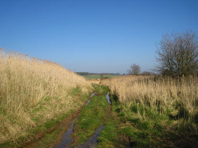
Ram Wood also boasts several well-maintained trails and footpaths, allowing visitors to explore the area at their own pace. These paths provide access to the heart of the woodland, where visitors can discover hidden ponds, streams, and other natural features.

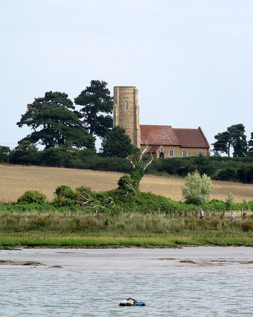
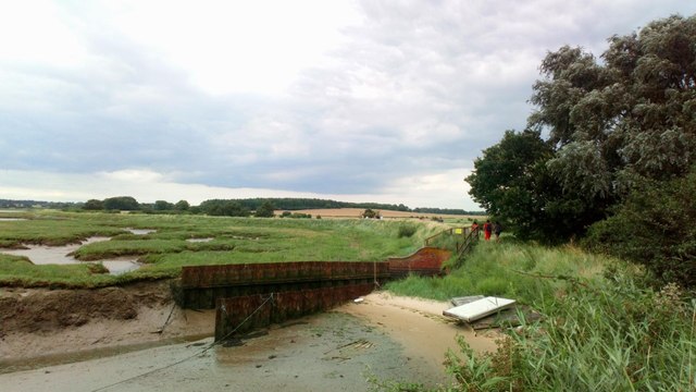
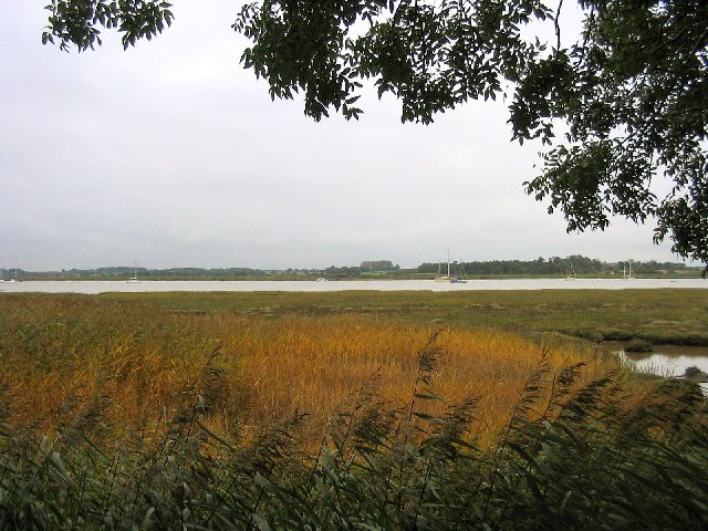
Given its proximity to the coast, Ram Wood offers a unique combination of woodland and coastal landscapes. Visitors can enjoy stunning views of the nearby estuary and marshland, adding to the area's natural beauty.

Overall, Ram Wood in Suffolk is a delightful destination for those seeking a peaceful and immersive experience in nature. Its diverse flora and fauna, coupled with its scenic surroundings, make it a true gem in the Suffolk countryside.

If you have any feedback on the listing, please let us know in the comments section below.

Ram Wood Images

Images are sourced within 2km of 52.02831/1.3296576 or Grid Reference TM2841. Thanks to Geograph Open Source API. All images are credited.

Towards Ramsholt Church The Grade II* listed round-towered All Saints' church is about a quarter of a mile from the riverside, and in <a href="https://www.geograph.org.uk/gridref/TM3042">TM3042</a>. Two women and a dog (on the right) were taking the riverside footpath as our boat passed.
Towards Ramsholt Church
The Grade II* listed round-towered All Saints' church is about a quarter of a mile from the riverside, and in TM3042. Two women and a dog (on the right) were taking the riverside footpath as our boat passed.
Shottisham Creek Sluice
Sunset over the River Deben, Ramsholt
River Deben from Ramsholt Quay The Deben, at this point is less than three miles from the sea and although not as congested as Waldringfield Quay is a popular spot, especially with the Ramsholt Arms for food and drink on site. <a title="https://www.geograph.org.uk/photo/6833874" href="https://www.geograph.org.uk/photo/6833874">Link</a>
River Deben from Ramsholt Quay
The Deben, at this point is less than three miles from the sea and although not as congested as Waldringfield Quay is a popular spot, especially with the Ramsholt Arms for food and drink on site. Link
In Cragpit Plantation
Reed beds, River Deben, Suffolk Looking south-west from Snottisham Creek
Reed beds, River Deben, Suffolk
Looking south-west from Snottisham Creek
Samphire island This is a close-up of a tiny islet in the mud flats of the River Deben, north of Ramsholt. Green algae has encrusted last year's samphire, whilst new bright-green shoots are emerging from the mud.
Samphire island
This is a close-up of a tiny islet in the mud flats of the River Deben, north of Ramsholt. Green algae has encrusted last year's samphire, whilst new bright-green shoots are emerging from the mud.
Keeper's Cottage Sluice The sluice controls water flow between the River Deben and the neighbouring marshes. The woodland to the right of the photo is Cragpit Plantation.
Keeper's Cottage Sluice
The sluice controls water flow between the River Deben and the neighbouring marshes. The woodland to the right of the photo is Cragpit Plantation.
Footpath through arable land, near Falkenham Woods <span class="nowrap"><a title="https://en.wikipedia.org/wiki/Falkenham" rel="nofollow ugc noopener" href="https://en.wikipedia.org/wiki/Falkenham">Link</a><img style="margin-left:2px;" alt="External link" title="External link - shift click to open in new window" src="https://s1.geograph.org.uk/img/external.png" width="10" height="10"/></span>
Footpath through arable land, near Falkenham Woods
Kirton Marshes Looking south towards Falkenham Creek, over the reed-lined backwater behind the sea wall.
Kirton Marshes
Looking south towards Falkenham Creek, over the reed-lined backwater behind the sea wall.
Shottisham Creek The creek as it emerges from the sluice
Shottisham Creek
The creek as it emerges from the sluice
Track near Shottisham Creek Sluice
Sluice Cottage
Sluice Cottage
Along The Bank Looking southeast along the sea band next to the River Deben near to Hemley, Suffolk.
Along The Bank
Looking southeast along the sea band next to the River Deben near to Hemley, Suffolk.
Waiting For A High Tide Small boat moored at Shottisham Creek awaiting a high tide near to Shottisham, Suffolk.
Waiting For A High Tide
Small boat moored at Shottisham Creek awaiting a high tide near to Shottisham, Suffolk.
War Memorials in Hemley church The uppermost memorial is to a WW2 casualty.
The lower plaque is a combination of Roll of Honour and Memorial for both WW1 and WW2 as it bears two names with a cross beside them denoting that they fell during the relevant War.
War Memorials in Hemley church
The uppermost memorial is to a WW2 casualty. The lower plaque is a combination of Roll of Honour and Memorial for both WW1 and WW2 as it bears two names with a cross beside them denoting that they fell during the relevant War.
Eelsfoot Cottage, Hemley Weatherboarded cottage, now in use as a holiday rental.
Eelsfoot Cottage, Hemley
Weatherboarded cottage, now in use as a holiday rental.
Show me another place!

Ram Wood is located at Grid Ref: TM2841 (Lat: 52.02831, Lng: 1.3296576)

Administrative County: Suffolk

District: East Suffolk

Police Authority: Suffolk

What 3 Words

///officials.prevents.assume. Near Woodbridge, Suffolk

Related Wikis

Hemley

Hemley is a village and a civil parish in the East Suffolk district, in the English county of Suffolk. It is located near the River Deben. Nearby settlements...

Ramsholt Cliff

Ramsholt Cliff is a 2.1-hectare (5.2-acre) geological Site of Special Scientific Interest north-west of Ramsholt in Suffolk. It is a Geological Conservation...

Newbourne

Newbourne is a village and civil parish in the East Suffolk district of Suffolk, England. It lies on the peninsula between the River Orwell and the River...

Deben Estuary

Deben Estuary is a 981.1-hectare (2,424-acre) biological Site of Special Scientific Interest (SSSI) covering the River Deben and its banks 12 kilometres...

Kirton, Suffolk

Kirton is a village and a civil parish in the shire county of Suffolk, England, situated off the A14 road, about 4.5 km (2.8 mi) from Felixstowe and around...

Newbourne Springs

Newbourne Springs is a 15.7-hectare (39-acre) biological Site of Special Scientific Interest in Newbourne in Suffolk. It is owned by Anglian Water and...

Ramsholt

Ramsholt is a small village and civil parish within the East Suffolk district, located in the county of Suffolk, England. It is situated on the northern...

Waldringfield

Waldringfield is a village and civil parish in the East Suffolk district, in the county of Suffolk, England. It is situated on the bank of the River Deben...

Nearby Amenities

Located within 500m of 52.02831,1.3296576
Church
Naptan AtcoCode: 390060402
Naptan Bearing: E
Naptan BusStopType: CUS
Naptan CommonName: Church
Naptan Indicator: adj
Naptan Landmark: Church
Naptan NaptanCode: sufgpjwm
Naptan Street: Mill Road
Naptan Verified: no
Source: naptan_import
Lat/Long: 52.032333/1.3298882
Post Box
Collection Times: Mo-Fr 16:30; Sa 10:00
Operator: Royal Mail
Operator Type: private
Operator Wikidata: Q638098
Post Box Type: wall
Ref: IP12 6218
Royal Cypher: VR
Royal Cypher Wikidata: Q33102356
Lat/Long: 52.0322932/1.3297808
The data included in this document is from www.openstreetmap.org. The data is made available under ODbL.

Have you been to Ram Wood?

Leave your review of Ram Wood below (or comments, questions and feedback).