Shepherds Wood

Wood, Forest in Suffolk East Suffolk

England

Shepherds Wood

River Deben from Ramsholt Quay The Deben, at this point is less than three miles from the sea and although not as congested as Waldringfield Quay is a popular spot, especially with the Ramsholt Arms for food and drink on site. <a title="https://www.geograph.org.uk/photo/6833874" href="https://www.geograph.org.uk/photo/6833874">Link</a>
River Deben from Ramsholt Quay Credit: Adrian S Pye

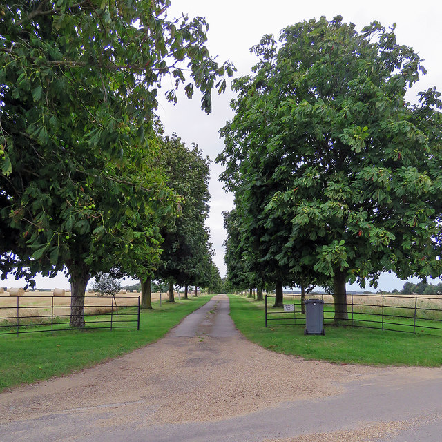
Shepherds Wood is a picturesque forest located in Suffolk, England. Covering an area of approximately 100 hectares, this woodland is a charming and natural haven for both locals and visitors alike. The forest is primarily composed of oak and beech trees, which create a dense canopy providing shelter and shade to a diverse range of flora and fauna.

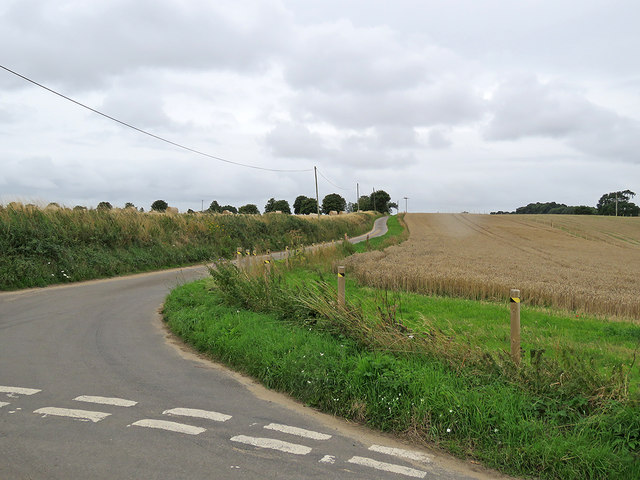
The wood is crisscrossed by a network of well-maintained footpaths, allowing visitors to explore its beauty while enjoying a leisurely stroll or an invigorating hike. As they traverse through the forest, visitors may come across enchanting streams and small ponds, adding to the tranquility of the surroundings.

Shepherds Wood is not only a delight for nature enthusiasts but also a haven for wildlife. The forest is home to a variety of bird species, including woodpeckers, owls, and various songbirds. Squirrels can be seen scurrying up and down the trees, while deer may be spotted grazing in the clearings during quieter times of the day.

In addition to its natural beauty, Shepherds Wood offers recreational opportunities such as picnicking and wildlife spotting. Local authorities have also set up designated areas for camping and barbeques, allowing visitors to fully immerse themselves in the forest experience.

Overall, Shepherds Wood in Suffolk is a captivating destination that offers a chance to escape the hustle and bustle of everyday life. Whether one seeks a peaceful walk, wildlife encounters, or a family picnic, this woodland sanctuary is sure to leave a lasting impression.

If you have any feedback on the listing, please let us know in the comments section below.

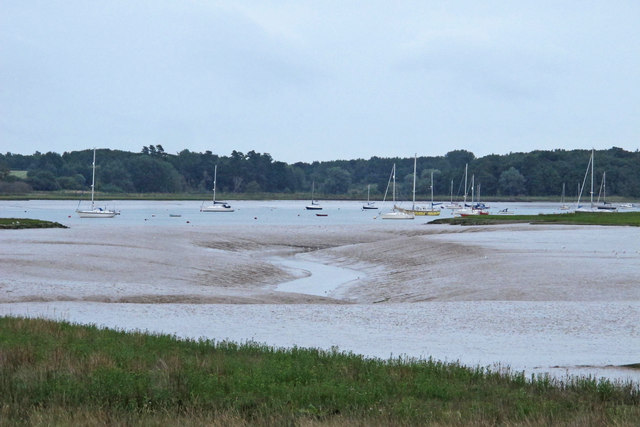
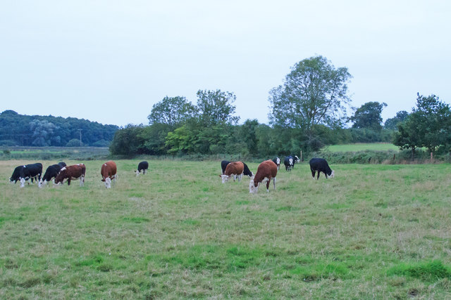
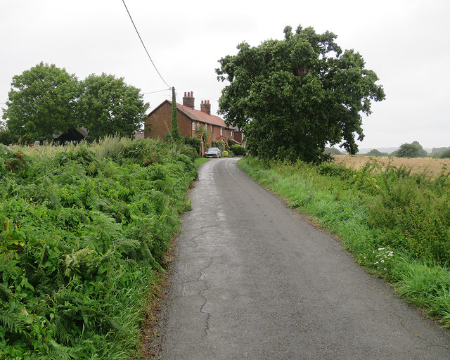
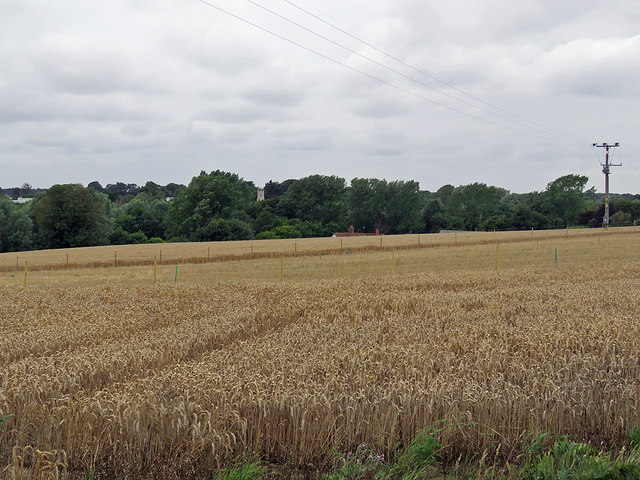
Shepherds Wood Images

Images are sourced within 2km of 52.021892/1.3253608 or Grid Reference TM2841. Thanks to Geograph Open Source API. All images are credited.

River Deben from Ramsholt Quay The Deben, at this point is less than three miles from the sea and although not as congested as Waldringfield Quay is a popular spot, especially with the Ramsholt Arms for food and drink on site. <a title="https://www.geograph.org.uk/photo/6833874" href="https://www.geograph.org.uk/photo/6833874">Link</a>
River Deben from Ramsholt Quay
The Deben, at this point is less than three miles from the sea and although not as congested as Waldringfield Quay is a popular spot, especially with the Ramsholt Arms for food and drink on site. Link
Proud parents Family of swans on The Fleet.
Proud parents
Family of swans on The Fleet.
Footpath through arable land, near Falkenham Woods <span class="nowrap"><a title="https://en.wikipedia.org/wiki/Falkenham" rel="nofollow ugc noopener" href="https://en.wikipedia.org/wiki/Falkenham">Link</a><img style="margin-left:2px;" alt="External link" title="External link - shift click to open in new window" src="https://s1.geograph.org.uk/img/external.png" width="10" height="10"/></span>
Footpath through arable land, near Falkenham Woods
Fields north of Falkenham Road
Kirton Marshes Looking south towards Falkenham Creek, over the reed-lined backwater behind the sea wall.
Kirton Marshes
Looking south towards Falkenham Creek, over the reed-lined backwater behind the sea wall.
War Memorials in Hemley church The uppermost memorial is to a WW2 casualty.
The lower plaque is a combination of Roll of Honour and Memorial for both WW1 and WW2 as it bears two names with a cross beside them denoting that they fell during the relevant War.
War Memorials in Hemley church
The uppermost memorial is to a WW2 casualty. The lower plaque is a combination of Roll of Honour and Memorial for both WW1 and WW2 as it bears two names with a cross beside them denoting that they fell during the relevant War.
Eelsfoot Cottage, Hemley Weatherboarded cottage, now in use as a holiday rental.
Eelsfoot Cottage, Hemley
Weatherboarded cottage, now in use as a holiday rental.
Soggy footpath near the Deben, Hemley Marshy footpath close to the River Deben.

The footpath signpost is the same one as seen in <a href="https://www.geograph.org.uk/photo/3901618">TM2942 : No Through Route</a> by Keith Evans.
Soggy footpath near the Deben, Hemley
Marshy footpath close to the River Deben. The footpath signpost is the same one as seen in TM2942 : No Through Route by Keith Evans.
Looking over Kirton Creek to boats in the Deben, Hemley
Cows in field as seen from footpath, Hemley
Hemley: cottages on Church Lane Soon after the cottages the lane turns into a bridle path to Mill Road, Waldringfield. Steady rain had swept in after a dry morning.
Hemley: cottages on Church Lane
Soon after the cottages the lane turns into a bridle path to Mill Road, Waldringfield. Steady rain had swept in after a dry morning.
Hemley: nearing All Saints' Church "W tower of red brick with dark blue diapering. The W window and the bell-openings are of brick too" (Nikolaus Pevsner). Rain was imminent on an August afternoon.
Hemley: nearing All Saints' Church
"W tower of red brick with dark blue diapering. The W window and the bell-openings are of brick too" (Nikolaus Pevsner). Rain was imminent on an August afternoon.
Towards Hemley Church Rain was imminent on an August afternoon.
Towards Hemley Church
Rain was imminent on an August afternoon.
A wheatfield near Newbourne Newbourne church tower shows among the trees on the other side of the valley, the roof and chimneys of Street Farm beyond the wheat. Rain set in later on this August afternoon.

Update (December 2017): the stakes mark the course of the Ea1 onshore electricity cable, whose construction began later in the year (see <a href="https://www.geograph.org.uk/photo/5637802">TM2742 : Electricity cable works near Newbourne</a>).
A wheatfield near Newbourne
Newbourne church tower shows among the trees on the other side of the valley, the roof and chimneys of Street Farm beyond the wheat. Rain set in later on this August afternoon. Update (December 2017): the stakes mark the course of the Ea1 onshore electricity cable, whose construction began later in the year (see TM2742 : Electricity cable works near Newbourne).
Hemley Hall only So reads the sign at the end of the drive, seen from the Newbourne-Hemley road on a cloudy August afternoon.
Hemley Hall only
So reads the sign at the end of the drive, seen from the Newbourne-Hemley road on a cloudy August afternoon.
The road to Hemley The junction of the roads from Waldringfield and Newbourne (right) on a cloudy August afternoon.
The road to Hemley
The junction of the roads from Waldringfield and Newbourne (right) on a cloudy August afternoon.
Towards Hemley A view from a boat sailing gently upstream towards its moorings at Waldringfield on a fine August afternoon.
Towards Hemley
A view from a boat sailing gently upstream towards its moorings at Waldringfield on a fine August afternoon.
Towards Ramsholt Lodge Farm A view from a boat heading upstream to Waldringfield, taken on a fine August afternoon.
Towards Ramsholt Lodge Farm
A view from a boat heading upstream to Waldringfield, taken on a fine August afternoon.
Show me another place!

Shepherds Wood is located at Grid Ref: TM2841 (Lat: 52.021892, Lng: 1.3253608)

Administrative County: Suffolk

District: East Suffolk

Police Authority: Suffolk

What 3 Words

///graphics.hesitate.lamppost. Near Felixstowe, Suffolk

Related Wikis

Hemley

Hemley is a village and a civil parish in the East Suffolk district, in the English county of Suffolk. It is located near the River Deben. Nearby settlements...

Kirton, Suffolk

Kirton is a village and a civil parish in the shire county of Suffolk, England, situated off the A14 road, about 4.5 km (2.8 mi) from Felixstowe and around...

Newbourne

Newbourne is a village and civil parish in the East Suffolk district of Suffolk, England. It lies on the peninsula between the River Orwell and the River...

Ramsholt Cliff

Ramsholt Cliff is a 2.1-hectare (5.2-acre) geological Site of Special Scientific Interest north-west of Ramsholt in Suffolk. It is a Geological Conservation...

Deben Estuary

Deben Estuary is a 981.1-hectare (2,424-acre) biological Site of Special Scientific Interest (SSSI) covering the River Deben and its banks 12 kilometres...

Newbourne Springs

Newbourne Springs is a 15.7-hectare (39-acre) biological Site of Special Scientific Interest in Newbourne in Suffolk. It is owned by Anglian Water and...

Falkenham

Falkenham is a village and a civil parish in the East Suffolk district, in the English county of Suffolk, near the village of Kirton and the towns of Ipswich...

Ramsholt

Ramsholt is a small village and civil parish within the East Suffolk district, located in the county of Suffolk, England. It is situated on the northern...

Nearby Amenities

Located within 500m of 52.021892,1.3253608
The data included in this document is from www.openstreetmap.org. The data is made available under ODbL.

Have you been to Shepherds Wood?

Leave your review of Shepherds Wood below (or comments, questions and feedback).