Brickeltons Wood

Wood, Forest in Kent Dover

England

Brickeltons Wood

Dover Transmitting Station The Dover transmitting station is a facility for broadcasting and telecommunications, located at West Hougham, near Dover. It has a 243.2 metres (798 ft) high guyed steel lattice mast.
Wikipedia: <span class="nowrap"><a title="https://en.wikipedia.org/wiki/Dover_transmitting_station" rel="nofollow ugc noopener" href="https://en.wikipedia.org/wiki/Dover_transmitting_station">Link</a><img style="margin-left:2px;" alt="External link" title="External link - shift click to open in new window" src="https://s1.geograph.org.uk/img/external.png" width="10" height="10"/></span>
Dover Transmitting Station Credit: N Chadwick

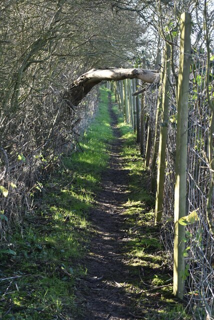
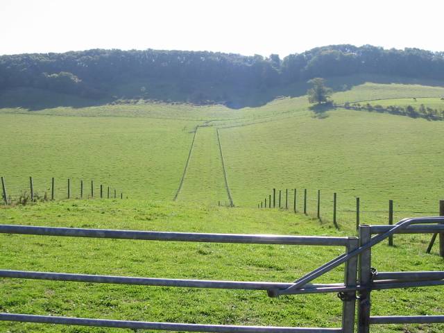
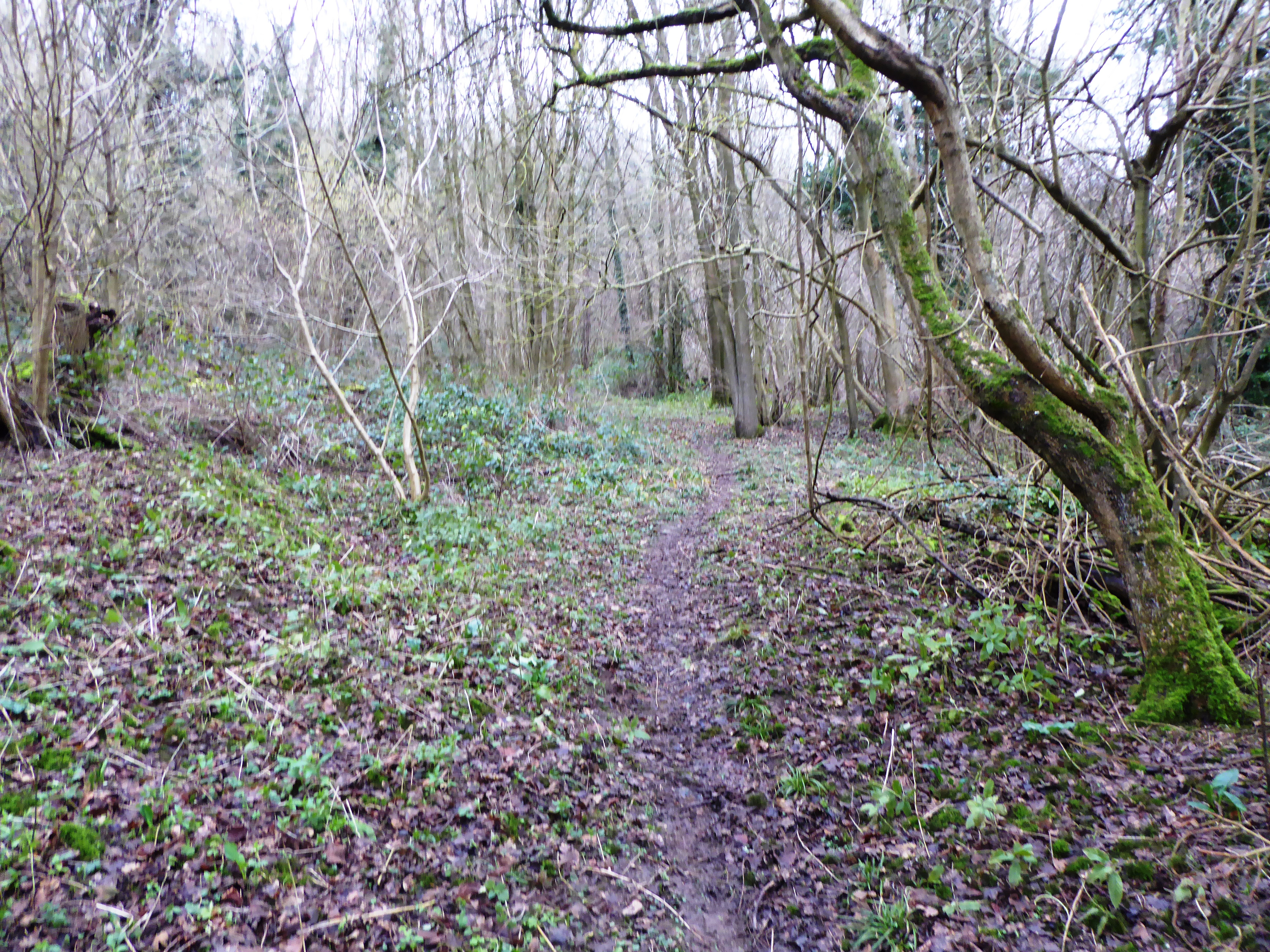
Brickeltons Wood, located in Kent, is a captivating forest that offers visitors a tranquil escape from the bustling city life. Spread across a vast area, this wood is renowned for its breathtaking natural beauty and diverse wildlife.

The wood boasts a variety of tree species, including oak, beech, and birch, which create a dense canopy overhead, providing shade on sunny days. The forest floor is adorned with a lush carpet of ferns, bluebells, and wildflowers, adding vibrant splashes of color to the landscape.

As you wander through the wood, you may come across several walking trails that meander through the trees. These trails offer an opportunity to explore the forest at your own pace, immersing yourself in its peaceful ambiance. Birdwatchers will be delighted to spot a wide range of avian species, including woodpeckers, nuthatches, and various songbirds.

Brickeltons Wood is also home to an array of wildlife, such as deer, foxes, and rabbits. Nature enthusiasts can observe these creatures in their natural habitats, ensuring an unforgettable experience. Additionally, the wood provides an ideal setting for photography, with its picturesque vistas and captivating wildlife.

The forest is open to the public throughout the year, allowing visitors to enjoy its wonders during any season. Whether you seek solitude and serenity or an opportunity to reconnect with nature, Brickeltons Wood is a perfect destination for an outdoor adventure.

If you have any feedback on the listing, please let us know in the comments section below.

Brickeltons Wood Images

Images are sourced within 2km of 51.122414/1.2391952 or Grid Reference TR2640. Thanks to Geograph Open Source API. All images are credited.

Dover Transmitting Station The Dover transmitting station is a facility for broadcasting and telecommunications, located at West Hougham, near Dover. It has a 243.2 metres (798 ft) high guyed steel lattice mast.
Wikipedia: <span class="nowrap"><a title="https://en.wikipedia.org/wiki/Dover_transmitting_station" rel="nofollow ugc noopener" href="https://en.wikipedia.org/wiki/Dover_transmitting_station">Link</a><img style="margin-left:2px;" alt="External link" title="External link - shift click to open in new window" src="https://s1.geograph.org.uk/img/external.png" width="10" height="10"/></span>
Dover Transmitting Station
The Dover transmitting station is a facility for broadcasting and telecommunications, located at West Hougham, near Dover. It has a 243.2 metres (798 ft) high guyed steel lattice mast. Wikipedia: LinkExternal link
Victorian postbox In the British Isles the first pillar post boxes were erected in Jersey in 1852. Roadside wall boxes first appeared in 1857 as a cheaper alternative to pillar boxes, especially in rural districts. In 1853 the first pillar box in Britain was installed at Botchergate, Carlisle. In 1856 Richard Redgrave of the Department of Science and Art designed an ornate pillar box for use in London and other large cities. In 1859 the design was improved, and this became the first National Standard pillar box. Green was adopted as the standard colour for the early Victorian post boxes. Between 1866 and 1879 the hexagonal Penfold post box became the standard design for pillar boxes and it was during this period that red was first adopted as the standard colour. The first boxes to be painted red were in London in July 1874, although it would be nearly 10 years before all the boxes had been repainted.
Victorian postbox
In the British Isles the first pillar post boxes were erected in Jersey in 1852. Roadside wall boxes first appeared in 1857 as a cheaper alternative to pillar boxes, especially in rural districts. In 1853 the first pillar box in Britain was installed at Botchergate, Carlisle. In 1856 Richard Redgrave of the Department of Science and Art designed an ornate pillar box for use in London and other large cities. In 1859 the design was improved, and this became the first National Standard pillar box. Green was adopted as the standard colour for the early Victorian post boxes. Between 1866 and 1879 the hexagonal Penfold post box became the standard design for pillar boxes and it was during this period that red was first adopted as the standard colour. The first boxes to be painted red were in London in July 1874, although it would be nearly 10 years before all the boxes had been repainted.
Church Farmhouse
Church Farmhouse
War Memorial, Church of St Lawrence Grade II listed.
War Memorial, Church of St Lawrence
Grade II listed.
Church of St Lawrence and war memorial Grade I listed. <span class="nowrap"><a title="https://historicengland.org.uk/listing/the-list/list-entry/1070024" rel="nofollow ugc noopener" href="https://historicengland.org.uk/listing/the-list/list-entry/1070024">Link</a><img style="margin-left:2px;" alt="External link" title="External link - shift click to open in new window" src="https://s1.geograph.org.uk/img/external.png" width="10" height="10"/></span> 
<span class="nowrap"><a title="https://www.kentchurches.info/church.asp?p=Hougham" rel="nofollow ugc noopener" href="https://www.kentchurches.info/church.asp?p=Hougham">Link</a><img style="margin-left:2px;" alt="External link" title="External link - shift click to open in new window" src="https://s1.geograph.org.uk/img/external.png" width="10" height="10"/></span>
Church of St Lawrence and war memorial
Grade I listed. LinkExternal link LinkExternal link
Church of St Lawrence Grade I listed. <span class="nowrap"><a title="https://historicengland.org.uk/listing/the-list/list-entry/1070024" rel="nofollow ugc noopener" href="https://historicengland.org.uk/listing/the-list/list-entry/1070024">Link</a><img style="margin-left:2px;" alt="External link" title="External link - shift click to open in new window" src="https://s1.geograph.org.uk/img/external.png" width="10" height="10"/></span> 
<span class="nowrap"><a title="https://www.kentchurches.info/church.asp?p=Hougham" rel="nofollow ugc noopener" href="https://www.kentchurches.info/church.asp?p=Hougham">Link</a><img style="margin-left:2px;" alt="External link" title="External link - shift click to open in new window" src="https://s1.geograph.org.uk/img/external.png" width="10" height="10"/></span>
Church of St Lawrence
Grade I listed. LinkExternal link LinkExternal link
Church of St Lawrence Grade I listed buildings and structures are of exceptional, even international importance. There are over 6,000 in the country. Only 2.5% of listed buildings are Grade I listed.
In Scotland the classification is Category A
Index: <span class="nowrap"><a title="http://en.wikipedia.org/wiki/Category:Grade_I_listed_buildings" rel="nofollow ugc noopener" href="http://en.wikipedia.org/wiki/Category:Grade_I_listed_buildings">Link</a><img style="margin-left:2px;" alt="External link" title="External link - shift click to open in new window" src="https://s1.geograph.org.uk/img/external.png" width="10" height="10"/></span>
Church of St Lawrence
Grade I listed buildings and structures are of exceptional, even international importance. There are over 6,000 in the country. Only 2.5% of listed buildings are Grade I listed. In Scotland the classification is Category A Index: LinkExternal link
Dover Transmitting Station The Dover transmitting station is a facility for broadcasting and telecommunications, located at West Hougham, near Dover. It has a 243.2 metres (798 ft) high guyed steel lattice mast.
Wikipedia: <span class="nowrap"><a title="https://en.wikipedia.org/wiki/Dover_transmitting_station" rel="nofollow ugc noopener" href="https://en.wikipedia.org/wiki/Dover_transmitting_station">Link</a><img style="margin-left:2px;" alt="External link" title="External link - shift click to open in new window" src="https://s1.geograph.org.uk/img/external.png" width="10" height="10"/></span>
Dover Transmitting Station
The Dover transmitting station is a facility for broadcasting and telecommunications, located at West Hougham, near Dover. It has a 243.2 metres (798 ft) high guyed steel lattice mast. Wikipedia: LinkExternal link
Church of St Lawrence Grade I listed. <span class="nowrap"><a title="https://historicengland.org.uk/listing/the-list/list-entry/1070024" rel="nofollow ugc noopener" href="https://historicengland.org.uk/listing/the-list/list-entry/1070024">Link</a><img style="margin-left:2px;" alt="External link" title="External link - shift click to open in new window" src="https://s1.geograph.org.uk/img/external.png" width="10" height="10"/></span> 
<span class="nowrap"><a title="https://www.kentchurches.info/church.asp?p=Hougham" rel="nofollow ugc noopener" href="https://www.kentchurches.info/church.asp?p=Hougham">Link</a><img style="margin-left:2px;" alt="External link" title="External link - shift click to open in new window" src="https://s1.geograph.org.uk/img/external.png" width="10" height="10"/></span>
Church of St Lawrence
Grade I listed. LinkExternal link LinkExternal link
Narrow, enclosed footpath
Dover Transmitting Station The Dover transmitting station is a facility for broadcasting and telecommunications, located at West Hougham, near Dover. It has a 243.2 metres (798 ft) high guyed steel lattice mast.
Wikipedia: <span class="nowrap"><a title="https://en.wikipedia.org/wiki/Dover_transmitting_station" rel="nofollow ugc noopener" href="https://en.wikipedia.org/wiki/Dover_transmitting_station">Link</a><img style="margin-left:2px;" alt="External link" title="External link - shift click to open in new window" src="https://s1.geograph.org.uk/img/external.png" width="10" height="10"/></span>
Dover Transmitting Station
The Dover transmitting station is a facility for broadcasting and telecommunications, located at West Hougham, near Dover. It has a 243.2 metres (798 ft) high guyed steel lattice mast. Wikipedia: LinkExternal link
Show me another place!

Brickeltons Wood is located at Grid Ref: TR2640 (Lat: 51.122414, Lng: 1.2391952)

Administrative County: Kent

District: Dover

Police Authority: Kent

What 3 Words

///resonated.pollution.fades. Near Capel le Ferne, Kent

Related Wikis

Hougham Without

Hougham Without is a civil parish between Dover and Folkestone in southeast England. The main settlements are the villages of Church Hougham and West Hougham...

Dover transmitting station

The Dover transmitting station is a facility for broadcasting and telecommunications, located at West Hougham, near Dover, Kent (grid reference TR274397...

St. Radegund's Abbey

St. Radegund's Abbey at Bradsole was a medieval monastic house in the parish of Hougham Without near Dover in southeast England. It was dedicated to Radegund...

St Mary's Church, Capel-le-Ferne

St Mary's Church is a redundant Anglican church to the northeast of the village of Capel-le-Ferne, Kent, England. It is recorded in the National Heritage...

Alkham

Alkham is a village and civil parish in the Dover district of Kent, England, about five miles west of Dover. Within the parish are the settlements of Chalksole...

Alkham Valley

The Alkham Valley is in the Kent Downs (the eastern part of the North Downs), an Area of Outstanding Natural Beauty, in South East Kent, England. The valley...

RNAS Capel

RNAS Capel (later RAF Folkestone) was a First World War airship station near Folkestone, Kent. == History == When Germany declared in February 1915 that...

Sladden Wood

Sladden Wood is a 7-hectare (17-acre) nature reserve north of Alkham in Kent. It is managed by the Kent Wildlife Trust.The main trees in this wood are...

Nearby Amenities

Located within 500m of 51.122414,1.2391952
Barrier: stile
Lat/Long: 51.1230628/1.2390833
Barrier: stile
Lat/Long: 51.1240831/1.2401196
Barrier: stile
Lat/Long: 51.124624/1.2407303
Barrier: stile
Lat/Long: 51.1255262/1.241846
Barrier: stile
Lat/Long: 51.1235433/1.2451746
Power: tower
Lat/Long: 51.1214743/1.2368097
Power: tower
Lat/Long: 51.1213187/1.2353181
Power: tower
Lat/Long: 51.122316/1.2449358
Power: tower
Lat/Long: 51.1220604/1.2424573
Power: tower
Lat/Long: 51.1210603/1.2328352
Power: tower
Lat/Long: 51.1217576/1.2395273
Power: pole
Lat/Long: 51.1184425/1.2413487
Power: pole
Transformer: distribution
Lat/Long: 51.1182388/1.2394737
The data included in this document is from www.openstreetmap.org. The data is made available under ODbL.

Have you been to Brickeltons Wood?

Leave your review of Brickeltons Wood below (or comments, questions and feedback).