Round Hill Plantation

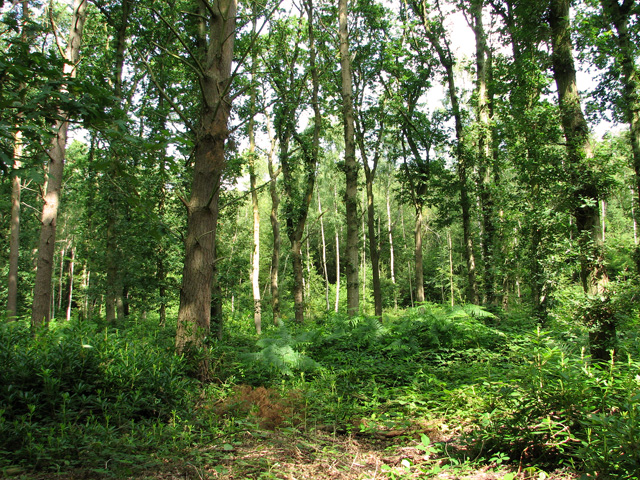
Wood, Forest in Norfolk Broadland

England

Round Hill Plantation

Atlantic Avenue Part of an expansion of Norwich to the northeast.
Atlantic Avenue Credit: Hugh Venables

Round Hill Plantation is a picturesque and historic estate located in Norfolk, Virginia. Nestled amidst lush woodlands and sprawling forests, this plantation offers a serene and idyllic setting for those seeking a retreat from the bustling city life.

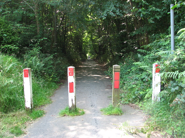
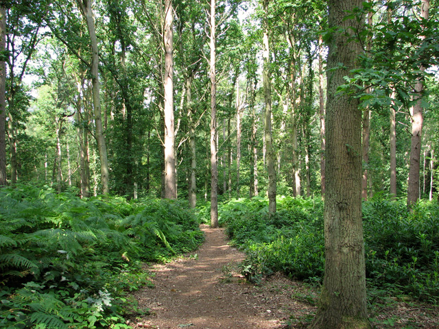
The plantation spans over hundreds of acres, with its landscape characterized by rolling hills, towering trees, and meandering streams. The woodlands surrounding Round Hill are predominantly composed of deciduous trees such as oak, maple, and hickory, creating a vibrant and ever-changing color palette throughout the seasons. The forested areas within the estate serve as a haven for various wildlife species, including deer, foxes, and a wide array of bird species, making it an ideal destination for nature enthusiasts and birdwatchers.

The main house at Round Hill Plantation is a beautiful example of colonial architecture, exuding timeless elegance and southern charm. It features a classic design with a grand entrance, stately columns, and a spacious veranda that overlooks the sprawling gardens and surrounding woods.

The plantation offers various recreational activities for its visitors, including hiking trails that wind through the woodlands, providing opportunities for exploration and enjoying the natural beauty of the area. Additionally, there are well-maintained picnic areas and designated spots for camping, allowing visitors to immerse themselves in the tranquility of the forest.

Round Hill Plantation is not only a scenic destination but also a place of historical significance. It has been recognized as a historic site due to its ties to the colonial era and its role in the agricultural history of the region.

Overall, Round Hill Plantation in Norfolk, Virginia, offers a perfect blend of natural beauty, historical significance, and recreational opportunities, making it a must-visit destination for nature lovers and history enthusiasts alike.

If you have any feedback on the listing, please let us know in the comments section below.

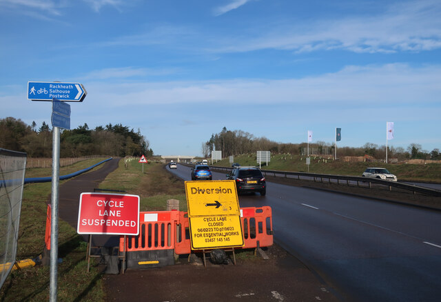
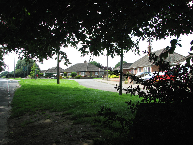
Round Hill Plantation Images

Images are sourced within 2km of 52.656087/1.350875 or Grid Reference TG2611. Thanks to Geograph Open Source API. All images are credited.

Atlantic Avenue Part of an expansion of Norwich to the northeast.
Atlantic Avenue
Part of an expansion of Norwich to the northeast.
Cycle path closed by Broadland Northway The cyclepath doesn't follow the length of the new road, just stretches where roads have been cut off.
Cycle path closed by Broadland Northway
The cyclepath doesn't follow the length of the new road, just stretches where roads have been cut off.
New part of New Rackheath Large housing development between the existing village and new dual carriageway.
New part of New Rackheath
Large housing development between the existing village and new dual carriageway.
Offices, Sprowston Hidden away on an industrial estate is a novel-looking office block built for British Gas "utilizing the German Burolandschaft concept, whereby the first floor is open-plan while the ground floor has areas divided by low partitions." Built in 1970-71 to the designs of the Design Group for Industry.
Now known as Sapphire House. It's not clear to what extent the internal layout has survived.
Offices, Sprowston
Hidden away on an industrial estate is a novel-looking office block built for British Gas "utilizing the German Burolandschaft concept, whereby the first floor is open-plan while the ground floor has areas divided by low partitions." Built in 1970-71 to the designs of the Design Group for Industry. Now known as Sapphire House. It's not clear to what extent the internal layout has survived.
Pound Lane past Belmore Plantation, Thorpe St Andrew Belmore Plantation is one of three woodlands (Racecourse, Belmore and Brown’s Plantations) in Thorpe St Andrew, just outside Norwich. Their total area is 205 acres (82 hectares), and together they form the largest area of woodland within several miles of Norwich. The woodlands are owned by the Thorpe & Felthorpe Trust, the Trustees of which are five members of the Gurney family. Local residents are opposing a developer's plan to build 631 housing 'units' here.
Pound Lane past Belmore Plantation, Thorpe St Andrew
Belmore Plantation is one of three woodlands (Racecourse, Belmore and Brown’s Plantations) in Thorpe St Andrew, just outside Norwich. Their total area is 205 acres (82 hectares), and together they form the largest area of woodland within several miles of Norwich. The woodlands are owned by the Thorpe & Felthorpe Trust, the Trustees of which are five members of the Gurney family. Local residents are opposing a developer's plan to build 631 housing 'units' here.
Belmore Plantation as seen from Pound Lane, Thorpe St Andrew Belmore Plantation is one of three woodlands (Racecourse, Belmore and Brown’s Plantations) in Thorpe St Andrew, just outside Norwich. Their total area is 205 acres (82 hectares), and together they form the largest area of woodland within several miles of Norwich. The woodlands are owned by the Thorpe & Felthorpe Trust, the Trustees of which are five members of the Gurney family. Local residents are opposing a developer's plan to build 631 housing 'units' here.
Belmore Plantation as seen from Pound Lane, Thorpe St Andrew
Belmore Plantation is one of three woodlands (Racecourse, Belmore and Brown’s Plantations) in Thorpe St Andrew, just outside Norwich. Their total area is 205 acres (82 hectares), and together they form the largest area of woodland within several miles of Norwich. The woodlands are owned by the Thorpe & Felthorpe Trust, the Trustees of which are five members of the Gurney family. Local residents are opposing a developer's plan to build 631 housing 'units' here.
Cottages in Pound Lane, Thorpe St Andrew
Cottages on the edge of Belmore Plantation, Thorpe St Andrew The tree in the foreground (right) is a large redwood tree. The term 'redwood' generally refers to one of several species of tree with red or reddish coloured wood; the bark of mature trees is commonly orange to red-brown in colour and of a stringy texture. Redwoods are conifers of the Cupressaceae or cypress family that has a worldwide distribution ranging from arctic Norway to southern Chile.

Belmore Plantation is one of three woodlands (Racecourse, Belmore and Brown’s Plantations) in Thorpe St Andrew, just outside Norwich. Their total area is 205 acres (82 hectares), and together they form the largest area of woodland within several miles of Norwich. The woodlands are owned by the Thorpe & Felthorpe Trust, the Trustees of which are five members of the Gurney family. Local residents are opposing a developer's plan to build 631 housing 'units' here.
Cottages on the edge of Belmore Plantation, Thorpe St Andrew
The tree in the foreground (right) is a large redwood tree. The term 'redwood' generally refers to one of several species of tree with red or reddish coloured wood; the bark of mature trees is commonly orange to red-brown in colour and of a stringy texture. Redwoods are conifers of the Cupressaceae or cypress family that has a worldwide distribution ranging from arctic Norway to southern Chile. Belmore Plantation is one of three woodlands (Racecourse, Belmore and Brown’s Plantations) in Thorpe St Andrew, just outside Norwich. Their total area is 205 acres (82 hectares), and together they form the largest area of woodland within several miles of Norwich. The woodlands are owned by the Thorpe & Felthorpe Trust, the Trustees of which are five members of the Gurney family. Local residents are opposing a developer's plan to build 631 housing 'units' here.
Redwood tree on the edge of Belmore Plantation, Thorpe St Andrew In a class of its own and standing out from the surrounding broadleaf trees this large redwood tree is growing on the edge of Belmore Plantation. The term 'redwood' generally refers to one of several species of tree with red or reddish coloured wood; the bark of mature trees is commonly orange to red-brown in colour and of a stringy texture. Redwoods are conifers of the Cupressaceae or cypress family that has a worldwide distribution ranging from arctic Norway to southern Chile.

Belmore Plantation is one of three woodlands (Racecourse, Belmore and Brown’s Plantations) in Thorpe St Andrew, just outside Norwich. Their total area is 205 acres (82 hectares), and together they form the largest area of woodland within several miles of Norwich. The woodlands are owned by the Thorpe & Felthorpe Trust, the Trustees of which are five members of the Gurney family. Local residents are opposing a developer's plan to build 631 housing 'units' here.
Redwood tree on the edge of Belmore Plantation, Thorpe St Andrew
In a class of its own and standing out from the surrounding broadleaf trees this large redwood tree is growing on the edge of Belmore Plantation. The term 'redwood' generally refers to one of several species of tree with red or reddish coloured wood; the bark of mature trees is commonly orange to red-brown in colour and of a stringy texture. Redwoods are conifers of the Cupressaceae or cypress family that has a worldwide distribution ranging from arctic Norway to southern Chile. Belmore Plantation is one of three woodlands (Racecourse, Belmore and Brown’s Plantations) in Thorpe St Andrew, just outside Norwich. Their total area is 205 acres (82 hectares), and together they form the largest area of woodland within several miles of Norwich. The woodlands are owned by the Thorpe & Felthorpe Trust, the Trustees of which are five members of the Gurney family. Local residents are opposing a developer's plan to build 631 housing 'units' here.
Dry pond in Belmore Plantation, Thorpe St Andrew Belmore Plantation is one of three woodlands (Racecourse, Belmore and Brown’s Plantations) in Thorpe St Andrew, just outside Norwich. Their total area is 205 acres (82 hectares), and together they form the largest area of woodland within several miles of Norwich. The woodlands are owned by the Thorpe & Felthorpe Trust, the Trustees of which are five members of the Gurney family. Local residents are opposing a developer's plan to build 631 housing 'units' here.
Dry pond in Belmore Plantation, Thorpe St Andrew
Belmore Plantation is one of three woodlands (Racecourse, Belmore and Brown’s Plantations) in Thorpe St Andrew, just outside Norwich. Their total area is 205 acres (82 hectares), and together they form the largest area of woodland within several miles of Norwich. The woodlands are owned by the Thorpe & Felthorpe Trust, the Trustees of which are five members of the Gurney family. Local residents are opposing a developer's plan to build 631 housing 'units' here.
Path past ponds in Belmore Plantation, Thorpe St Andrew Belmore Plantation is one of three woodlands (Racecourse, Belmore and Brown’s Plantations) in Thorpe St Andrew, just outside Norwich. Their total area is 205 acres (82 hectares), and together they form the largest area of woodland within several miles of Norwich. The woodlands are owned by the Thorpe & Felthorpe Trust, the Trustees of which are five members of the Gurney family. Local residents are opposing a developer's plan to build 631 housing 'units' here.
Path past ponds in Belmore Plantation, Thorpe St Andrew
Belmore Plantation is one of three woodlands (Racecourse, Belmore and Brown’s Plantations) in Thorpe St Andrew, just outside Norwich. Their total area is 205 acres (82 hectares), and together they form the largest area of woodland within several miles of Norwich. The woodlands are owned by the Thorpe & Felthorpe Trust, the Trustees of which are five members of the Gurney family. Local residents are opposing a developer's plan to build 631 housing 'units' here.
Path in Belmore Plantation, Thorpe St Andrew Belmore Plantation is one of three woodlands (Racecourse, Belmore and Brown’s Plantations) in Thorpe St Andrew, just outside Norwich. Their total area is 205 acres (82 hectares), and together they form the largest area of woodland within several miles of Norwich. The woodlands are owned by the Thorpe & Felthorpe Trust, the Trustees of which are five members of the Gurney family. Local residents are opposing a developer's plan to build 631 housing 'units' here.
Path in Belmore Plantation, Thorpe St Andrew
Belmore Plantation is one of three woodlands (Racecourse, Belmore and Brown’s Plantations) in Thorpe St Andrew, just outside Norwich. Their total area is 205 acres (82 hectares), and together they form the largest area of woodland within several miles of Norwich. The woodlands are owned by the Thorpe & Felthorpe Trust, the Trustees of which are five members of the Gurney family. Local residents are opposing a developer's plan to build 631 housing 'units' here.
Pound Lane past Brown's Plantation, Thorpe St Andrew The woodland to the right (west) of the lane is Belmore Plantation. Belmore Plantation is one of three woodlands (Racecourse, Belmore and Brown’s Plantations) in Thorpe St Andrew, just outside Norwich. Their total area is 205 acres (82 hectares), and together they form the largest area of woodland within several miles of Norwich. The woodlands are owned by the Thorpe & Felthorpe Trust, the Trustees of which are five members of the Gurney family. Local residents are opposing a developer's plan to build 631 housing 'units' here.
Pound Lane past Brown's Plantation, Thorpe St Andrew
The woodland to the right (west) of the lane is Belmore Plantation. Belmore Plantation is one of three woodlands (Racecourse, Belmore and Brown’s Plantations) in Thorpe St Andrew, just outside Norwich. Their total area is 205 acres (82 hectares), and together they form the largest area of woodland within several miles of Norwich. The woodlands are owned by the Thorpe & Felthorpe Trust, the Trustees of which are five members of the Gurney family. Local residents are opposing a developer's plan to build 631 housing 'units' here.
The northern end of Pound Lane, Thorpe St Andrew
Bungalows by the southern edge of Belmore Plantation, Thorpe St Andrew
Path through bracken in Belmore Plantation, Thorpe St Andrew Belmore Plantation is one of three woodlands (Racecourse, Belmore and Brown’s Plantations) in Thorpe St Andrew, just outside Norwich. Their total area is 205 acres (82 hectares), and together they form the largest area of woodland within several miles of Norwich. The woodlands are owned by the Thorpe & Felthorpe Trust, the Trustees of which are five members of the Gurney family. Local residents are opposing a developer's plan to build 631 housing 'units' here.
Path through bracken in Belmore Plantation, Thorpe St Andrew
Belmore Plantation is one of three woodlands (Racecourse, Belmore and Brown’s Plantations) in Thorpe St Andrew, just outside Norwich. Their total area is 205 acres (82 hectares), and together they form the largest area of woodland within several miles of Norwich. The woodlands are owned by the Thorpe & Felthorpe Trust, the Trustees of which are five members of the Gurney family. Local residents are opposing a developer's plan to build 631 housing 'units' here.
Belmore Plantation, Thorpe St Andrew Belmore Plantation is one of three woodlands (Racecourse, Belmore and Brown’s Plantations) in Thorpe St Andrew, just outside Norwich. Their total area is 205 acres (82 hectares), and together they form the largest area of woodland within several miles of Norwich. The woodlands are owned by the Thorpe & Felthorpe Trust, the Trustees of which are five members of the Gurney family. Local residents are opposing a developer's plan to build 631 housing 'units' here.
Belmore Plantation, Thorpe St Andrew
Belmore Plantation is one of three woodlands (Racecourse, Belmore and Brown’s Plantations) in Thorpe St Andrew, just outside Norwich. Their total area is 205 acres (82 hectares), and together they form the largest area of woodland within several miles of Norwich. The woodlands are owned by the Thorpe & Felthorpe Trust, the Trustees of which are five members of the Gurney family. Local residents are opposing a developer's plan to build 631 housing 'units' here.
St Mary & St Margaret, Sprowston, Norwich
Show me another place!

Round Hill Plantation is located at Grid Ref: TG2611 (Lat: 52.656087, Lng: 1.350875)

Administrative County: Norfolk

District: Broadland

Police Authority: Norfolk

What 3 Words

///metals.people.spaces. Near Rackheath, Norfolk

Related Wikis

RAF Mousehold Heath

The area of Norwich between the Salhouse and Plumstead roads (outside of the outer ring road) was originally the Cavalry Training Ground and then became...

Heartsease Estate, Norwich

The Heartsease is a housing estate located in Norwich, Norfolk and takes its name from the heartsease, a common European wild flower. == Location == The...

Sprowston Community Academy

Sprowston Community Academy is a coeducational secondary school located in Sprowston, Norwich, Norfolk, England. == Description == Ofsted visiting the...

Sprowston

Sprowston ( or ) is a town and civil parish in the Broadland district of Norfolk, England. It is bounded by Heartsease to the east, Mousehold Heath and...

Open Academy

Open Academy (formerly Heartsease High School) is a secondary school with academy status located in the Heartsease area of Norwich, in the English county...

Norwich Northern Distributor Road

The Norwich Northern Distributor Road, now officially named the Broadland Northway (but also known as the NDR) is a 12.4 mi (20.0 km) dual-carriageway...

Thorpe St Andrew School

Thorpe St. Andrew School is an 11 to 18 mixed secondary school in Thorpe St. Andrew on the outskirts of the city of Norwich in the English county of Norfolk...

Thorpe St Andrew

Thorpe St Andrew is a town and civil parish in the Broadland district of Norfolk, England. It is situated on the River Yare, two miles east of the centre...

Nearby Amenities

Located within 500m of 52.656087,1.350875
Crossing
Bicycle: designated
Crossing: unmarked
Foot: designated
Tactile Paving: yes
Lat/Long: 52.6579168/1.347515
Crossing
Crossing: unmarked
Tactile Paving: no
Lat/Long: 52.657811/1.3481722
Addr Postcode: NR7 8GD
Lat/Long: 52.6568161/1.3467157
Addr Postcode: NR7 8FZ
Lat/Long: 52.6566022/1.3469655
Addr Postcode: NR7 8FU
Lat/Long: 52.6571544/1.3465197
Addr Postcode: NR7 8GG
Lat/Long: 52.6528826/1.3506446
Addr Postcode: NR7 8GJ
Lat/Long: 52.653337/1.3501617
Addr Postcode: NR7 8GH
Lat/Long: 52.6532777/1.3516213
Addr Postcode: NR7 8GA
Building: yes
Lat/Long: 52.6568841/1.346854
Crossing
Bicycle: designated
Crossing: unmarked
Foot: designated
Tactile Paving: yes
Lat/Long: 52.6579859/1.3474104
Crossing
Crossing: unmarked
Crossing Island: no
Tactile Paving: no
Lat/Long: 52.6589479/1.3465656
Crossing
Crossing: unmarked
Crossing Island: no
Kerb: lowered
Tactile Paving: yes
Lat/Long: 52.6548442/1.3508383
Post Box
Collection Times: Mo-Fr 16:00; Sa 11:00
Colour: red
Operator: Royal Mail
Ref: NR7 745
Royal Cypher: EIIR
Royal Cypher Wikidata: Q33102113
Lat/Long: 52.6589317/1.346552
Waste Basket
Waste: dog_excrement
Lat/Long: 52.6553702/1.3493033
Waste Basket
Waste: dog_excrement
Lat/Long: 52.6577747/1.3475378
Bus Stop
Atlantic Avenue/Overstrand Way
Bench: no
Bin: no
Bus: yes
Departures Board: timetable
Lit: yes
Operator: First Bus
Public Transport: platform
Shelter: no
Tactile Paving: no
Lat/Long: 52.6591407/1.3464533
Crossing
Crossing: unmarked
Crossing Island: no
Kerb: lowered
Tactile Paving: yes
Lat/Long: 52.6531786/1.3523436
Give Way
Barrier: kerb
Kerb: flush
Lat/Long: 52.6531919/1.3523926
Give Way
Barrier: kerb
Kerb: flush
Lat/Long: 52.6531642/1.3522873
Crossing
Crossing: unmarked
Crossing Island: no
Kerb: lowered
Tactile Paving: yes
Lat/Long: 52.6539316/1.3516826
Give Way
Lat/Long: 52.6529365/1.3524988
Give Way
Lat/Long: 52.6531944/1.3535266
The data included in this document is from www.openstreetmap.org. The data is made available under ODbL.

Have you been to Round Hill Plantation?

Leave your review of Round Hill Plantation below (or comments, questions and feedback).