Cony Wood

Wood, Forest in Kent Canterbury

England

Cony Wood

Farm track with barrier Off Westcourt Lane.
Farm track with barrier Credit: Robin Webster

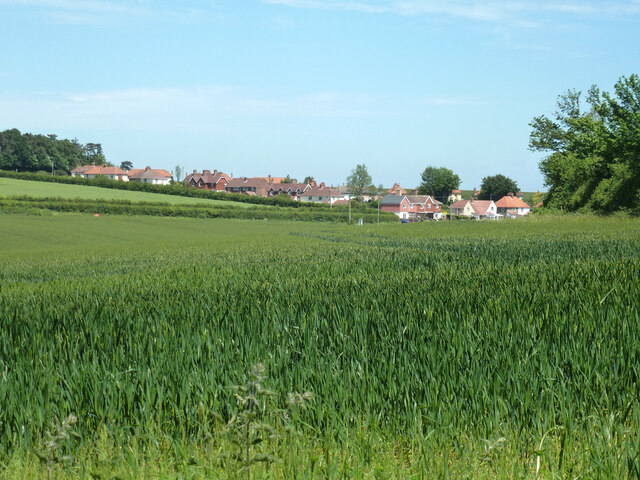
Cony Wood is a beautiful forest located in Kent, England. Covering an area of approximately 300 acres, it is a renowned woodland and natural reserve that offers visitors a tranquil and enchanting experience.

The wood is predominantly composed of oak and beech trees, which create a dense canopy that provides shade on hot summer days. The forest floor is adorned with a rich diversity of vegetation, including bluebells, ferns, and wildflowers, creating a vibrant and colorful landscape.

Cony Wood is home to a variety of wildlife, making it a popular destination for nature enthusiasts. Visitors have the opportunity to spot a wide range of species, including deer, foxes, squirrels, and a multitude of bird species. The peaceful atmosphere and diverse ecosystem make it an ideal spot for birdwatching and photography.

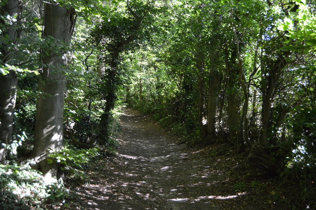
For those seeking outdoor activities, Cony Wood offers several well-maintained walking and cycling trails. These trails wind through the forest, offering breathtaking views and the chance to immerse oneself in nature. The wood is also intersected by a small stream, adding to its picturesque charm.

Cony Wood is not only a haven for wildlife but also a place of historical significance. It is believed that the forest has been in existence since medieval times, and remnants of old pathways and archaeological sites can still be found within its boundaries.

Overall, Cony Wood, Kent, is a captivating woodland that combines natural beauty, wildlife diversity, and historical elements. It is a must-visit destination for anyone seeking a peaceful retreat in the heart of nature.

If you have any feedback on the listing, please let us know in the comments section below.
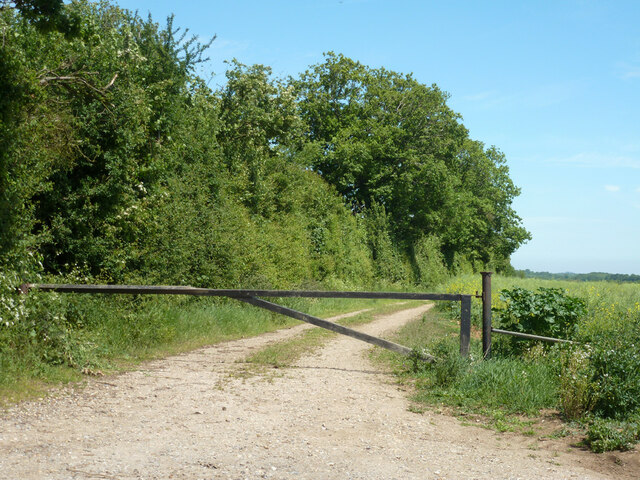
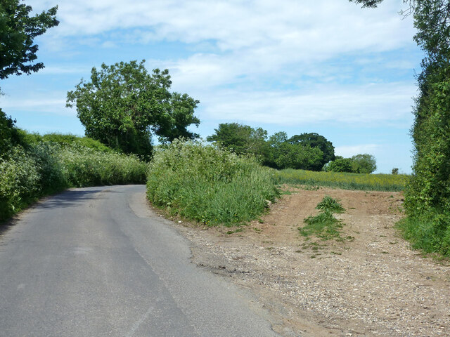
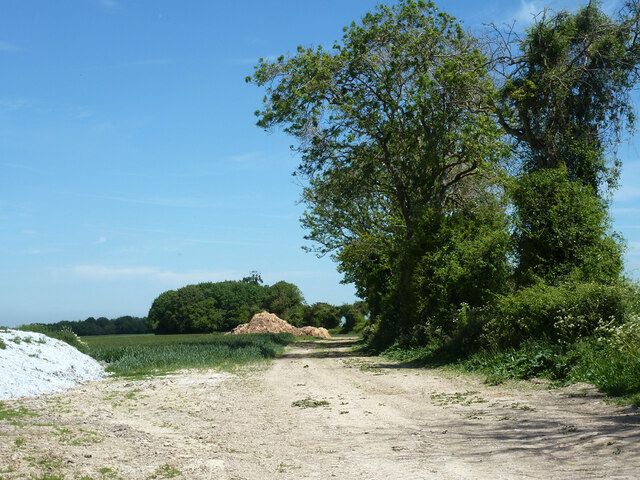
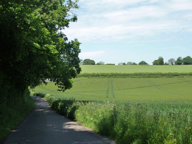
Cony Wood Images

Images are sourced within 2km of 51.210193/1.2076785 or Grid Reference TR2450. Thanks to Geograph Open Source API. All images are credited.

Farm track with barrier Off Westcourt Lane.
Farm track with barrier
Off Westcourt Lane.
Westcourt Lane and field entrance off it Looking towards Woolage Green.
Westcourt Lane and field entrance off it
Looking towards Woolage Green.
Farm track with heaps near Woolage Green The hedge is an administrative boundary - Canterbury this side, Dover the other.
Farm track with heaps near Woolage Green
The hedge is an administrative boundary - Canterbury this side, Dover the other.
Lane heading away from Woolage Green
View towards Woolage Village
Road closure, Woolage Green The road some way along was dug up for gas purposes.
Road closure, Woolage Green
The road some way along was dug up for gas purposes.
The Two Sawyers, Woolage Green
Leighgate Bottom
Leighgate Bottom
Byway to Woolage Green
Nethersole Rd
Nethersole Rd
Leighgate Bottom
Leighgate Bottom
Nethersole Rd
Nethersole Rd
North Downs Way A long distance path in southern England. It runs from Farnham to Dover, past Godalming, Guildford, Dorking, Merstham, Otford and Rochester, along the Surrey Hills Area of Outstanding Natural Beauty (AONB) and Kent Downs AONB. East of Boughton Lees, the path splits in two, the northern section running via Canterbury and the southern via Wye. The two sections of the path reunite at Dover. The northern route is 211 km long, and the southern route 201 km, the total length of the North Downs Way being 246 km.
The pathway is mixed in that it varies throughout its length from footpath status to bridleway, byway and road. Some 19% of the Way follows roads, though 75% of those are minor lanes. It is marked by an acorn. See <a href="https://www.geograph.org.uk/photo/1165027">TQ6561 : Crossover in Long Distance pathways</a>.
See <span class="nowrap"><a title="http://www.nationaltrail.co.uk/Northdowns/" rel="nofollow ugc noopener" href="http://www.nationaltrail.co.uk/Northdowns/">Link</a><img style="margin-left:2px;" alt="External link" title="External link - shift click to open in new window" src="https://s1.geograph.org.uk/img/external.png" width="10" height="10"/></span> for more details and an interactive map of the trail.
North Downs Way
A long distance path in southern England. It runs from Farnham to Dover, past Godalming, Guildford, Dorking, Merstham, Otford and Rochester, along the Surrey Hills Area of Outstanding Natural Beauty (AONB) and Kent Downs AONB. East of Boughton Lees, the path splits in two, the northern section running via Canterbury and the southern via Wye. The two sections of the path reunite at Dover. The northern route is 211 km long, and the southern route 201 km, the total length of the North Downs Way being 246 km. The pathway is mixed in that it varies throughout its length from footpath status to bridleway, byway and road. Some 19% of the Way follows roads, though 75% of those are minor lanes. It is marked by an acorn. See TQ6561 : Crossover in Long Distance pathways. See LinkExternal link for more details and an interactive map of the trail.
Farmland, Leightongate Bottom
North Downs Way A long distance path in southern England. It runs from Farnham to Dover, past Godalming, Guildford, Dorking, Merstham, Otford and Rochester, along the Surrey Hills Area of Outstanding Natural Beauty (AONB) and Kent Downs AONB. East of Boughton Lees, the path splits in two, the northern section running via Canterbury and the southern via Wye. The two sections of the path reunite at Dover. The northern route is 211 km long, and the southern route 201 km, the total length of the North Downs Way being 246 km.
The pathway is mixed in that it varies throughout its length from footpath status to bridleway, byway and road. Some 19% of the Way follows roads, though 75% of those are minor lanes. It is marked by an acorn. See <a href="https://www.geograph.org.uk/photo/1165027">TQ6561 : Crossover in Long Distance pathways</a>.
See <span class="nowrap"><a title="http://www.nationaltrail.co.uk/Northdowns/" rel="nofollow ugc noopener" href="http://www.nationaltrail.co.uk/Northdowns/">Link</a><img style="margin-left:2px;" alt="External link" title="External link - shift click to open in new window" src="https://s1.geograph.org.uk/img/external.png" width="10" height="10"/></span> for more details and an interactive map of the trail.
North Downs Way
A long distance path in southern England. It runs from Farnham to Dover, past Godalming, Guildford, Dorking, Merstham, Otford and Rochester, along the Surrey Hills Area of Outstanding Natural Beauty (AONB) and Kent Downs AONB. East of Boughton Lees, the path splits in two, the northern section running via Canterbury and the southern via Wye. The two sections of the path reunite at Dover. The northern route is 211 km long, and the southern route 201 km, the total length of the North Downs Way being 246 km. The pathway is mixed in that it varies throughout its length from footpath status to bridleway, byway and road. Some 19% of the Way follows roads, though 75% of those are minor lanes. It is marked by an acorn. See TQ6561 : Crossover in Long Distance pathways. See LinkExternal link for more details and an interactive map of the trail.
Three Barrows Down
Three Barrows Down
Three Barrows Down
Three Barrows Down
North Downs way, Three Barrows Down
Show me another place!

Cony Wood is located at Grid Ref: TR2450 (Lat: 51.210193, Lng: 1.2076785)

Administrative County: Kent

District: Canterbury

Police Authority: Kent

What 3 Words

///lame.whiplash.abstracts. Near Aylesham, Kent

Related Wikis

Snowdown

Snowdown is a hamlet near Dover in Kent, England. It was the location of one of the four chief collieries of the Kent coalfield, which closed in 1987....

Snowdown railway station

Snowdown railway station is on the Dover branch of the Chatham Main Line in England, and serves the hamlet of Snowdown, Kent. It is 69 miles 60 chains...

Woolage Village

Woolage Village is a former mining village situated midway between Canterbury and Dover in the English county of Kent. It is 1 mile (1.6 km) to the east...
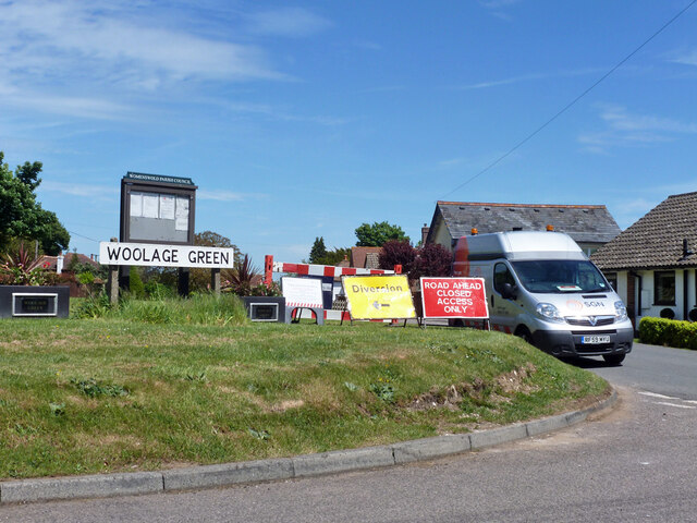
Woolage Green

Woolage Green is a small hamlet, situated about 7 miles (11 km) south-east of Canterbury, Kent, England, 1 mile to the east of the A2 road. Together with...

Have you been to Cony Wood?

Leave your review of Cony Wood below (or comments, questions and feedback).