Long Broom Covert
Wood, Forest in Norfolk North Norfolk
England
Long Broom Covert

Located in Norfolk, England, Long Broom Covert is a woodland area known for its stunning natural beauty and abundant wildlife. Covering an area of approximately 100 hectares, this forest is a haven for nature enthusiasts and outdoor adventurers alike.
Long Broom Covert boasts a diverse range of tree species, including oak, beech, and birch, which create a rich and vibrant landscape throughout the year. The forest floor is adorned with a carpet of bluebells and other wildflowers during the springtime, attracting a plethora of insects and birds. This makes it an ideal spot for birdwatching and photography enthusiasts.
The woodland is crisscrossed by a network of well-maintained trails, allowing visitors to explore the area on foot or by bike. These paths wind through the trees, offering glimpses of the various wildlife that call Long Broom Covert home. From deer and foxes to badgers and rabbits, there is no shortage of animal encounters to be had.
For those seeking a tranquil retreat, Long Broom Covert provides several picnic areas where visitors can relax and enjoy the peaceful surroundings. The forest also offers camping facilities, allowing nature lovers to immerse themselves fully in the beauty of the woodland.
Long Broom Covert is easily accessible, with ample parking available for visitors. Its proximity to the nearby village ensures that amenities such as shops and cafes are within easy reach.
In conclusion, Long Broom Covert in Norfolk is a picturesque woodland paradise, offering a wide array of natural wonders to explore. Whether you are seeking a peaceful walk, wildlife spotting, or simply a place to reconnect with nature, this forest is a must-visit destination for nature enthusiasts and adventurers alike.
If you have any feedback on the listing, please let us know in the comments section below.
Long Broom Covert Images
Images are sourced within 2km of 52.910583/1.331912 or Grid Reference TG2439. Thanks to Geograph Open Source API. All images are credited.


Long Broom Covert is located at Grid Ref: TG2439 (Lat: 52.910583, Lng: 1.331912)
Administrative County: Norfolk
District: North Norfolk
Police Authority: Norfolk
What 3 Words
///typical.repair.evaporate. Near Overstrand, Norfolk
Nearby Locations
Related Wikis
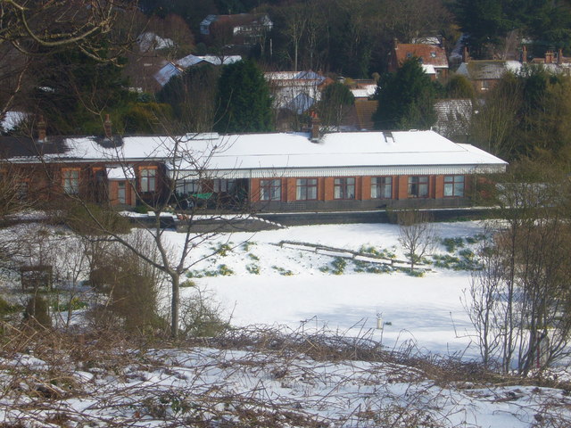
Overstrand railway station
Overstrand railway station was a station in North Norfolk on the Norfolk and Suffolk Joint Railway, serving the settlement of Overstrand. It opened on...
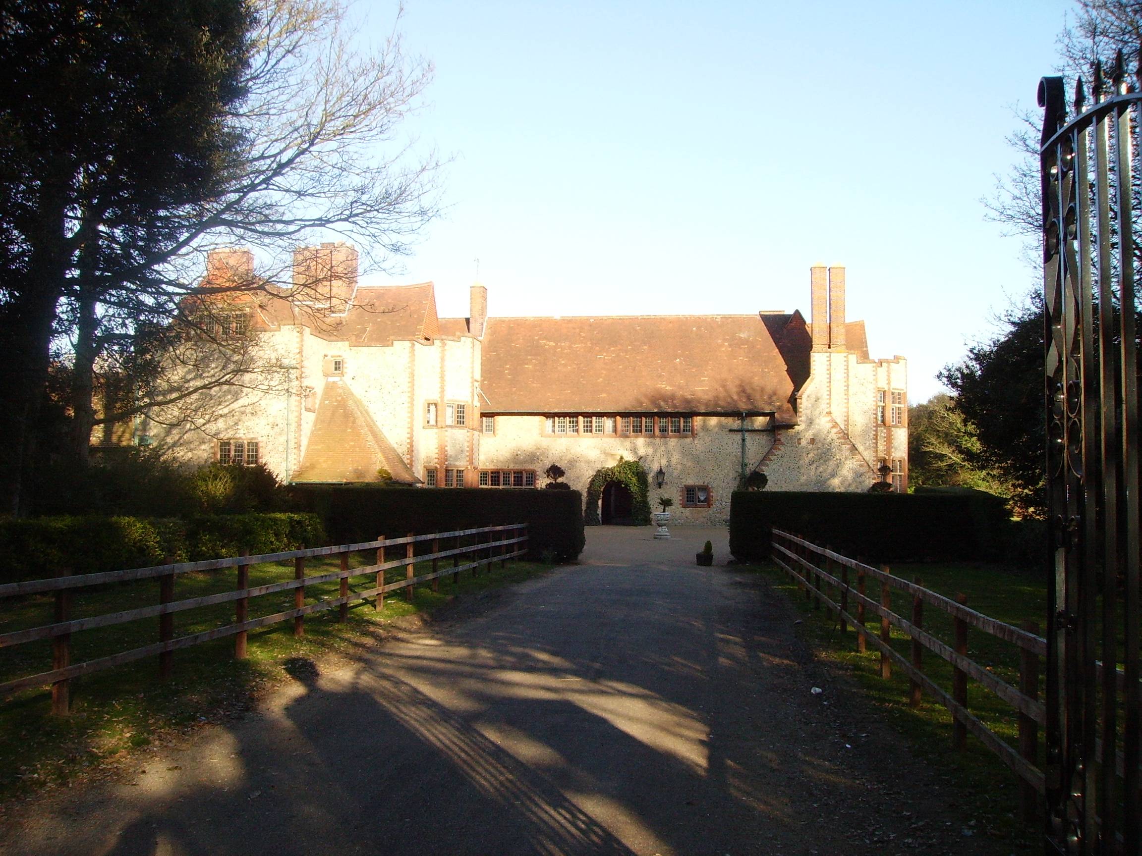
Overstrand Hall
Overstrand Hall is a country house in Overstrand, Norfolk, England, designed by Edwin Lutyens for Charles William Mills, 2nd Baron Hillingdon, a partner...

Northrepps
Northrepps is a village and a civil parish in the English county of Norfolk. It is 3.4 miles (5.5 km) southeast of Cromer, 22.2 miles (35.7 km) north of...

Overstrand Cliffs
Overstrand Cliffs is a 57.8-hectare (143-acre) biological and geological Site of Special Scientific Interest in Cromer in Norfolk. It is a Special Area...

Sidestrand Halt railway station
Sidestrand Halt was a railway station on the Norfolk and Suffolk Joint Railway which briefly served the Norfolk coastal village of Sidestrand from 1936...
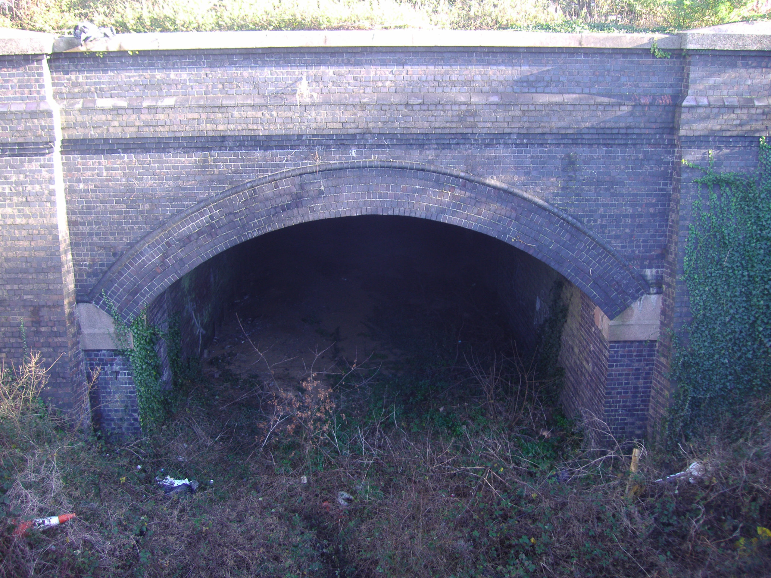
Cromer Tunnel
The Cromer Tunnel was built by the Norfolk and Suffolk Joint Railway to take their Cromer Beach to Mundesley line under the Great Eastern's Cromer High...
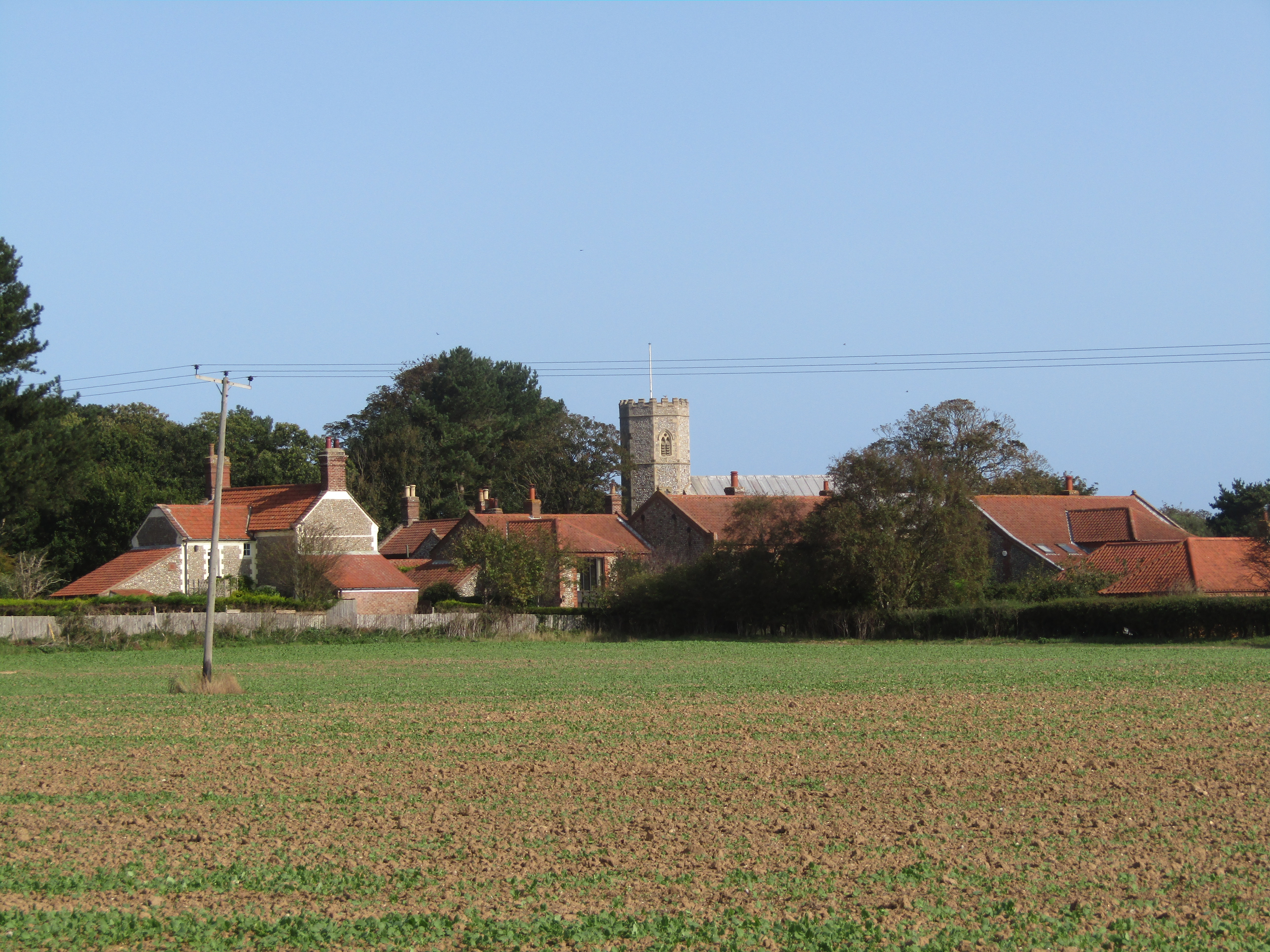
Sidestrand
Sidestrand is a village and a civil parish on the coast of the English county of Norfolk. The village is 23.7 mi (38.1 km) north of Norwich, 3.3 mi (5...

Cromer Lighthouse
Cromer Lighthouse is situated in the coastal town of Cromer, in the English county of Norfolk. == History == There has been a lighthouse on the cliff top...
Nearby Amenities
Located within 500m of 52.910583,1.331912Have you been to Long Broom Covert?
Leave your review of Long Broom Covert below (or comments, questions and feedback).