Turpin's Grove

Wood, Forest in Essex Tendring

England

Turpin's Grove

Winter afternoon at Frinton Greensward
Winter afternoon at Frinton Greensward Credit: roger geach

Turpin's Grove is a picturesque woodland located in the county of Essex, England. Situated within the larger area known as the Essex Forest, this idyllic grove is a popular destination for nature enthusiasts and those seeking a peaceful retreat from the hustle and bustle of urban life.

Covering an area of approximately 50 acres, Turpin's Grove is characterized by its dense woodland, consisting primarily of oak and beech trees. The grove's rich biodiversity is a result of its location within the larger Essex Forest, which is known for its diverse flora and fauna.

Visitors to Turpin's Grove can enjoy a variety of activities, such as walking, hiking, and bird-watching. The grove is home to numerous walking trails, allowing visitors to explore its natural beauty at their own pace. The tranquil atmosphere and lush surroundings make it a perfect spot for relaxation and meditation.

In addition to its natural beauty, Turpin's Grove has a historical significance dating back centuries. Legend has it that the notorious highwayman, Dick Turpin, used the grove as a hideout during the 18th century. Although there is limited evidence to support this claim, the name "Turpin's Grove" has persisted, adding an element of intrigue to the area's allure.

Overall, Turpin's Grove offers visitors a unique blend of natural beauty, historical intrigue, and recreational opportunities. Whether one seeks a quiet stroll amidst the trees or an immersive nature experience, this enchanting woodland in Essex provides a serene and captivating escape.

If you have any feedback on the listing, please let us know in the comments section below.

Turpin's Grove Images

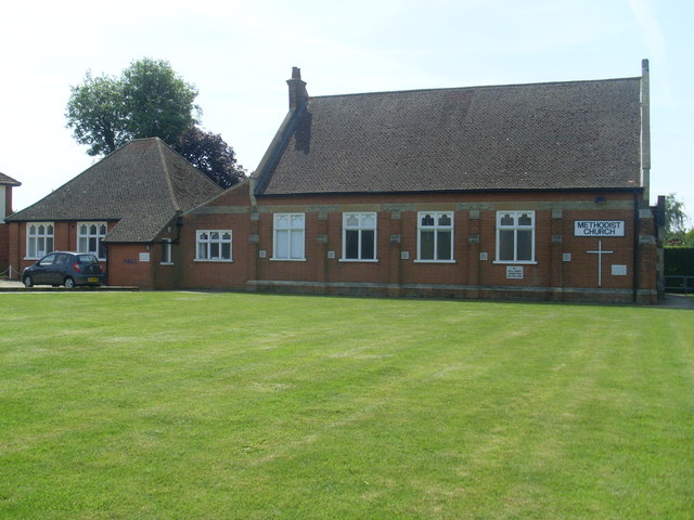
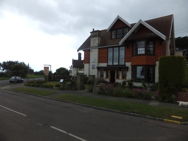
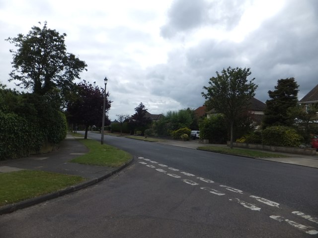
Images are sourced within 2km of 51.841931/1.24397 or Grid Reference TM2320. Thanks to Geograph Open Source API. All images are credited.

Winter afternoon at Frinton Greensward
St Marys Church, Frinton
Commemoration Stone, Frinton-on-Sea This commemoration stone was erected on the Esplanade in the year 2000 and says the following:
                            2000AD
                          To remember
                   Sir Richard Powell Cooper BT
                          1847 - 1913
                   His Vision and Generosity changed
                   small village into
                   this charming town  
                   renowned for its sands
                 greensward, tree-lined avenues
                    and tranquility
Commemoration Stone, Frinton-on-Sea
This commemoration stone was erected on the Esplanade in the year 2000 and says the following: 2000AD To remember Sir Richard Powell Cooper BT 1847 - 1913 His Vision and Generosity changed small village into this charming town renowned for its sands greensward, tree-lined avenues and tranquility
Frinton Methodist Church (1) Situated in Ashlyns Road CO13 9ET, this Church is one of nineteen such churches in the Tendring Methodist Circuit which covers North East Essex. Services are held here every Sunday at 11.00am, whilst activities take place here during the week.
Frinton Methodist Church (1)
Situated in Ashlyns Road CO13 9ET, this Church is one of nineteen such churches in the Tendring Methodist Circuit which covers North East Essex. Services are held here every Sunday at 11.00am, whilst activities take place here during the week.
Frinton Methodist Church (2) This photo shows the side view of the Methodist Church in Ashlyns Road with the adjacent Church Hall to the left of the photo.
Frinton Methodist Church (2)
This photo shows the side view of the Methodist Church in Ashlyns Road with the adjacent Church Hall to the left of the photo.
Peacocks Store Peacocks store Connaught Avenue Frinton-On-Sea, Essex.
Peacocks Store
Peacocks store Connaught Avenue Frinton-On-Sea, Essex.
Memorial With Sea View Memorial to Sir Richard Powell Cooper Bt 1847 – 1913 the man who conceived Frinton-On-Sea, Essex for close of the memorial see <a title="https://www.geograph.org.uk/photo/4027963" href="https://www.geograph.org.uk/photo/4027963">Link</a> and for more info on the man see <span class="nowrap"><a title="http://www.frinton.org/history/sir-richard-cooper.php" rel="nofollow ugc noopener" href="http://www.frinton.org/history/sir-richard-cooper.php">Link</a><img style="margin-left:2px;" alt="External link" title="External link - shift click to open in new window" src="https://s1.geograph.org.uk/img/external.png" width="10" height="10"/></span>
Memorial With Sea View
Memorial to Sir Richard Powell Cooper Bt 1847 – 1913 the man who conceived Frinton-On-Sea, Essex for close of the memorial see Link and for more info on the man see LinkExternal link
Memorial To Sir Richard Powell Cooper Bt Memorial to Sir Richard Powell Cooper Bt 1847 – 1913 the man who conceived Frinton-On-Sea, Essex for overall view of the memorial see <a title="https://www.geograph.org.uk/photo/4027960" href="https://www.geograph.org.uk/photo/4027960">Link</a> and for more info on the man see <span class="nowrap"><a title="http://www.frinton.org/history/sir-richard-cooper.php" rel="nofollow ugc noopener" href="http://www.frinton.org/history/sir-richard-cooper.php">Link</a><img style="margin-left:2px;" alt="External link" title="External link - shift click to open in new window" src="https://s1.geograph.org.uk/img/external.png" width="10" height="10"/></span>
Memorial To Sir Richard Powell Cooper Bt
Memorial to Sir Richard Powell Cooper Bt 1847 – 1913 the man who conceived Frinton-On-Sea, Essex for overall view of the memorial see Link and for more info on the man see LinkExternal link
Post Office, Connaught Avenue, Frinton-on-Sea
Public toilets, The Esplanade, Frinton-on-Sea
The side of the Rock Hotel, Frinton-on-Sea Above the door is a faded sign claiming "Ancient Lights", the right not to have any building blocking the illumination from the side.  (Picture taken from the adjacent private garden, with the permission of the resident.)
The side of the Rock Hotel, Frinton-on-Sea
Above the door is a faded sign claiming "Ancient Lights", the right not to have any building blocking the illumination from the side. (Picture taken from the adjacent private garden, with the permission of the resident.)
Third Avenue, Frinton-on-Sea One of the parallel roads that run inland from the sea front (The Esplanade)
Third Avenue, Frinton-on-Sea
One of the parallel roads that run inland from the sea front (The Esplanade)
The Rock Hotel, Third Avenue, Frinton-on-Sea
The seafront at Frinton-on-Sea Looking along the coast from close to an access path from Third Avenue
The seafront at Frinton-on-Sea
Looking along the coast from close to an access path from Third Avenue
The Greensward, Frinton-on-Sea The building with numerous balconies is at the corner of The Esplanade and Fourth Avenue;  it was formerly a hotel.  On the right is a seaside shelter complete with a clock-tower
The Greensward, Frinton-on-Sea
The building with numerous balconies is at the corner of The Esplanade and Fourth Avenue; it was formerly a hotel. On the right is a seaside shelter complete with a clock-tower
Ashlyns Road, Frinton-on-Sea A residential road about a kilometre from the seafront
Ashlyns Road, Frinton-on-Sea
A residential road about a kilometre from the seafront
St Mary's Church, Frinton-on-Sea Photograph taken on a day when the sea fret was reluctant to budge whil the rest of the country was bathed in sunshine.
St Mary's Church, Frinton-on-Sea
Photograph taken on a day when the sea fret was reluctant to budge whil the rest of the country was bathed in sunshine.
Butcher's shop, Connaught Avenue, Frinton
Show me another place!

Turpin's Grove is located at Grid Ref: TM2320 (Lat: 51.841931, Lng: 1.24397)

Administrative County: Essex

District: Tendring

Police Authority: Essex

What 3 Words

///careless.endlessly.joins. Near Frinton-on-Sea, Essex

Nearby Locations

Turpin's Grove

Related Wikis

Tendring Technology College

Tendring Technology College is a secondary school with Sixth Form College located in Essex, England. It is one of the six secondary schools in the Tendring...

Frinton-on-Sea railway station

Frinton-on-Sea railway station is on the Walton branch of the Sunshine Coast Line in the East of England, serving the seaside town of Frinton-on-Sea, Essex...

Frinton and Walton

Frinton and Walton is a civil parish in the Tendring district of Essex, England. It is a successor parish, established in 1974 to replace the Frinton and...

Frinton-on-Sea

Frinton-on-Sea is a seaside town and (as just Frinton) a former civil parish, now in the parish of Frinton and Walton, in the Tendring district of Essex...

Nearby Amenities

Located within 500m of 51.841931,1.24397
Mini Roundabout
Direction: clockwise
Lat/Long: 51.8379338/1.2447846
Frinton-on-Sea
Naptan AtcoCode: 9100FRINTON
Network: National Rail
Network Website: https://www.nationalrail.co.uk/stations/fri/
Network Wikidata: Q26334
Railway: station
Ref Crs: FRI
Wikidata: Q5504626
Wikipedia: en:Frinton-on-Sea railway station
Lat/Long: 51.8377612/1.2433218
Frinton LC
Railway: level_crossing
Lat/Long: 51.8376997/1.2447606
Mini Roundabout
Direction: clockwise
Lat/Long: 51.8390503/1.2391673
Post Box
Postal Code: CO13 9JT
Ref: CO13 14
Lat/Long: 51.8376416/1.2433393
Post Box
Postal Code: CO13 0AJ
Ref: CO13 110
Lat/Long: 51.8386908/1.2476803
Bus Stop
Elm Tree Avenue
Kerb: raised
Naptan AtcoCode: 150032010004
Naptan Bearing: NE
Naptan CommonName: Elm Tree Avenue
Naptan Crossing: Frietuna Road
Naptan Indicator: NE-bound
Naptan Landmark: Elm Tree Avenue
Naptan NaptanCode: esxgjtgw
Naptan Street: Elm Tree Avenue
Public Transport: platform
Source: naptan_import;survey
Lat/Long: 51.8412054/1.2457794
Post Box
Postal Code: CO13 0TQ
Ref: CO13 188
Lat/Long: 51.8451901/1.2409114
Post Box
Postal Code: CO13 0QP
Ref: CO13 183
Lat/Long: 51.8393007/1.2395679
Barrier: bollard
Bicycle: yes
Foot: yes
Lat/Long: 51.8437537/1.2382395
Post Box
Post Box Mounting: pier
Post Box Type: lamp
Postal Code: CO13 0AS
Ref: CO13 148
Lat/Long: 51.8408358/1.245752
Post Box
Brand: Royal Mail
Brand Wikidata: Q638098
Operator: Royal Mail
Operator Wikidata: Q638098
Post Box Type: pillar
Postal Code: CO13 0AU
Ref: CO13 178
Lat/Long: 51.8435907/1.2493598
Waste Basket
Lat/Long: 51.8444455/1.2496429
Waste Basket
Waste: dog_excrement
Lat/Long: 51.8444535/1.2448009
Bench
Lat/Long: 51.8442776/1.2436838
Bench
Lat/Long: 51.8442531/1.2436528
Power: pole
Source: bing;survey
Lat/Long: 51.8439382/1.2418729
Power: pole
Source: bing;survey
Lat/Long: 51.8441548/1.2406781
Power: pole
Source: bing;survey
Lat/Long: 51.8443856/1.2393119
Barrier: chicane
Lat/Long: 51.8437163/1.2383722
Waste Basket
Waste: dog_excrement
Lat/Long: 51.8437796/1.2382791
Barrier: bollard
Bicycle: yes
Foot: yes
Lat/Long: 51.8443408/1.2386429
Waste Basket
Lat/Long: 51.8439198/1.2420634
Waste Basket
Waste: dog_excrement
Lat/Long: 51.8440541/1.2422292
The Oaks
Naptan AtcoCode: 150032010002
Naptan Bearing: N
Naptan BusStopType: CUS
Naptan CommonName: The Oaks
Naptan Crossing: The Oaks
Naptan Indicator: Adj
Naptan Landmark: The Oaks
Naptan NaptanCode: esxgjtgp
Naptan Street: Elm Tree Avenue
Naptan Verified: no
Public Transport: platform
Source: naptan_import
Lat/Long: 51.8385299/1.2448154
Bus Stop
Elm Tree Avenue
Kerb: raised
Naptan AtcoCode: 150032010003
Naptan Bearing: S
Naptan CommonName: Elm Tree Avenue
Naptan Crossing: Frietuna Road
Naptan Indicator: S-bound
Naptan Landmark: Elm Tree Avenue
Naptan NaptanCode: esxgjtgt
Naptan Street: Elm Tree Avenue
Public Transport: platform
Source: naptan_import;survey
Lat/Long: 51.8402467/1.2454291
Bus Stop
Frietuna Road
Naptan AtcoCode: 150032010005
Naptan Bearing: SW
Naptan CommonName: Frietuna Road
Naptan Crossing: Frietuna Road
Naptan Indicator: Opp
Naptan Landmark: Frietuna Road
Naptan NaptanCode: esxgjtja
Naptan Street: Elm Tree Avenue
Naptan Verified: no
Public Transport: platform
Source: naptan_import
Lat/Long: 51.841893/1.2467052
Bus Stop
Triangle Shopping Centre
Naptan AtcoCode: 150032010007
Naptan Bearing: E
Naptan CommonName: Triangle Shopping Centre
Naptan Crossing: Elm Tree Avenue
Naptan Indicator: Opp
Naptan Landmark: Triangle Shopping Centre
Naptan NaptanCode: esxgjtjg
Naptan Street: Rochford Way
Naptan Verified: no
Public Transport: platform
Source: naptan_import
Lat/Long: 51.843556/1.2497659
Bus Stop
D'arcy Close
Naptan AtcoCode: 150032010013
Naptan Bearing: SW
Naptan CommonName: D'arcy Close
Naptan Indicator: Adj
Naptan Landmark: D'arcy Close
Naptan NaptanCode: esxgjtmd
Naptan PlusbusZoneRef: CLACTON
Naptan Status: ina
Naptan Street: Frietuna Road
Naptan Verified: no
Public Transport: platform
Source: naptan_import
Lat/Long: 51.8418715/1.2453027
Bus Stop
Frinton Road Nurseries
Naptan AtcoCode: 150032010032
Naptan Bearing: SE
Naptan CommonName: Frinton Road Nurseries
Naptan Indicator: Opp
Naptan Landmark: Frinton Road Nurseries
Naptan NaptanCode: esxgjtwt
Naptan PlusbusZoneRef: CLACTON
Naptan Street: Frinton Road
Public Transport: platform
Source: naptan_import; survey
Lat/Long: 51.8411276/1.236923
Bus Stop
Laburnum Crescent
Naptan AtcoCode: 150032010033
Naptan Bearing: NW
Naptan CommonName: Laburnum Crescent
Naptan Crossing: Laburnum Crescent
Naptan Indicator: Adj
Naptan Landmark: Laburnum Crescent
Naptan NaptanCode: esxgjwad
Naptan PlusbusZoneRef: CLACTON
Naptan Street: Frinton Road
Public Transport: platform
Shelter: yes
Source: naptan_import; survey
Timetable Case: yes
Lat/Long: 51.8399855/1.2379569
Bus Stop
Laburnum Crescent
Naptan AtcoCode: 150032010034
Naptan Bearing: SE
Naptan CommonName: Laburnum Crescent
Naptan Crossing: Laburnum Crescent
Naptan Indicator: Opp
Naptan Landmark: Laburnum Crescent
Naptan NaptanCode: esxgjwag
Naptan PlusbusZoneRef: CLACTON
Naptan Street: Frinton Road
Public Transport: platform
Shelter: yes
Source: naptan_import; survey
Timetable Case: yes
Lat/Long: 51.8396723/1.2385517
Bus Stop
Frinton Rail Gates
Kerb: raised
Naptan AtcoCode: 150032010036
Naptan Bearing: E
Naptan CommonName: Frinton Rail Gates
Naptan Indicator: Opp
Naptan Landmark: Frinton Rail Gates
Naptan NaptanCode: esxgjwam
Naptan Street: Frinton Road
Public Transport: platform
Source: naptan_import; survey
Lat/Long: 51.8379525/1.2439026
Bus Stop
Walden Way
Naptan AtcoCode: 150032011020
Naptan Bearing: SW
Naptan CommonName: Walden Way
Naptan Crossing: Walden Way
Naptan Indicator: Adj
Naptan Landmark: Walden Way
Naptan NaptanCode: esxgjpwa
Naptan Street: Walton Road
Public Transport: platform
Source: naptan_import; survey
Lat/Long: 51.8381948/1.2475064
Bus Stop
Walden Way
Naptan AtcoCode: 150032011021
Naptan Bearing: NE
Naptan CommonName: Walden Way
Naptan Crossing: Walden Way
Naptan Indicator: Opp
Naptan Landmark: Walden Way
Naptan NaptanCode: esxgjpwd
Naptan Street: Walton Road
Public Transport: platform
Source: naptan_import; survey
Lat/Long: 51.8387122/1.2484124
Charlotte Drive
Naptan AtcoCode: 1500FRINTFAA
Naptan Bearing: SW
Naptan BusStopType: CUS
Naptan CommonName: Charlotte Drive
Naptan Crossing: Charlotte Drive
Naptan Indicator: Opp
Naptan Landmark: Charlotte Drive
Naptan NaptanCode: esxjagtg
Naptan PlusbusZoneRef: CLACTON
Naptan Street: Frietuna Road
Naptan Verified: no
Public Transport: platform
Source: naptan_import
Lat/Long: 51.8398492/1.2406849
Bus Stop
Charlotte Drive
Naptan AtcoCode: 1500FRINTFRD
Naptan Bearing: NE
Naptan CommonName: Charlotte Drive
Naptan Crossing: Charlotte Drive
Naptan Indicator: Adj
Naptan Landmark: Charlotte Drive
Naptan NaptanCode: esxgjtmg
Naptan PlusbusZoneRef: CLACTON
Naptan Street: Frietuna Road
Naptan Verified: no
Public Transport: platform
Source: naptan_import
Lat/Long: 51.8398406/1.2405023
Bus Stop
The Oaks
Naptan AtcoCode: 1500FRINTN2
Naptan Bearing: S
Naptan CommonName: The Oaks
Naptan Crossing: The Oaks
Naptan Indicator: Opp
Naptan Landmark: The Oaks
Naptan NaptanCode: esxjapjd
Naptan Street: Elm Tree Avenue
Naptan Verified: no
Public Transport: platform
Source: naptan_import
Lat/Long: 51.8384737/1.2448984
Bus Stop
Frinton Rail Gates
Layby: yes
Naptan AtcoCode: 1500IM1176
Naptan Bearing: W
Naptan CommonName: Frinton Rail Gates
Naptan Indicator: o/s
Naptan Landmark: Frinton Rail Gates
Naptan NaptanCode: esxgjwaj
Naptan Street: Frinton Road
Public Transport: platform
Shelter: yes
Source: naptan_import; survey
Timetable Case: yes
Lat/Long: 51.8378706/1.2432869
Bus Stop
Triangle Shopping Centre
Layby: yes
Naptan AtcoCode: 1500IM1336
Naptan Bearing: W
Naptan CommonName: Triangle Shopping Centre
Naptan Crossing: Elm Tree Avenue
Naptan Indicator: o/s
Naptan Landmark: Triangle Shopping Centre
Naptan NaptanCode: esxgjtjd
Naptan Street: Rochford Way
Public Transport: platform
Source: naptan_import;survey
Lat/Long: 51.8434798/1.249142
Barrier: bollard
Lat/Long: 51.8407703/1.2454138
Barrier: bollard
Lat/Long: 51.8409458/1.2449528
Barrier: stile
Lat/Long: 51.8415227/1.2441369
Post Office
Triangle Estate Post Office
Addr Postcode: CO13 0AU
Brand: Post Office
Brand Wikidata: Q1783168
Ref Pol Id: 176218
Lat/Long: 51.8440369/1.2491267
Barrier: bollard
Foot: yes
Lat/Long: 51.8435218/1.2379653
Barrier: cycle_barrier
Foot: yes
Lat/Long: 51.8435708/1.2375492
Barrier: bollard
Foot: yes
Lat/Long: 51.8435842/1.2374257
Atm
Lat/Long: 51.8441966/1.2490109
Defibrillator
Access: yes
Defibrillator Location: On outside wall of toilet building at Triangle Shopping Centre, next to car park
Emergency: defibrillator
Indoor: no
Mapillary: 1025976578366150
Ref GB The Circuit: 8829EF92-187E-45DF-B8CD-AF0100C47638
Survey Date: 2023-05-13
Lat/Long: 51.844438/1.2495884
Bicycle Parking
Bicycle Parking: shed
Capacity: 16
Covered: yes
Source: survey
Lat/Long: 51.8377484/1.2428449
Bus Stop
Frinton-on-Sea Rail Station
Naptan AtcoCode: 1500FRINTON1
Naptan NaptanCode: esxgjpwm
Naptan Verified: no
Note: location from naptan lat/lon. address though is station forecourt, refers to north entrance
Public Transport: platform
Lat/Long: 51.8379512/1.2435386
Kindergarten
Frinton Montessori
Website: https://www.frintonmontessori.co.uk
Lat/Long: 51.8375277/1.2437
Bus Stop
Edenside
Naptan AtcoCode: 1500HNR651
Naptan BusStopType: HAR
Naptan NaptanCode: esxjpwam
Naptan Verified: no
Public Transport: platform
Source: naptan
Lat/Long: 51.8461604/1.2423284
Bus Stop
Skyrmans Fee
Naptan AtcoCode: 1500HNR650
Naptan BusStopType: HAR
Naptan NaptanCode: esxjpwag
Naptan Verified: no
Public Transport: platform
Source: naptan
Lat/Long: 51.8417632/1.2406618
Bus Stop
Skyrmans Fee
Naptan AtcoCode: 1500HNR650A
Naptan BusStopType: HAR
Naptan NaptanCode: esxjpwaj
Naptan Verified: no
Public Transport: platform
Source: naptan
Lat/Long: 51.8417253/1.2407317
Bus Stop
Edenside
Naptan AtcoCode: 1500HNR651A
Naptan BusStopType: HAR
Naptan NaptanCode: esxjpwap
Naptan Verified: no
Public Transport: platform
Source: naptan
Lat/Long: 51.8461066/1.2423245
Man Made: village_sign
Lat/Long: 51.8381029/1.2446456
Entrance: main
Lat/Long: 51.8437952/1.248846
Entrance: yes
Lat/Long: 51.8439669/1.248771
Defibrillator
Access: yes
Defibrillator Location: On exterior of station building on platform side, between café and ticket machine (under roof over platform)
Emergency: defibrillator
Indoor: no
Ref GB The Circuit: 4116CA27-2DCE-4C86-8BBA-AE5900CB5C26
Lat/Long: 51.8376963/1.2432556
The data included in this document is from www.openstreetmap.org. The data is made available under ODbL.

Have you been to Turpin's Grove?

Leave your review of Turpin's Grove below (or comments, questions and feedback).