Appleton Wood
Wood, Forest in Kent Canterbury
England
Appleton Wood

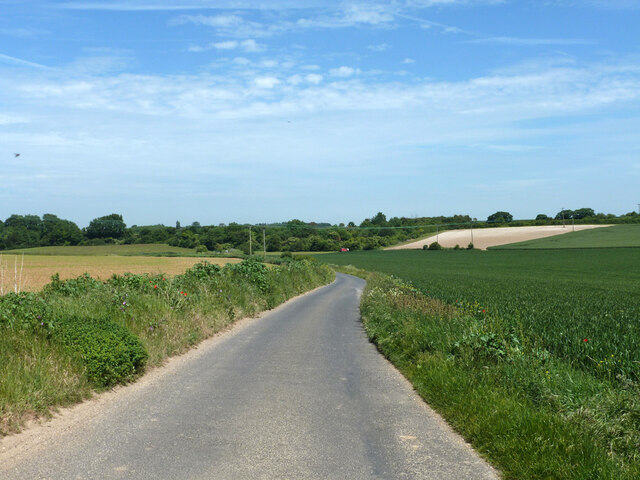
Appleton Wood is a picturesque forest located in the county of Kent, England. Known for its natural beauty and tranquil atmosphere, it covers an area of approximately 100 acres. The wood is a mix of ancient woodland and newer plantings, creating a diverse and rich habitat for a wide range of flora and fauna.
The woodland is predominantly made up of broadleaf trees, including oak, beech, and ash. These majestic trees provide a dense canopy that filters sunlight, creating a cool and shaded environment. The forest floor is carpeted with a variety of wildflowers, ferns, and mosses, adding to the enchanting atmosphere.
Appleton Wood is home to a diverse array of wildlife. Birdwatchers will delight in the opportunity to spot species such as woodpeckers, nuthatches, and tawny owls. The wood also provides a habitat for mammals such as deer, badgers, and foxes, which can occasionally be seen roaming through the trees.
Visitors to Appleton Wood can enjoy a range of activities, including walking, hiking, and picnicking. There are several well-maintained trails that meander through the woodland, offering opportunities to explore the different sections of the forest. The peaceful ambiance makes it an ideal spot for nature lovers seeking a break from the hustle and bustle of everyday life.
Overall, Appleton Wood in Kent is a haven for nature enthusiasts, offering a stunning display of flora and fauna. Its rich biodiversity, combined with its tranquil surroundings, make it a wonderful destination for anyone seeking a connection with nature in the heart of the English countryside.
If you have any feedback on the listing, please let us know in the comments section below.
Appleton Wood Images
Images are sourced within 2km of 51.25534/1.1947962 or Grid Reference TR2355. Thanks to Geograph Open Source API. All images are credited.


Appleton Wood is located at Grid Ref: TR2355 (Lat: 51.25534, Lng: 1.1947962)
Administrative County: Kent
District: Canterbury
Police Authority: Kent
What 3 Words
///rings.hammer.opened. Near Wingham, Kent
Nearby Locations
Related Wikis

Bramling
Bramling is a hamlet five miles (8 km) east of Canterbury in Kent, England. It lies on the A257 road between Littlebourne and Wingham. The local public...

Adisham
Adisham (formerly Adesham) is a village and civil parish in the English county of Kent. It is twinned with Campagne-lès-Hesdin in France. == Geography... ==
Adisham railway station
Adisham railway station is on the Dover branch of the Chatham Main Line in England, and serves the village of Adisham, Kent. It is 67 miles 60 chains...
Ickham and Well
Ickham and Well is a mostly rural civil parish east of Canterbury in Kent, South East England. The parish covers the villages of Ickham and Bramling just...

Wingham (Canterbury Road) railway station
Wingham (Canterbury Road) railway station was a terminus on the East Kent Light Railway. It opened in 1925 (named Wingham) and the last passenger train...

Wingham Town railway station
Wingham Town railway station was a railway station on the East Kent Light Railway, which served the village of Wingham. It opened in 1920 and closed to...

St Mary's Church, Wingham
St Mary's Church, Wingham, is an Anglican parish church in Wingham, Kent. It is recorded in the National Heritage List for England as a designated Grade...

Wingham, Kent
Wingham is a village and civil parish in the Dover District of Kent, England. The village lies along the ancient coastal road, now the A257, from Richborough...
Nearby Amenities
Located within 500m of 51.25534,1.1947962Have you been to Appleton Wood?
Leave your review of Appleton Wood below (or comments, questions and feedback).