Heath Plantation
Wood, Forest in Norfolk North Norfolk
England
Heath Plantation

Heath Plantation is a picturesque woodland located in the county of Norfolk in England. Covering an expansive area, it is renowned for its natural beauty and diverse range of flora and fauna. The plantation predominantly consists of dense woodland, characterized by tall, majestic trees and a rich undergrowth of shrubs, ferns, and wildflowers.
The plantation is home to a variety of native wildlife species, including deer, foxes, rabbits, and numerous species of birds. Birdwatchers flock to the area to catch a glimpse of the rare and elusive species that inhabit the woodland. The enchanting melodies of birdsong can often be heard echoing through the trees, creating a tranquil and serene atmosphere.
Heath Plantation offers a network of well-maintained trails, allowing visitors to explore the woodland at their own pace. These trails wind through the plantation, leading visitors to hidden clearings, babbling brooks, and scenic viewpoints. The plantation also features picnic areas and seating, providing visitors with the opportunity to rest and enjoy the natural surroundings.
With its breathtaking natural vistas and abundant wildlife, Heath Plantation is a haven for nature enthusiasts and outdoor lovers. The plantation offers a peaceful escape from the hustle and bustle of everyday life, allowing visitors to reconnect with nature and soak in the beauty of the Norfolk countryside. Whether it's a leisurely stroll through the woodland or a day spent birdwatching, Heath Plantation promises a memorable and immersive experience for all who visit.
If you have any feedback on the listing, please let us know in the comments section below.
Heath Plantation Images
Images are sourced within 2km of 52.902045/1.3021042 or Grid Reference TG2238. Thanks to Geograph Open Source API. All images are credited.


Heath Plantation is located at Grid Ref: TG2238 (Lat: 52.902045, Lng: 1.3021042)
Administrative County: Norfolk
District: North Norfolk
Police Authority: Norfolk
What 3 Words
///swimsuits.gifted.exact. Near Overstrand, Norfolk
Nearby Locations
Related Wikis
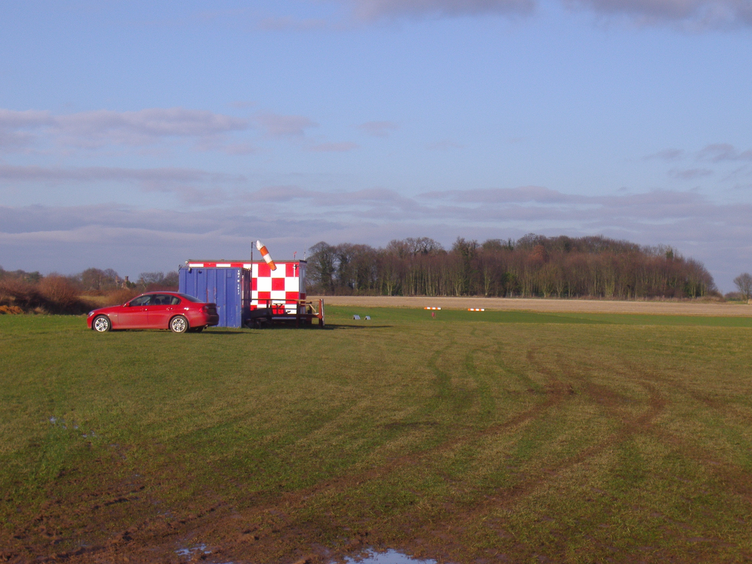
Northrepps Aerodrome
Northrepps Aerodrome is a privately owned airfield south west of the village of Northrepps, North Norfolk, England approximately 3 mi (4.8 km) south-south...

Felbrigg
Felbrigg is a village and civil parish in the English county of Norfolk. The village is 1.7 miles (2.7 km) south-west of Cromer and 20 miles (32 km) north...
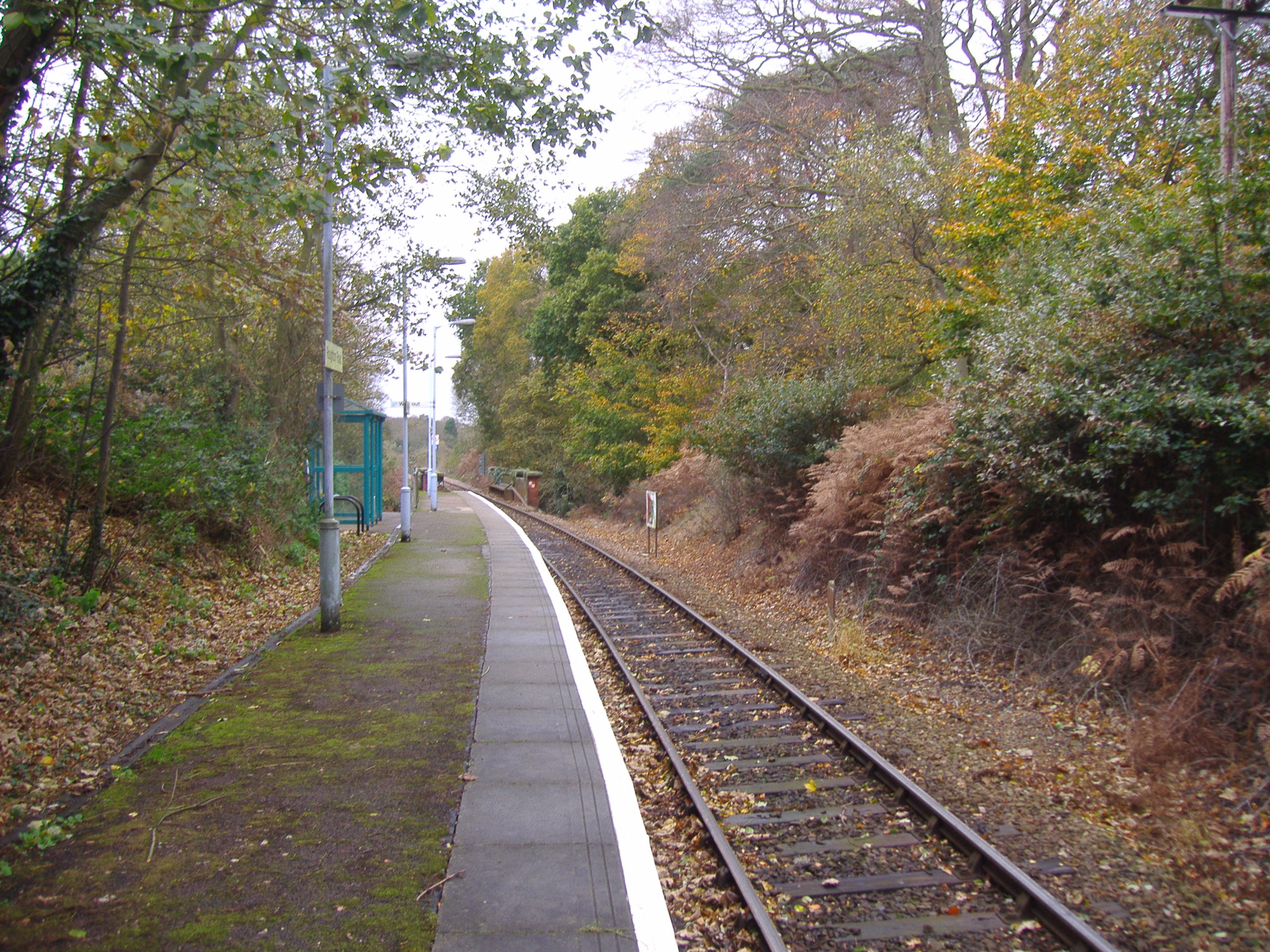
Roughton Road railway station
Roughton Road railway station is on the Bittern Line in Norfolk, England, on the outskirts of the town of Cromer. It takes its name from the street on...
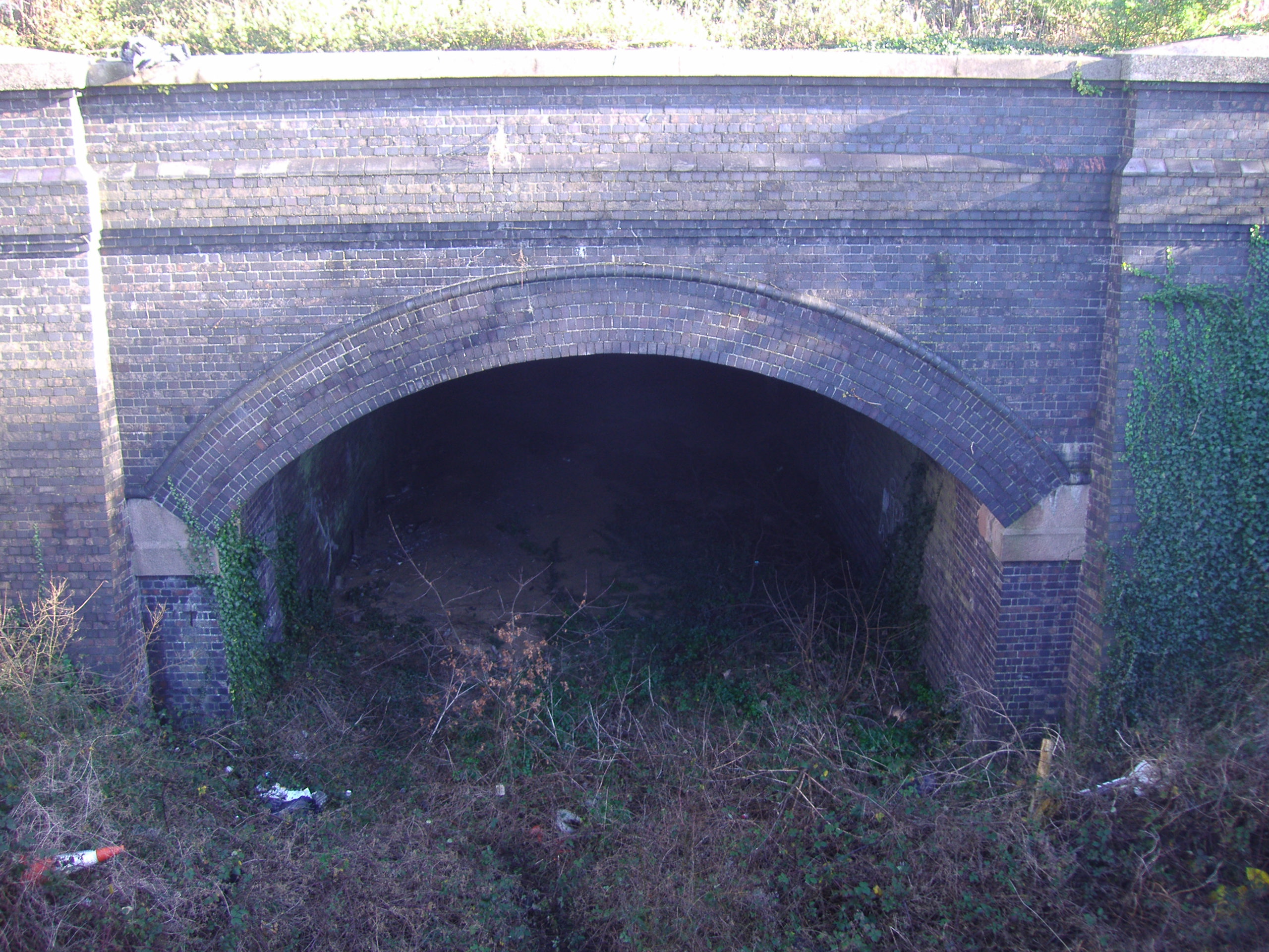
Cromer Tunnel
The Cromer Tunnel was built by the Norfolk and Suffolk Joint Railway to take their Cromer Beach to Mundesley line under the Great Eastern's Cromer High...
Roughton, Norfolk
Roughton is a village and a civil parish in the English county of Norfolk. The village is 3.7 miles (6.0 km) south of Cromer, 19.6 miles (31.5 km) north...

Cromer Academy
Cromer Academy (formerly Cromer High School, Sports College, Cromer Institute of Science) is a 11- 16 secondary school with academy status in Cromer, Norfolk...

Northrepps
Northrepps is a village and a civil parish in the English county of Norfolk. It is 3.4 miles (5.5 km) southeast of Cromer, 22.2 miles (35.7 km) north of...

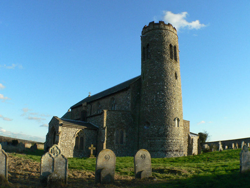
St Margaret's Church, Felbrigg
St Margaret's Church is a Grade II* listed parish church in the Church of England Diocese of Norwich in Felbrigg, Norfolk. == History == The church is...
Nearby Amenities
Located within 500m of 52.902045,1.3021042Have you been to Heath Plantation?
Leave your review of Heath Plantation below (or comments, questions and feedback).