Freswick

Settlement in Caithness

Scotland

Freswick

Layby on the A99 near Milltown The A99 follows the east coast of Caithness from Latheron, where it leaves the A9, though the town of Wick to John o' Groats at the north-east corner of the Highlands. The road is a trunk road between Latheron and Wick. It was part of the A9 until 1997, when the A9 was re-routed along what had been the A895-A882 link between Latheron and Thurso.

The A99 forms part of the North Coast 500 (NC500) which was launched in 2015. NC500 is a 516-mile scenic route around the north coast of Scotland, starting and ending at Inverness Castle,
Layby on the A99 near Milltown Credit: David Dixon

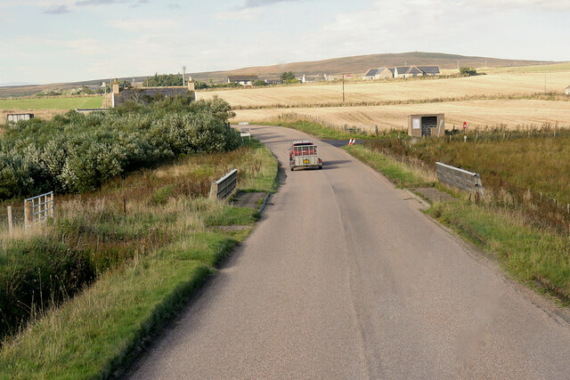
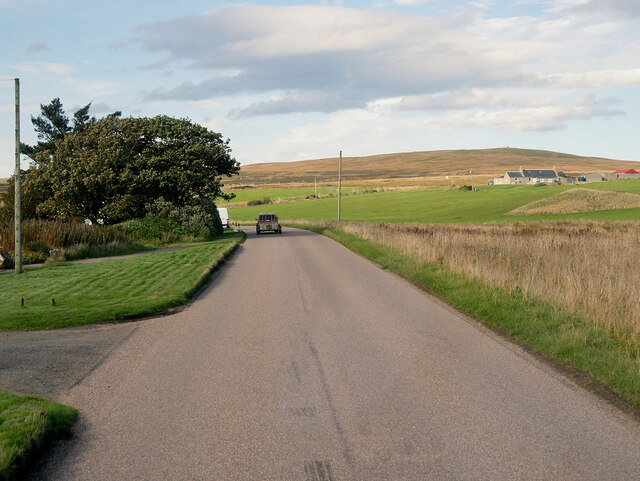
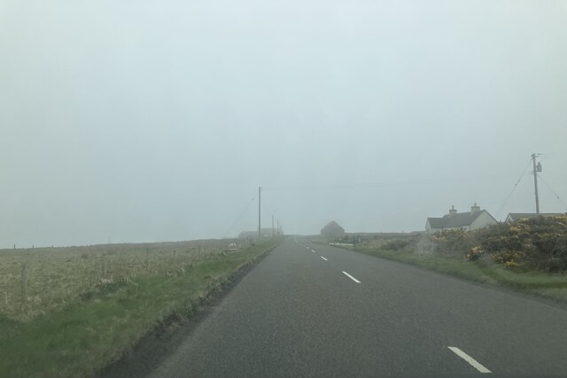
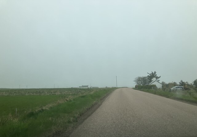
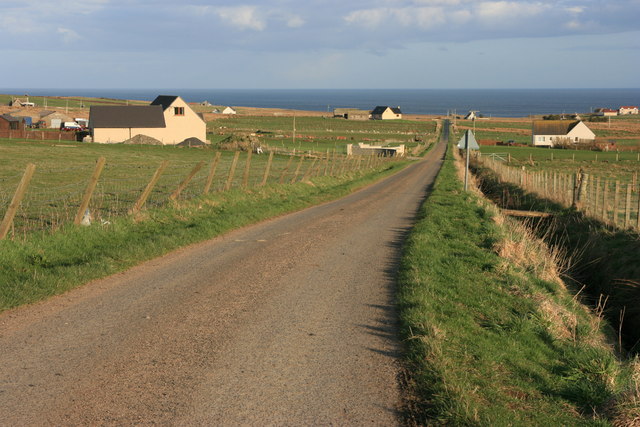
Freswick is a small village located in the county of Caithness, Scotland. Situated on the northeastern coast of the country, it lies approximately 6 miles north of the town of Wick. With a population of just over 100 residents, Freswick is a tight-knit community known for its peaceful and picturesque surroundings.

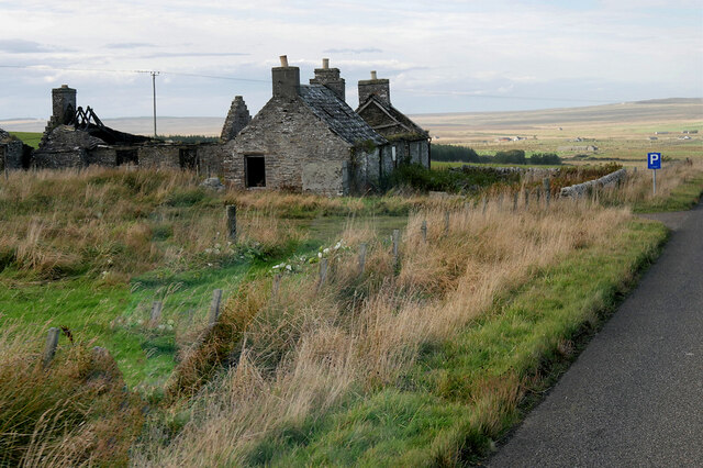
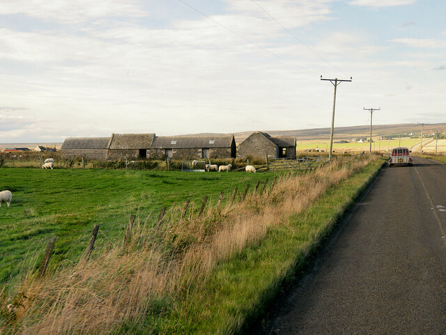
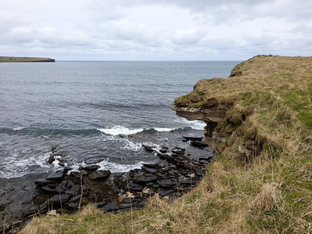
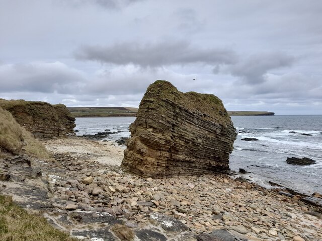
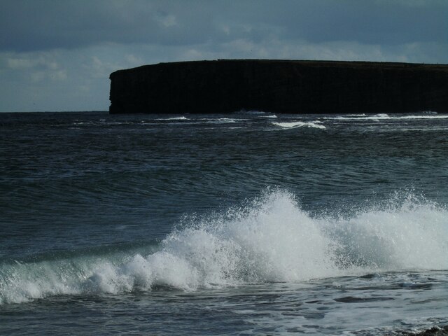
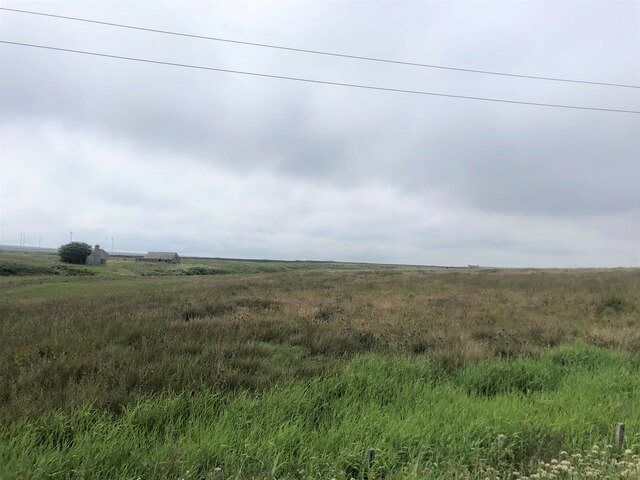
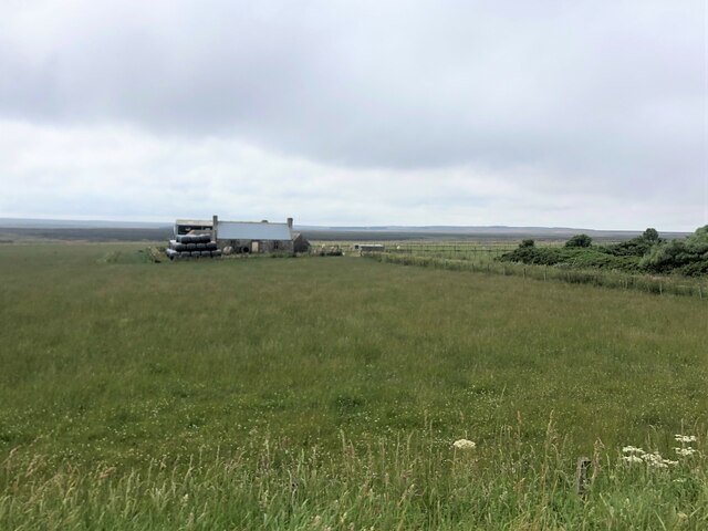
The village is nestled between the rugged cliffs of the North Sea and rolling hills, offering breathtaking views of the coastline. The landscape is characterized by its untamed beauty, with dramatic cliffs, secluded sandy beaches, and abundant wildlife. The area is a haven for birdwatchers, as numerous species, including puffins, guillemots, and kittiwakes, can be spotted along the cliffs.

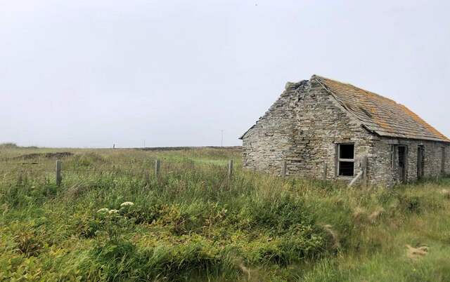
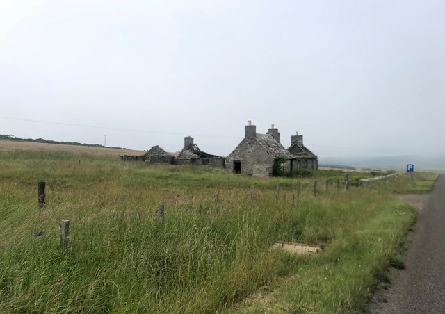
Historically, Freswick played a significant role in the defense of the region, with the ruins of a 16th-century castle still visible on the coastline. The castle, known as Freswick Castle, was once a stronghold of the Sinclair family, a prominent Scottish clan. Today, it stands as a reminder of the village's rich history and attracts visitors interested in exploring its ancient walls.

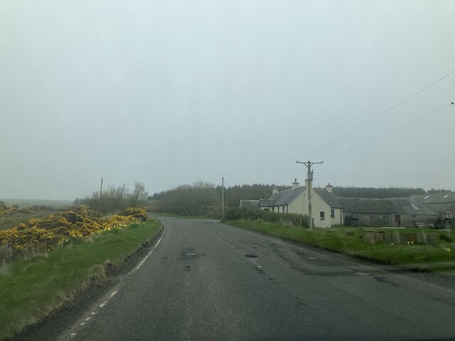
Although small in size, Freswick offers amenities such as a local pub, a primary school, and a community center, which serves as a hub for various activities and events. The village also benefits from its close proximity to Wick, where residents can access a wider range of services, including shops, healthcare facilities, and secondary schools.

Overall, Freswick is a tranquil and charming village, providing residents and visitors alike with a welcoming atmosphere and stunning natural landscapes to explore.

If you have any feedback on the listing, please let us know in the comments section below.
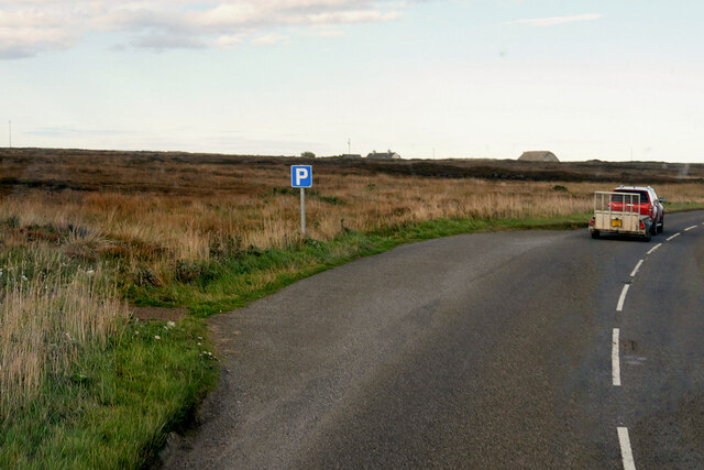
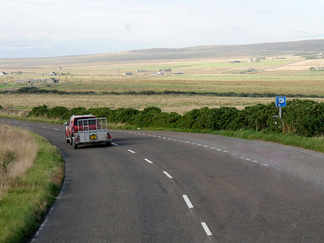
Freswick Images

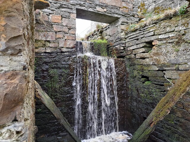
Images are sourced within 2km of 58.585145/-3.079565 or Grid Reference ND3766. Thanks to Geograph Open Source API. All images are credited.

Layby on the A99 near Milltown The A99 follows the east coast of Caithness from Latheron, where it leaves the A9, though the town of Wick to John o' Groats at the north-east corner of the Highlands. The road is a trunk road between Latheron and Wick. It was part of the A9 until 1997, when the A9 was re-routed along what had been the A895-A882 link between Latheron and Thurso.

The A99 forms part of the North Coast 500 (NC500) which was launched in 2015. NC500 is a 516-mile scenic route around the north coast of Scotland, starting and ending at Inverness Castle,
Layby on the A99 near Milltown
The A99 follows the east coast of Caithness from Latheron, where it leaves the A9, though the town of Wick to John o' Groats at the north-east corner of the Highlands. The road is a trunk road between Latheron and Wick. It was part of the A9 until 1997, when the A9 was re-routed along what had been the A895-A882 link between Latheron and Thurso. The A99 forms part of the North Coast 500 (NC500) which was launched in 2015. NC500 is a 516-mile scenic route around the north coast of Scotland, starting and ending at Inverness Castle,
Smithy House (Ruin), Hill of Harley The A99 follows the east coast of Caithness from Latheron, where it leaves the A9, though the town of Wick to John o' Groats at the north-east corner of the Highlands. The road is a trunk road between Latheron and Wick. It was part of the A9 until 1997, when the A9 was re-routed along what had been the A895-A882 link between Latheron and Thurso.

The A99 forms part of the North Coast 500 (NC500) which was launched in 2015. NC500 is a 516-mile scenic route around the north coast of Scotland, starting and ending at Inverness Castle,
Smithy House (Ruin), Hill of Harley
The A99 follows the east coast of Caithness from Latheron, where it leaves the A9, though the town of Wick to John o' Groats at the north-east corner of the Highlands. The road is a trunk road between Latheron and Wick. It was part of the A9 until 1997, when the A9 was re-routed along what had been the A895-A882 link between Latheron and Thurso. The A99 forms part of the North Coast 500 (NC500) which was launched in 2015. NC500 is a 516-mile scenic route around the north coast of Scotland, starting and ending at Inverness Castle,
Layby on the A99 near Harley The A99 follows the east coast of Caithness from Latheron, where it leaves the A9, though the town of Wick to John o' Groats at the north-east corner of the Highlands. The road is a trunk road between Latheron and Wick. It was part of the A9 until 1997, when the A9 was re-routed along what had been the A895-A882 link between Latheron and Thurso.

The A99 forms part of the North Coast 500 (NC500) which was launched in 2015. NC500 is a 516-mile scenic route around the north coast of Scotland, starting and ending at Inverness Castle,
Layby on the A99 near Harley
The A99 follows the east coast of Caithness from Latheron, where it leaves the A9, though the town of Wick to John o' Groats at the north-east corner of the Highlands. The road is a trunk road between Latheron and Wick. It was part of the A9 until 1997, when the A9 was re-routed along what had been the A895-A882 link between Latheron and Thurso. The A99 forms part of the North Coast 500 (NC500) which was launched in 2015. NC500 is a 516-mile scenic route around the north coast of Scotland, starting and ending at Inverness Castle,
A99, Farm Buildings near Freswick The A99 follows the east coast of Caithness from Latheron, where it leaves the A9, though the town of Wick to John o' Groats at the north-east corner of the Highlands. The road is a trunk road between Latheron and Wick. It was part of the A9 until 1997, when the A9 was re-routed along what had been the A895-A882 link between Latheron and Thurso.

The A99 forms part of the North Coast 500 (NC500) which was launched in 2015. NC500 is a 516-mile scenic route around the north coast of Scotland, starting and ending at Inverness Castle,
A99, Farm Buildings near Freswick
The A99 follows the east coast of Caithness from Latheron, where it leaves the A9, though the town of Wick to John o' Groats at the north-east corner of the Highlands. The road is a trunk road between Latheron and Wick. It was part of the A9 until 1997, when the A9 was re-routed along what had been the A895-A882 link between Latheron and Thurso. The A99 forms part of the North Coast 500 (NC500) which was launched in 2015. NC500 is a 516-mile scenic route around the north coast of Scotland, starting and ending at Inverness Castle,
A99, Bridge over Little Gill Burn The A99 follows the east coast of Caithness from Latheron, where it leaves the A9, though the town of Wick to John o' Groats at the north-east corner of the Highlands. The road is a trunk road between Latheron and Wick. It was part of the A9 until 1997, when the A9 was re-routed along what had been the A895-A882 link between Latheron and Thurso.

The A99 forms part of the North Coast 500 (NC500) which was launched in 2015. NC500 is a 516-mile scenic route around the north coast of Scotland, starting and ending at Inverness Castle,
A99, Bridge over Little Gill Burn
The A99 follows the east coast of Caithness from Latheron, where it leaves the A9, though the town of Wick to John o' Groats at the north-east corner of the Highlands. The road is a trunk road between Latheron and Wick. It was part of the A9 until 1997, when the A9 was re-routed along what had been the A895-A882 link between Latheron and Thurso. The A99 forms part of the North Coast 500 (NC500) which was launched in 2015. NC500 is a 516-mile scenic route around the north coast of Scotland, starting and ending at Inverness Castle,
A99 near Tofts House The A99 follows the east coast of Caithness from Latheron, where it leaves the A9, though the town of Wick to John o' Groats at the north-east corner of the Highlands. The road is a trunk road between Latheron and Wick. It was part of the A9 until 1997, when the A9 was re-routed along what had been the A895-A882 link between Latheron and Thurso.

The A99 forms part of the North Coast 500 (NC500) which was launched in 2015. NC500 is a 516-mile scenic route around the north coast of Scotland, starting and ending at Inverness Castle,
A99 near Tofts House
The A99 follows the east coast of Caithness from Latheron, where it leaves the A9, though the town of Wick to John o' Groats at the north-east corner of the Highlands. The road is a trunk road between Latheron and Wick. It was part of the A9 until 1997, when the A9 was re-routed along what had been the A895-A882 link between Latheron and Thurso. The A99 forms part of the North Coast 500 (NC500) which was launched in 2015. NC500 is a 516-mile scenic route around the north coast of Scotland, starting and ending at Inverness Castle,
Overhanging Cliff near Freswick Beyond, across Freswick Bay, is Skirza Head.
Overhanging Cliff near Freswick
Beyond, across Freswick Bay, is Skirza Head.
Sea Stack at Freswick This stack shows the layered sedimentary rocks of the area.
Sea Stack at Freswick
This stack shows the layered sedimentary rocks of the area.
At Freswick Mains Within the buildings at Freswick Mains.
At Freswick Mains
Within the buildings at Freswick Mains.
Freswick Bay Waves catching the afternoon sunlight.
Freswick Bay
Waves catching the afternoon sunlight.
Derelict old barn by the A99
Croft in ruins by the A99
Boggy land at Freswick
Croft at Tofts
Croft at Tofts
Approaching Hilltop Cottage
Approaching Westlands
Approaching Granton Cottage
Minor road near Parkview, Auckengill
Show me another place!

Freswick is located at Grid Ref: ND3766 (Lat: 58.585145, Lng: -3.079565)

Unitary Authority: Highland

Police Authority: Highlands and Islands

What 3 Words

///lads.basher.requests. Near John o' Groats, Highland

Nearby Locations

Freswick

Related Wikis

Freswick

Freswick ( FREZZ-ik) or Skirsa, is a small remote hamlet, overlooking Freswick Bay to the east, in eastern Caithness, Scottish Highlands and is in the...

Skirza

Skirza or Skirsa, is a small remote linear fishing village, overlooking Freswick Bay to the south and Skirza Head to the southeast, in eastern Caithness...

Auckengill

Auckengill is a settlement, 6 miles (10 kilometres) south of John o' Groats, on the east coast of Caithness, within the Scottish council area of Highland...

Nybster

Nybster is a scattered rural and crofting township, situated in Caithness and is in the Scottish council area of Highland. It is located along the A9 road...

Nearby Amenities

Located within 500m of 58.585145,-3.079565
Parking
Access: yes
Fee: no
Parking: layby
Surface: asphalt
Lat/Long: 58.5811091/-3.0766922
Power: pole
Lat/Long: 58.587536/-3.0724756
Power: pole
Lat/Long: 58.5872598/-3.073308
Power: pole
Lat/Long: 58.5870122/-3.0740694
Power: pole
Lat/Long: 58.5867836/-3.0747821
Power: pole
Lat/Long: 58.5865476/-3.0755171
Power: pole
Lat/Long: 58.5863645/-3.0760349
Power: pole
Lat/Long: 58.5854809/-3.075643
Power: pole
Lat/Long: 58.5846893/-3.0752897
Power: pole
Lat/Long: 58.5839188/-3.0749425
Power: pole
Lat/Long: 58.5829875/-3.0745364
Power: pole
Lat/Long: 58.5822085/-3.0741791
Power: pole
Lat/Long: 58.5894868/-3.0803982
Power: pole
Lat/Long: 58.5888265/-3.0817951
Power: pole
Lat/Long: 58.5881736/-3.083123
Power: pole
Lat/Long: 58.5878392/-3.0838437
Power: pole
Lat/Long: 58.588254/-3.0842275
Power: pole
Lat/Long: 58.5886773/-3.0844935
Power: pole
Lat/Long: 58.5889482/-3.0796713
Power: pole
Lat/Long: 58.5884265/-3.0789241
Power: pole
Lat/Long: 58.587781/-3.0780186
Power: pole
Lat/Long: 58.5870582/-3.0769912
The data included in this document is from www.openstreetmap.org. The data is made available under ODbL.

Have you been to Freswick?

Leave your review of Freswick below (or comments, questions and feedback).