The Belt

Wood, Forest in Norfolk North Norfolk

England

The Belt

Hanworth Hall <span class="nowrap"><a title="https://historicengland.org.uk/listing/the-list/list-entry/1049863?section=official-list-entry" rel="nofollow ugc noopener" href="https://historicengland.org.uk/listing/the-list/list-entry/1049863?section=official-list-entry">Link</a><img style="margin-left:2px;" alt="External link" title="External link - shift click to open in new window" src="https://s1.geograph.org.uk/img/external.png" width="10" height="10"/></span>
Hanworth Hall Credit: Sandy Gerrard

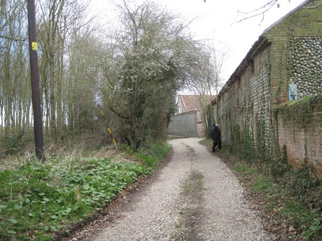
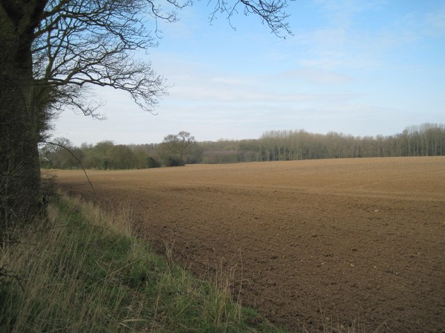
The Belt, Norfolk, also known as Wood or Forest, is a vast wooded area situated in the county of Norfolk, England. Spanning approximately 45 square miles, it is one of the largest forested regions in the area. The Belt is located to the north of the city of Norwich, and its boundaries stretch across several towns and villages, including Horsford, Spixworth, and Horsham St Faith.

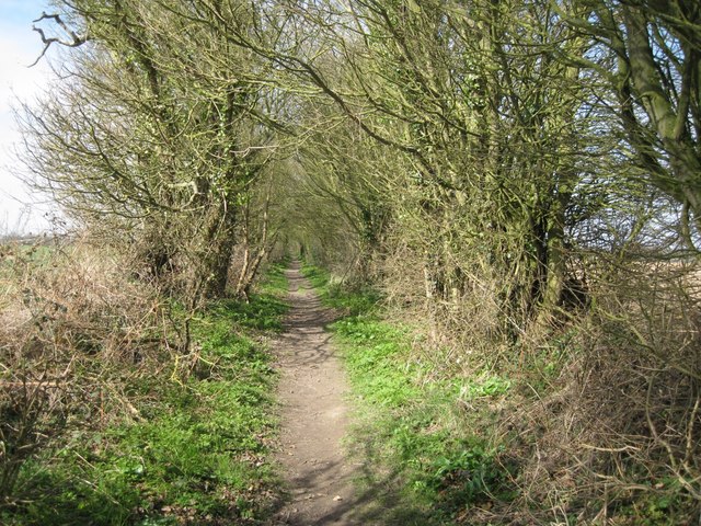
The forest comprises a diverse range of tree species, including oak, beech, and pine, creating a rich and vibrant ecosystem. It is home to a variety of wildlife, such as deer, squirrels, and a diverse array of bird species. The Belt also features several walking trails, allowing visitors to explore the natural beauty of the area.

The woodland provides a tranquil escape from urban life, attracting both locals and tourists alike. Many visitors engage in recreational activities such as hiking, birdwatching, and photography. The Belt also offers picnic areas and camping facilities, providing opportunities for outdoor enthusiasts to immerse themselves in the peaceful surroundings.

In addition to its natural beauty, The Belt holds historical significance. It was once part of the royal hunting grounds during the medieval period, and remnants of ancient hunting lodges can still be found within the forest. The area is also dotted with archaeological sites, including the remains of Roman settlements.

Overall, The Belt, Norfolk (Wood, Forest) is a captivating natural landscape, offering a haven of tranquility, recreational activities, and a glimpse into Norfolk's rich history.

If you have any feedback on the listing, please let us know in the comments section below.

The Belt Images

Images are sourced within 2km of 52.868642/1.2771826 or Grid Reference TG2035. Thanks to Geograph Open Source API. All images are credited.

Hanworth Hall <span class="nowrap"><a title="https://historicengland.org.uk/listing/the-list/list-entry/1049863?section=official-list-entry" rel="nofollow ugc noopener" href="https://historicengland.org.uk/listing/the-list/list-entry/1049863?section=official-list-entry">Link</a><img style="margin-left:2px;" alt="External link" title="External link - shift click to open in new window" src="https://s1.geograph.org.uk/img/external.png" width="10" height="10"/></span>
Hanworth Hall
Track past Malthouse Farm On the route of Weavers' Way. My companions were examining an opening in the wall.
Track past Malthouse Farm
On the route of Weavers' Way. My companions were examining an opening in the wall.
Field east of Weavers' Way The corner of Thurgarton Grove, left, is in the square, receding into TG1934, with Thurgarton Wood on the right.
Field east of Weavers' Way
The corner of Thurgarton Grove, left, is in the square, receding into TG1934, with Thurgarton Wood on the right.
Pack Lane A footpath between single rows of trees and bushes, not really hedgerows, heading for Aldborough from near Alby Church in TG2033. There was Dog's Mercury in the ground flora, indicating ancient woodland in the past.
Pack Lane
A footpath between single rows of trees and bushes, not really hedgerows, heading for Aldborough from near Alby Church in TG2033. There was Dog's Mercury in the ground flora, indicating ancient woodland in the past.
Field east of Alby Hill Seen from Pack Lane.
Field east of Alby Hill
Seen from Pack Lane.
Junction of Middle Hill and Dovehouse Lane Postbox number NR11 1147.
Junction of Middle Hill and Dovehouse Lane
Postbox number NR11 1147.
House and Aldborough Primary School On Dovehouse Lane, Alby Hill, seen from Middle Hill. Roadside trees are oak and ash.
House and Aldborough Primary School
On Dovehouse Lane, Alby Hill, seen from Middle Hill. Roadside trees are oak and ash.
The Bessingham road joins Ringbank Lane Approaching Hanworth from the southeast.
The Bessingham road joins Ringbank Lane
Approaching Hanworth from the southeast.
Front garden, Ringbank Lane In drab mid-March this colourful garden stood out. It holds a large number of ornamental conifers, like the golden Lawson Cypress on the right (probably Chamaecyparis lawsoniana 'Stewartii'). The inverted tree stump recalls Victorian 'stumperies' that used many such stumps planted with, eg, ferns. The harsh winter of 2010-11 may have killed the multistemmed Cabbage Palm (Cordyline australis).
Front garden, Ringbank Lane
In drab mid-March this colourful garden stood out. It holds a large number of ornamental conifers, like the golden Lawson Cypress on the right (probably Chamaecyparis lawsoniana 'Stewartii'). The inverted tree stump recalls Victorian 'stumperies' that used many such stumps planted with, eg, ferns. The harsh winter of 2010-11 may have killed the multistemmed Cabbage Palm (Cordyline australis).
Scarrow Beck above Ringbank Lane Looking tame and suburban as it flows towards the camera, then south to Aldborough.
Scarrow Beck above Ringbank Lane
Looking tame and suburban as it flows towards the camera, then south to Aldborough.
Leading to Emery's Lane Ivy envelops an ash tree on the left. Ash is a 'preferred' support for ivy because it has a shorter season in leaf than other trees, therefore the ivy gets more light.
Leading to Emery's Lane
Ivy envelops an ash tree on the left. Ash is a 'preferred' support for ivy because it has a shorter season in leaf than other trees, therefore the ivy gets more light.
West end of Hanworth Common A cluster of flint-and-brick houses looks across the ponds at the low, southwest corner of the Common, where a number of specimen trees have been planted and protected.
West end of Hanworth Common
A cluster of flint-and-brick houses looks across the ponds at the low, southwest corner of the Common, where a number of specimen trees have been planted and protected.
Houses at Hanworth The signpost on the right marks the crossroads of Ringbank Lane and Emery's Lane.
Houses at Hanworth
The signpost on the right marks the crossroads of Ringbank Lane and Emery's Lane.
Estate yard, Hanworth A block of woodland stands between Hanworth Hall and the village, at the centre of the common.
Estate yard, Hanworth
A block of woodland stands between Hanworth Hall and the village, at the centre of the common.
East from Hanworth Common Cherry-plum (Prunus cerasifera) hangs over a gate and cattle grid at the southeastern exit from the common.
East from Hanworth Common
Cherry-plum (Prunus cerasifera) hangs over a gate and cattle grid at the southeastern exit from the common.
Hanworth Hall from south of Hanworth Church It is evident on the ground if not on the map that the blocks of woodland create a setting for the house seen from around the church. Conversely, the woodlands frame the view of the church from the house: a classic 18th-century designed landscape.
Hanworth Hall from south of Hanworth Church
It is evident on the ground if not on the map that the blocks of woodland create a setting for the house seen from around the church. Conversely, the woodlands frame the view of the church from the house: a classic 18th-century designed landscape.
Hanworth Hall, Hanworth A plain and refined nine-bay brick house, early C18th for Robert Doughty. Grade I listed.
The park in front was probably landscaped in the late C18th, perhaps with the involvement of Humphrey Repton, but the lake was created c1900.
Hanworth Hall, Hanworth
A plain and refined nine-bay brick house, early C18th for Robert Doughty. Grade I listed. The park in front was probably landscaped in the late C18th, perhaps with the involvement of Humphrey Repton, but the lake was created c1900.
Hunworth Hall from the churchyard
Show me another place!

The Belt is located at Grid Ref: TG2035 (Lat: 52.868642, Lng: 1.2771826)

Administrative County: Norfolk

District: North Norfolk

Police Authority: Norfolk

What 3 Words

///latitudes.glows.shows. Near Overstrand, Norfolk

Related Wikis

Hanworth, Norfolk

Hanworth is a village and a civil parish in the English county of Norfolk. It is 18.8 miles (30.3 km) north of Norwich, 5.4 miles (8.7 km) south-west of...
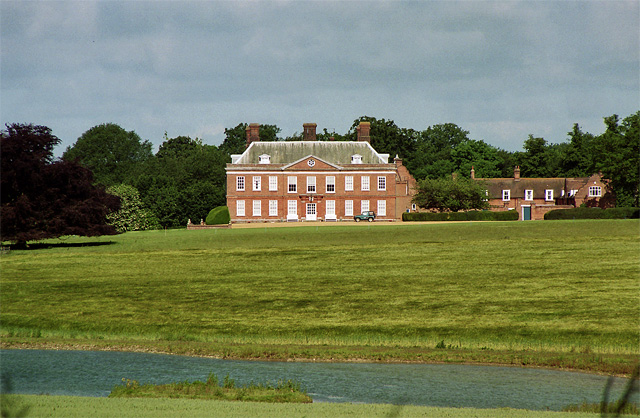
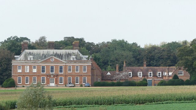
Hanworth Hall

Hanworth Hall is a large late 17th-century country house some 500 m to the south of the village of Hanworth, Norfolk, England. It is protected and recognised...

Gunton Park Lake

Gunton Park Lake is a 18.3-hectare (45-acre) biological Site of Special Scientific Interest by Gunton Hall, north-west of North Walsham in Norfolk. It...

Gur Beck

Gur Beck is a minor watercourse which rises in the north of the English county of Norfolk. It is a tributary of the Scarrow Beck. Its spring is a little...

Nearby Amenities

Located within 500m of 52.868642,1.2771826
Entrance: main
Lat/Long: 52.8665627/1.2716675
Entrance: yes
Lat/Long: 52.8664329/1.2716621
The data included in this document is from www.openstreetmap.org. The data is made available under ODbL.

Have you been to The Belt?

Leave your review of The Belt below (or comments, questions and feedback).