Stodmarsh Court Wood

Wood, Forest in Kent Canterbury

England

Stodmarsh Court Wood

Longwall Lane Longwall Lane is a road on a development, which has been named The Hoplands; it has been built on land, which was once <a href="https://www.geograph.org.uk/photo/4825555">TR2061 : Hoplands Farm</a>. 

Planning permission has been granted by Canterbury City Council under application number CA//16/00404 for an “outline planning application for a neighbourhood extension for the creation of up to 250 houses including affordable housing, neighbourhood centre (comprising Class A1 food store (400sq.m), Class D1 medical centre (380sq.m), Class D1 dentist (150sq.m), Class A1 pharmacy (150sq.m), Class D1 nursery (120sq.m) and Class A1 convenience retail (360sq.m)), commercial estate (comprising Class B1 business floor space (up to 5572sq.m), Class D1 apprenticeship centre (616sq.m) and Class D1/D2 community building (up to 672sq.m)), parish parkland and associated access, parking, amenity space and landscaping.
Longwall Lane Credit: John Baker

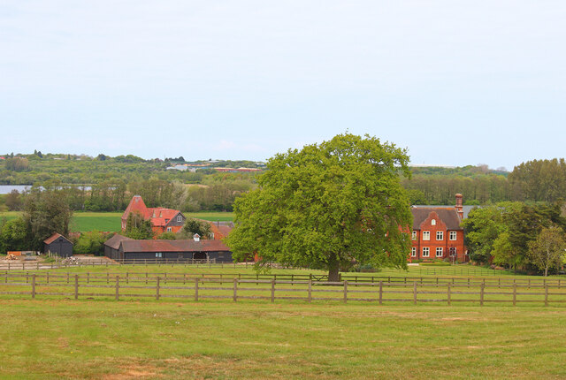
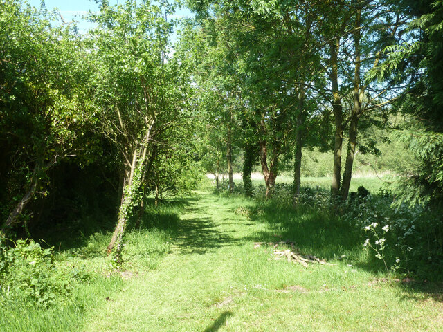
Stodmarsh Court Wood is a picturesque woodland located in the county of Kent, England. Situated near the village of Stodmarsh, the wood covers an area of approximately 150 acres and is part of the wider Stodmarsh National Nature Reserve.

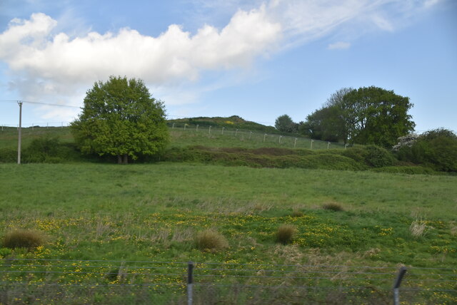
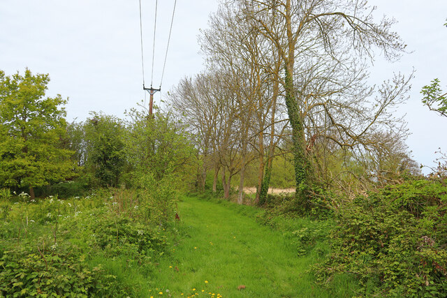
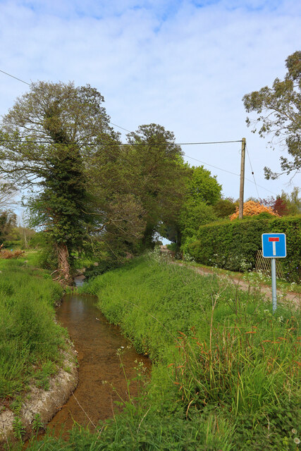
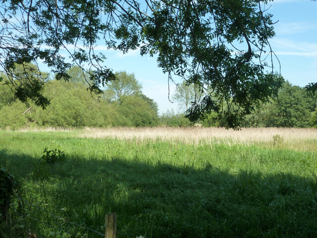
The wood is predominantly composed of wet woodland, making it a unique and valuable habitat for a range of plants and animals. The area is characterized by its damp and marshy conditions, which are created by the nearby River Stour and its associated floodplain. This rich combination of water and woodland creates an ideal environment for a diverse array of flora and fauna.

Visitors to Stodmarsh Court Wood can expect to find a variety of tree species, including oak, ash, alder, and willow, which thrive in the wet conditions. The woodland floor is covered in a vibrant carpet of wildflowers in the spring and summer months, including bluebells and primroses.

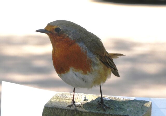
The wood is also home to numerous bird species, with notable residents including the kingfisher, marsh harrier, and reed warbler. These birds are attracted to the wetland environment, which provides them with ample food and nesting opportunities. Other wildlife, such as water voles, otters, and a variety of insects, can also be spotted within the wood.

Stodmarsh Court Wood offers visitors the chance to explore and appreciate the natural beauty of a wet woodland ecosystem. Its location within the Stodmarsh National Nature Reserve further enhances its importance as a protected and cherished natural site.

If you have any feedback on the listing, please let us know in the comments section below.

Stodmarsh Court Wood Images

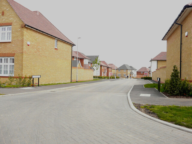
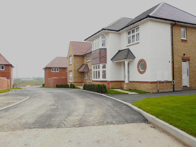
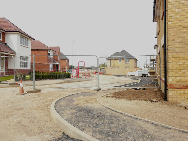
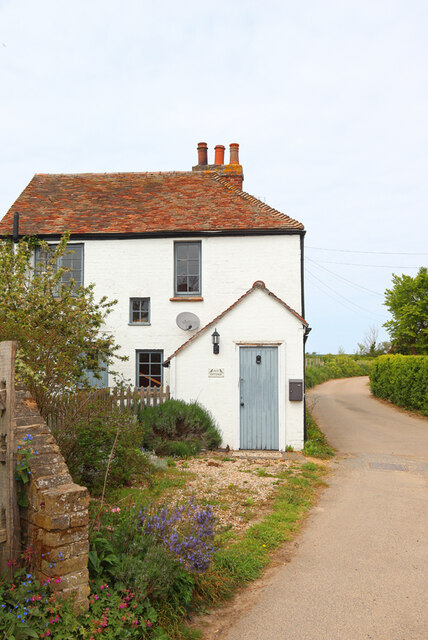
Images are sourced within 2km of 51.296311/1.1623909 or Grid Reference TR2059. Thanks to Geograph Open Source API. All images are credited.

Longwall Lane Longwall Lane is a road on a development, which has been named The Hoplands; it has been built on land, which was once <a href="https://www.geograph.org.uk/photo/4825555">TR2061 : Hoplands Farm</a>. 

Planning permission has been granted by Canterbury City Council under application number CA//16/00404 for an “outline planning application for a neighbourhood extension for the creation of up to 250 houses including affordable housing, neighbourhood centre (comprising Class A1 food store (400sq.m), Class D1 medical centre (380sq.m), Class D1 dentist (150sq.m), Class A1 pharmacy (150sq.m), Class D1 nursery (120sq.m) and Class A1 convenience retail (360sq.m)), commercial estate (comprising Class B1 business floor space (up to 5572sq.m), Class D1 apprenticeship centre (616sq.m) and Class D1/D2 community building (up to 672sq.m)), parish parkland and associated access, parking, amenity space and landscaping.
Longwall Lane
Longwall Lane is a road on a development, which has been named The Hoplands; it has been built on land, which was once TR2061 : Hoplands Farm. Planning permission has been granted by Canterbury City Council under application number CA//16/00404 for an “outline planning application for a neighbourhood extension for the creation of up to 250 houses including affordable housing, neighbourhood centre (comprising Class A1 food store (400sq.m), Class D1 medical centre (380sq.m), Class D1 dentist (150sq.m), Class A1 pharmacy (150sq.m), Class D1 nursery (120sq.m) and Class A1 convenience retail (360sq.m)), commercial estate (comprising Class B1 business floor space (up to 5572sq.m), Class D1 apprenticeship centre (616sq.m) and Class D1/D2 community building (up to 672sq.m)), parish parkland and associated access, parking, amenity space and landscaping.
Hoplands Road Hoplands Road is a road on a development, which has been named The Hoplands; it has been built on land, which was once <a href="https://www.geograph.org.uk/photo/4825555">TR2061 : Hoplands Farm</a>. 

Planning permission has been granted by Canterbury City Council under application number CA//16/00404 for an “outline planning application for a neighbourhood extension for the creation of up to 250 houses including affordable housing, neighbourhood centre (comprising Class A1 food store (400sq.m), Class D1 medical centre (380sq.m), Class D1 dentist (150sq.m), Class A1 pharmacy (150sq.m), Class D1 nursery (120sq.m) and Class A1 convenience retail (360sq.m)), commercial estate (comprising Class B1 business floor space (up to 5572sq.m), Class D1 apprenticeship centre (616sq.m) and Class D1/D2 community building (up to 672sq.m)), parish parkland and associated access, parking, amenity space and landscaping.
Hoplands Road
Hoplands Road is a road on a development, which has been named The Hoplands; it has been built on land, which was once TR2061 : Hoplands Farm. Planning permission has been granted by Canterbury City Council under application number CA//16/00404 for an “outline planning application for a neighbourhood extension for the creation of up to 250 houses including affordable housing, neighbourhood centre (comprising Class A1 food store (400sq.m), Class D1 medical centre (380sq.m), Class D1 dentist (150sq.m), Class A1 pharmacy (150sq.m), Class D1 nursery (120sq.m) and Class A1 convenience retail (360sq.m)), commercial estate (comprising Class B1 business floor space (up to 5572sq.m), Class D1 apprenticeship centre (616sq.m) and Class D1/D2 community building (up to 672sq.m)), parish parkland and associated access, parking, amenity space and landscaping.
Pastureland
Pastureland
Robin in the car park of Stodmarsh National Nature Reserve Robins and blue tits are fed by visitors and, therefore, become extremely tame. They appear so friendly but, of course, it's cupboard love.
Robin in the car park of Stodmarsh National Nature Reserve
Robins and blue tits are fed by visitors and, therefore, become extremely tame. They appear so friendly but, of course, it's cupboard love.
Black Horse Lane Part of a housing estate called The Hoplands for which planning permission has been granted by Canterbury City Council under application number CA//16/00404. 

An  “outline planning application for a neighbourhood extension for the creation of up to 250 houses including affordable housing, neighbourhood centre (comprising Class A1 food store (400sq.m), Class D1 medical centre (380sq.m), Class D1 dentist (150sq.m), Class A1 pharmacy (150sq.m), Class D1 nursery (120sq.m) and Class A1 convenience retail (360sq.m)), commercial estate (comprising Class B1 business floorspace (up to 5572sq.m), Class D1 apprenticeship centre (616sq.m) and Class D1/D2 community building (up to 672sq.m)), parish parkland and associated access, parking, amenity space and landscaping”.
Black Horse Lane
Part of a housing estate called The Hoplands for which planning permission has been granted by Canterbury City Council under application number CA//16/00404. An “outline planning application for a neighbourhood extension for the creation of up to 250 houses including affordable housing, neighbourhood centre (comprising Class A1 food store (400sq.m), Class D1 medical centre (380sq.m), Class D1 dentist (150sq.m), Class A1 pharmacy (150sq.m), Class D1 nursery (120sq.m) and Class A1 convenience retail (360sq.m)), commercial estate (comprising Class B1 business floorspace (up to 5572sq.m), Class D1 apprenticeship centre (616sq.m) and Class D1/D2 community building (up to 672sq.m)), parish parkland and associated access, parking, amenity space and landscaping”.
Black Horse Lane Part of a housing estate called The Hoplands for which planning permission has been granted by Canterbury City Council under application number CA//16/00404. An  “outline planning application for a neighbourhood extension for the creation of up to 250 houses including affordable housing, neighbourhood centre (comprising Class A1 food store (400sq.m), Class D1 medical centre (380sq.m), Class D1 dentist (150sq.m), Class A1 pharmacy (150sq.m), Class D1 nursery (120sq.m) and Class A1 convenience retail (360sq.m)), commercial estate (comprising Class B1 business floorspace (up to 5572sq.m), Class D1 apprenticeship centre (616sq.m) and Class D1/D2 community building (up to 672sq.m)), parish parkland and associated access, parking, amenity space and landscaping”.

The road is one of the furthest parts of this length of <a href="https://www.geograph.org.uk/photo/7309735">TR2061 : Black Horse Lane</a>.
Black Horse Lane
Part of a housing estate called The Hoplands for which planning permission has been granted by Canterbury City Council under application number CA//16/00404. An “outline planning application for a neighbourhood extension for the creation of up to 250 houses including affordable housing, neighbourhood centre (comprising Class A1 food store (400sq.m), Class D1 medical centre (380sq.m), Class D1 dentist (150sq.m), Class A1 pharmacy (150sq.m), Class D1 nursery (120sq.m) and Class A1 convenience retail (360sq.m)), commercial estate (comprising Class B1 business floorspace (up to 5572sq.m), Class D1 apprenticeship centre (616sq.m) and Class D1/D2 community building (up to 672sq.m)), parish parkland and associated access, parking, amenity space and landscaping”. The road is one of the furthest parts of this length of TR2061 : Black Horse Lane.
Longwall Lane Part of a housing estate called The Hoplands for which planning permission has been granted by Canterbury City Council under application number CA//16/00404. An  “outline planning application for a neighbourhood extension for the creation of up to 250 houses including affordable housing, neighbourhood centre (comprising Class A1 food store (400sq.m), Class D1 medical centre (380sq.m), Class D1 dentist (150sq.m), Class A1 pharmacy (150sq.m), Class D1 nursery (120sq.m) and Class A1 convenience retail (360sq.m)), commercial estate (comprising Class B1 business floorspace (up to 5572sq.m), Class D1 apprenticeship centre (616sq.m) and Class D1/D2 community building (up to 672sq.m)), parish parkland and associated access, parking, amenity space and landscaping”.

A similar view of <a href="https://www.geograph.org.uk/photo/6935546">TR2061 : Longwall Lane</a> was taken in July 2021.
Longwall Lane
Part of a housing estate called The Hoplands for which planning permission has been granted by Canterbury City Council under application number CA//16/00404. An “outline planning application for a neighbourhood extension for the creation of up to 250 houses including affordable housing, neighbourhood centre (comprising Class A1 food store (400sq.m), Class D1 medical centre (380sq.m), Class D1 dentist (150sq.m), Class A1 pharmacy (150sq.m), Class D1 nursery (120sq.m) and Class A1 convenience retail (360sq.m)), commercial estate (comprising Class B1 business floorspace (up to 5572sq.m), Class D1 apprenticeship centre (616sq.m) and Class D1/D2 community building (up to 672sq.m)), parish parkland and associated access, parking, amenity space and landscaping”. A similar view of TR2061 : Longwall Lane was taken in July 2021.
Lakehill Road Part of a housing estate called The Hoplands for which planning permission has been granted by Canterbury City Council under application number CA//16/00404.
Lakehill Road
Part of a housing estate called The Hoplands for which planning permission has been granted by Canterbury City Council under application number CA//16/00404.
Unnamed Road Part of a housing estate called The Hoplands for which planning permission has been granted by Canterbury City Council under application number CA//16/00404.
Unnamed Road
Part of a housing estate called The Hoplands for which planning permission has been granted by Canterbury City Council under application number CA//16/00404.
Stodmarsh Court Farm Farm near Stodmarsh.
Stodmarsh Court Farm
Farm near Stodmarsh.
Lambkin Wall House in Stodmarsh.
Lambkin Wall
House in Stodmarsh.
Near Stodmarsh Church Power lines and trees.
Near Stodmarsh Church
Power lines and trees.
Stream near Stodmarsh Stream at the road junction for Stodmarsh.
Stream near Stodmarsh
Stream at the road junction for Stodmarsh.
Field east of churchyard, Stodmarsh
Track east of churchyard, Stodmarsh It seems to give access to a small field beyond the churchyard.
Track east of churchyard, Stodmarsh
It seems to give access to a small field beyond the churchyard.
Converted oast house, Stodmarsh Looking from behind the church.
Converted oast house, Stodmarsh
Looking from behind the church.
Show me another place!

Stodmarsh Court Wood is located at Grid Ref: TR2059 (Lat: 51.296311, Lng: 1.1623909)

Administrative County: Kent

District: Canterbury

Police Authority: Kent

What 3 Words

///desks.ogre.perch. Near Littlebourne, Kent

Nearby Locations

Stodmarsh Court Wood

Related Wikis

Stodmarsh SSSI

Stodmarsh SSSI is a 623.2-hectare (1,540-acre) biological Site of Special Scientific Interest near Stodmarsh, north-east of Canterbury in Kent. Parts of...

Stodmarsh

Stodmarsh is a small village in the civil parish of Wickhambreaux, in the Canterbury district, in east Kent, England. It is 5 miles to the east of Canterbury...

Chislet Colliery Halt railway station

Chislet Colliery Halt was a minor station on the Ashford to Ramsgate line. It opened in September 1919 and closed in 1971. == History == Chislet Colliery...

Westbere

Westbere is a small village and civil parish in Kent, England, centred 4 miles (6.4 km) north-east of Canterbury city centre along the A28 road to the...

Nearby Amenities

Located within 500m of 51.296311,1.1623909
Power: pole
Lat/Long: 51.2998691/1.1610702
Power: pole
Lat/Long: 51.2997528/1.162523
Power: pole
Lat/Long: 51.2998635/1.157982
Power: pole
Lat/Long: 51.2999599/1.1597952
Barrier: kissing_gate
Lat/Long: 51.2947337/1.1566544
Barrier: stile
Lat/Long: 51.2961468/1.1663266
The data included in this document is from www.openstreetmap.org. The data is made available under ODbL.

Have you been to Stodmarsh Court Wood?

Leave your review of Stodmarsh Court Wood below (or comments, questions and feedback).