Ale Well Plantation

Wood, Forest in Norfolk North Norfolk

England

Ale Well Plantation

Disused church at North Barningham
Disused church at North Barningham Credit: Raymond Knapman

Ale Well Plantation is a picturesque woodland located in Norfolk, England. Covering an area of approximately 100 acres, it is nestled in the heart of the county, just a few miles from the bustling town of Norwich. The plantation is part of a larger forested area known as Norfolk Wood, known for its rich biodiversity and natural beauty.

The plantation is characterized by its dense canopy of towering trees, predominantly consisting of oak, beech, and ash. These majestic trees provide a haven for a wide variety of flora and fauna, making it a popular spot for nature enthusiasts and bird watchers. Rare bird species such as the lesser spotted woodpecker and the tawny owl have been spotted within the plantation, making it a haven for avid birdwatchers.

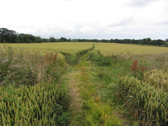
Tranquil pathways wind their way through the plantation, offering visitors the opportunity to explore the woodland at their leisure. These paths are well-maintained, allowing for ease of access for visitors of all ages and abilities. Along the way, visitors can admire the vibrant carpet of bluebells that bloom in the spring, adding a burst of color to the already stunning landscape.

Ale Well Plantation also has a rich history. It was once part of a medieval deer park and remnants of this past can still be seen today, with the presence of ancient earthworks and deer enclosures. These historical features add an extra layer of intrigue to the plantation, captivating visitors with stories of days gone by.

Overall, Ale Well Plantation is a hidden gem in Norfolk, offering visitors a tranquil retreat in the midst of nature's beauty.

If you have any feedback on the listing, please let us know in the comments section below.

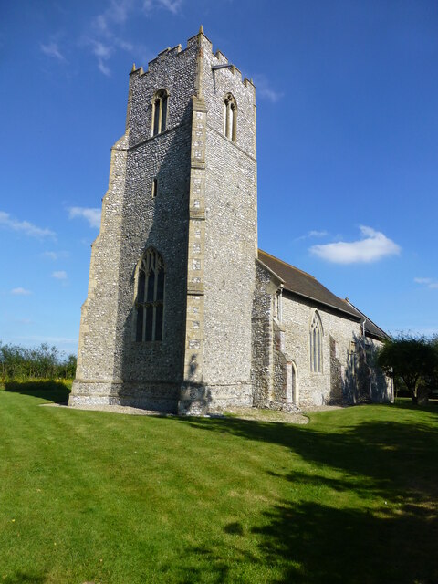
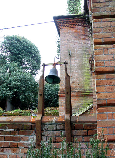
Ale Well Plantation Images

Images are sourced within 2km of 52.898958/1.2177072 or Grid Reference TG1638. Thanks to Geograph Open Source API. All images are credited.

Disused church at North Barningham
Bessingham Manor Due to be demolished the Manor has an unusually interesting history. For more information read the shared description by Evelyn Simak.
Bessingham Manor
Due to be demolished the Manor has an unusually interesting history. For more information read the shared description by Evelyn Simak.
Bessingham Manor - the bell It is still in its place but not for very much longer - the manor house is scheduled for demolition.
Bessingham Manor - the bell
It is still in its place but not for very much longer - the manor house is scheduled for demolition.
Bessingham Manor - the wash-house The coppers and fireplaces are still there but everything surrounding them has collapsed. The manor house is scheduled for demolition.
Bessingham Manor - the wash-house
The coppers and fireplaces are still there but everything surrounding them has collapsed. The manor house is scheduled for demolition.
Bessingham Manor - the chamber pot Found amongst the debris.  The manor house is scheduled for demolition.
Bessingham Manor - the chamber pot
Found amongst the debris. The manor house is scheduled for demolition.
Bessingham Manor - redundant doorknob The manor house is scheduled for demolition.
Bessingham Manor - redundant doorknob
The manor house is scheduled for demolition.
Bessingham Manor - crystal chandelier The manor house is scheduled for demolition but the crystal chandeliers are still hanging on.
Bessingham Manor - crystal chandelier
The manor house is scheduled for demolition but the crystal chandeliers are still hanging on.
Bessingham Manor and outbuildings The manor house is scheduled for demolition.
Bessingham Manor and outbuildings
The manor house is scheduled for demolition.
Dovecote by the entrance to Bessingham Manor (interior) This tower > <a title="https://www.geograph.org.uk/photo/2287318" href="https://www.geograph.org.uk/photo/2287318">Link</a> on a corner of the wall surrounding the manor house is described as having been a dovecote. I don't think that's correct: there is a very narrow spiral staircase inside going up all the way and according to the original plans it served as an obervatory.
Dovecote by the entrance to Bessingham Manor (interior)
This tower > Link on a corner of the wall surrounding the manor house is described as having been a dovecote. I don't think that's correct: there is a very narrow spiral staircase inside going up all the way and according to the original plans it served as an obervatory.
Dovecote by the entrance to Bessingham Manor This tower on a corner of the wall surrounding the manor house is described as having been a dovecote.  I don't think that's correct: there is a very narrow spiral staircase inside going up all the way > <a title="https://www.geograph.org.uk/photo/2334184" href="https://www.geograph.org.uk/photo/2334184">Link</a> - what purpose it served I do not know.
Dovecote by the entrance to Bessingham Manor
This tower on a corner of the wall surrounding the manor house is described as having been a dovecote. I don't think that's correct: there is a very narrow spiral staircase inside going up all the way > Link - what purpose it served I do not know.
On the Weaver's Way, northwest of Sustead, Norfolk
All Saints' church, Gresham See <span class="nowrap"><a title="http://www.norfolkchurches.co.uk/gresham/gresham.htm" rel="nofollow ugc noopener" href="http://www.norfolkchurches.co.uk/gresham/gresham.htm">Link</a><img style="margin-left:2px;" alt="External link" title="External link - shift click to open in new window" src="https://s1.geograph.org.uk/img/external.png" width="10" height="10"/></span>.
All Saints' church, Gresham
See LinkExternal link.
St Mary's church, Bessingham According to <span class="nowrap"><a title="http://www.norfolkchurches.co.uk/bessingham/bessingham.htm" rel="nofollow ugc noopener" href="http://www.norfolkchurches.co.uk/bessingham/bessingham.htm">Link</a><img style="margin-left:2px;" alt="External link" title="External link - shift click to open in new window" src="https://s1.geograph.org.uk/img/external.png" width="10" height="10"/></span> , the tower is anglo-saxon but the body of the church was rebuilt in the 1870's.
St Mary's church, Bessingham
According to LinkExternal link , the tower is anglo-saxon but the body of the church was rebuilt in the 1870's.
Aylmerton Cross Restored ancient cross situated one mile south of the village of Aylmerton at a crossroads (3 roads and a track).
Aylmerton Cross
Restored ancient cross situated one mile south of the village of Aylmerton at a crossroads (3 roads and a track).
Aylmerton Stone Cross before restoration
Pillar piscina in St Peter's Church At the end of the aisle of St Peter's in North Barningham (or Barningham Northwood) is this unusual form of piscina.  To quote from the church guide by Derek A. Palgrave: "It is positioned so as to be convenient for a side altar, suggesting that in the 15th century the north aisle was probably in use as a Lady or Guild Chapel.  The presence of the two elevated stone brackets north and south of the site of this altar, which may well have been used for statues, adds weight to this view."
Pillar piscina in St Peter's Church
At the end of the aisle of St Peter's in North Barningham (or Barningham Northwood) is this unusual form of piscina. To quote from the church guide by Derek A. Palgrave: "It is positioned so as to be convenient for a side altar, suggesting that in the 15th century the north aisle was probably in use as a Lady or Guild Chapel. The presence of the two elevated stone brackets north and south of the site of this altar, which may well have been used for statues, adds weight to this view."
Show me another place!

Ale Well Plantation is located at Grid Ref: TG1638 (Lat: 52.898958, Lng: 1.2177072)

Administrative County: Norfolk

District: North Norfolk

Police Authority: Norfolk

What 3 Words

///rejects.gifted.piled. Near Sheringham, Norfolk

Related Wikis

Gresham, Norfolk

Gresham is a village and civil parish in North Norfolk, England, five miles (8 km) south-west of Cromer. A predominantly rural parish, Gresham centres...

Gresham Castle

Gresham Castle is located south of the village of Gresham in the north of the English county of Norfolk. The medieval castle was actually a fortified manor...

Bessingham

Bessingham is a village and former civil parish, now in the parish of Sustead, in the North Norfolk district of the English county of Norfolk. It lies...

East Beckham

East Beckham is a village and a civil parish in the English county of Norfolk. The village is 23.4 miles (37.7 km) north of Norwich, 5 miles (8 km) south...

Aylmerton

Aylmerton is a village in the county of Norfolk, England. It is in the area of North Norfolk and lies 2.2 miles (3.5 km) south of the North Sea, 3.2 miles...

North Barningham

North Barningham is a hamlet within the civil parish of Gresham in the English county of Norfolk. The hamlet is 7 miles (11 km) south-west of Cromer, 23...

Wood-Dene School

Wood-Dene School was a private school for the creative arts in the English county of Norfolk in Great Britain, closing during March 2010. The school was...

RAF West Beckham

Royal Air Force Station West Beckham, commonly known as RAF West Beckham, is a former Chain Home radar station controlled by the Royal Air Force (RAF)...

Nearby Amenities

Located within 500m of 52.898958,1.2177072
Holt Road, W-bound
Naptan AtcoCode: 2900G102
Naptan Bearing: W
Naptan BusStopType: CUS
Naptan CommonName: Holt Road
Naptan Indicator: W-bound
Naptan Locality: Gresham
Naptan NaptanCode: nfoatawm
Naptan Street: Holt Road
Naptan Verified: no
Source: naptan_import
Lat/Long: 52.8995197/1.2120478
School, adj
Naptan AtcoCode: 2900G104
Naptan Bearing: E
Naptan BusStopType: CUS
Naptan CommonName: School
Naptan Indicator: adj
Naptan Landmark: school
Naptan Locality: Gresham
Naptan NaptanCode: nfoatawt
Naptan Street: School Lane
Naptan Verified: no
Source: naptan_import
Lat/Long: 52.9000436/1.2220464
Holt Road, E-bound
Naptan AtcoCode: 2900G105
Naptan Bearing: E
Naptan BusStopType: CUS
Naptan CommonName: Holt Road
Naptan Indicator: E-bound
Naptan Landmark: bus shelter
Naptan Locality: Gresham
Naptan NaptanCode: nfoatdad
Naptan Street: Holt Road
Naptan Verified: no
Source: naptan_import
Lat/Long: 52.8993689/1.2134296
School, opp
Naptan AtcoCode: 2900G106
Naptan Bearing: E
Naptan BusStopType: CUS
Naptan CommonName: School
Naptan Indicator: opp
Naptan Landmark: School
Naptan Locality: Gresham
Naptan NaptanCode: nfoatdag
Naptan Street: School Lane
Naptan Verified: no
Source: naptan_import
Lat/Long: 52.9001583/1.2221293
Turning Circle
Lat/Long: 52.8997553/1.2140535
Gresham
Place: village
Lat/Long: 52.9002993/1.2209559
Post Box
Post Box Type: lamp
Lat/Long: 52.8999036/1.221287
Gresham
Colour: grey
Inscription: 1978
Man Made: village_sign
Material: wood
Start Date: 1978
Lat/Long: 52.9003671/1.2208425
Bench
Backrest: yes
Material: wood
Seats: 4
Lat/Long: 52.900386/1.2210413
Historic: memorial
Inscription: To the Glorious Memory of the Gresham Men Who Laid Down Their Lives for Their Country in the Great War
Memorial: war_memorial
Note: Front lists 12 names, rear 1939 - 1945 lists 6 names
Lat/Long: 52.9003885/1.2211123
Entrance: main
Lat/Long: 52.9007289/1.2210842
Give Way
Lat/Long: 52.9002855/1.2208397
Bench
Backrest: no
Material: wood
Seats: 3
Lat/Long: 52.9009424/1.2174721
Bench
Backrest: yes
Material: wood
Seats: 2
Lat/Long: 52.901054/1.2174775
Leisure: playground
Lat/Long: 52.9014132/1.2176948
Leisure: picnic_table
Lat/Long: 52.9015292/1.2180958
Bench
Backrest: no
Material: wood
Seats: 3
Lat/Long: 52.9015608/1.2181869
Bench
Backrest: no
Material: wood
Seats: 3
Lat/Long: 52.901579/1.2182245
Bench
Backrest: no
Material: wood
Seats: 3
Lat/Long: 52.901583/1.2181615
Bench
Backrest: no
Material: wood
Seats: 3
Lat/Long: 52.9015855/1.2181943
Gresham Castle
Castle Type: manor
Historic: castle
Ruins: yes
Wikidata: Q5607570
Wikipedia: en:Gresham Castle
Lat/Long: 52.8964786/1.2197078
Defibrillator
Defibrillator Location: Fixed to external wall by hall entrance.
Emergency: defibrillator
Ref: CHT 9021
Lat/Long: 52.9012354/1.2198391
Bench
Backrest: yes
Material: wood
Seats: 3
Lat/Long: 52.8995135/1.2120958
Dog Waste Basket
Lat/Long: 52.9015092/1.2188027
Give Way
Lat/Long: 52.9002651/1.2210472
Entrance: yes
Lat/Long: 52.9008517/1.2212944
Give Way
Lat/Long: 52.9003619/1.2209139
Communication Mobile Phone: yes
Man Made: mast
Material: metal
Operator: O2-UK
Tower Construction: lattice
Tower Type: communication
Lat/Long: 52.8959367/1.2228164
The data included in this document is from www.openstreetmap.org. The data is made available under ODbL.

Have you been to Ale Well Plantation?

Leave your review of Ale Well Plantation below (or comments, questions and feedback).