Cushion's Common Plantation

Wood, Forest in Norfolk Broadland

England

Cushion's Common Plantation

Old Milestone (south face) by the B1149, Holt Road, Felthorpe Parish Carved stone post by the B1149, in parish of FELTHORPE (BROADLAND District), Holt Road, opposite No. 24, on the verge, on West side of road. Norfolk County Council pillar, erected by an unknown authority in the 19th century. An earlier photograph can be found here <a title="https://www.geograph.org.uk/photo/6616348" href="https://www.geograph.org.uk/photo/6616348">Link</a>.

Inscription reads:- : TO / HOLT / 7 / MILES : : FELTHORPE : : TO / NORWICH / 14 / MILES : 

Listed. 

Milestone Society National ID: NO_NH07.
Old Milestone (south face) by the B1149, Holt Road, Felthorpe Parish Credit: Alan Lake

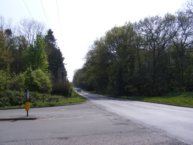
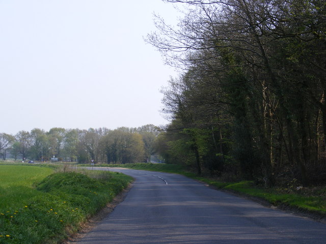
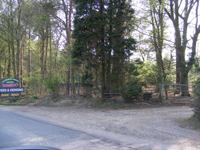
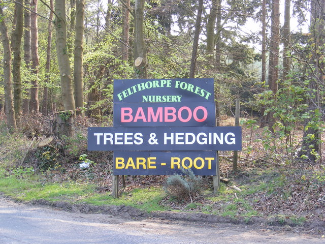
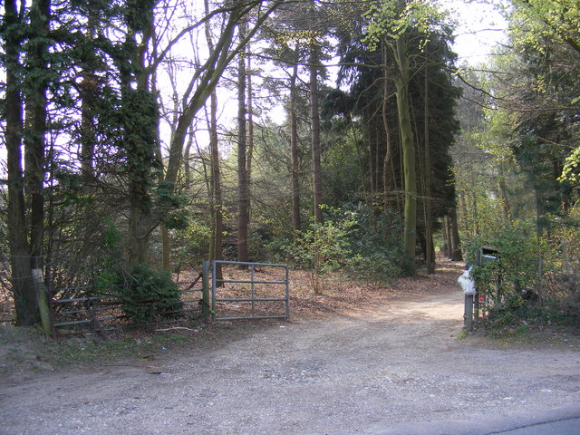
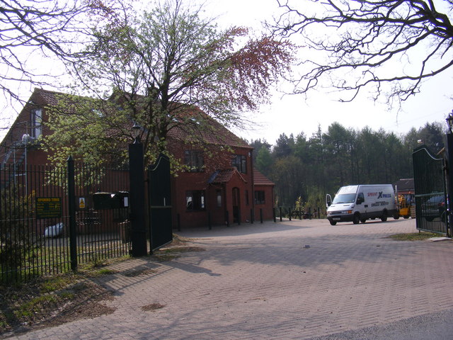
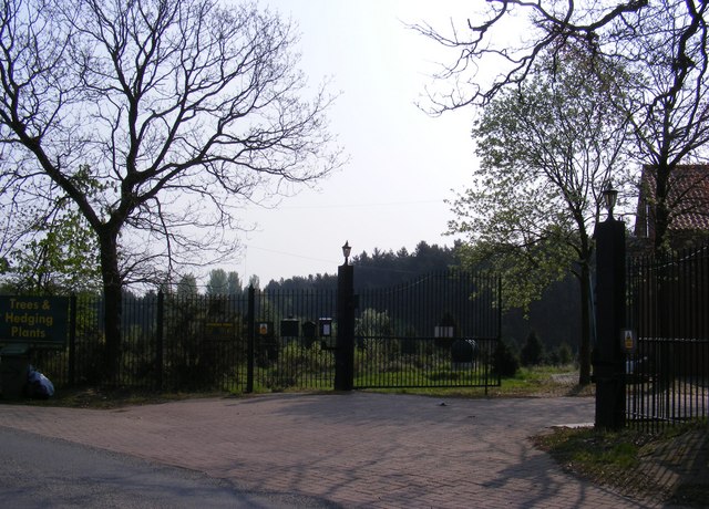
Cushion's Common Plantation, located in Norfolk, is a picturesque woodland area that boasts a diverse range of plant species. Covering a vast expanse, the plantation is primarily composed of various types of wood and forest, creating a serene and tranquil environment.

The plantation is known for its lush vegetation, with towering trees providing ample shade and creating a cool atmosphere even in the hottest months. The woodlands consist of a mix of deciduous and evergreen trees, including oak, beech, birch, and pine, among others. This variety of trees results in a vibrant and colorful landscape throughout the year, with leaves changing hues during the autumn season.

The woodland floor is home to an abundance of plant life, including ferns, mosses, and wildflowers. These provide a rich ecosystem for insects, birds, and small mammals, making the plantation a haven for wildlife enthusiasts. Nature enthusiasts can often spot squirrels, rabbits, and a variety of bird species, adding to the charm and biodiversity of the area.

Cushion's Common Plantation is a popular destination for leisurely walks, hikes, and picnics amidst nature. Well-maintained trails wind through the plantation, offering visitors the opportunity to explore the woodlands and appreciate its natural beauty up close. Additionally, the plantation provides an ideal location for nature photography, with its stunning vistas and abundant wildlife.

Overall, Cushion's Common Plantation in Norfolk offers a serene escape from the hustle and bustle of everyday life, providing a sanctuary for both plant and animal species and a peaceful retreat for visitors seeking to immerse themselves in nature.

If you have any feedback on the listing, please let us know in the comments section below.

Cushion's Common Plantation Images

Images are sourced within 2km of 52.725504/1.2014614 or Grid Reference TG1619. Thanks to Geograph Open Source API. All images are credited.

Old Milestone (south face) by the B1149, Holt Road, Felthorpe Parish Carved stone post by the B1149, in parish of FELTHORPE (BROADLAND District), Holt Road, opposite No. 24, on the verge, on West side of road. Norfolk County Council pillar, erected by an unknown authority in the 19th century. An earlier photograph can be found here <a title="https://www.geograph.org.uk/photo/6616348" href="https://www.geograph.org.uk/photo/6616348">Link</a>.

Inscription reads:- : TO / HOLT / 7 / MILES : : FELTHORPE : : TO / NORWICH / 14 / MILES : 

Listed. 

Milestone Society National ID: NO_NH07.
Old Milestone (south face) by the B1149, Holt Road, Felthorpe Parish
Carved stone post by the B1149, in parish of FELTHORPE (BROADLAND District), Holt Road, opposite No. 24, on the verge, on West side of road. Norfolk County Council pillar, erected by an unknown authority in the 19th century. An earlier photograph can be found here Link. Inscription reads:- : TO / HOLT / 7 / MILES : : FELTHORPE : : TO / NORWICH / 14 / MILES : Listed. Milestone Society National ID: NO_NH07.
Short -Thorn Road Approaching the B1149 Holt Road
Short -Thorn Road
Approaching the B1149 Holt Road
Short -Thorn Road Approaching the B1149 Holt Road
Short -Thorn Road
Approaching the B1149 Holt Road
B1149 Holt Road Looking towards Short-Thorn Road at the junction with Short-Thorn Road
B1149 Holt Road
Looking towards Short-Thorn Road at the junction with Short-Thorn Road
Road signs on the B1149 Holt Road At the junction with Short-Thorn Road
Road signs on the B1149 Holt Road
At the junction with Short-Thorn Road
Stratton Strawless sign On Short-Thorn Road near the junction with the B1149 Holt Road
Stratton Strawless sign
On Short-Thorn Road near the junction with the B1149 Holt Road
Short -Thorn Road sign At the junction with the B1149 Holt Road
Short -Thorn Road sign
At the junction with the B1149 Holt Road
B1149 Holt Road Looking towards Horsford at the junction with Short-Thorn Road
B1149 Holt Road
Looking towards Horsford at the junction with Short-Thorn Road
Roadsigns on the B1149 Holt Road At the junction with Short-Thorn Road
Roadsigns on the B1149 Holt Road
At the junction with Short-Thorn Road
B1149 Holt Road Looking towards Haveringland Road
B1149 Holt Road
Looking towards Haveringland Road
Short -Thorn Road <span class="nowrap"><a title="https://en.wikipedia.org/wiki/Felthorpe" rel="nofollow ugc noopener" href="https://en.wikipedia.org/wiki/Felthorpe">Link</a><img style="margin-left:2px;" alt="External link" title="External link - shift click to open in new window" src="https://s1.geograph.org.uk/img/external.png" width="10" height="10"/></span>
Short -Thorn Road
Short -Thorn Road Approaching the B1149 Holt Road
Short -Thorn Road
Approaching the B1149 Holt Road
Short -Thorn Road, Felthorpe Approaching the B1149 Holt Road
Short -Thorn Road, Felthorpe
Approaching the B1149 Holt Road
The entrance to Felthorpe Forest Nursery Off Short-Thorn Road
The entrance to Felthorpe Forest Nursery
Off Short-Thorn Road
Felthorpe Forest Nursery sign Off Short-Thorn Road
Felthorpe Forest Nursery sign
Off Short-Thorn Road
The entrance to Felthorpe Forest Nursery Off Short-Thorn Road
The entrance to Felthorpe Forest Nursery
Off Short-Thorn Road
Nursery entrance off Short Thorn Road <span class="nowrap"><a title="https://en.wikipedia.org/wiki/Felthorpe" rel="nofollow ugc noopener" href="https://en.wikipedia.org/wiki/Felthorpe">Link</a><img style="margin-left:2px;" alt="External link" title="External link - shift click to open in new window" src="https://s1.geograph.org.uk/img/external.png" width="10" height="10"/></span>
Nursery entrance off Short Thorn Road
Show me another place!

Cushion's Common Plantation is located at Grid Ref: TG1619 (Lat: 52.725504, Lng: 1.2014614)

Administrative County: Norfolk

District: Broadland

Police Authority: Norfolk

What 3 Words

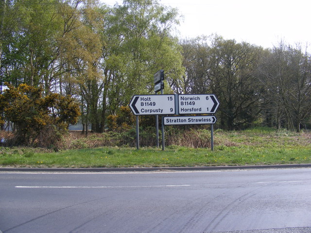
///mulled.brothers.rotations. Near Horsford, Norfolk

Related Wikis

Felthorpe

Felthorpe is a village and civil parish in the English county of Norfolk. The village is located 11 miles (18 km) east of Dereham and 7.1 miles (11.4 km...

Haveringland

Haveringland is a village and civil parish in the English county of Norfolk about 8 miles (13 km) north-west of Norwich. It covers an area of 8.91 km2...

Swannington Upgate Common

Swannington Upgate Common is a 20.5-hectare (51-acre) biological Site of Special Scientific Interest north-west of Norwich in Norfolk.This site has varied...

1966 Felthorpe Trident crash

On 3 June 1966, a newly built Hawker Siddeley Trident jetliner crashed during a pre-delivery test flight near the village of Felthorpe, Norfolk, England...

Broadland (UK Parliament constituency)

Broadland is a Norfolk constituency, which has been represented in the House of Commons of the UK Parliament since the 2019 general election by Jerome...

Swannington, Norfolk

Swannington is a village and civil parish in the English county of Norfolk, United Kingdom. The villages name means 'Farm/settlement connected with Swan...

St Nicholas Church, Brandiston

St Nicholas Church is a redundant Anglican church in the village of Brandiston, Norfolk, England. It is recorded in the National Heritage List for England...

Guton

Guton was a settlement in the county of Norfolk in England mentioned in the Domesday Book as Guthetuna. It is described as being held by Osbert from Tihel...

Nearby Amenities

Located within 500m of 52.725504,1.2014614
Old Kings Head, adj
Naptan AtcoCode: 2900H101
Naptan Bearing: E
Naptan BusStopType: CUS
Naptan CommonName: Old Kings Head
Naptan Indicator: adj
Naptan Landmark: public house
Naptan Locality: Haveringland
Naptan NaptanCode: nfoatwdp
Naptan ShortCommonName: Old Kings Head
Naptan Street: Haveringland Road
Naptan Verified: no
Source: naptan_import
Lat/Long: 52.7273263/1.2026802
Old Kings Head, opp
Naptan AtcoCode: 2900H102
Naptan Bearing: W
Naptan BusStopType: CUS
Naptan CommonName: Old Kings Head
Naptan Indicator: opp
Naptan Landmark: public house
Naptan Locality: Haveringland
Naptan NaptanCode: nfoatwdt
Naptan ShortCommonName: Old Kings Head
Naptan Street: Haveringland Road
Naptan Verified: no
Source: naptan_import
Lat/Long: 52.7272451/1.202689
Foot: designated
Motorcar: private
Lat/Long: 52.7268349/1.2052816
Haveringland
Inscription: Erected by Haveringland Parish Meeting to commemorate the Millennium / 2003
Man Made: village_sign
Material: wood
Place: hamlet
Start Date: 2003
Lat/Long: 52.7271999/1.2026183
Man Made: village_stocks
Material: wood
Lat/Long: 52.7272058/1.2026979
Give Way
Lat/Long: 52.7272253/1.2021822
The data included in this document is from www.openstreetmap.org. The data is made available under ODbL.

Have you been to Cushion's Common Plantation?

Leave your review of Cushion's Common Plantation below (or comments, questions and feedback).