Framingham Pigot

Settlement in Norfolk South Norfolk

England

Framingham Pigot

Poringland, near Norwich Shops and offices are in this area.
Poringland, near Norwich Credit: Christine Matthews

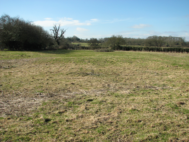
Framingham Pigot is a small village located in the county of Norfolk, England. Situated approximately 6 miles south-east of the city of Norwich, it is nestled in the picturesque countryside, surrounded by fields and farmland. The village has a population of around 300 people, making it a close-knit and tight community.

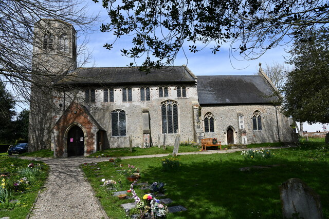
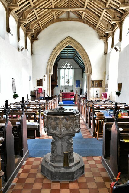
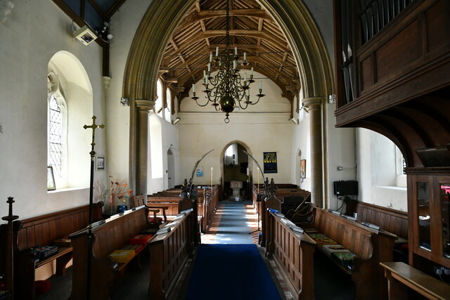
The village is known for its beautiful and well-preserved architecture, with many traditional thatched-roof cottages lining the streets. The parish church, St. Andrew's, is a prominent landmark, dating back to the 14th century and boasting stunning stained glass windows and intricate stone carvings.

Framingham Pigot offers a peaceful and tranquil atmosphere, making it an ideal location for those seeking a rural retreat. The village is well-connected, with good road links to Norwich and other nearby towns. The local bus service also provides convenient transportation options for residents and visitors.

While it may be small in size, Framingham Pigot offers a range of amenities to cater to the needs of its residents. These include a village hall, a primary school, and a public house, where locals can gather and socialize. The surrounding countryside provides ample opportunities for outdoor activities such as walking, cycling, and fishing.

Overall, Framingham Pigot is a charming and idyllic village that offers a peaceful and close community feel. With its stunning architecture, beautiful countryside, and convenient location, it is a prime destination for those seeking a quintessential English village experience.

If you have any feedback on the listing, please let us know in the comments section below.

Framingham Pigot Images

Images are sourced within 2km of 52.583121/1.351872 or Grid Reference TG2703. Thanks to Geograph Open Source API. All images are credited.

Poringland, near Norwich Shops and offices are in this area.
Poringland, near Norwich
Shops and offices are in this area.
Poringland, All Saints Church: Southern aspect
Poringland, All Saints Church: c.1200 round tower with octagonal c14th top
Poringland, All Saints Church: Blocked north doorway
Poringland, All Saints Church: The nave
Poringland, All Saints Church: Octagonal font with the signs of the four Evangelists
Poringland, All Saints Church: Octagonal font with the signs of the four Evangelists and nave
Poringland, All Saints Church: The hammerbeam nave roof
Poringland, All Saints Church: c15th glass in the east window
Poringland, All Saints Church: c15th glass in the east window (detail)
Poringland, All Saints Church: The chancel and nave beyond
Poringland, All Saints Church: c15th glass fragments in a chancel window
Show me another place!

Framingham Pigot is located at Grid Ref: TG2703 (Lat: 52.583121, Lng: 1.351872)

Administrative County: Norfolk

District: South Norfolk

Police Authority: Norfolk

What 3 Words

///shins.zebra.saddens. Near Poringland, Norfolk

Related Wikis

Framingham Pigot

Framingham Pigot is a village and civil parish in the English county of Norfolk. The village is located 6.4 miles (10.3 km) north-west of Loddon and 3...

Framingham Earl High School

Framingham Earl High School is a secondary school located in Framingham Earl in the English county of Norfolk to the south of Norwich. The school enrolls...

Framingham Earl

Framingham Earl is a small village and civil parish in the English county of Norfolk. The village is located 5.8 miles (9.3 km) north-west of Loddon and...

Bixley medieval settlement

Bixley medieval settlement is a deserted medieval village in Norfolk, England, about 2 miles (3.2 km) south-east of Norwich. It is a Scheduled Monument...

Nearby Amenities

Located within 500m of 52.583121,1.351872
Power: pole
Lat/Long: 52.58184/1.358826
Framingham Pigot
Man Made: village_sign
Material: metal
Lat/Long: 52.5832046/1.3516641
Restaurant
Brasted's
Addr City: Framingham Pigot
Addr Housename: Manor Farm Barns
Addr Postcode: NR14 7PZ
Addr Village: Framingham Pigot
Cuisine: international
Fhrs Id: 648342
Opening Hours: Th-Sa 19:00-22:00; Sa 12:00-14:30
Phone: +44 1508 491112
Website: https://www.brasteds.co.uk/
Lat/Long: 52.5853605/1.3482508
Post Box
Collection Times: Mo-Fr 16:15, Sa 09:30
Operator: Royal Mail
Post Box Type: wall
Lat/Long: 52.583151/1.3519345
Give Way
Lat/Long: 52.5830609/1.3516314
Give Way
Lat/Long: 52.5832516/1.3516483
Framingham Pigot
Place: hamlet
Lat/Long: 52.5832701/1.3530809
The data included in this document is from www.openstreetmap.org. The data is made available under ODbL.

Have you been to Framingham Pigot?

Leave your review of Framingham Pigot below (or comments, questions and feedback).