Perry Wood

Wood, Forest in Kent Shepway

England

Perry Wood

Westenhanger Station Westenhanger station serves Westenhanger in Kent. The station is on the South Eastern Main Line 64 miles south east of London Charing Cross. All trains serving Westenhanger are operated by Southeastern. It serves Folkestone Racecourse and the village of Stanford. The station opened in 1844.
Westenhanger Station Credit: N Chadwick

Perry Wood, Kent, also known as Wood or Forest, is a picturesque and expansive woodland located in the southeastern part of England. Covering an area of approximately 400 acres, it is situated near the village of Selling, about 7 miles southeast of the city of Canterbury.

Perry Wood is renowned for its natural beauty and biodiversity. The woodland consists of a mix of ancient and semi-natural broadleaved trees, including oak, beech, ash, and birch. These majestic trees create a dense canopy, providing a shady and tranquil environment for visitors to explore.

The wood is crisscrossed by a network of well-maintained footpaths and trails, making it a popular destination for walkers, hikers, and nature enthusiasts. These paths wind through the wood, taking visitors on a journey through a diverse range of habitats, including ponds, meadows, and wetland areas. This variety of ecosystems supports a rich array of wildlife, such as deer, badgers, foxes, and numerous species of birds.

Perry Wood is managed by the Woodland Trust, a leading conservation charity in the UK. The Trust works tirelessly to protect and enhance the natural environment of the wood, ensuring its preservation for future generations to enjoy. As part of their efforts, they engage in activities such as tree planting, habitat restoration, and educational programs.

Overall, Perry Wood, Kent is a haven for nature lovers, offering a peaceful retreat from the hustle and bustle of everyday life. Its ancient trees, diverse wildlife, and well-maintained trails make it a must-visit destination for anyone seeking a connection with nature.

If you have any feedback on the listing, please let us know in the comments section below.

Perry Wood Images

Images are sourced within 2km of 51.097742/1.0527457 or Grid Reference TR1337. Thanks to Geograph Open Source API. All images are credited.

Westenhanger Station Westenhanger station serves Westenhanger in Kent. The station is on the South Eastern Main Line 64 miles south east of London Charing Cross. All trains serving Westenhanger are operated by Southeastern. It serves Folkestone Racecourse and the village of Stanford. The station opened in 1844.
Westenhanger Station
Westenhanger station serves Westenhanger in Kent. The station is on the South Eastern Main Line 64 miles south east of London Charing Cross. All trains serving Westenhanger are operated by Southeastern. It serves Folkestone Racecourse and the village of Stanford. The station opened in 1844.
HS1 and South Eastern Lines, Westenhanger High Speed 1 (originally called The Channel Tunnel Rail Link or CTRL), is a 69-mile stretch of railway linking the Channel Tunnel and St Pancras station in London. Built at a cost of £5.2 billion, the line was opened on 14th November 2007, cutting Eurostar journey times by 40 minutes, compared with the previous route which was shared with local trains, restricting the speed severely. Trains travel at speeds up to 140mph on the high speed line.

In June 2010 the government put the line up for sale for £1.5 billion.
HS1 and South Eastern Lines, Westenhanger
High Speed 1 (originally called The Channel Tunnel Rail Link or CTRL), is a 69-mile stretch of railway linking the Channel Tunnel and St Pancras station in London. Built at a cost of £5.2 billion, the line was opened on 14th November 2007, cutting Eurostar journey times by 40 minutes, compared with the previous route which was shared with local trains, restricting the speed severely. Trains travel at speeds up to 140mph on the high speed line. In June 2010 the government put the line up for sale for £1.5 billion.
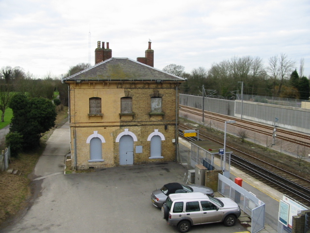
Former station house, Westenhanger Westenhanger station serves Westenhanger in Kent. The station is on the South Eastern Main Line 64 miles south east of London Charing Cross. All trains serving Westenhanger are operated by Southeastern. It serves Folkestone Racecourse and the village of Stanford. The station opened in 1844.
Former station house, Westenhanger
Westenhanger station serves Westenhanger in Kent. The station is on the South Eastern Main Line 64 miles south east of London Charing Cross. All trains serving Westenhanger are operated by Southeastern. It serves Folkestone Racecourse and the village of Stanford. The station opened in 1844.
Folkestone Racecourse Folkestone Racecourse was a horse racing venue, until it closed in 2012. It is located in Westenhanger, by junction 11 of the M20 motorway and about two miles west of Folkestone. In 2013, the venue hosted the War and Peace show previously held at The Hop Farm at Beltring.
Folkestone Racecourse
Folkestone Racecourse was a horse racing venue, until it closed in 2012. It is located in Westenhanger, by junction 11 of the M20 motorway and about two miles west of Folkestone. In 2013, the venue hosted the War and Peace show previously held at The Hop Farm at Beltring.
Tollgate Cottage
Tollgate Cottage
Folkestone Racecourse Folkestone Racecourse was a horse racing venue, until it closed in 2012. It is located in Westenhanger, by junction 11 of the M20 motorway and about two miles west of Folkestone. In 2013, the venue hosted the War and Peace show previously held at The Hop Farm at Beltring.
Folkestone Racecourse
Folkestone Racecourse was a horse racing venue, until it closed in 2012. It is located in Westenhanger, by junction 11 of the M20 motorway and about two miles west of Folkestone. In 2013, the venue hosted the War and Peace show previously held at The Hop Farm at Beltring.
Footpath off Stone Street
Road to the racecourse Folkestone Racecourse was a horse racing venue, until it closed in 2012. It is located in Westenhanger, by junction 11 of the M20 motorway and about two miles west of Folkestone. In 2013, the venue hosted the War and Peace show previously held at The Hop Farm at Beltring.
Road to the racecourse
Folkestone Racecourse was a horse racing venue, until it closed in 2012. It is located in Westenhanger, by junction 11 of the M20 motorway and about two miles west of Folkestone. In 2013, the venue hosted the War and Peace show previously held at The Hop Farm at Beltring.
Folkestone Racecourse Folkestone Racecourse was a horse racing venue, until it closed in 2012. It is located in Westenhanger, by junction 11 of the M20 motorway and about two miles west of Folkestone. In 2013, the venue hosted the War and Peace show previously held at The Hop Farm at Beltring.
Folkestone Racecourse
Folkestone Racecourse was a horse racing venue, until it closed in 2012. It is located in Westenhanger, by junction 11 of the M20 motorway and about two miles west of Folkestone. In 2013, the venue hosted the War and Peace show previously held at The Hop Farm at Beltring.
Entering Westenhanger
Stone Street A former Roman Road, which runs south for some 12 miles from Watling Street at Canterbury (the Roman 'Durovernum') to Lympne ('Lemanis') at the western edge of the Romney Marsh. Most of it is now the current B2068 road that runs from Canterbury to the M20 motorway.

See also <span class="nowrap"><a title="http://www.answers.com/topic/watling-street" rel="nofollow ugc noopener" href="http://www.answers.com/topic/watling-street">Link</a><img style="margin-left:2px;" alt="External link" title="External link - shift click to open in new window" src="https://s1.geograph.org.uk/img/external.png" width="10" height="10"/></span> for other Roman Roads.

Note: Another Stone Street, is from Magnis (Kenchester) in modern Herefordshire to Caerleon, Isca Augusta and the main Roman legionary base in the south of Roman Wales.
Stone Street
A former Roman Road, which runs south for some 12 miles from Watling Street at Canterbury (the Roman 'Durovernum') to Lympne ('Lemanis') at the western edge of the Romney Marsh. Most of it is now the current B2068 road that runs from Canterbury to the M20 motorway. See also LinkExternal link for other Roman Roads. Note: Another Stone Street, is from Magnis (Kenchester) in modern Herefordshire to Caerleon, Isca Augusta and the main Roman legionary base in the south of Roman Wales.
Westenhanger
Westenhanger
Footpath waymarkers, Stone Street
Stone Street A former Roman Road, which runs south for some 12 miles from Watling Street at Canterbury (the Roman 'Durovernum') to Lympne ('Lemanis') at the western edge of the Romney Marsh. Most of it is now the current B2068 road that runs from Canterbury to the M20 motorway.

See also <span class="nowrap"><a title="http://www.answers.com/topic/watling-street" rel="nofollow ugc noopener" href="http://www.answers.com/topic/watling-street">Link</a><img style="margin-left:2px;" alt="External link" title="External link - shift click to open in new window" src="https://s1.geograph.org.uk/img/external.png" width="10" height="10"/></span> for other Roman Roads.

Note: Another Stone Street, is from Magnis (Kenchester) in modern Herefordshire to Caerleon, Isca Augusta and the main Roman legionary base in the south of Roman Wales.
Stone Street
A former Roman Road, which runs south for some 12 miles from Watling Street at Canterbury (the Roman 'Durovernum') to Lympne ('Lemanis') at the western edge of the Romney Marsh. Most of it is now the current B2068 road that runs from Canterbury to the M20 motorway. See also LinkExternal link for other Roman Roads. Note: Another Stone Street, is from Magnis (Kenchester) in modern Herefordshire to Caerleon, Isca Augusta and the main Roman legionary base in the south of Roman Wales.
Entering Westenhanger
Little Greys, Stone Street A former Roman Road, which runs south for some 12 miles from Watling Street at Canterbury (the Roman 'Durovernum') to Lympne ('Lemanis') at the western edge of the Romney Marsh. Most of it is now the current B2068 road that runs from Canterbury to the M20 motorway.

See also <span class="nowrap"><a title="http://www.answers.com/topic/watling-street" rel="nofollow ugc noopener" href="http://www.answers.com/topic/watling-street">Link</a><img style="margin-left:2px;" alt="External link" title="External link - shift click to open in new window" src="https://s1.geograph.org.uk/img/external.png" width="10" height="10"/></span> for other Roman Roads.

Note: Another Stone Street, is from Magnis (Kenchester) in modern Herefordshire to Caerleon, Isca Augusta and the main Roman legionary base in the south of Roman Wales.
Little Greys, Stone Street
A former Roman Road, which runs south for some 12 miles from Watling Street at Canterbury (the Roman 'Durovernum') to Lympne ('Lemanis') at the western edge of the Romney Marsh. Most of it is now the current B2068 road that runs from Canterbury to the M20 motorway. See also LinkExternal link for other Roman Roads. Note: Another Stone Street, is from Magnis (Kenchester) in modern Herefordshire to Caerleon, Isca Augusta and the main Roman legionary base in the south of Roman Wales.
Industrial units
Industrial units
Show me another place!

Perry Wood is located at Grid Ref: TR1337 (Lat: 51.097742, Lng: 1.0527457)

Administrative County: Kent

District: Shepway

Police Authority: Kent

What 3 Words

///screeches.venue.boasted. Near Lympne, Kent

Related Wikis

Folkestone services

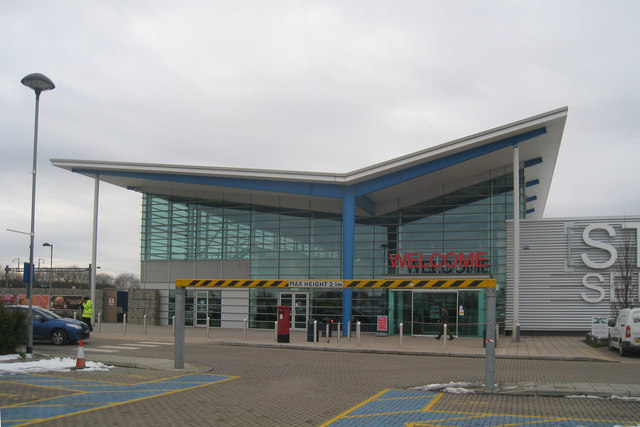
Folkestone services is a motorway service station on the M20 motorway at Westenhanger, seven miles from Folkestone in Kent, England. They are the second...

Stanford, Kent

Stanford is a village and civil parish in Kent, England. It is part of the Folkestone and Hythe district. The village developed along the ancient Roman...

Stanford Windmill

Stanford Windmill is a Grade II* listed tower mill in Stanford, Kent, England that was built in 1857. It stands on Kennett Lane in Stanford. == History... ==

Westenhanger railway station

Westenhanger railway station is on the South Eastern Main Line in England, serving the villages of Westenhanger and Stanford, and was near the now-closed...

Sandling railway station

Sandling railway station is on the South Eastern Main Line in England, serving the village of Sandling and the town of Hythe, Kent. It is 65 miles 36 chains...

Folkestone Racecourse

Folkestone Racecourse was a thoroughbred horse racing venue in southeast England, until it closed in 2012. It is located in Westenhanger, by junction 11...

Westenhanger Castle

Westenhanger Castle is a fortified manor house once owned by royalty, located next to Westenhanger railway station and the grandstand of Folkestone Racecourse...

Postling

Postling is a village and civil parish situated near the Roman road of Stone Street, about 17 miles (27 km) south of Canterbury, Kent, in South East England...

Nearby Amenities

Located within 500m of 51.097742,1.0527457
Barrier: stile
Lat/Long: 51.0965911/1.0477195
Barrier: stile
Lat/Long: 51.0965915/1.0477005
Phone
Emergency: phone
Lat/Long: 51.0957241/1.0493912
Barrier: stile
Lat/Long: 51.0963049/1.050705
Barrier: stile
Lat/Long: 51.0989761/1.0493649
Barrier: stile
Lat/Long: 51.0991629/1.0496199
Barrier: stile
Lat/Long: 51.0982027/1.0553972
Power: pole
Lat/Long: 51.0996661/1.0555444
Power: pole
Lat/Long: 51.0985098/1.0590738
Power: pole
Lat/Long: 51.1014026/1.0502734
Power: pole
Lat/Long: 51.1002323/1.053838
Power: pole
Lat/Long: 51.0990381/1.0574713
Power: pole
Lat/Long: 51.1008258/1.052022
Street Lamp
Lat/Long: 51.0943085/1.0501455
Street Lamp
Lat/Long: 51.0939632/1.0500811
Street Lamp
Lat/Long: 51.09366/1.0500221
Street Lamp
Lat/Long: 51.0964463/1.0490477
Street Lamp
Lat/Long: 51.0964475/1.0494314
Street Lamp
Lat/Long: 51.0966473/1.0492237
The data included in this document is from www.openstreetmap.org. The data is made available under ODbL.

Have you been to Perry Wood?

Leave your review of Perry Wood below (or comments, questions and feedback).