Woodside Wood

Wood, Forest in Kent Canterbury

England

Woodside Wood

Whitstable from the air South Tankerton plus Tankerton and its beach are prominent in this view which was taken from a Gatwick bound flight from Prague.

See also <a href="https://www.geograph.org.uk/photo/7091164">TR1266 : Whitstable from the air</a>.
Whitstable from the air Credit: Thomas Nugent

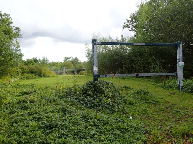
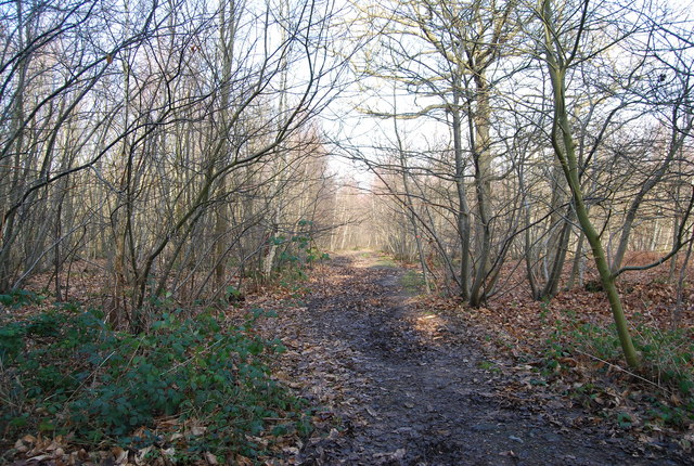
Woodside Wood is a picturesque forest located in the county of Kent, England. Nestled amidst the rolling hills and verdant countryside, it covers an area of approximately 100 acres, making it a significant natural attraction in the region. The forest is predominantly composed of various species of deciduous trees, including oak, beech, and birch, which create a stunning display of colors during the autumn months.

The woodland is known for its diverse wildlife, providing a habitat for numerous species of birds, mammals, and insects. Visitors to Woodside Wood can often spot deer grazing in the meadows, while squirrels scurry amongst the tree branches. The forest is also home to a variety of bird species, such as woodpeckers, owls, and thrushes, making it an ideal spot for birdwatching enthusiasts.

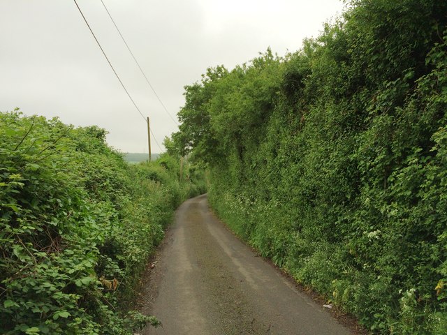
Walking trails wind their way through the forest, offering visitors the opportunity to immerse themselves in the tranquil and serene atmosphere. These paths are well-maintained and suitable for all ages and fitness levels, making Woodside Wood an excellent destination for families and nature lovers alike. Along the trails, informative signs provide interesting facts about the flora and fauna that can be found within the forest, enhancing the educational experience for visitors.

Woodside Wood offers a peaceful retreat from the hustle and bustle of daily life. Whether one is seeking solace in nature, enjoying a leisurely stroll, or engaging in wildlife observation, this enchanting woodland provides a captivating experience for all who venture into its depths.

If you have any feedback on the listing, please let us know in the comments section below.

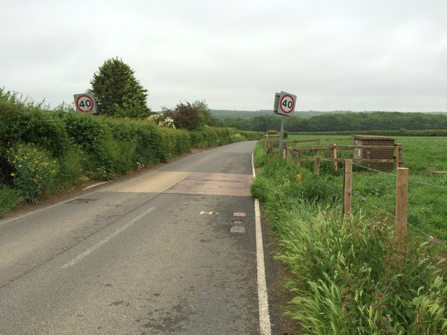
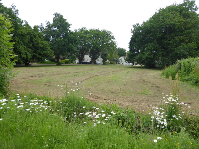
Woodside Wood Images

Images are sourced within 2km of 51.336025/1.0594116 or Grid Reference TR1364. Thanks to Geograph Open Source API. All images are credited.

Whitstable from the air South Tankerton plus Tankerton and its beach are prominent in this view which was taken from a Gatwick bound flight from Prague.

See also <a href="https://www.geograph.org.uk/photo/7091164">TR1266 : Whitstable from the air</a>.
Whitstable from the air
South Tankerton plus Tankerton and its beach are prominent in this view which was taken from a Gatwick bound flight from Prague. See also TR1266 : Whitstable from the air.
A299 Thanet Way Eastbound
Former car park in Thornden Wood Street view of July 2009 for Thornden Wood Road shows this as a very small car park but as can be seen, it has now been closed off.
Former car park in Thornden Wood
Street view of July 2009 for Thornden Wood Road shows this as a very small car park but as can be seen, it has now been closed off.
Thornden Wood Road through Thornden Wood This is looking south from the entrance to the West Blean  & Thornden Woods Car Park.
Thornden Wood Road through Thornden Wood
This is looking south from the entrance to the West Blean & Thornden Woods Car Park.
Thornden Wood Road through Thornden Wood This looks north from the site of the former car park seen at <a title="www.geograph.org.uk/photo/7578619" href="https://www.geograph.org.uk/photo/7578619">Link</a>
Thornden Wood Road through Thornden Wood
This looks north from the site of the former car park seen at Link
Path into Thornden Wood This is looking west from the West Blean & Thornden Woods Car Park into Thornden Wood. West Blean and Thornden Woods are managed by Kent Wildlife Trust. They are a Site of Special Scientific Interest and in July 2022, as part of the Wilder Blean project, European bison were released into West Blean and Thornden Woods - see <span class="nowrap"><a title="https://en.wikipedia.org/wiki/West_Blean_and_Thornden_Woods" rel="nofollow ugc noopener" href="https://en.wikipedia.org/wiki/West_Blean_and_Thornden_Woods">Link</a><img style="margin-left:2px;" alt="External link" title="External link - shift click to open in new window" src="https://s1.geograph.org.uk/img/external.png" width="10" height="10"/></span>
Path into Thornden Wood
This is looking west from the West Blean & Thornden Woods Car Park into Thornden Wood. West Blean and Thornden Woods are managed by Kent Wildlife Trust. They are a Site of Special Scientific Interest and in July 2022, as part of the Wilder Blean project, European bison were released into West Blean and Thornden Woods - see LinkExternal link
Path into Thornden Wood West Blean and Thornden Woods are managed by Kent Wildlife Trust. They are a Site of Special Scientific Interest and in July 2022, as part of the Wilder Blean project, European bison were released into West Blean and Thornden Woods - see <span class="nowrap"><a title="https://en.wikipedia.org/wiki/West_Blean_and_Thornden_Woods" rel="nofollow ugc noopener" href="https://en.wikipedia.org/wiki/West_Blean_and_Thornden_Woods">Link</a><img style="margin-left:2px;" alt="External link" title="External link - shift click to open in new window" src="https://s1.geograph.org.uk/img/external.png" width="10" height="10"/></span>
Path into Thornden Wood
West Blean and Thornden Woods are managed by Kent Wildlife Trust. They are a Site of Special Scientific Interest and in July 2022, as part of the Wilder Blean project, European bison were released into West Blean and Thornden Woods - see LinkExternal link
Deborah Close, Whitstable
Golden Hill, Whitstable
Eversleigh Rise, Whitstable
Golden Hill, near Whitstable
Aurelie Way, Whitstable
South Street, Whitstable
South Street, near Whitstable
The Halt, Whitstable
A2990 Thanet Way Bypassing the older Whitstable, but now bypassed itself by the newer A299.
A2990 Thanet Way
Bypassing the older Whitstable, but now bypassed itself by the newer A299.
Green space next to Molehill Road This is in Chestfield to the south of Whitstable.
Green space next to Molehill Road
This is in Chestfield to the south of Whitstable.
Show me another place!

Woodside Wood is located at Grid Ref: TR1364 (Lat: 51.336025, Lng: 1.0594116)

Administrative County: Kent

District: Canterbury

Police Authority: Kent

What 3 Words

///them.follow.friday. Near Tankerton, Kent

Related Wikis

Radfall

Radfall is a hamlet between Whitstable and Canterbury, in southeast England. It lies between the Thanet Way and Thornden Wood, in the Canterbury district...

South Street Halt railway station

South Street Halt was a minor station on the Canterbury and Whitstable Railway at Tankerton, Kent. It opened in 1911 and closed in 1931. == History... ==

Chestfield

Chestfield is a village (and civil parish and with Swalecliffe a district council ward) in the Canterbury District of Kent, England. The parish is centred...

West Blean and Thornden Woods

West Blean and Thornden Woods is a 781-hectare (1,930-acre) biological Site of Special Scientific Interest north of Canterbury in Kent. It is part of the...

The Whitstable School

The Whitstable School is a coeducational secondary school and sixth form located in Whitstable, Kent, England. It was established in 1952 as the Sir William...

Blean and Tyler Hill Halt railway station

Blean and Tyler Hill Halt was a minor station on the Canterbury and Whitstable Railway at Tyler Hill, Kent. It opened in 1908 and closed in 1931. ��2...

Heart Kent

Heart Kent (previously Invicta FM) was an Independent Local Radio station owned and operated by Global Radio as part of the Heart network. It broadcast...

All Saints Church, Whitstable

All Saints Church is a Church of England church in Whitstable, Kent. It is one of five Church of England churches in the Whitstable Team Ministry. There...

Nearby Amenities

Located within 500m of 51.336025,1.0594116
Radfall
Place: hamlet
Wikidata: Q7280140
Lat/Long: 51.3391881/1.0638321
Generator Method: photovoltaic
Generator Output Electricity: yes
Generator Source: solar
Generator Type: solar_photovoltaic_panel
Location: roof
Power: generator
Lat/Long: 51.337608/1.0627502
Generator Method: photovoltaic
Generator Output Electricity: yes
Generator Source: solar
Generator Type: solar_photovoltaic_panel
Location: roof
Power: generator
Lat/Long: 51.3353848/1.0624404
Generator Method: photovoltaic
Generator Output Electricity: yes
Generator Source: solar
Generator Type: solar_photovoltaic_panel
Location: roof
Power: generator
Lat/Long: 51.3362147/1.0626362
The data included in this document is from www.openstreetmap.org. The data is made available under ODbL.

Have you been to Woodside Wood?

Leave your review of Woodside Wood below (or comments, questions and feedback).