Buckholt Wood

Wood, Forest in Kent Canterbury

England

Buckholt Wood

Ansdore village Ansdore is a tiny farming community along this short dead end road. Behind this point is the private farm of Upper Ansdore which I did not venture into.
Ansdore village Credit: David Howard

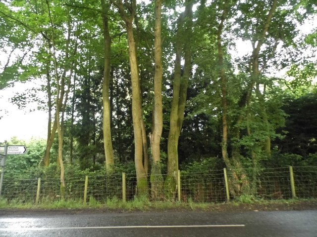
Buckholt Wood, located in the county of Kent, is a charming woodland area renowned for its natural beauty and diverse flora and fauna. Spanning approximately 50 acres, this ancient wood is a haven for nature enthusiasts and those seeking tranquility amidst the bustling city life.

The wood is characterized by its dense canopy of towering trees, predominantly consisting of native species such as oak, beech, and ash. These majestic giants create a cool and shaded environment, perfect for leisurely walks and exploration. The forest floor is carpeted with a plethora of wildflowers, ferns, and mosses, adding to the wood's enchanting and ethereal atmosphere.

The biodiversity within Buckholt Wood is remarkable, attracting a wide range of wildlife. Visitors may be fortunate enough to spot deer, foxes, badgers, and a variety of bird species including woodpeckers, owls, and thrushes. The wood is also home to numerous insects, providing an ideal habitat for butterflies, beetles, and dragonflies.

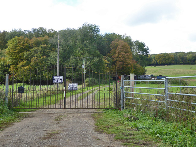
The wood is crisscrossed with well-maintained trails and pathways, allowing visitors to immerse themselves in the natural surroundings. These paths lead to small clearings, where one can rest, have a picnic, or simply take in the serene ambiance.

Buckholt Wood is a cherished local treasure, attracting visitors throughout the year. It offers a peaceful retreat for nature lovers and provides an opportunity to reconnect with the natural world. Whether it's for a leisurely stroll, birdwatching, or simply enjoying the beauty of nature, Buckholt Wood is a must-visit destination for anyone seeking solace in the heart of Kent.

If you have any feedback on the listing, please let us know in the comments section below.

Buckholt Wood Images

Images are sourced within 2km of 51.216336/1.0303123 or Grid Reference TR1150. Thanks to Geograph Open Source API. All images are credited.

Ansdore village Ansdore is a tiny farming community along this short dead end road. Behind this point is the private farm of Upper Ansdore which I did not venture into.
Ansdore village
Ansdore is a tiny farming community along this short dead end road. Behind this point is the private farm of Upper Ansdore which I did not venture into.
The road to Ansdore Off Duckpit Lane, this short track leads to the small collection of farms in Ansdore.
The road to Ansdore
Off Duckpit Lane, this short track leads to the small collection of farms in Ansdore.
Field in Ansdore
Field in Ansdore
The entrance to Springfield Farm, Ansdore
Duckpit Road, Ansdore
Fields by Duckpit Road
Woodland by Waltham Road
Field by Anvil Green Road
Gate and track, Dene Meadows Apart from the impressive gates, the rest of the establishment looks rather impermanent.
Gate and track, Dene Meadows
Apart from the impressive gates, the rest of the establishment looks rather impermanent.
Kake Street Heading north from Waltham, with ahead a former Wesleyan Methodist chapel, now a house.
Kake Street
Heading north from Waltham, with ahead a former Wesleyan Methodist chapel, now a house.
Ploughed Field off Kake Street
Old pit at edge of woodland There were two or three hereabouts. They look like filled in bell-pits, most often found for extracting iron, but flints are more likely on this geology.
Old pit at edge of woodland
There were two or three hereabouts. They look like filled in bell-pits, most often found for extracting iron, but flints are more likely on this geology.
Denge Wood Open access woodland managed by the Woodland Trust.
Denge Wood
Open access woodland managed by the Woodland Trust.
Parking area on Penny Pot lane For access to Denge Wood.
Parking area on Penny Pot lane
For access to Denge Wood.
Parking area on Penny Pot lane For access to Denge Wood.
Parking area on Penny Pot lane
For access to Denge Wood.
Denge Wood Denge Wood is a wood located 8 miles southwest of Canterbury in Kent, England. The wood is owned by the Forestry Commission and the Woodland Trust. Part of the wood is also privately owned. Much of Denge Wood is classified as ancient semi-natural woodland suggesting it has been in existence since at least 1600AD and probably longer. See <span class="nowrap"><a title="http://www.woodlandtrust.org.uk/en/our-woods/Pages/wood-details.aspx?wood=4021" rel="nofollow ugc noopener" href="http://www.woodlandtrust.org.uk/en/our-woods/Pages/wood-details.aspx?wood=4021">Link</a><img style="margin-left:2px;" alt="External link" title="External link - shift click to open in new window" src="https://s1.geograph.org.uk/img/external.png" width="10" height="10"/></span> for Woodland Trust website page. See also <span class="nowrap"><a title="http://www.forestry.gov.uk/pdf/se-casestudies-dengewood.pdf/$FILE/se-casestudies-dengewood.pdf" rel="nofollow ugc noopener" href="http://www.forestry.gov.uk/pdf/se-casestudies-dengewood.pdf/$FILE/se-casestudies-dengewood.pdf">Link</a><img style="margin-left:2px;" alt="External link" title="External link - shift click to open in new window" src="https://s1.geograph.org.uk/img/external.png" width="10" height="10"/></span>
for Forestry Commission website page.
Denge Wood
Denge Wood is a wood located 8 miles southwest of Canterbury in Kent, England. The wood is owned by the Forestry Commission and the Woodland Trust. Part of the wood is also privately owned. Much of Denge Wood is classified as ancient semi-natural woodland suggesting it has been in existence since at least 1600AD and probably longer. See LinkExternal link for Woodland Trust website page. See also LinkExternal link for Forestry Commission website page.
Track through Denge Wood Denge Wood is a wood located 8 miles southwest of Canterbury in Kent, England. The wood is owned by the Forestry Commission and the Woodland Trust. Part of the wood is also privately owned. Much of Denge Wood is classified as ancient semi-natural woodland suggesting it has been in existence since at least 1600AD and probably longer. See <span class="nowrap"><a title="http://www.woodlandtrust.org.uk/en/our-woods/Pages/wood-details.aspx?wood=4021" rel="nofollow ugc noopener" href="http://www.woodlandtrust.org.uk/en/our-woods/Pages/wood-details.aspx?wood=4021">Link</a><img style="margin-left:2px;" alt="External link" title="External link - shift click to open in new window" src="https://s1.geograph.org.uk/img/external.png" width="10" height="10"/></span> for Woodland Trust website page. See also <span class="nowrap"><a title="http://www.forestry.gov.uk/pdf/se-casestudies-dengewood.pdf/$FILE/se-casestudies-dengewood.pdf" rel="nofollow ugc noopener" href="http://www.forestry.gov.uk/pdf/se-casestudies-dengewood.pdf/$FILE/se-casestudies-dengewood.pdf">Link</a><img style="margin-left:2px;" alt="External link" title="External link - shift click to open in new window" src="https://s1.geograph.org.uk/img/external.png" width="10" height="10"/></span>
for Forestry Commission website page.
Track through Denge Wood
Denge Wood is a wood located 8 miles southwest of Canterbury in Kent, England. The wood is owned by the Forestry Commission and the Woodland Trust. Part of the wood is also privately owned. Much of Denge Wood is classified as ancient semi-natural woodland suggesting it has been in existence since at least 1600AD and probably longer. See LinkExternal link for Woodland Trust website page. See also LinkExternal link for Forestry Commission website page.
Show me another place!

Buckholt Wood is located at Grid Ref: TR1150 (Lat: 51.216336, Lng: 1.0303123)

Administrative County: Kent

District: Canterbury

Police Authority: Kent

What 3 Words

///ideas.divorcing.eagle. Near Chartham, Kent

Related Wikis

Petham

Petham is a rural village and civil parish in the North Downs, five miles south of Canterbury in Kent, South East England. The village church is All Saints...

Anvil Green

Anvil Green is a small settlement located near Waltham in Kent, England, about nine miles (14.4 km) north east of Ashford. == External links == Media...

Denge Wood

Denge Wood is a wood located 8 miles southwest of Canterbury in Kent, England. The wood is owned by the Forestry Commission and the Woodland Trust. Part...

Waltham, Kent

Waltham is a village and civil parish 7 miles (11 km) southwest of Canterbury in Kent, England. == History == The village was once associated with the...

St Augustine's Hospital, Chartham

St Augustine's Hospital was a psychiatric hospital in Chartham, Kent, England. It was founded as the second, or East, Kent County Asylum in 1872. In 1948...

Yockletts Bank

Yockletts Bank is a 25.4-hectare (63-acre) biological Site of Special Scientific Interest west of Stelling Minnis in Kent. It is managed by KWT and is...

Upper Hardres

Upper Hardres is a village and civil parish in the City of Canterbury, in the district of Kent, England. The name of the Hardres family is perpetuated...

Down Bank

Down Bank is a 5.9-hectare (15-acre) biological Site of Special Scientific Interest south-west of Canterbury in Kent.This sloping chalk meadow has the...

Nearby Amenities

Located within 500m of 51.216336,1.0303123
Power: pole
Lat/Long: 51.2177528/1.0367784
Power: pole
Lat/Long: 51.2170178/1.0369644
The data included in this document is from www.openstreetmap.org. The data is made available under ODbL.

Have you been to Buckholt Wood?

Leave your review of Buckholt Wood below (or comments, questions and feedback).