Dunstan's Wood
Wood, Forest in Kent Canterbury
England
Dunstan's Wood

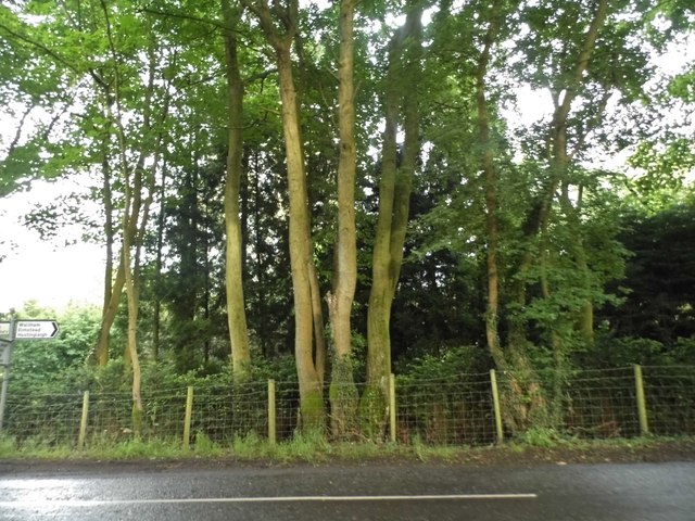
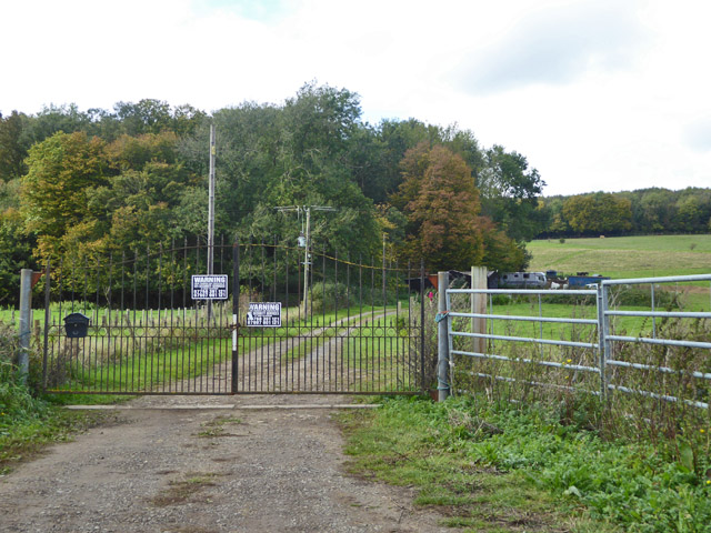
Dunstan's Wood, located in Kent, England, is a picturesque forest that covers an area of approximately 100 acres. It is nestled within the charming village of Dunstan, providing a tranquil and serene environment for visitors to enjoy. The wood is predominantly made up of native broadleaf trees, including oak, ash, and beech, which create a rich and diverse ecosystem.
One of the notable features of Dunstan's Wood is its beautiful walking trails, which wind their way through the trees, offering visitors the opportunity to explore the natural beauty of the area. These paths are well-maintained and suitable for all ages and fitness levels, making it an ideal destination for families, nature enthusiasts, and avid hikers.
The wood is home to a variety of wildlife, including deer, foxes, rabbits, and a wide range of bird species. Birdwatchers will be delighted by the chance to spot woodpeckers, owls, and various songbirds in their natural habitat.
Dunstan's Wood also offers a picnic area, providing a perfect spot for visitors to relax and enjoy a packed lunch amidst the tranquil surroundings. Additionally, there are information boards scattered throughout the wood, providing educational insights into the local flora and fauna.
Overall, Dunstan's Wood is a haven of natural beauty, offering visitors the opportunity to escape the hustle and bustle of everyday life and immerse themselves in the peacefulness of nature. Whether it's for a leisurely stroll, a family outing, or a birdwatching adventure, Dunstan's Wood is a must-visit destination for nature lovers in Kent.
If you have any feedback on the listing, please let us know in the comments section below.
Dunstan's Wood Images
Images are sourced within 2km of 51.213737/1.023024 or Grid Reference TR1150. Thanks to Geograph Open Source API. All images are credited.


Dunstan's Wood is located at Grid Ref: TR1150 (Lat: 51.213737, Lng: 1.023024)
Administrative County: Kent
District: Canterbury
Police Authority: Kent
What 3 Words
///pancake.lipstick.desktops. Near Chartham, Kent
Nearby Locations
Related Wikis

Anvil Green
Anvil Green is a small settlement located near Waltham in Kent, England, about nine miles (14.4 km) north east of Ashford. == External links == Media...

Denge Wood
Denge Wood is a wood located 8 miles southwest of Canterbury in Kent, England. The wood is owned by the Forestry Commission and the Woodland Trust. Part...

Waltham, Kent
Waltham is a village and civil parish 7 miles (11 km) southwest of Canterbury in Kent, England. == History == The village was once associated with the...

Petham
Petham is a rural village and civil parish in the North Downs, five miles south of Canterbury in Kent, South East England. The village church is All Saints...

Yockletts Bank
Yockletts Bank is a 25.4-hectare (63-acre) biological Site of Special Scientific Interest west of Stelling Minnis in Kent. It is managed by KWT and is...

Stour Valley Walk
The Stour Valley Walk is a recreational walking route that follows the River Stour, through the Low Weald and Kent Downs, from its source at Lenham to...

Down Bank
Down Bank is a 5.9-hectare (15-acre) biological Site of Special Scientific Interest south-west of Canterbury in Kent.This sloping chalk meadow has the...

St Augustine's Hospital, Chartham
St Augustine's Hospital was a psychiatric hospital in Chartham, Kent, England. It was founded as the second, or East, Kent County Asylum in 1872. In 1948...
Nearby Amenities
Located within 500m of 51.213737,1.023024Have you been to Dunstan's Wood?
Leave your review of Dunstan's Wood below (or comments, questions and feedback).