Spring Head Plantation
Wood, Forest in Norfolk North Norfolk
England
Spring Head Plantation

Spring Head Plantation is a captivating woodland area located in Norfolk, England. Nestled amidst the idyllic countryside, this plantation is renowned for its enchanting beauty and rich biodiversity. Spanning over a vast area, it encompasses a diverse range of flora and fauna, making it a haven for nature enthusiasts and explorers.
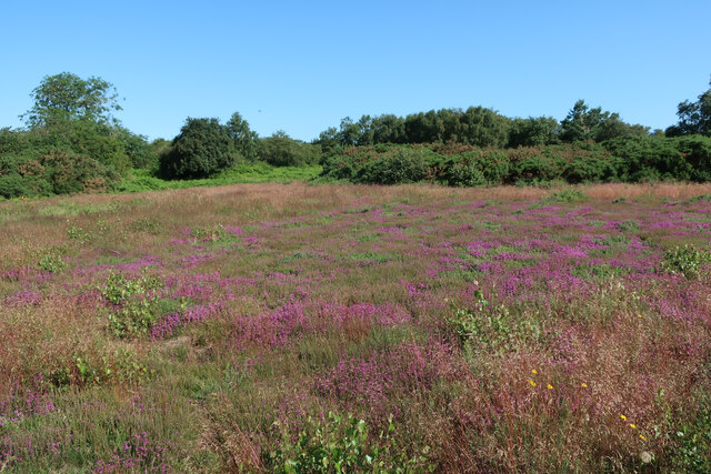
The plantation is characterized by its magnificent ancient woodlands, which are home to a plethora of old oak trees, beech trees, and various other species. These towering trees create a dense canopy, allowing only specks of sunlight to filter through, providing a mystical ambiance to the surroundings. The forest floor is adorned with a vibrant carpet of bluebells, primroses, and wild garlic during the spring season, transforming the landscape into a captivating tapestry of colors.
Spring Head Plantation is teeming with wildlife, making it a popular destination for birdwatchers and wildlife photographers. The woodland is a habitat for a variety of bird species, including woodpeckers, owls, and various songbirds. Additionally, the plantation is home to an array of mammals, such as deer, foxes, and badgers, which can be spotted roaming freely within the woodland.
The plantation offers a network of well-maintained trails, allowing visitors to explore the woodland at their own pace. These trails lead to hidden gems, such as a picturesque pond and a small stream, adding to the tranquility of the plantation.
Spring Head Plantation is a true gem in Norfolk, offering a serene and captivating experience for nature lovers, hikers, and wildlife enthusiasts alike. Its ancient woodlands, diverse flora and fauna, and stunning scenery make it a must-visit destination for those seeking solace in nature's embrace.
If you have any feedback on the listing, please let us know in the comments section below.
Spring Head Plantation Images
Images are sourced within 2km of 52.932645/1.1473079 or Grid Reference TG1141. Thanks to Geograph Open Source API. All images are credited.


Spring Head Plantation is located at Grid Ref: TG1141 (Lat: 52.932645, Lng: 1.1473079)
Administrative County: Norfolk
District: North Norfolk
Police Authority: Norfolk
What 3 Words
///calms.chuck.precautions. Near Sheringham, Norfolk
Nearby Locations
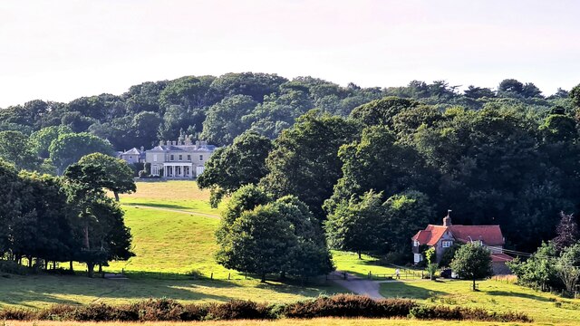
Related Wikis
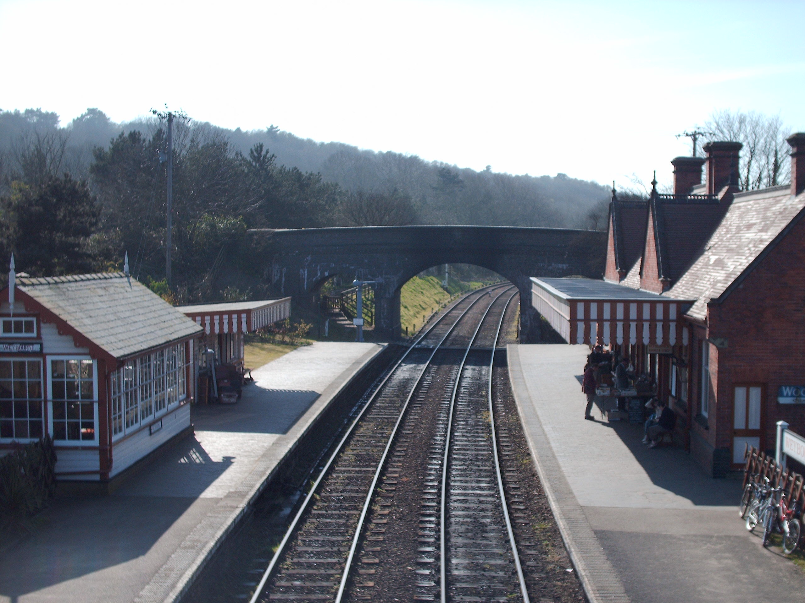
Weybourne railway station
Weybourne railway station is a station in Weybourne, Norfolk, on the preserved North Norfolk Railway. It was formerly part of the Midland and Great Northern...
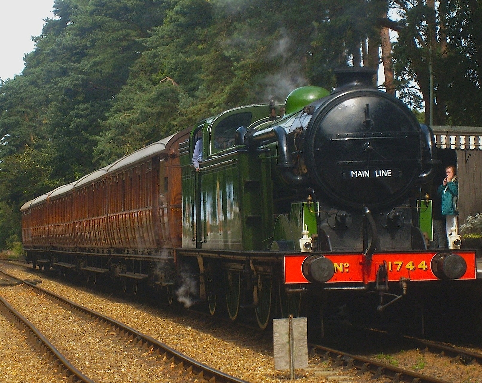
North Norfolk Railway
The North Norfolk Railway (NNR) – also known as the "Poppy Line" – is a 5+1⁄4-mile (8.4 km) heritage steam railway in Norfolk, England, running between...

Kelling Heath Park railway station
Kelling Heath Park is a small halt on the North Norfolk Railway (NNR), used mostly by hikers using Kelling Heath. It was opened after the line was preserved...

Kelling Heath Holiday Park
Kelling Heath Holiday Park is a holiday park in Norfolk, England, owned and operated by Blue Sky Leisure. Kelling Heath Holiday Park is located on the...
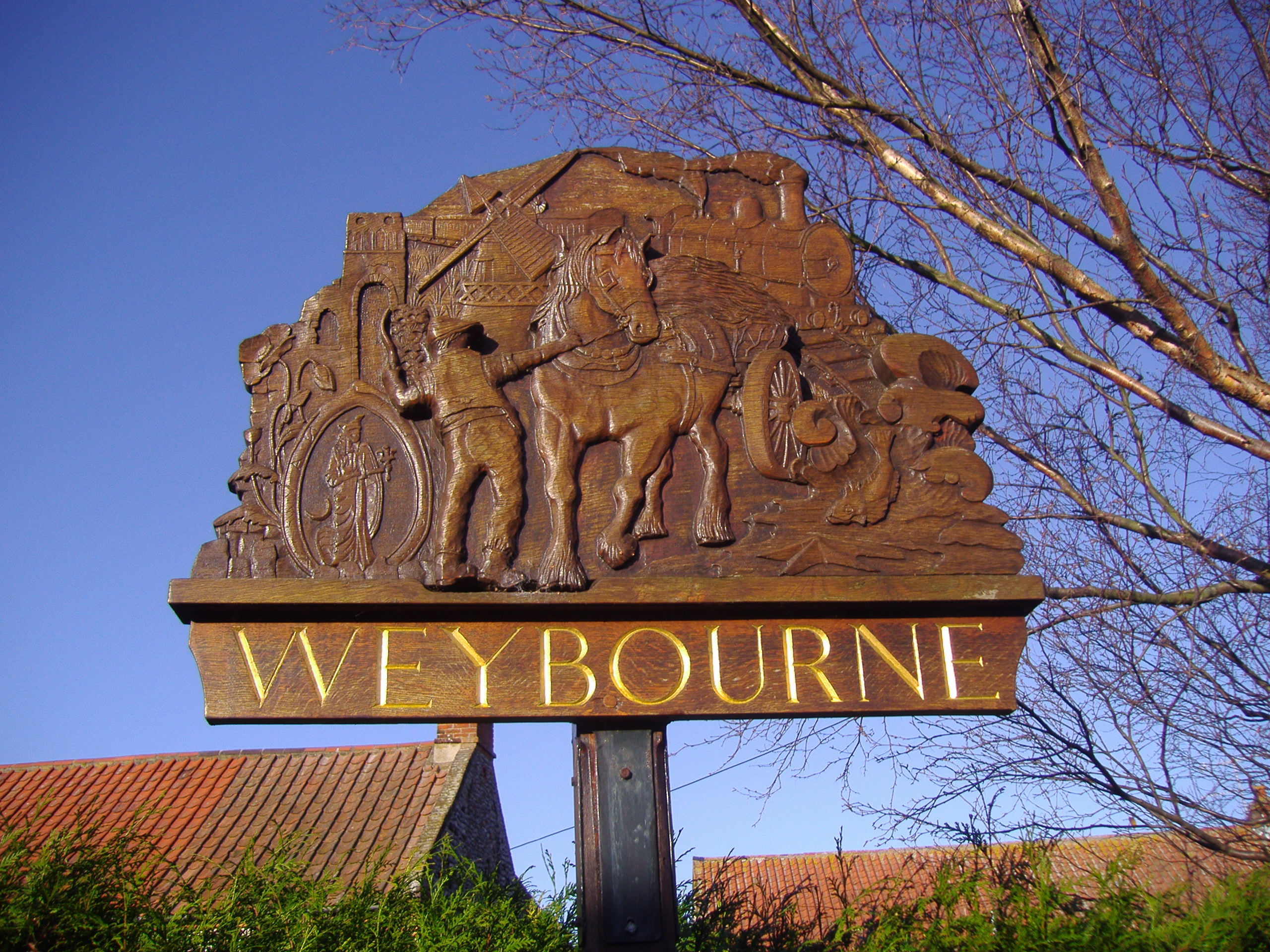
Weybourne, Norfolk
Weybourne is a village on the coast of North Norfolk, England. The village is surrounded by arable fields, woodland and heathland; it straddles the A149...
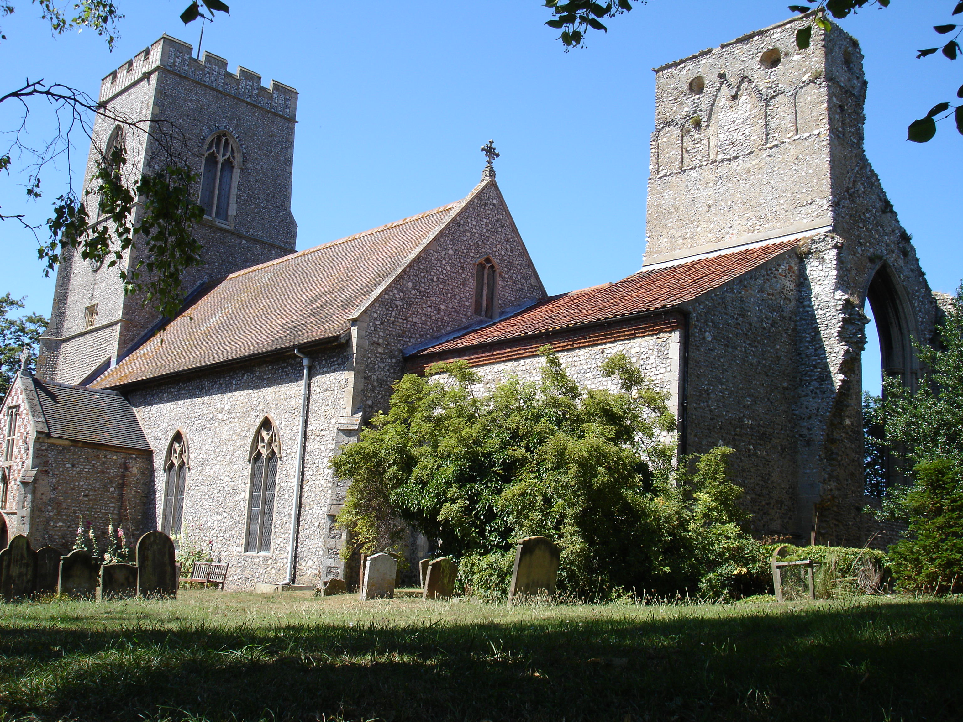
Weybourne Priory
Weybourne Priory was a small Augustinian medieval monastic house in Weybourne, Norfolk, England. It was founded around 1200 AD by Sir Ralph de Meyngaren...

Weybourne Windmill
Weybourne Windmill is located on the eastern high ground above the village of Weybourne in the English county of Norfolk. It is on the northern side of...
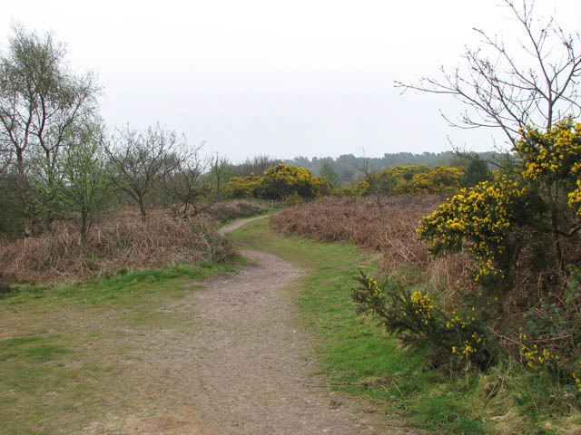
Kelling Heath
Kelling Heath is an 89.4-hectare (221-acre) biological Site of Special Scientific Interest between Holt and Weybourne in Norfolk. It is in the Norfolk...
Nearby Amenities
Located within 500m of 52.932645,1.1473079Have you been to Spring Head Plantation?
Leave your review of Spring Head Plantation below (or comments, questions and feedback).