Sutton Hook Wood
Wood, Forest in Kent Canterbury
England
Sutton Hook Wood

Sutton Hook Wood is a picturesque woodland located in the county of Kent, England. Covering an area of approximately 40 hectares, it forms part of the larger Sutton At Hone and Hawley Commons. The wood is situated near the village of Sutton At Hone, just south of the River Darent.
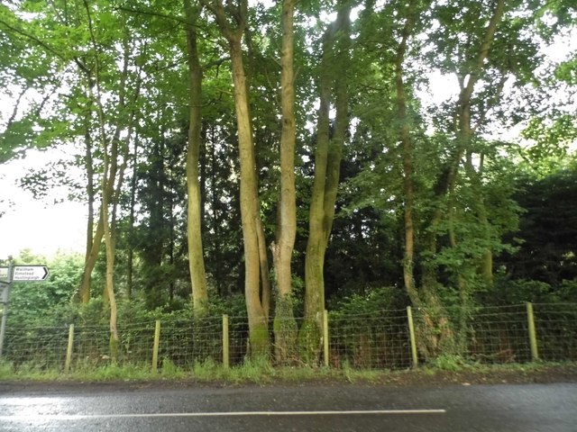
This ancient woodland is a haven for nature lovers and outdoor enthusiasts. It comprises a diverse range of tree species, including oak, sweet chestnut, and ash, which create a dense canopy overhead. The forest floor is adorned with a carpet of bluebells in the spring, while ferns and mosses thrive in the shaded areas.
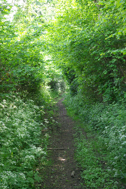
The wood is crisscrossed with footpaths and trails, inviting visitors to explore its serene surroundings. These well-maintained paths offer the opportunity to immerse oneself in the peaceful ambiance of the woodland, with the sound of birdsong and the rustling of leaves providing a soothing soundtrack. As one navigates through the forest, they may come across charming clearings, perfect for a picnic or a moment of tranquility.
Sutton Hook Wood is not only a place of natural beauty but also of historical significance. The wood is thought to have been part of the ancient forest of Anderida, which covered much of the Weald during Roman times. Remnants of an Iron Age settlement have also been discovered within its bounds, adding an extra layer of intrigue to this enchanting woodland.
Overall, Sutton Hook Wood offers a peaceful retreat from the hustle and bustle of everyday life, where visitors can connect with nature and enjoy the beauty of Kent's woodlands.
If you have any feedback on the listing, please let us know in the comments section below.
Sutton Hook Wood Images
Images are sourced within 2km of 51.203375/1.0237054 or Grid Reference TR1149. Thanks to Geograph Open Source API. All images are credited.


Sutton Hook Wood is located at Grid Ref: TR1149 (Lat: 51.203375, Lng: 1.0237054)
Administrative County: Kent
District: Canterbury
Police Authority: Kent
What 3 Words
///professed.purist.highs. Near Chartham, Kent
Nearby Locations
Related Wikis

Anvil Green
Anvil Green is a small settlement located near Waltham in Kent, England, about nine miles (14.4 km) north east of Ashford. == External links == Media...

Waltham, Kent
Waltham is a village and civil parish 7 miles (11 km) southwest of Canterbury in Kent, England. == History == The village was once associated with the...

Yockletts Bank
Yockletts Bank is a 25.4-hectare (63-acre) biological Site of Special Scientific Interest west of Stelling Minnis in Kent. It is managed by KWT and is...

Denge Wood
Denge Wood is a wood located 8 miles southwest of Canterbury in Kent, England. The wood is owned by the Forestry Commission and the Woodland Trust. Part...

Petham
Petham is a rural village and civil parish in the North Downs, five miles south of Canterbury in Kent, South East England. The village church is All Saints...

Stour Valley Walk
The Stour Valley Walk is a recreational walking route that follows the River Stour, through the Low Weald and Kent Downs, from its source at Lenham to...

Shrub's Wood Long Barrow
Shrub's Wood Long Barrow is an unchambered long barrow located near to the village of Elmsted in the south-eastern English county of Kent. It was probably...

Park Gate Down
Park Gate Down or Parkgate Down is a 7-hectare (17-acre) biological Site of Special Scientific Interest south-east of Stelling Minnis in Kent. It is also...
Nearby Amenities
Located within 500m of 51.203375,1.0237054Have you been to Sutton Hook Wood?
Leave your review of Sutton Hook Wood below (or comments, questions and feedback).