Nursery Plantation

Wood, Forest in Suffolk Mid Suffolk

England

Nursery Plantation

Roe deer on arable farmland between Gislingham and Mellis Roe deer are very common in North Suffolk and can often be seen in open fields. Sometimes in winter large numbers can be seen together although usually they are in much smaller groups than this. When the crops are high only their heads are visible and they can easily go unnoticed. It is difficult to get close enough to the deer to get a good photograph. I prefer to watch them from a distance -if you try to get too near they can panic and dash across roads, putting themselves and motorists at risk.
Roe deer on arable farmland between Gislingham and Mellis Credit: Richard Rice

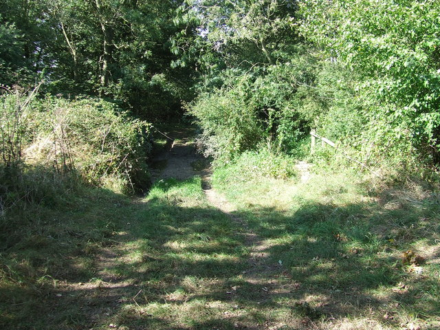
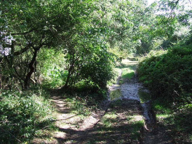
Nursery Plantation, located in Suffolk, is a picturesque woodland area known for its thriving nursery and diverse plant life. Spanning over a vast area, the plantation boasts an impressive collection of trees and plants, making it a popular destination for nature enthusiasts and gardeners alike.

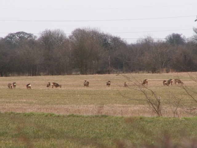
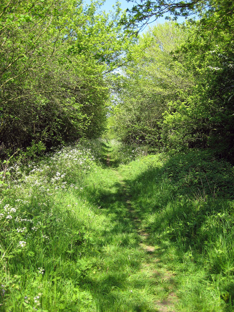
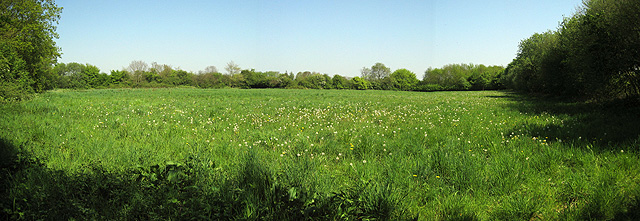
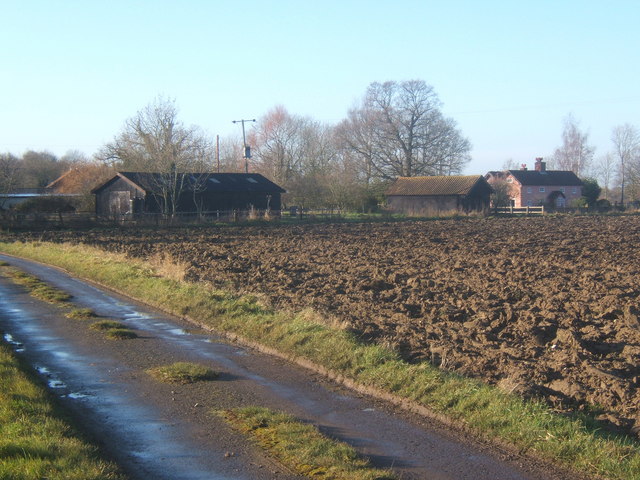
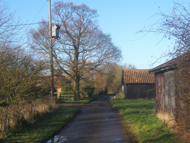
The woodland area is predominantly covered by a variety of trees, including oak, beech, ash, and birch, which create a dense and lush forest environment. These trees provide a habitat for numerous wildlife species, such as birds, squirrels, and rabbits, contributing to the plantation's rich biodiversity.

Nursery Plantation is renowned for its nursery, where a wide range of plants, shrubs, and flowers are cultivated. The nursery offers an extensive selection of both native and exotic species, catering to the diverse needs and preferences of customers. Skilled horticulturists and knowledgeable staff are present to assist visitors in choosing the appropriate plants for their gardens or landscaping projects.

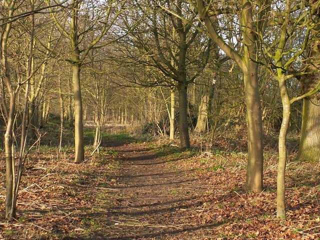
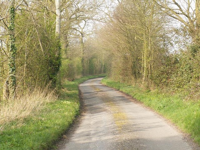
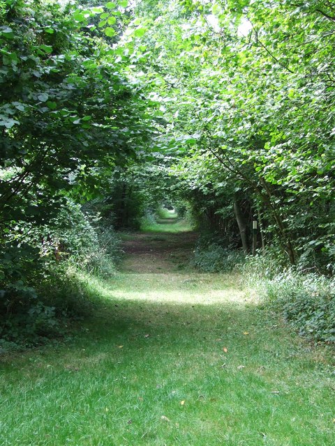
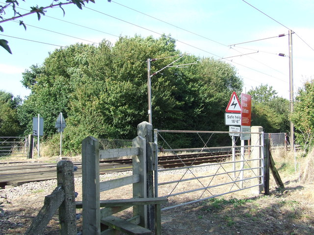
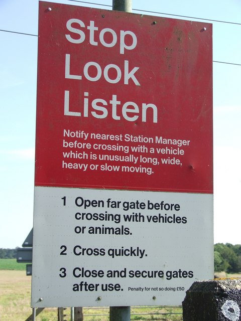
The plantation also provides various amenities and services to enhance the visitor experience. Well-maintained walking trails are available throughout the woodland area, allowing visitors to explore the plantation's natural beauty at their own pace. Picnic areas and benches are strategically placed, inviting visitors to relax and appreciate the tranquility of the surroundings. Additionally, guided tours and workshops are organized periodically to educate visitors about plant care, cultivation techniques, and sustainable gardening practices.

Nursery Plantation, Suffolk, truly offers a haven for nature lovers and gardening enthusiasts, providing a unique opportunity to connect with nature and discover a diverse array of plant life.

If you have any feedback on the listing, please let us know in the comments section below.

Nursery Plantation Images

Images are sourced within 2km of 52.306862/1.0829703 or Grid Reference TM1072. Thanks to Geograph Open Source API. All images are credited.

Roe deer on arable farmland between Gislingham and Mellis Roe deer are very common in North Suffolk and can often be seen in open fields. Sometimes in winter large numbers can be seen together although usually they are in much smaller groups than this. When the crops are high only their heads are visible and they can easily go unnoticed. It is difficult to get close enough to the deer to get a good photograph. I prefer to watch them from a distance -if you try to get too near they can panic and dash across roads, putting themselves and motorists at risk.
Roe deer on arable farmland between Gislingham and Mellis
Roe deer are very common in North Suffolk and can often be seen in open fields. Sometimes in winter large numbers can be seen together although usually they are in much smaller groups than this. When the crops are high only their heads are visible and they can easily go unnoticed. It is difficult to get close enough to the deer to get a good photograph. I prefer to watch them from a distance -if you try to get too near they can panic and dash across roads, putting themselves and motorists at risk.
Railway Bridge This brick railway bridge carries the Norwich to London main line and it blends well into the surrounding wooded countryside between Gislinham and Thornham Magna.
Railway Bridge
This brick railway bridge carries the Norwich to London main line and it blends well into the surrounding wooded countryside between Gislinham and Thornham Magna.
Path on the Thornham Estate Thornham Estate is a beautiful place to walk and is open to the public each day. There are 12 miles of footpaths through ancient parkland, woodland, farmland and water meadows.
Path on the Thornham Estate
Thornham Estate is a beautiful place to walk and is open to the public each day. There are 12 miles of footpaths through ancient parkland, woodland, farmland and water meadows.
Star House Lane
Star House Lane
To Dormans Wood Footpath to Dormans Wood from Clay Street near to Wickham Street Suffolk.
To Dormans Wood
Footpath to Dormans Wood from Clay Street near to Wickham Street Suffolk.
Through the trees A view along the many miles of walks at Thornham walks Thornham Parva Suffolk.
Through the trees
A view along the many miles of walks at Thornham walks Thornham Parva Suffolk.
Unbridged track A ford across the footpath with footpath bridge on the right. The track as marked on the O.S. 1:25:000 is called Cowpasture Lane near to Mellis Suffolk.
Unbridged track
A ford across the footpath with footpath bridge on the right. The track as marked on the O.S. 1:25:000 is called Cowpasture Lane near to Mellis Suffolk.
Un bridged track A ford across the footpath with footpath bridge on the left. The track as marked on the O.S. 1:25:000 is called Cowpasture Lane near to Mellis Suffolk.
Un bridged track
A ford across the footpath with footpath bridge on the left. The track as marked on the O.S. 1:25:000 is called Cowpasture Lane near to Mellis Suffolk.
Footpath crossing Footpath railway crossing point near to Mellis Suffolk.
Footpath crossing
Footpath railway crossing point near to Mellis Suffolk.
Ant eye view Looking southwest along the London to Norwich line from a footpath crossing point near Mellis Suffolk.
Ant eye view
Looking southwest along the London to Norwich line from a footpath crossing point near Mellis Suffolk.
An ant's northeast eye view Looking northeast along the London to Norwich line from a footpath crossing point near Mellis Suffolk.
An ant's northeast eye view
Looking northeast along the London to Norwich line from a footpath crossing point near Mellis Suffolk.
Stop look listen Sign at footpath railway crossing point near to Mellis Suffolk.
Stop look listen
Sign at footpath railway crossing point near to Mellis Suffolk.
Safe height Sign at the footpath railway crossing point near to Mellis Suffolk.
Safe height
Sign at the footpath railway crossing point near to Mellis Suffolk.
Cowpasture Lane on a sunny Spring day This lane was protected against vehicular traffic in 2007 <a href="https://www.geograph.org.uk/photo/793432">TM0973 : Protecting Cowpasture Lane</a>. One of those campaigning to protect it was the late Roger Deakin, who lived nearby.
Cowpasture Lane on a sunny Spring day
This lane was protected against vehicular traffic in 2007 TM0973 : Protecting Cowpasture Lane. One of those campaigning to protect it was the late Roger Deakin, who lived nearby.
Vanishing point This is where Cowpasture Lane (<a href="https://www.geograph.org.uk/photo/793398">TM0973 : Cowpasture Lane on a sunny Spring day</a>) crosses the main line to Norwich.  This location must be particularly tempting for Geographers: see <a href="https://www.geograph.org.uk/photo/557986">TM0973 : Ant eye view</a> and others in this square.  Somehow just looking at it, the dead straight track on this fast section of line speaks speed!
Vanishing point
This is where Cowpasture Lane (TM0973 : Cowpasture Lane on a sunny Spring day) crosses the main line to Norwich. This location must be particularly tempting for Geographers: see TM0973 : Ant eye view and others in this square. Somehow just looking at it, the dead straight track on this fast section of line speaks speed!
Meadow thriving under a light touch This meadow in early May was full of dandelion clocks and a rich variety of other meadow plants.  Over nearly 40 years it has benefited from a benevolent landowner with a light, almost neglectful, touch.
Meadow thriving under a light touch
This meadow in early May was full of dandelion clocks and a rich variety of other meadow plants. Over nearly 40 years it has benefited from a benevolent landowner with a light, almost neglectful, touch.
Near Chapel Farm Approaching the west end of Chapel Farm Lane.
Near Chapel Farm
Approaching the west end of Chapel Farm Lane.
Byway past Chapel Farm
Show me another place!

Nursery Plantation is located at Grid Ref: TM1072 (Lat: 52.306862, Lng: 1.0829703)

Administrative County: Suffolk

District: Mid Suffolk

Police Authority: Suffolk

What 3 Words

///dart.secretly.bookshelf. Near Bacton, Suffolk

Related Wikis

Thornham Magna

Thornham Magna is the larger sister village of Thornham Parva on the former estate of Thornham Hall, the Henniker family seat, in Suffolk. It is about...

St Mary's Church, Thornham Parva

St Mary's Church is a medieval church in Thornham Parva, Suffolk, England. Much of the fabric dates from the 12th century, and it is a Grade I listed building...

Thornham Parva

Thornham Parva is a village and civil parish in the Mid Suffolk district of Suffolk in eastern England. Located to the north of sister village Thornham...

Hartismere Hundred

Hartismere was a hundred of Suffolk, that later gave its name to a poor law union, a rural sanitary district, and the Hartismere Rural District. Listed...

Pye Road

Pye Road is a Roman road running from the capital of the Iceni at Venta Icenorum (Caistor St Edmund near Norwich) to the original Roman provincial capital...

Major Farm Meadow

Major Farm Meadow is a 1.8-hectare (4.4-acre) biological Site of Special Scientific Interest south-west of Eye in Suffolk.This is one of the few surviving...

Gislingham

Gislingham is a village and civil parish in the Mid Suffolk district of Suffolk in eastern England. == History == Gislingham is situated around the area...

Stoke Ash

Stoke Ash is a village and civil parish in the Mid Suffolk district of Suffolk in eastern England. Located around six miles south of Diss, in 2011 its...

Nearby Amenities

Located within 500m of 52.306862,1.0829703
Bench
Backrest: yes
Material: wood
Source: survey
Lat/Long: 52.3040276/1.0775399
Bench
Backrest: yes
Material: wood
Source: survey
Lat/Long: 52.3039965/1.077497
Bench
Backrest: no
Material: wood
Source: survey
Lat/Long: 52.3043118/1.0775077
Waste Basket
Source: survey
Waste: dog_excrement
Lat/Long: 52.3046492/1.0783312
Bench
Backrest: yes
Material: wood
Source: survey
Lat/Long: 52.3047124/1.0787952
Toilets
Lat/Long: 52.3061425/1.0825972
Bench
Lat/Long: 52.3047054/1.0794591
The data included in this document is from www.openstreetmap.org. The data is made available under ODbL.

Have you been to Nursery Plantation?

Leave your review of Nursery Plantation below (or comments, questions and feedback).