Stile Farm Alders

Wood, Forest in Kent Ashford

England

Stile Farm Alders

Stour Valley Walk South of Shalmsford Street The long distance footpath veers left at the post - indicating a crossing of routes in the middle of the field
Stour Valley Walk South of Shalmsford Street Credit: Chris Heaton

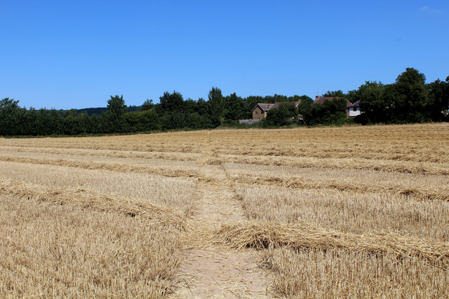
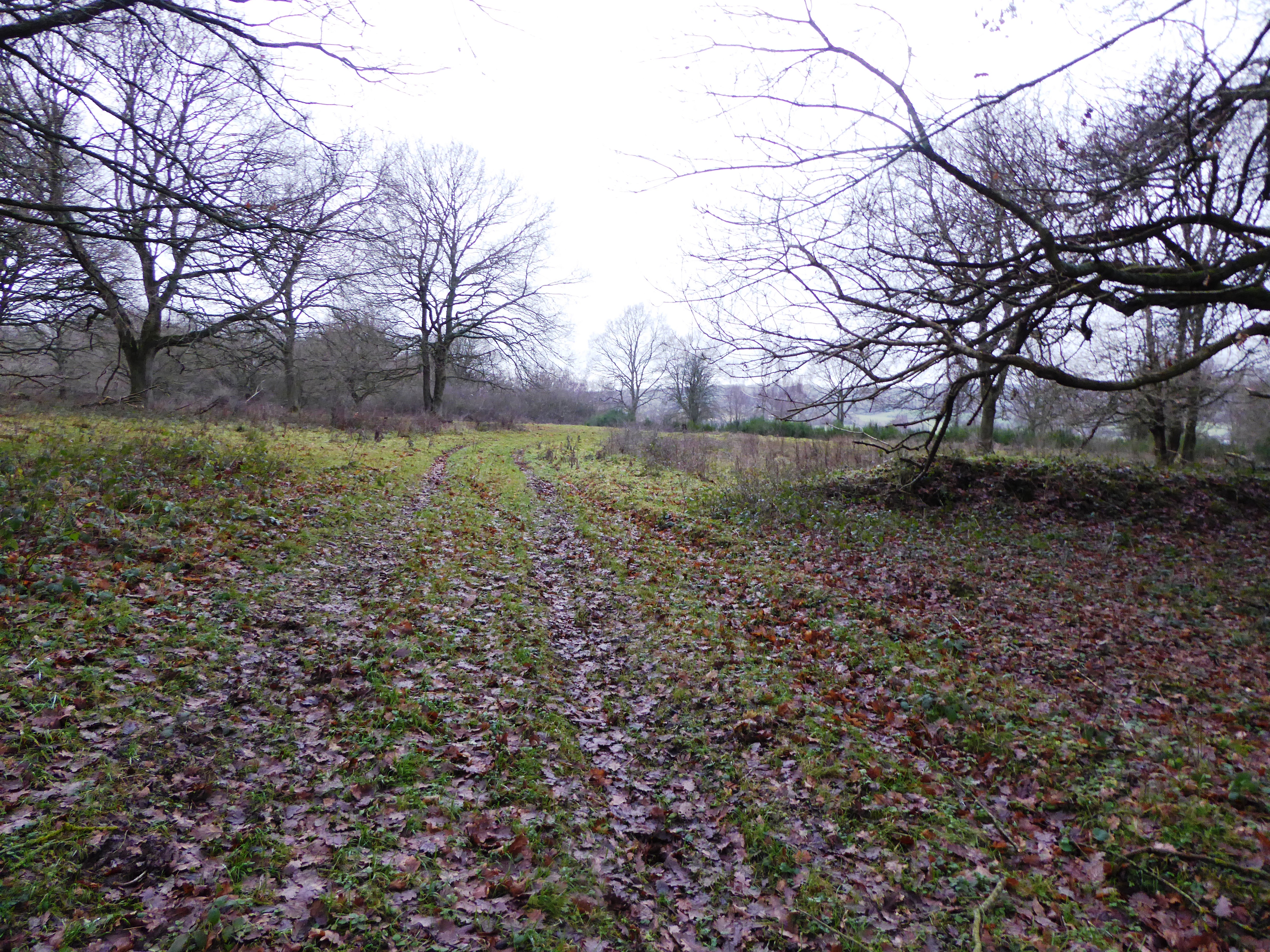
Stile Farm Alders is a picturesque woodland located in Kent, England. Situated in the heart of the county, this forested area spans over a vast expanse of approximately 500 acres. It is known for its dense alder tree population, which gives the woodland its unique character and name.

The forest is a haven for nature enthusiasts and provides a diverse habitat for a wide variety of flora and fauna. The alder trees dominate the landscape, creating a lush and vibrant environment. Their distinctive slender trunks and feathery leaves form a dense canopy, casting dappled sunlight on the forest floor below.

Stile Farm Alders is home to an array of wildlife, including numerous bird species, small mammals, and insects. Birdwatchers can delight in the chance to spot woodpeckers, owls, and various songbirds. The forest floor is teeming with life, with squirrels, rabbits, and hedgehogs scurrying amongst the undergrowth.

The woodland offers a tranquil setting for visitors to explore and enjoy nature. Several walking trails wind their way through the forest, allowing hikers to immerse themselves in the natural beauty of the area. Along these paths, visitors can encounter enchanting wildflowers, sprawling ferns, and the occasional babbling brook.

Stile Farm Alders is a popular destination for nature walks, photography, and educational field trips. Its unique ecosystem and stunning natural scenery make it an ideal location for individuals seeking solace in the great outdoors. Whether one is a seasoned nature lover or simply looking for a peaceful escape, Stile Farm Alders provides a captivating experience for all who venture within its wooded embrace.

If you have any feedback on the listing, please let us know in the comments section below.

Stile Farm Alders Images

Images are sourced within 2km of 51.24502/0.98659838 or Grid Reference TR0853. Thanks to Geograph Open Source API. All images are credited.

Stour Valley Walk South of Shalmsford Street The long distance footpath veers left at the post - indicating a crossing of routes in the middle of the field
Stour Valley Walk South of Shalmsford Street
The long distance footpath veers left at the post - indicating a crossing of routes in the middle of the field
Footpath heading towards Shalmsford Street
Pickeldon Lane Lane deep in the Great Stour Valley
Pickeldon Lane
Lane deep in the Great Stour Valley
Stile Farm A grassy track heads towards the farmhouse deep in the Great Stour Valley
Stile Farm
A grassy track heads towards the farmhouse deep in the Great Stour Valley
Pasture near Stile Farm
Track heading for Bagham Runs parallel to a strip of woodland - separating the path from the Great Stour
Track heading for Bagham
Runs parallel to a strip of woodland - separating the path from the Great Stour
Chilham Mill Nineteenth century corn mill on an island in the middle of the Great Stour - now a Grade II Listed Building.
Chilham Mill
Nineteenth century corn mill on an island in the middle of the Great Stour - now a Grade II Listed Building.
Bridge over the Great Stour Carries a track over the river towards the A28 at Bagham.
Bridge over the Great Stour
Carries a track over the river towards the A28 at Bagham.
Great Stour at Bagham
Church Hill, Chilham The ancient White Horse Inn stands to the right of this shot, and to the north end of The Square - from which all roads run downhill.
I stopped for lunch here, providing excellent fare and fine ales.
Church Hill, Chilham
The ancient White Horse Inn stands to the right of this shot, and to the north end of The Square - from which all roads run downhill. I stopped for lunch here, providing excellent fare and fine ales.
Taylors Hill, Chilham Having walked from Canterbury - this was quite a climb to reach the White Horse Inn at the top, in "The Square"
Taylors Hill, Chilham
Having walked from Canterbury - this was quite a climb to reach the White Horse Inn at the top, in "The Square"
Bagham  A28   A252  junction The A28 Ashford Canterbury road is joined here by the A252 from Maidstone and the A28 has to give way! Temporary lights at the moment due to building work alongside the road
Bagham A28 A252 junction
The A28 Ashford Canterbury road is joined here by the A252 from Maidstone and the A28 has to give way! Temporary lights at the moment due to building work alongside the road
Pumping  station  alongside  the  A28  at  Bagham
Pumping station alongside the A28 at Bagham
Chilham: Shelly's Tea Room
Chilham: "Pilgrim Milestone" by Steven Andrews
Chilham: Attractive half timbered buildings
Chilham: The White Horse PH
Show me another place!

Stile Farm Alders is located at Grid Ref: TR0853 (Lat: 51.24502, Lng: 0.98659838)

Administrative County: Kent

District: Ashford

Police Authority: Kent

What 3 Words

///affords.repeat.aspect. Near Chartham, Kent

Related Wikis

Broadham Down

Broadham Down is a 16-hectare (40-acre) nature reserve east of Chilham and west of Canterbury in Kent. It is managed by the Kent Wildlife Trust.This nature...

Chilham railway station

Chilham railway station is a railway station in Chilham, Kent. It is on the Ashford to Ramsgate line between Ashford International and Canterbury West...

Julliberrie's Grave

Julliberrie's Grave, also known as The Giant's Grave or The Grave, is an unchambered long barrow located near to the village of Chilham in the south-eastern...

Down Bank

Down Bank is a 5.9-hectare (15-acre) biological Site of Special Scientific Interest south-west of Canterbury in Kent.This sloping chalk meadow has the...

Nearby Amenities

Located within 500m of 51.24502,0.98659838
Chilham Road Level Crossing
Crossing Barrier: full
Railway: level_crossing
Lat/Long: 51.2471009/0.9838807
Kerb: no
Lat/Long: 51.2472757/0.980948
Barrier: stile
Lat/Long: 51.2475531/0.9840763
Barrier: motorcycle_barrier
Lat/Long: 51.2469704/0.9840188
Chilham Road Level Crossing
Crossing Barrier: full
Railway: level_crossing
Lat/Long: 51.2471234/0.9838521
Generator Method: photovoltaic
Generator Orientation: 242
Generator Output Electricity: yes
Generator Source: solar
Generator Type: solar_photovoltaic_panel
Location: roof
Power: generator
Lat/Long: 51.2485896/0.9827024
The data included in this document is from www.openstreetmap.org. The data is made available under ODbL.

Have you been to Stile Farm Alders?

Leave your review of Stile Farm Alders below (or comments, questions and feedback).