Bullock Wood

Wood, Forest in Essex Colchester

England

Bullock Wood

Telephone Box, Highwoods
Telephone Box, Highwoods Credit: PAUL FARMER

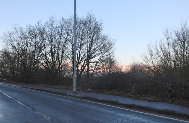
Bullock Wood is a picturesque forest located in the county of Essex, England. Covering an area of approximately 100 acres, this woodland is renowned for its natural beauty and diverse range of flora and fauna. It is situated on the outskirts of the charming village of Bullock, hence the name.

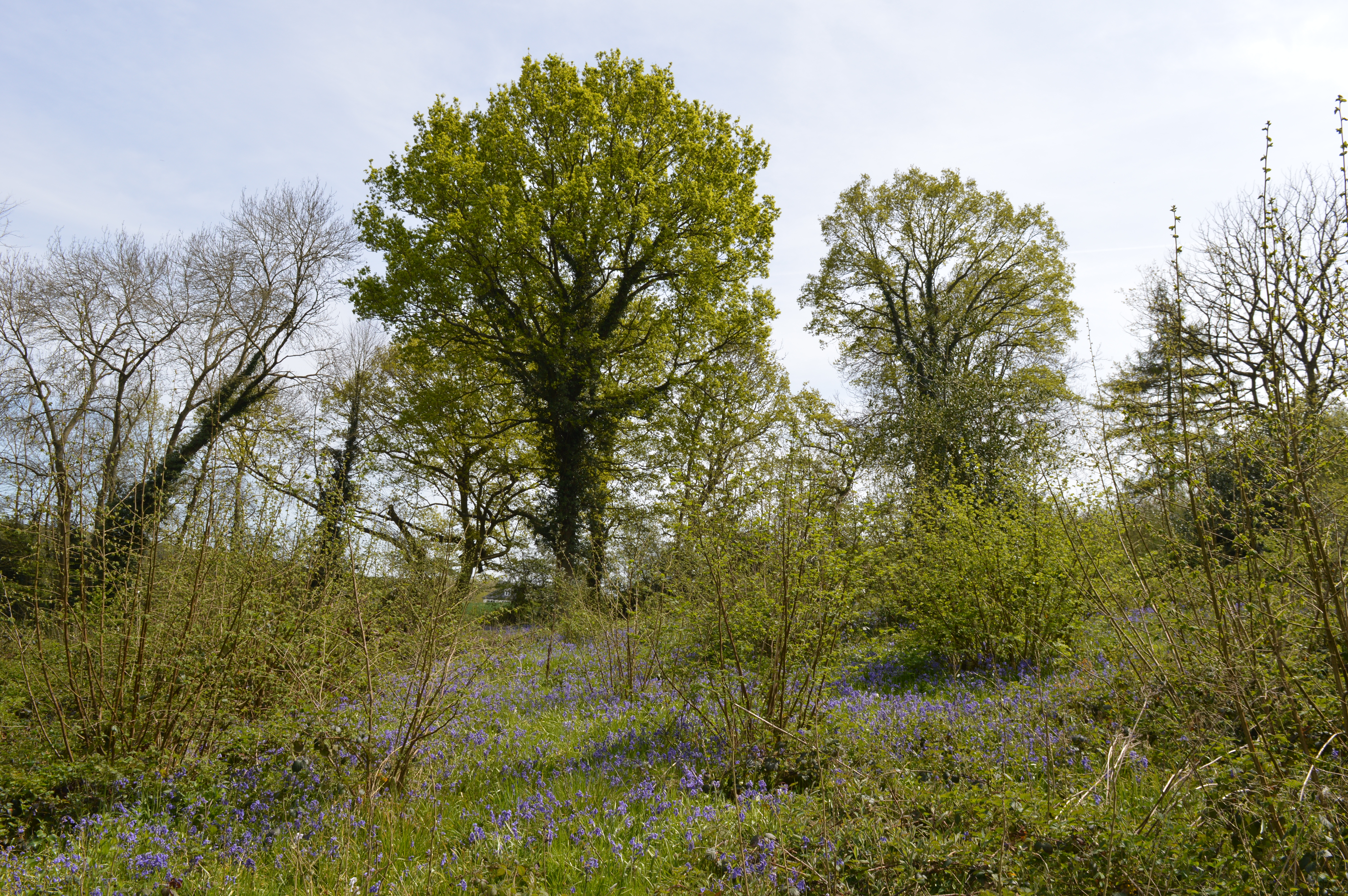
The forest is predominantly composed of broadleaf trees, including oak, beech, and birch, which create a dense canopy that allows only dappled sunlight to filter through. This provides the perfect habitat for a variety of wildlife species, such as deer, foxes, badgers, and numerous species of birds. Nature enthusiasts and photographers flock to Bullock Wood to witness the enchanting sights and sounds of these creatures in their natural habitat.

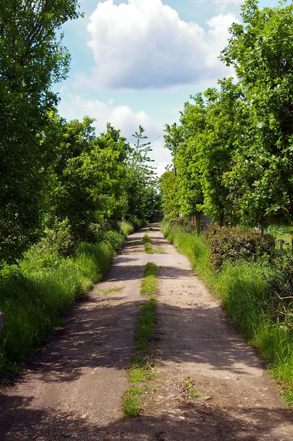
Traversing through the woodland, visitors can explore a network of well-maintained walking trails that meander through the trees. These paths offer a peaceful and serene experience, allowing visitors to immerse themselves in the tranquility of nature. Additionally, the forest is intersected by a small stream, adding to the idyllic atmosphere and providing a habitat for aquatic life.

Bullock Wood is a popular destination for outdoor activities such as hiking, picnicking, and nature walks. The forest is managed by the local authorities, ensuring the preservation of its natural beauty and protecting its wildlife. It serves as a valuable recreational space for both locals and tourists, providing an escape from the hustle and bustle of everyday life.

In conclusion, Bullock Wood in Essex is a captivating forest that offers a haven of natural beauty, abundant wildlife, and peaceful surroundings. It is a cherished destination for nature enthusiasts and provides a much-needed respite for those seeking solace in the great outdoors.

If you have any feedback on the listing, please let us know in the comments section below.
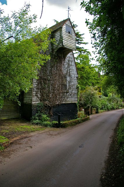
Bullock Wood Images

Images are sourced within 2km of 51.913056/0.93523037 or Grid Reference TM0127. Thanks to Geograph Open Source API. All images are credited.

Telephone Box, Highwoods
Severalls Lane, Colchester
Farmland near Colchester
Ardleigh Reservoir This is a shot of Ardleigh Reservoir north of Colchester taken from the end of Lodge Lane. The picture looks west across the water. See also <a href="https://www.geograph.org.uk/gridref/TM0429">TM0429</a> & <a href="https://www.geograph.org.uk/gridref/TM0329">TM0329</a>
Ardleigh Reservoir
This is a shot of Ardleigh Reservoir north of Colchester taken from the end of Lodge Lane. The picture looks west across the water. See also TM0429 & TM0329
Wycliffe Baptist Church In Parsons Heath
Wycliffe Baptist Church
In Parsons Heath
The Rovers Tye Public House and Restaurant on Ipswich Road.  The original building is 200 years old and has previously been a farmhouse and a butchers.
The Rovers Tye
Public House and Restaurant on Ipswich Road. The original building is 200 years old and has previously been a farmhouse and a butchers.
The Gilberd School Comprehensive School named after William Gilberd, the pioneer of the study of magnetism in England. He lived in Trinity Street, Colchester.
The Gilberd School
Comprehensive School named after William Gilberd, the pioneer of the study of magnetism in England. He lived in Trinity Street, Colchester.
The Crown Inn On Old Ipswich Road near Ardleigh
The Crown Inn
On Old Ipswich Road near Ardleigh
Unofficial Path This path leads out of High Woods Country Park north of Colchester. However it is of little use to the average walker as you are confronted with the back garden gates of Friars Close (behind the photographer)  and no way to reach a public road or right of way.
Unofficial Path
This path leads out of High Woods Country Park north of Colchester. However it is of little use to the average walker as you are confronted with the back garden gates of Friars Close (behind the photographer) and no way to reach a public road or right of way.
Further Meadow This meadow in High Woods Country Park has never been cultivated due to the soggy nature of the soil. It is now periodically grazed to maintain the habitat for wildlife.
Further Meadow
This meadow in High Woods Country Park has never been cultivated due to the soggy nature of the soil. It is now periodically grazed to maintain the habitat for wildlife.
Highwoods Lake This lake is used to control the water level in the meadows down stream holding excess water thus preventing flooding. This type of flood control is known as a balancing Lake
Highwoods Lake
This lake is used to control the water level in the meadows down stream holding excess water thus preventing flooding. This type of flood control is known as a balancing Lake
Brunel Way This is Brunel Way part of a large business park to the north of Colchester. The mainly service industries based here have to some degree helped alleviate the unemployment caused by the closure of Colchester’s traditional engineering employers such as the lathe company.
Brunel Way
This is Brunel Way part of a large business park to the north of Colchester. The mainly service industries based here have to some degree helped alleviate the unemployment caused by the closure of Colchester’s traditional engineering employers such as the lathe company.
Fen Farm footpath This footpath/private Road  near Fen Farm,  Fox Street runs from the A137 to A12/A120 Junction at TM019289
Fen Farm footpath
This footpath/private Road near Fen Farm, Fox Street runs from the A137 to A12/A120 Junction at TM019289
Henless Huts These abandoned chicken sheds are on Fen Farm, Fox Street north of Colchester.
Henless Huts
These abandoned chicken sheds are on Fen Farm, Fox Street north of Colchester.
Springvalley Lane Mill This mill near Ardleigh north of Colchester looks to be at the start of an extensive restoration it is a tad dilapidated at the moment.
Springvalley Lane Mill
This mill near Ardleigh north of Colchester looks to be at the start of an extensive restoration it is a tad dilapidated at the moment.
Springvalley Lane This is Springvalley Lane and the mill near Ardleigh north of Colchester.
Springvalley Lane
This is Springvalley Lane and the mill near Ardleigh north of Colchester.
Bumblebee This bumblebee was feasting on the rhododendrons near the mill in <a href="https://www.geograph.org.uk/photo/176756">TM0327 : Springvalley Lane</a>
Bumblebee
This bumblebee was feasting on the rhododendrons near the mill in TM0327 : Springvalley Lane
Tesco at High Wood, Colchester, Essex Looking at the grid reference for this picture on the 1940s O/S map, this Tesco stands on, what was once, the grounds of Maynard Hall.
Tesco at High Wood, Colchester, Essex
Looking at the grid reference for this picture on the 1940s O/S map, this Tesco stands on, what was once, the grounds of Maynard Hall.
Show me another place!

Bullock Wood is located at Grid Ref: TM0127 (Lat: 51.913056, Lng: 0.93523037)

Administrative County: Essex

District: Colchester

Police Authority: Essex

What 3 Words

///could.thin.shops. Near Colchester, Essex

Related Wikis

Bullock Wood

Bullock Wood is a 23.3-hectare (58-acre) biological Site of Special Scientific Interest on the northern outskirts of Colchester in Essex.The site is mature...
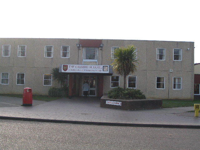
The Gilberd School

The Gilberd School is a coeducational secondary school with academy status, in Colchester, Essex, England. == History == The school originally opened on...

Ardleigh Reservoir

Ardleigh Reservoir is a 49-hectare (120-acre) lake near Colchester in Essex, England constructed in the valley of the Salary Brook. It supplies water both...

Welsh Wood

Welsh Wood is a 3.2 hectare Local Nature Reserve in Colchester in Essex. It is owned and managed by Colchester Borough Council.Trees in this site are managed...

St Aubyn Centre

The St Aubyn Centre is a mental health facility at 216 Turner Road, Colchester, Essex. It has two wards: (i) Longview Ward which is a General Adolescent...

Colchester Hospital

Colchester Hospital is a district general hospital located in Colchester, Essex. It is managed by East Suffolk and North Essex NHS Foundation Trust....

Ipswich Road, Colchester

Ipswich Road, formally the A1232, is a road in Colchester, Essex, England. It was the historic coaching route and main road to Ipswich from the Middle...

Colchester Academy

Colchester Academy, formerly Sir Charles Lucas Arts College, is a secondary school in Colchester, Essex specialising in English and Health Sciences. It...

Nearby Amenities

Located within 500m of 51.913056,0.93523037
Traffic Signals
Lat/Long: 51.9136083/0.9289962
Bus Stop
Avellana Place
Bus: yes
Naptan AtcoCode: 150033017003
Naptan Bearing: S
Naptan Crossing: Severalls Lane
Naptan Indicator: Opp
Naptan Landmark: Severalls Lane
Naptan NaptanCode: esxajwmw
Naptan PlusbusZoneRef: CLCHSTR
Naptan Street: Ipswich Road
Naptan Verified: no
Public Transport: platform
Source: naptan_import
Lat/Long: 51.9145226/0.9297195
Shop: car_repair
Lat/Long: 51.913804/0.9295023
Traffic Signals
Lat/Long: 51.9133728/0.92872
Traffic Signals
Lat/Long: 51.9135604/0.9286704
Bicycle Parking
Access: private
Capacity: 8
Lat/Long: 51.9119022/0.9285979
Waste Basket
Lat/Long: 51.9136892/0.92922
Crossing
Bicycle: yes
Crossing: traffic_signals
Lat/Long: 51.9158385/0.9304619
Bus Stop
Avellana Place
Bus: yes
Naptan AtcoCode: 1500330170Y3
Naptan NaptanCode: esxjmtwt
Naptan Verified: no
Public Transport: platform
Source: naptan
Lat/Long: 51.9146133/0.9293739
Crossing
Crossing: uncontrolled
Lat/Long: 51.9130617/0.928664
Bicycle Parking
Bicycle Parking: shed
Lat/Long: 51.9166296/0.9314449
Barrier: bollard
Bollard: fixed
Lat/Long: 51.9169718/0.9333323
Defibrillator
Access: yes
Defibrillator Location: on road side of garden wall between 2 James Mayger Chase and 2 Francis Gunn Close
Emergency: defibrillator
Indoor: no
Ref GB The Circuit: D8236BDF-0853-4708-A592-AE190105C925
Lat/Long: 51.9167187/0.9322814
Description: RAF Lancaster DV177 memorial
Historic: memorial
Lat/Long: 51.9162221/0.9304088
The data included in this document is from www.openstreetmap.org. The data is made available under ODbL.

Have you been to Bullock Wood?

Leave your review of Bullock Wood below (or comments, questions and feedback).