Brockley Wood
Wood, Forest in Suffolk West Suffolk
England
Brockley Wood

Brockley Wood is a picturesque woodland located in Suffolk, England. It covers an area of approximately 500 acres and is known for its diverse range of flora and fauna. The wood is primarily composed of broadleaf trees, including oak, beech, and ash, which provide a lush canopy and create a peaceful and tranquil atmosphere.
The wood is crisscrossed with a network of walking trails, making it a popular destination for avid hikers and nature enthusiasts. These trails offer visitors the opportunity to explore the wood's natural beauty and discover its hidden gems, such as ancient trees and wildflower meadows.
The woodland is also home to a variety of wildlife, including deer, foxes, badgers, and a wide range of bird species. Birdwatchers will be delighted to spot woodpeckers, owls, and various migratory birds during the appropriate seasons.
In addition to its natural beauty, Brockley Wood has historical significance. It is believed to have been used as a hunting ground by the Saxons and has remnants of an Iron Age fort located within its boundaries. These historical features add an extra layer of intrigue and make the wood a fascinating destination for history enthusiasts.
Overall, Brockley Wood is a haven for nature lovers, offering a peaceful retreat away from the hustle and bustle of everyday life. Its stunning landscapes, diverse wildlife, and rich history make it a must-visit destination for anyone seeking a true connection with nature.
If you have any feedback on the listing, please let us know in the comments section below.
Brockley Wood Images
Images are sourced within 2km of 52.339337/0.93477902 or Grid Reference TM0075. Thanks to Geograph Open Source API. All images are credited.


Brockley Wood is located at Grid Ref: TM0075 (Lat: 52.339337, Lng: 0.93477902)
Administrative County: Suffolk
District: West Suffolk
Police Authority: Suffolk
What 3 Words
///noon.deleting.noisy. Near Rickinghall, Suffolk
Nearby Locations
Related Wikis

Wattisfield
Wattisfield is a village and civil parish in the Mid Suffolk district of Suffolk in eastern England. Located on the A143 around seven miles south-west...
Hepworth, Suffolk
Hepworth is a village and civil parish in the West Suffolk district of the English county of Suffolk. Nearby settlements include the villages of Stanton...
Market Weston
Market Weston is a small village and civil parish in the West Suffolk district of Suffolk in eastern England. It is located near the Norfolk border around...

RAF Shepherds Grove
Royal Air Force Shepherds Grove or more simply RAF Shepherds Grove is a former Royal Air Force station located in Suffolk, active from 1943–44 to 1966...

Hinderclay
Hinderclay is a village and civil parish in the Mid Suffolk district of Suffolk in eastern England. The village is located around 14 miles (23 km) - from...
Rickinghall Inferior
Rickinghall Inferior is a civil parish in the Mid Suffolk district of Suffolk, England. According to the 2011 census there were 233 males and 216 females...

Thelnetham
Thelnetham is a village and civil parish in the West Suffolk district of Suffolk in eastern England. Located on the southern bank of the River Little Ouse...
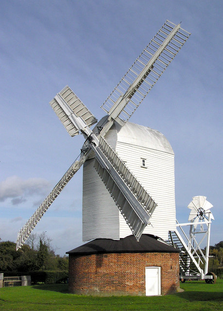
Upthorpe Mill, Stanton
Upthorpe Mill is a Grade II* listed post mill and scheduled monument at Stanton, Suffolk, England, which has been restored to working order. == History... ==
Nearby Amenities
Located within 500m of 52.339337,0.93477902Have you been to Brockley Wood?
Leave your review of Brockley Wood below (or comments, questions and feedback).