Ash Plantation

Wood, Forest in Kent Ashford

England

Ash Plantation

Shirley Moor Pumping Station Built in 1973 by the Kent River Authority.
Shirley Moor Pumping Station Credit: Julian P Guffogg

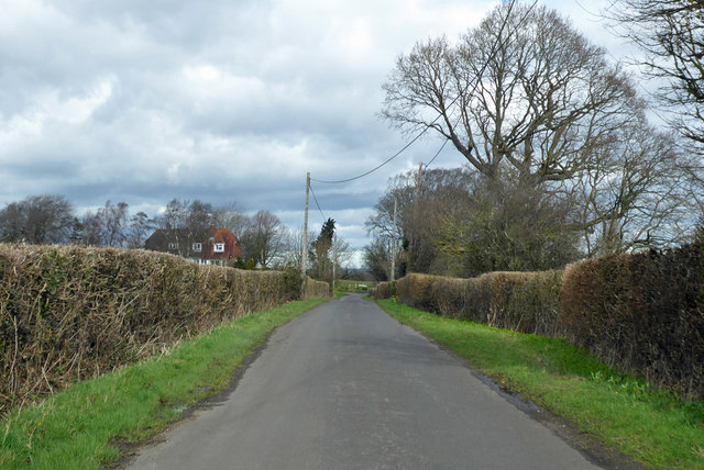
Ash Plantation is a picturesque woodland located in the county of Kent, England. Situated in the heart of the Kent Downs Area of Outstanding Natural Beauty, this enchanting forest covers an area of approximately 100 acres.

The plantation is predominantly composed of ash trees, hence its name, which create a dense and lush canopy overhead. The tall, slender trunks of the ash trees stretch towards the sky, forming an impressive backdrop to the woodland landscape. The forest floor is carpeted with a rich assortment of wildflowers, ferns, and mosses, adding vibrant splashes of color to the scenery.

Ash Plantation is known for its diverse ecosystem and abundant wildlife. It serves as a habitat for various bird species, including woodpeckers, owls, and warblers, which fill the air with their melodic songs. The forest also provides shelter for small mammals like squirrels and rabbits, while deer and foxes can occasionally be spotted roaming through the undergrowth.

Visitors to Ash Plantation can enjoy a network of well-maintained walking trails that wind their way through the forest. These trails provide excellent opportunities for hiking, jogging, and birdwatching. The tranquil atmosphere and natural beauty of the woodland make it a popular destination for nature lovers, photographers, and those seeking a peaceful escape from the bustling city life.

Overall, Ash Plantation in Kent offers a captivating blend of scenic beauty, biodiversity, and recreational opportunities, making it a cherished natural gem of the region.

If you have any feedback on the listing, please let us know in the comments section below.

Ash Plantation Images

Images are sourced within 2km of 51.020006/0.75634448 or Grid Reference TQ9328. Thanks to Geograph Open Source API. All images are credited.

Shirley Moor Pumping Station Built in 1973 by the Kent River Authority.
Shirley Moor Pumping Station
Built in 1973 by the Kent River Authority.
Pumping station at sewer junction The Cradlebridge Sewer, at right, connects to the Reading Sewer, hidden by its banks, via this pumping station.
Pumping station at sewer junction
The Cradlebridge Sewer, at right, connects to the Reading Sewer, hidden by its banks, via this pumping station.
Redhill Bridge Pumping Station On the Reading Sewer (large dyke) between Reading Street and the Royal Military Canal. It is also the junction of the Cradlebridge Sewer joining the Reading Sewer.
Redhill Bridge Pumping Station
On the Reading Sewer (large dyke) between Reading Street and the Royal Military Canal. It is also the junction of the Cradlebridge Sewer joining the Reading Sewer.
Claw on the Redhill Bridge Pumping Station This Pumping Station is on the junction of Cradlebridge Sewer and the Reading Sewer. The claw apparatus is used to clear the front of the pump from debris in the dyke.
Claw on the Redhill Bridge Pumping Station
This Pumping Station is on the junction of Cradlebridge Sewer and the Reading Sewer. The claw apparatus is used to clear the front of the pump from debris in the dyke.
Dyke Junction near Redhill Bridge Pumping station Reading Sewer (on the left) leads through the pumping station on the right. Cradlebridge Sewer (in front) leads from Brattle.
Dyke Junction near Redhill Bridge Pumping station
Reading Sewer (on the left) leads through the pumping station on the right. Cradlebridge Sewer (in front) leads from Brattle.
Footpath to Appledore Road A path leads across this large field from the B2060 Tenterden Road towards the road.
Footpath to Appledore Road
A path leads across this large field from the B2060 Tenterden Road towards the road.
Footbridge over Newknock Channel This carries a public footpath from Military Road to Church Hill in Stone-in-Oxney. Mark Duncan’s <a href="https://www.geograph.org.uk/photo/470092">TQ9426 : Footbridge Over Newknock Channel</a> shows the former footbridge, which this one has replaced.
Footbridge over Newknock Channel
This carries a public footpath from Military Road to Church Hill in Stone-in-Oxney. Mark Duncan’s TQ9426 : Footbridge Over Newknock Channel shows the former footbridge, which this one has replaced.
Looker’s hut Lookers were employed to look after a farmer’s stock and these huts provided basic accommodation, which was used at lambing time. The huts had an open fire, on the hearth, over which a kettle or cauldron was hung, on a pot-hook, to provide meals for the shepherd or for heating milk for weak and sickly lambs. The huts would have also had crude sleeping arrangements – probably nothing more than a few boards on which there might have been sacks, stuffed with straw, to act as a mattress. Sanitary arrangements would have been non-existent and any water for cooking would have been obtained from the nearest dyke. His family would come at weekends to spend a day with him, bringing his supplies for the whole week.            

Nigel P Crick has written an illustrated book called The Lookers’ Huts
ISBN 978 1 84624 426 1, which gives the grid reference locations of 16 huts, that can be found on Romney Marsh, as well as a link to his photography business <span class="nowrap"><a title="http://www.gallerytwentyone.co.uk" rel="nofollow ugc noopener" href="http://www.gallerytwentyone.co.uk">Link</a><img style="margin-left:2px;" alt="External link" title="External link - shift click to open in new window" src="https://s1.geograph.org.uk/img/external.png" width="10" height="10"/></span>

The same hut as Mark Duncan’s <a href="https://www.geograph.org.uk/photo/442317">TQ9427 : Looker's Hut</a> but seen from another direction to show the magnificent oak growing beyond it.
Looker’s hut
Lookers were employed to look after a farmer’s stock and these huts provided basic accommodation, which was used at lambing time. The huts had an open fire, on the hearth, over which a kettle or cauldron was hung, on a pot-hook, to provide meals for the shepherd or for heating milk for weak and sickly lambs. The huts would have also had crude sleeping arrangements – probably nothing more than a few boards on which there might have been sacks, stuffed with straw, to act as a mattress. Sanitary arrangements would have been non-existent and any water for cooking would have been obtained from the nearest dyke. His family would come at weekends to spend a day with him, bringing his supplies for the whole week. Nigel P Crick has written an illustrated book called The Lookers’ Huts ISBN 978 1 84624 426 1, which gives the grid reference locations of 16 huts, that can be found on Romney Marsh, as well as a link to his photography business LinkExternal link The same hut as Mark Duncan’s TQ9427 : Looker's Hut but seen from another direction to show the magnificent oak growing beyond it.
Footbridge over Newknock Channel It carries a footpath that runs between Military Road and Church Hill, Stone in Oxney. To the left of the trees, in the middle distance, is a <a href="https://www.geograph.org.uk/photo/5237185">TQ9427 : Looker’s hut</a>, while prominent to its left is St Mary’s church in <a href="https://www.geograph.org.uk/gridref/TQ9427">TQ9427</a>.
Footbridge over Newknock Channel
It carries a footpath that runs between Military Road and Church Hill, Stone in Oxney. To the left of the trees, in the middle distance, is a TQ9427 : Looker’s hut, while prominent to its left is St Mary’s church in TQ9427.
Stone Cliff from the Fairfield Road on Walland Marsh Walland Marsh is on the western side of Romney Marsh.  Stone Cliff in the distance on the Isle of Oxney was on the coast hundreds years ago but is now about 8 km from the sea at Rye Bay.  The cliff is a Regionally Important Geological Site.  See <span class="nowrap"><a title="http://www.kentrigs.org.uk/index.php?option=com_content&view=article&id=45&Itemid=21" rel="nofollow ugc noopener" href="http://www.kentrigs.org.uk/index.php?option=com_content&view=article&id=45&Itemid=21">Link</a><img style="margin-left:2px;" alt="External link" title="External link - shift click to open in new window" src="https://s1.geograph.org.uk/img/external.png" width="10" height="10"/></span>
Stone Cliff from the Fairfield Road on Walland Marsh
Walland Marsh is on the western side of Romney Marsh. Stone Cliff in the distance on the Isle of Oxney was on the coast hundreds years ago but is now about 8 km from the sea at Rye Bay. The cliff is a Regionally Important Geological Site. See LinkExternal link
Stone Cliff on the Isle of Oxney This cliff, a Regionally Important Geological Site, is on the south eastern end of the Isle of Oxney overlooking the Walland Marsh.  Oxney is now a land-bound area, but was an island until the 13th century when a severe storm changed the course of the river Rother.  Much of the marshland in the distance would have been under the sea until then.
Stone Cliff on the Isle of Oxney
This cliff, a Regionally Important Geological Site, is on the south eastern end of the Isle of Oxney overlooking the Walland Marsh. Oxney is now a land-bound area, but was an island until the 13th century when a severe storm changed the course of the river Rother. Much of the marshland in the distance would have been under the sea until then.
View from near Cliff Farm In front of the camera the ground falls away quite sharply (as the farm name suggests) to reach the edge of Romney Marsh (at no more than three metres above sea-level).  The Royal Military Canal runs along the marsh edge, but is hidden in this view by the convexity of the hillside.

In Roman times, tides would (at least at springs) have reached the foot of the hill - and what is now Romney Marsh would have been a wide bay with sand banks, not unlike the present-day Wash.

The view is a little to the south of east, with Dungeness power station visible on the horizon (close to the right-hand margin of the photo).
View from near Cliff Farm
In front of the camera the ground falls away quite sharply (as the farm name suggests) to reach the edge of Romney Marsh (at no more than three metres above sea-level). The Royal Military Canal runs along the marsh edge, but is hidden in this view by the convexity of the hillside. In Roman times, tides would (at least at springs) have reached the foot of the hill - and what is now Romney Marsh would have been a wide bay with sand banks, not unlike the present-day Wash. The view is a little to the south of east, with Dungeness power station visible on the horizon (close to the right-hand margin of the photo).
Knock Hill Looking east across Romney Marsh from a point near the entrance to Cliff Farm.  Another contributor was here before me, but at an earlier stage in the year:   <a title="https://www.geograph.org.uk/photo/1223872" href="https://www.geograph.org.uk/photo/1223872">Link</a>
Knock Hill
Looking east across Romney Marsh from a point near the entrance to Cliff Farm. Another contributor was here before me, but at an earlier stage in the year: Link
Wittersham Road towards Stone-in-Oxney
Top Road Heading east.
Top Road
Heading east.
Church Hill, Stone-in-Oxney Heading towards the village.
Church Hill, Stone-in-Oxney
Heading towards the village.
Cottages and pub on Appledore Road The Ferry Inn is hidden by the nearer cottages. These are clustered near the bridge over the Reading Sewer.
Cottages and pub on Appledore Road
The Ferry Inn is hidden by the nearer cottages. These are clustered near the bridge over the Reading Sewer.
Tree in Appledore Road It was a very windy night and day, coming in squalls with rain.
Tree in Appledore Road
It was a very windy night and day, coming in squalls with rain.
Show me another place!

Ash Plantation is located at Grid Ref: TQ9328 (Lat: 51.020006, Lng: 0.75634448)

Administrative County: Kent

District: Ashford

Police Authority: Kent

What 3 Words

///grasp.helpfully.affirming. Near Stone, Kent

Nearby Locations

Ash Plantation

Related Wikis

Isle of Oxney

Isle of Oxney is an area in Kent, England, close to the boundary with East Sussex. Up to the 13th century, the island was part of the coastline bordering...

Stone-cum-Ebony

Stone-cum-Ebony is a large mostly rural and marshland civil parish centred 7 miles (11 km) SSW of Ashford in Kent, South East England. It includes the...

Stone in Oxney

Stone in Oxney is a village south of Ashford in Kent, South East England, in the civil parish of Stone-cum-Ebony near Appledore. The village is 11 miles...

Ebony, Kent

Ebony is a hamlet south of Ashford in Kent, South East England, in the civil parish of Stone-cum-Ebony, on the Isle of Oxney in the Ashford district of...

Stocks Mill, Wittersham

Stocks Mill is a Grade II* listed post mill in Wittersham on the Isle of Oxney, in Kent, England which has been preserved. == History == Probably built...

Appledore, Kent

Appledore is a village and civil parish in the Ashford District of Kent, England. The village centre is on the northern edge of the Romney Marsh, 12 miles...

Reading Street, Ashford

Reading Street is a hamlet approximately 3 miles (4.8 km) south east of Tenterden in Kent, England. It is situated on the B2080 road between Tenterden...

Fairfield, Kent

Fairfield is a village and former civil parish, now in the parish of Snargate, in the Folkestone and Hythe district of Kent, England. In 1931 the parish...

Nearby Amenities

Located within 500m of 51.020006,0.75634448
Power: tower
Lat/Long: 51.021487/0.7557554
Power: tower
Lat/Long: 51.0198495/0.7540896
Power: tower
Lat/Long: 51.0180842/0.7522925
Power: tower
Lat/Long: 51.0238718/0.7579944
Barrier: stile
Source: survey
Lat/Long: 51.0223525/0.7574509
Barrier: stile
Source: survey
Lat/Long: 51.0230026/0.7575274
Power: tower
Lat/Long: 51.0233795/0.7575416
Barrier: stile
Source: survey
Lat/Long: 51.0217446/0.7575204
The data included in this document is from www.openstreetmap.org. The data is made available under ODbL.

Have you been to Ash Plantation?

Leave your review of Ash Plantation below (or comments, questions and feedback).