Seven Acre Plantation

Wood, Forest in Norfolk Breckland

England

Seven Acre Plantation

Peddars Way A section of the Peddars Way & Norfolk Coast Path, also the NCR 13 follows this section of the Peddars Way.
Peddars Way Credit: Chris McAuley

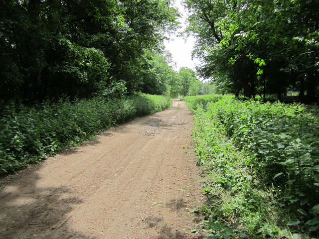
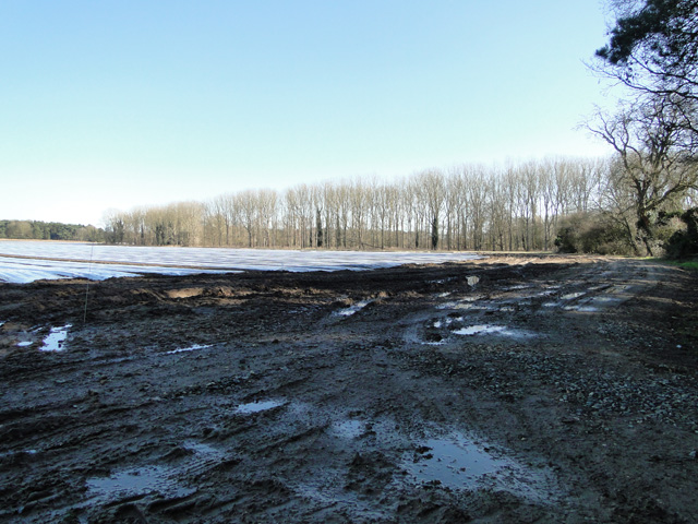
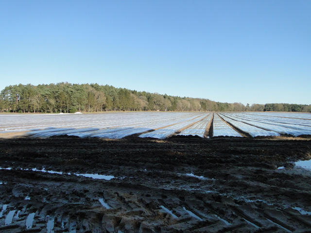
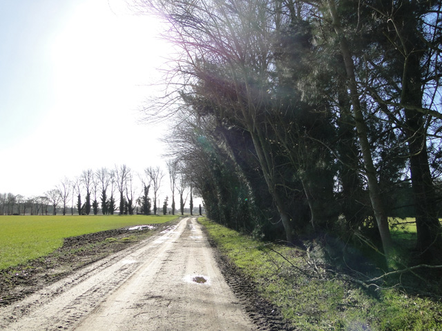
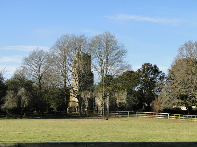
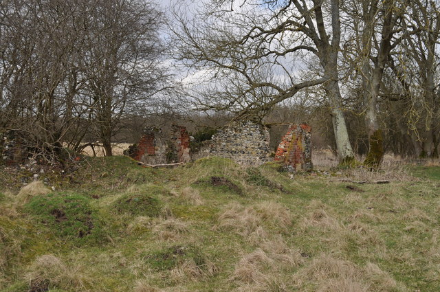
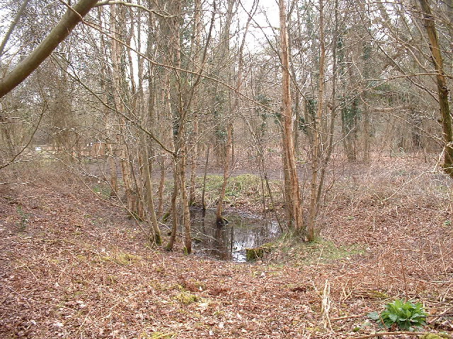
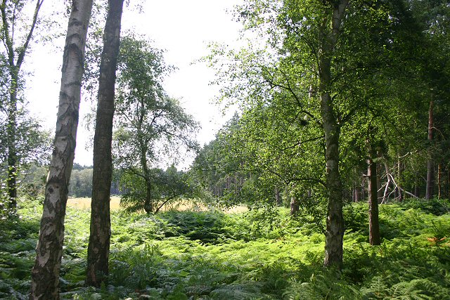
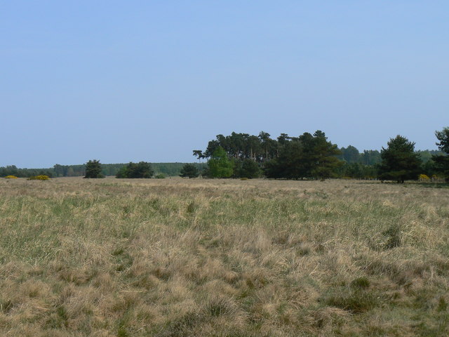
Seven Acre Plantation is a sprawling woodland located in Norfolk, England. Covering an area of approximately seven acres, this plantation is a popular destination for nature enthusiasts and outdoor lovers. Nestled amidst the picturesque Norfolk countryside, the plantation boasts a diverse range of flora and fauna, making it a haven for wildlife.

The woodland is predominantly made up of native tree species, including oak, beech, and birch trees, which create a dense and lush forest canopy. This provides a tranquil and peaceful atmosphere for visitors, allowing them to escape the hustle and bustle of everyday life.

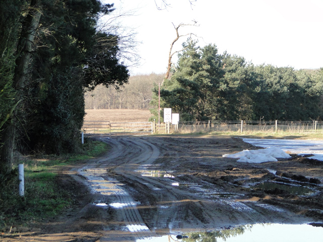
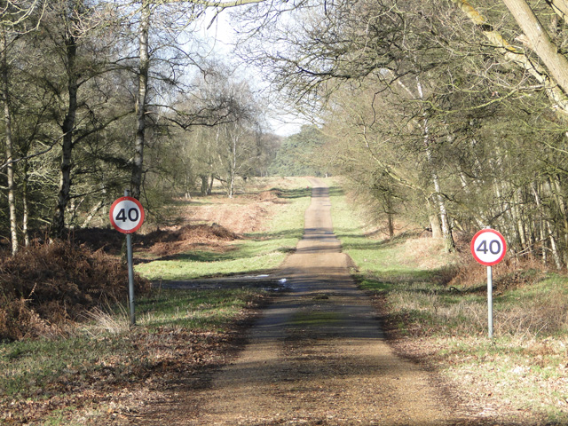
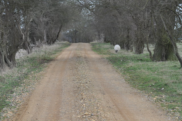
Walking trails wind their way through the plantation, offering visitors the opportunity to explore the natural beauty of the area. The trails are well-maintained and suitable for all levels of fitness, making it an ideal location for a leisurely stroll or a more challenging hike.

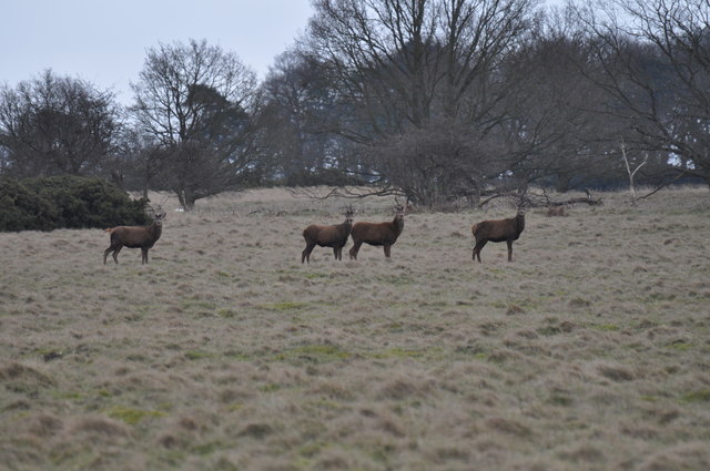
Seven Acre Plantation is not only a haven for plant life but also home to a wide variety of wildlife. Birdwatchers can spot a range of species, including woodpeckers, owls, and songbirds. Small mammals, such as squirrels, rabbits, and hedgehogs, can also be seen scurrying through the undergrowth.

The plantation is open to the public year-round, with no admission fees. Visitors are encouraged to respect and preserve the natural environment, ensuring that future generations can continue to enjoy the beauty of Seven Acre Plantation. Whether you're seeking a peaceful retreat or an opportunity to connect with nature, this Norfolk woodland offers an enriching and immersive experience for all.

If you have any feedback on the listing, please let us know in the comments section below.

Seven Acre Plantation Images

Images are sourced within 2km of 52.504997/0.79678514 or Grid Reference TL8993. Thanks to Geograph Open Source API. All images are credited.

Peddars Way A section of the Peddars Way & Norfolk Coast Path, also the NCR 13 follows this section of the Peddars Way.
Peddars Way
A section of the Peddars Way & Norfolk Coast Path, also the NCR 13 follows this section of the Peddars Way.
Agricultural crop under plastic next to the firing range STANTA stands for STANford Training Area situated roughly TL 8495. 
The area was established in 1942 when a battle training area was required and a 'Nazi village' established. Military exercises were already taking place in the area; tanks had deployed to Thetford in the First World War. The complete takeover involved the complete evacuation of the villages of Buckenham Tofts, Langford, Stanford, Sturston, Tottington and West Tofts. The occupants of the houses were all rehoused in the belief that they would be allowed to return after the war. However the site was so valuable to the military that they have taken up permanent occupancy.  
The area was used during the run-up to the D-Day invasion and since then has hosted many exercises. 
The battle area includes four historic churches; the one at West Tofts was restored by Pugin and a new "church" forms part of the specially constructed village of Eastmere. Eastmere was originally built to give soldiers experience of fighting on the northern European plains.
There is a short landing strip for Harrier aircraft at TL 8332 9704
As a live firing area, access is not allowed without special permission from the Army. In the main this is limited to a number of tours a year and compassionate grounds for former residents of the villages or their relatives.
The area forms part of the distinctive Breckland landscape region, a gorse-covered sandy heath which offers poor agricultural opportunities but farms are still active and sheep graze within its confines. Arguably, its use as a military training area has safeguarded a substantial archaeological landscape. It is the home of a wealth of rare species of flora and fauna already lost in other parts of the country. Parts of the training area are designated Site of Special Scientific Interest (SSSI).
The battle area was used in the filming of many of the episodes of the TV comedy series, Dad's Army.
Agricultural crop under plastic next to the firing range
STANTA stands for STANford Training Area situated roughly TL 8495. The area was established in 1942 when a battle training area was required and a 'Nazi village' established. Military exercises were already taking place in the area; tanks had deployed to Thetford in the First World War. The complete takeover involved the complete evacuation of the villages of Buckenham Tofts, Langford, Stanford, Sturston, Tottington and West Tofts. The occupants of the houses were all rehoused in the belief that they would be allowed to return after the war. However the site was so valuable to the military that they have taken up permanent occupancy. The area was used during the run-up to the D-Day invasion and since then has hosted many exercises. The battle area includes four historic churches; the one at West Tofts was restored by Pugin and a new "church" forms part of the specially constructed village of Eastmere. Eastmere was originally built to give soldiers experience of fighting on the northern European plains. There is a short landing strip for Harrier aircraft at TL 8332 9704 As a live firing area, access is not allowed without special permission from the Army. In the main this is limited to a number of tours a year and compassionate grounds for former residents of the villages or their relatives. The area forms part of the distinctive Breckland landscape region, a gorse-covered sandy heath which offers poor agricultural opportunities but farms are still active and sheep graze within its confines. Arguably, its use as a military training area has safeguarded a substantial archaeological landscape. It is the home of a wealth of rare species of flora and fauna already lost in other parts of the country. Parts of the training area are designated Site of Special Scientific Interest (SSSI). The battle area was used in the filming of many of the episodes of the TV comedy series, Dad's Army.
Track to Gregson's Plantation
Wretham St. Lawrence's derelict church
One of the many entrances to STANTA STANTA stands for STANford Training Area situated roughly TL 8495. 
The area was established in 1942 when a battle training area was required and a 'Nazi village' established. Military exercises were already taking place in the area; tanks had deployed to Thetford in the First World War. The complete takeover involved the complete evacuation of the villages of Buckenham Tofts, Langford, Stanford, Sturston, Tottington and West Tofts. The occupants of the houses were all rehoused in the belief that they would be allowed to return after the war. However the site was so valuable to the military that they have taken up permanent occupancy.  
The area was used during the run-up to the D-Day invasion and since then has hosted many exercises. 
The battle area includes four historic churches; the one at West Tofts was restored by Pugin and a new "church" forms part of the specially constructed village of Eastmere. Eastmere was originally built to give soldiers experience of fighting on the northern European plains.
There is a short landing strip for Harrier aircraft at TL 8332 9704
As a live firing area, access is not allowed without special permission from the Army. In the main this is limited to a number of tours a year and compassionate grounds for former residents of the villages or their relatives.
The area forms part of the distinctive Breckland landscape region, a gorse-covered sandy heath which offers poor agricultural opportunities but farms are still active and sheep graze within its confines. Arguably, its use as a military training area has safeguarded a substantial archaeological landscape. It is the home of a wealth of rare species of flora and fauna already lost in other parts of the country. Parts of the training area are designated Site of Special Scientific Interest (SSSI).
The battle area was used in the filming of many of the episodes of the TV comedy series, Dad's Army.
One of the many entrances to STANTA
STANTA stands for STANford Training Area situated roughly TL 8495. The area was established in 1942 when a battle training area was required and a 'Nazi village' established. Military exercises were already taking place in the area; tanks had deployed to Thetford in the First World War. The complete takeover involved the complete evacuation of the villages of Buckenham Tofts, Langford, Stanford, Sturston, Tottington and West Tofts. The occupants of the houses were all rehoused in the belief that they would be allowed to return after the war. However the site was so valuable to the military that they have taken up permanent occupancy. The area was used during the run-up to the D-Day invasion and since then has hosted many exercises. The battle area includes four historic churches; the one at West Tofts was restored by Pugin and a new "church" forms part of the specially constructed village of Eastmere. Eastmere was originally built to give soldiers experience of fighting on the northern European plains. There is a short landing strip for Harrier aircraft at TL 8332 9704 As a live firing area, access is not allowed without special permission from the Army. In the main this is limited to a number of tours a year and compassionate grounds for former residents of the villages or their relatives. The area forms part of the distinctive Breckland landscape region, a gorse-covered sandy heath which offers poor agricultural opportunities but farms are still active and sheep graze within its confines. Arguably, its use as a military training area has safeguarded a substantial archaeological landscape. It is the home of a wealth of rare species of flora and fauna already lost in other parts of the country. Parts of the training area are designated Site of Special Scientific Interest (SSSI). The battle area was used in the filming of many of the episodes of the TV comedy series, Dad's Army.
Speed limit through Blackrabbit Warren STANTA stands for STANford Training Area situated roughly TL 8495. 
The area was established in 1942 when a battle training area was required and a 'Nazi village' established. Military exercises were already taking place in the area; tanks had deployed to Thetford in the First World War. The complete takeover involved the complete evacuation of the villages of Buckenham Tofts, Langford, Stanford, Sturston, Tottington and West Tofts. The occupants of the houses were all rehoused in the belief that they would be allowed to return after the war. However the site was so valuable to the military that they have taken up permanent occupancy.  
The area was used during the run-up to the D-Day invasion and since then has hosted many exercises. 
The battle area includes four historic churches; the one at West Tofts was restored by Pugin and a new "church" forms part of the specially constructed village of Eastmere. Eastmere was originally built to give soldiers experience of fighting on the northern European plains.
There is a short landing strip for Harrier aircraft at TL 8332 9704
As a live firing area, access is not allowed without special permission from the Army. In the main this is limited to a number of tours a year and compassionate grounds for former residents of the villages or their relatives.
The area forms part of the distinctive Breckland landscape region, a gorse-covered sandy heath which offers poor agricultural opportunities but farms are still active and sheep graze within its confines. Arguably, its use as a military training area has safeguarded a substantial archaeological landscape. It is the home of a wealth of rare species of flora and fauna already lost in other parts of the country. Parts of the training area are designated Site of Special Scientific Interest (SSSI).
The battle area was used in the filming of many of the episodes of the TV comedy series, Dad's Army.
Speed limit through Blackrabbit Warren
STANTA stands for STANford Training Area situated roughly TL 8495. The area was established in 1942 when a battle training area was required and a 'Nazi village' established. Military exercises were already taking place in the area; tanks had deployed to Thetford in the First World War. The complete takeover involved the complete evacuation of the villages of Buckenham Tofts, Langford, Stanford, Sturston, Tottington and West Tofts. The occupants of the houses were all rehoused in the belief that they would be allowed to return after the war. However the site was so valuable to the military that they have taken up permanent occupancy. The area was used during the run-up to the D-Day invasion and since then has hosted many exercises. The battle area includes four historic churches; the one at West Tofts was restored by Pugin and a new "church" forms part of the specially constructed village of Eastmere. Eastmere was originally built to give soldiers experience of fighting on the northern European plains. There is a short landing strip for Harrier aircraft at TL 8332 9704 As a live firing area, access is not allowed without special permission from the Army. In the main this is limited to a number of tours a year and compassionate grounds for former residents of the villages or their relatives. The area forms part of the distinctive Breckland landscape region, a gorse-covered sandy heath which offers poor agricultural opportunities but farms are still active and sheep graze within its confines. Arguably, its use as a military training area has safeguarded a substantial archaeological landscape. It is the home of a wealth of rare species of flora and fauna already lost in other parts of the country. Parts of the training area are designated Site of Special Scientific Interest (SSSI). The battle area was used in the filming of many of the episodes of the TV comedy series, Dad's Army.
Wretham St. Lawrence's derelict church
Ruins of St Lawrence church This church at West Wretham has been disused since the end of the 18th century and is now in ruins. The parishes of East Wretham and West Wretham were consolidated on 27 October 1790. According to the 1845 White's 'Norfolk Directory', the church of St Lawrence at West Wretham "had long been in ruins". The church is scheduled as Grade II and is listed as a 'Building at Risk in Norfolk'.
Ruins of St Lawrence church
This church at West Wretham has been disused since the end of the 18th century and is now in ruins. The parishes of East Wretham and West Wretham were consolidated on 27 October 1790. According to the 1845 White's 'Norfolk Directory', the church of St Lawrence at West Wretham "had long been in ruins". The church is scheduled as Grade II and is listed as a 'Building at Risk in Norfolk'.
Tower of St Lawrence church The ivy has taken over almost all of the tower. See <a href="https://www.geograph.org.uk/photo/1016223">TL8991 : Ruins of St Lawrence church</a>
Tower of St Lawrence church
The ivy has taken over almost all of the tower. See TL8991 : Ruins of St Lawrence church
Ruins of St Lawrence church The eerie view from inside the nave of this ruined church as the ivy crowds in on you. See <a href="https://www.geograph.org.uk/photo/1016223">TL8991 : Ruins of St Lawrence church</a>
Ruins of St Lawrence church
The eerie view from inside the nave of this ruined church as the ivy crowds in on you. See TL8991 : Ruins of St Lawrence church
Approach to Hall Farm, West Wretham The village of West Wretham doesn't really exist; it was consolidated with East Wretham back in 1790. All that remains at West Wretham is the ruined church of St Lawrence <a href="https://www.geograph.org.uk/photo/1016223">TL8991 : Ruins of St Lawrence church</a>, Wretham House and Hall Farm. This track leads both to the farm and the house.
Approach to Hall Farm, West Wretham
The village of West Wretham doesn't really exist; it was consolidated with East Wretham back in 1790. All that remains at West Wretham is the ruined church of St Lawrence TL8991 : Ruins of St Lawrence church, Wretham House and Hall Farm. This track leads both to the farm and the house.
Tottington - remains of building This is the remains of a building just outside of Tottington. This is situated inside the STANTA military battle training area and I visited on 26th March 2010 with special permission from the MoD.

The area was originally established in 1942 when a battle training area was required. Military exercises were already known in the area; tanks had trained at Thetford in the First World War. The complete takeover involved the evacuation of the villages of Buckenham Tofts, Langford, Stanford, Sturston, Tottington and West Tofts. All residents were evacuated in 1942.
Tottington - remains of building
This is the remains of a building just outside of Tottington. This is situated inside the STANTA military battle training area and I visited on 26th March 2010 with special permission from the MoD. The area was originally established in 1942 when a battle training area was required. Military exercises were already known in the area; tanks had trained at Thetford in the First World War. The complete takeover involved the evacuation of the villages of Buckenham Tofts, Langford, Stanford, Sturston, Tottington and West Tofts. All residents were evacuated in 1942.
Sturston Warren - deer grazing This is some deer grazing at Sturston Warren, situated inside the STANTA military battle training area and I visited on 26th March 2010 with special permission from the MoD.

The area was originally established in 1942 when a battle training area was required. Military exercises were already known in the area; tanks had trained at Thetford in the First World War. The complete takeover involved the evacuation of the villages of Buckenham Tofts, Langford, Stanford, Sturston, Tottington and West Tofts. All residents were evacuated in 1942.
Sturston Warren - deer grazing
This is some deer grazing at Sturston Warren, situated inside the STANTA military battle training area and I visited on 26th March 2010 with special permission from the MoD. The area was originally established in 1942 when a battle training area was required. Military exercises were already known in the area; tanks had trained at Thetford in the First World War. The complete takeover involved the evacuation of the villages of Buckenham Tofts, Langford, Stanford, Sturston, Tottington and West Tofts. All residents were evacuated in 1942.
Sturston Warren - road to Tottington This is the road from Sturston to Tottington. This is situated inside the STANTA military battle training area and I visited on 26th March 2010 with special permission from the MoD.

The area was originally established in 1942 when a battle training area was required. Military exercises were already known in the area; tanks had trained at Thetford in the First World War. The complete takeover involved the evacuation of the villages of Buckenham Tofts, Langford, Stanford, Sturston, Tottington and West Tofts. All residents were evacuated in 1942.
Sturston Warren - road to Tottington
This is the road from Sturston to Tottington. This is situated inside the STANTA military battle training area and I visited on 26th March 2010 with special permission from the MoD. The area was originally established in 1942 when a battle training area was required. Military exercises were already known in the area; tanks had trained at Thetford in the First World War. The complete takeover involved the evacuation of the villages of Buckenham Tofts, Langford, Stanford, Sturston, Tottington and West Tofts. All residents were evacuated in 1942.
Pingo, near Thompson Water A pingo is a relic of the Ice Age - a frozen piece of ice forced the earth up, and when it melted the indentation was left - a pond today.
Pingo, near Thompson Water
A pingo is a relic of the Ice Age - a frozen piece of ice forced the earth up, and when it melted the indentation was left - a pond today.
Blackrabbit Warren Viewed from the Peddars Way, this area is part of the Stanford Training Area, where public access is forbidden due to the presence of unexploded ammunition.
Blackrabbit Warren
Viewed from the Peddars Way, this area is part of the Stanford Training Area, where public access is forbidden due to the presence of unexploded ammunition.
Edge of danger area The Peddars Way (and part of the Great Eastern Pingo Trail around Thompson Common here) runs along the edge of the Stanford training area.
Edge of danger area
The Peddars Way (and part of the Great Eastern Pingo Trail around Thompson Common here) runs along the edge of the Stanford training area.
Show me another place!

Seven Acre Plantation is located at Grid Ref: TL8993 (Lat: 52.504997, Lng: 0.79678514)

Administrative County: Norfolk

District: Breckland

Police Authority: Norfolk

What 3 Words

///preoccupied.prefix.proudest. Near Watton, Norfolk

Related Wikis

Wretham Park Meres

Wretham Park Meres is a 30-hectare (74-acre) biological Site of Special Scientific Interest north of Thetford in Norfolk.This site consists of four natural...

Sturston, Norfolk

Sturston is a deserted village and civil parish in the English county of Norfolk. It is situated some 7+1⁄2 miles (12 km) north of the town of Thetford...

Breckland

Breckland in Norfolk and Suffolk is a 39,433 hectare Special Protection Area (SPA) under the European Union Directive on the Conservation of Wild Birds...

Tottington, Norfolk

Tottington is a deserted village and civil parish in the English county of Norfolk. It is situated some 6.2 miles (10.0 km) north of the town of Thetford...

Great Eastern Pingo Trail

Great Eastern Pingo Trail is a 9.2 kilometres (5.7 miles) long footpath along a disused railway line north of Thetford in Norfolk. It is a 4.2-hectare...

Stanford Training Area SSSI

Stanford Training Area SSSI is part of the British Army Stanford Training Area. It is a 4,678-hectare (11,560-acre) biological and geological Site of Special...

Wretham

Wretham is a civil parish in the Breckland district of Norfolk, England. The parish includes the village of East Wretham, which is about 6 miles (10 km...

Thompson Water, Carr and Common

Thompson Water, Carr and Common is a 154.7-hectare (382-acre) biological Site of Special Scientific Interest north of Thetford in Norfolk. Most of it is...

Have you been to Seven Acre Plantation?

Leave your review of Seven Acre Plantation below (or comments, questions and feedback).