Decoy Covert

Wood, Forest in Suffolk West Suffolk

England

Decoy Covert

Euston watermill on the Black Bourn Disused watermill. Late C18/early C19. In red brick with black glazed pantiled roof: designed to look like a church, with a small crenellated tower. Pointed Gothic windows to top stage. The machinery is complete. The waterwheel drove a single pair of stones and also a reciprocating pump for raising water up to a tank in the tower, which provided the water supply for Euston Hall. A watermill was included in the estate as purchased by Lord Arlington in the 1660's: this is presumably a rebuilding on the same site. Copied from Historic England website <span class="nowrap"><a title="https://historicengland.org.uk/listing/the-list/list-entry/1031255" rel="nofollow ugc noopener" href="https://historicengland.org.uk/listing/the-list/list-entry/1031255">Link</a><img style="margin-left:2px;" alt="External link" title="External link - shift click to open in new window" src="https://s1.geograph.org.uk/img/external.png" width="10" height="10"/></span>
Euston watermill on the Black Bourn Credit: Adrian S Pye

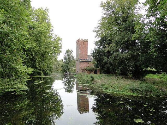
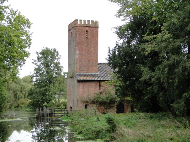
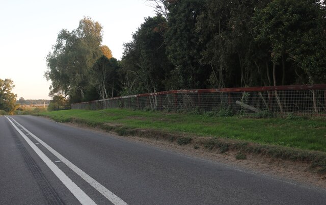
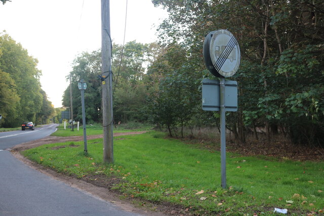
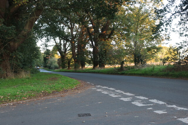
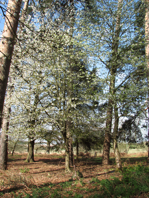
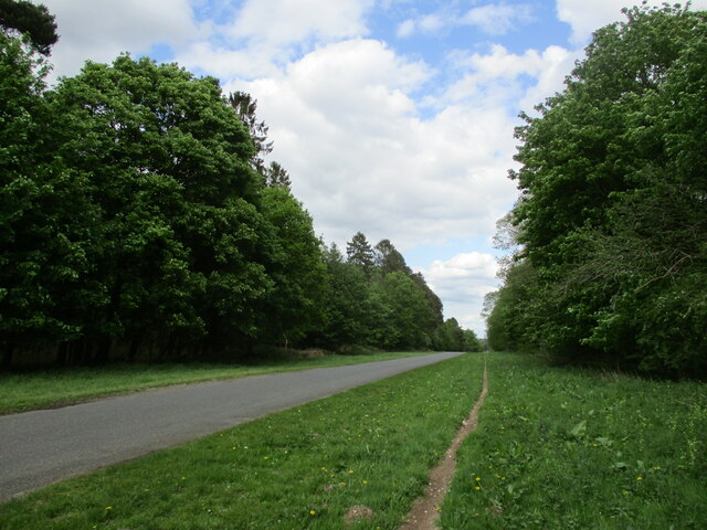
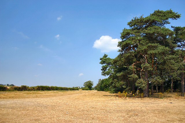
Decoy Covert is a wooded area located in Suffolk, England. Situated within the larger region of Suffolk Coastal, this forested area covers an approximate area of 200 acres. The covert is a mixture of deciduous and coniferous trees, creating a diverse and picturesque landscape.

The forest is known for its tranquil and peaceful ambiance, making it a popular destination for nature enthusiasts, hikers, and bird watchers. The variety of tree species provides a habitat for numerous bird species, including woodpeckers, owls, and various songbirds. Visitors can often hear the melodic chirping of these birds as they explore the area.

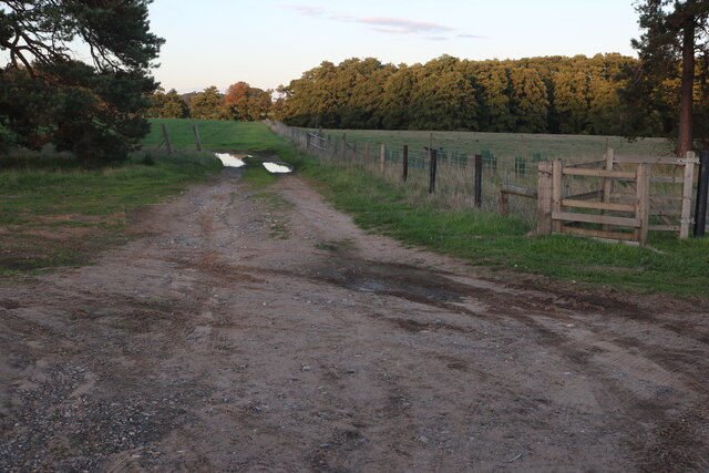
The woodland is also home to a variety of wildlife, such as deer, foxes, and rabbits. These animals can often be spotted among the trees, adding to the enchanting atmosphere of the covert. Nature photographers frequently visit Decoy Covert to capture images of these animals in their natural habitat.

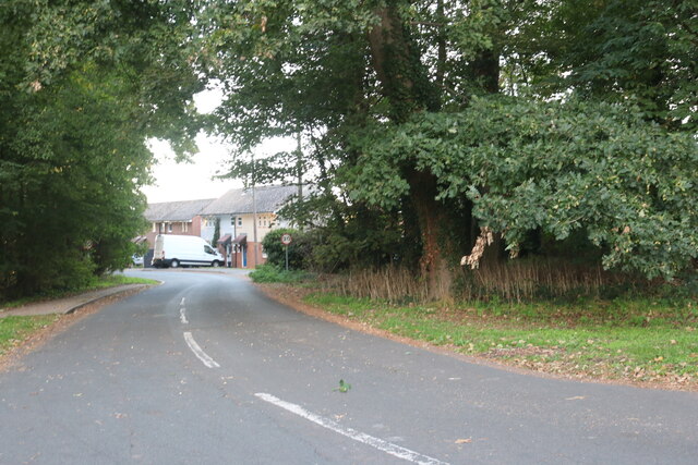
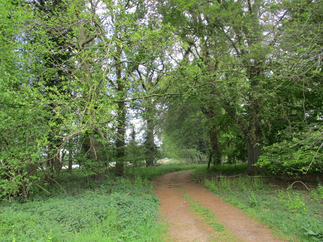
The forest offers several walking trails that wind through the trees, allowing visitors to immerse themselves in the beauty of nature. These paths are well-maintained and suitable for all skill levels, making it accessible to both casual walkers and more experienced hikers. The trails are clearly marked, ensuring that visitors can navigate their way through the forest easily.

Decoy Covert is a cherished natural treasure in Suffolk, offering a peaceful escape from the hustle and bustle of everyday life. Its diverse ecosystem, beautiful scenery, and abundant wildlife make it a must-visit destination for nature lovers and outdoor enthusiasts.

If you have any feedback on the listing, please let us know in the comments section below.

Decoy Covert Images

Images are sourced within 2km of 52.375432/0.78028565 or Grid Reference TL8978. Thanks to Geograph Open Source API. All images are credited.

Euston watermill on the Black Bourn Disused watermill. Late C18/early C19. In red brick with black glazed pantiled roof: designed to look like a church, with a small crenellated tower. Pointed Gothic windows to top stage. The machinery is complete. The waterwheel drove a single pair of stones and also a reciprocating pump for raising water up to a tank in the tower, which provided the water supply for Euston Hall. A watermill was included in the estate as purchased by Lord Arlington in the 1660's: this is presumably a rebuilding on the same site. Copied from Historic England website <span class="nowrap"><a title="https://historicengland.org.uk/listing/the-list/list-entry/1031255" rel="nofollow ugc noopener" href="https://historicengland.org.uk/listing/the-list/list-entry/1031255">Link</a><img style="margin-left:2px;" alt="External link" title="External link - shift click to open in new window" src="https://s1.geograph.org.uk/img/external.png" width="10" height="10"/></span>
Euston watermill on the Black Bourn
Disused watermill. Late C18/early C19. In red brick with black glazed pantiled roof: designed to look like a church, with a small crenellated tower. Pointed Gothic windows to top stage. The machinery is complete. The waterwheel drove a single pair of stones and also a reciprocating pump for raising water up to a tank in the tower, which provided the water supply for Euston Hall. A watermill was included in the estate as purchased by Lord Arlington in the 1660's: this is presumably a rebuilding on the same site. Copied from Historic England website LinkExternal link
Euston watermill on the Black Bourn Disused watermill. Late C18/early C19. In red brick with black glazed pantiled roof: designed to look like a church, with a small crenellated tower. Pointed Gothic windows to top stage. The machinery is complete. The waterwheel drove a single pair of stones and also a reciprocating pump for raising water up to a tank in the tower, which provided the water supply for Euston Hall. A watermill was included in the estate as purchased by Lord Arlington in the 1660's: this is presumably a rebuilding on the same site. Copied from Historic England website  <span class="nowrap"><a title="https://historicengland.org.uk/listing/the-list/list-entry/1031255" rel="nofollow ugc noopener" href="https://historicengland.org.uk/listing/the-list/list-entry/1031255">Link</a><img style="margin-left:2px;" alt="External link" title="External link - shift click to open in new window" src="https://s1.geograph.org.uk/img/external.png" width="10" height="10"/></span>
Euston watermill on the Black Bourn
Disused watermill. Late C18/early C19. In red brick with black glazed pantiled roof: designed to look like a church, with a small crenellated tower. Pointed Gothic windows to top stage. The machinery is complete. The waterwheel drove a single pair of stones and also a reciprocating pump for raising water up to a tank in the tower, which provided the water supply for Euston Hall. A watermill was included in the estate as purchased by Lord Arlington in the 1660's: this is presumably a rebuilding on the same site. Copied from Historic England website LinkExternal link
Vintage covered cart Of the type used as an ambulance in WW1
Vintage covered cart
Of the type used as an ambulance in WW1
Old fuel pump still in use
Thetford Road, Euston
Barnham Road at the junction of Thetford Road
Salmond Drive, Barnham
Barnham Road at the junction of Salmond Drive
Scrubby land in Rushfordroad Belt
The Rushfordroad Belts
In the Rushfordroad Belts A strip wood/windbreak on both sides of Rushford Road.
In the Rushfordroad Belts
A strip wood/windbreak on both sides of Rushford Road.
Flowering tree in the Rushfordroad Belts A windbreak on both sides of Rushford Road.
Flowering tree in the Rushfordroad Belts
A windbreak on both sides of Rushford Road.
On the edge of the Rushfordroad Belts
Gnarly trees near Ashfen Carr
Track into First Cross Belt
Rushford Road Looking towards Rushford.
Rushford Road
Looking towards Rushford.
Fields and woods in Fakenham Magna Off Thetford Road
Fields and woods in Fakenham Magna
Off Thetford Road
Thetford Road, between Fakenham Magna and Euston A wide strip of land borders the east side of the road, which runs alongside the hedgerow to the left.
Thetford Road, between Fakenham Magna and Euston
A wide strip of land borders the east side of the road, which runs alongside the hedgerow to the left.
Show me another place!

Decoy Covert is located at Grid Ref: TL8978 (Lat: 52.375432, Lng: 0.78028565)

Administrative County: Suffolk

District: West Suffolk

Police Authority: Suffolk

What 3 Words

///diggers.verse.skewing. Near Thetford, Norfolk

Related Wikis

Euston, Suffolk

Euston is a village and civil parish in the West Suffolk district of Suffolk in eastern England. Located on the A1088 around two miles south of Thetford...

Euston Hall

Euston Hall is a country house, with park by William Kent and Capability Brown, located in Euston, a small village in Suffolk located just south of Thetford...

Barnham Heath

Barnham Heath is a 78.6-hectare (194-acre) biological Site of Special Scientific Interest near Barnham, a village south of Thetford in Suffolk. It is a...

Barnham, Suffolk

Barnham is a village and civil parish in the West Suffolk district of the English county of Suffolk about 3 miles (4.8 km) south of Thetford and 9 miles...

Barnham Windmill, Suffolk

Barnham Mill is a tower mill at Barnham, Suffolk, England which has been converted to residential accommodation. == History == Barnham Mill was built for...

Brandon Rural District

Brandon was a rural district in Suffolk, England from 1894 to 1935. The district was created in 1894 as the Suffolk part of the Thetford rural sanitary...

Fakenham Magna

Fakenham Magna (or Great Fakenham) is a village and civil parish in the West Suffolk district of Suffolk in eastern England. The meaning of the word 'Fakenham...

Barnham railway station (Suffolk)

Barnham railway station is a former station in Barnham, Suffolk on a now closed line between Thetford and Bury St Edmunds. It was located close to the...

Nearby Amenities

Located within 500m of 52.375432,0.78028565
Euston
Created By: Potlatch 0.10b
Place: village
Wikidata: Q2290320
Lat/Long: 52.3771568/0.7851181
Bus Stop
Barnham Road
Naptan AtcoCode: 390050032
Naptan Bearing: N
Naptan BusStopType: CUS
Naptan CommonName: Barnham Road
Naptan Indicator: adj
Naptan Landmark: Barnham Road
Naptan NaptanCode: sufgdawa
Naptan Street: A1088
Naptan Verified: no
Source: naptan_import
Lat/Long: 52.3752446/0.7833645
Bus Stop
Barnham Road
Naptan AtcoCode: 390050033
Naptan Bearing: S
Naptan BusStopType: CUS
Naptan CommonName: Barnham Road
Naptan Indicator: opp
Naptan Landmark: Barnham Road
Naptan NaptanCode: sufgdawd
Naptan Street: A1088
Naptan Verified: no
Source: naptan_import
Lat/Long: 52.375132/0.7835632
Power: pole
Lat/Long: 52.3747265/0.773639
Power: pole
Lat/Long: 52.3721556/0.7759362
Power: pole
Lat/Long: 52.3735164/0.7749009
Power: pole
Lat/Long: 52.3741624/0.7744081
Grit Bin
Lat/Long: 52.3754665/0.7831809
The data included in this document is from www.openstreetmap.org. The data is made available under ODbL.

Have you been to Decoy Covert?

Leave your review of Decoy Covert below (or comments, questions and feedback).