Fodderty

Settlement in Ross-shire

Scotland

Fodderty

New House (or perhaps Newhouse), Heights of Keppoch The OS has two forms of the name, depending on the scale of the map.
New House (or perhaps Newhouse), Heights of Keppoch Credit: Julian Paren

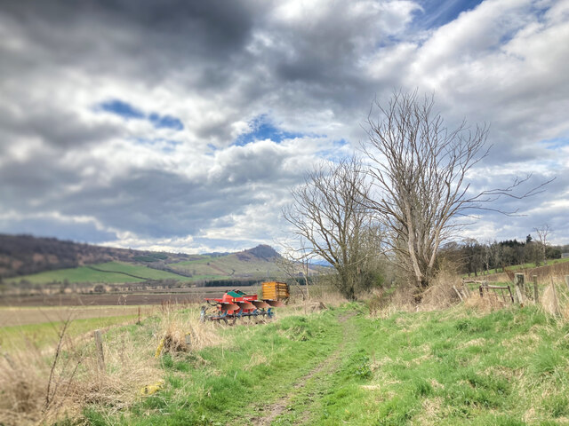
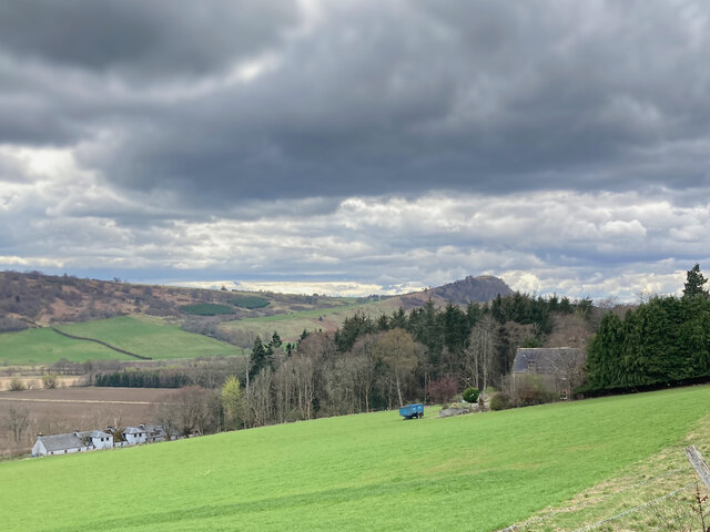
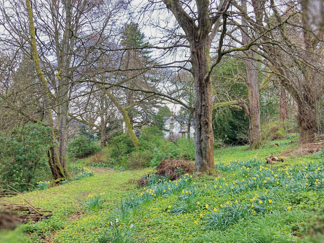
Fodderty is a small rural village located in the county of Ross-shire, in the Highlands of Scotland. Situated approximately 3 miles west of the town of Dingwall, Fodderty is nestled in a picturesque landscape surrounded by rolling hills and stunning natural beauty.

The village is known for its tranquil and peaceful atmosphere, making it an ideal place for those seeking a calm and idyllic setting. Fodderty offers a close-knit community feel, with friendly locals who take pride in their village.

One of the notable landmarks in Fodderty is the Fodderty Cemetery, which dates back several centuries and serves as a historical reminder of the village's past. The cemetery is a place of interest for those interested in genealogy and local history.

Fodderty is also home to a small primary school, providing education for the local children. Additionally, the village is well-connected to the nearby town of Dingwall, offering access to a range of amenities including shops, supermarkets, and healthcare facilities.

For nature enthusiasts, Fodderty offers ample opportunities for outdoor activities such as walking, hiking, and cycling. The surrounding countryside is dotted with scenic trails and paths, providing breathtaking views of the Scottish Highlands.

Overall, Fodderty presents a charming and peaceful retreat for those looking to escape the hustle and bustle of city life and immerse themselves in the beauty of rural Scotland.

If you have any feedback on the listing, please let us know in the comments section below.

Fodderty Images

Images are sourced within 2km of 57.600593/-4.489452 or Grid Reference NH5159. Thanks to Geograph Open Source API. All images are credited.

New House (or perhaps Newhouse), Heights of Keppoch The OS has two forms of the name, depending on the scale of the map.
New House (or perhaps Newhouse), Heights of Keppoch
The OS has two forms of the name, depending on the scale of the map.
View from the Heights
Sunset at the Neil M. Gunn memorial A memorial to the author Neil Miller Gunn.
Looking down towards Dingwall and the Cromarty Firth, with the Black Isle beyond. The setting sun is casting a yellow tint.
Sunset at the Neil M. Gunn memorial
A memorial to the author Neil Miller Gunn. Looking down towards Dingwall and the Cromarty Firth, with the Black Isle beyond. The setting sun is casting a yellow tint.
New house near Easter Blanaird
Achterneed Village Hall Not the smartest of halls these days, but I have had some great ceilidhs there.
Achterneed Village Hall
Not the smartest of halls these days, but I have had some great ceilidhs there.
Neil M Gunn Memorial in the Heights of Docharty A Scottish novelist most famous for the story "The Silver Darlings" has a memorial in his honour at a viewpoint overlooking Dingwall and the Cromarty Firth.  This view of the Monument that takes the form of a rock boulder is towards Knock Farrel and the Catsback Ridge on the other side of Strath Peffer. There is a circular walk to the Memorial that traverses the edge of a large pond.
Neil M Gunn Memorial in the Heights of Docharty
A Scottish novelist most famous for the story "The Silver Darlings" has a memorial in his honour at a viewpoint overlooking Dingwall and the Cromarty Firth. This view of the Monument that takes the form of a rock boulder is towards Knock Farrel and the Catsback Ridge on the other side of Strath Peffer. There is a circular walk to the Memorial that traverses the edge of a large pond.
Part of the Neil M Gunn Monument in the Heights of Docharty There are a number of vertical slabs surrounding the rock boulder that forms the central feature of the monument.  There is a pair of slabs with faces of a young man and woman.
Part of the Neil M Gunn Monument in the Heights of Docharty
There are a number of vertical slabs surrounding the rock boulder that forms the central feature of the monument. There is a pair of slabs with faces of a young man and woman.
Plate at the Memorial Viewpoint to Neil M Gunn This plate is located in the car park before the short walk to the Memorial to Neil M Gunn - author of Highland River and other books.
Plate at the Memorial Viewpoint to Neil M Gunn
This plate is located in the car park before the short walk to the Memorial to Neil M Gunn - author of Highland River and other books.
Road at Heights of Inchvannie Looking north-eastward.
Road at Heights of Inchvannie
Looking north-eastward.
Recently made track to Corrieben
Path from Fodderty to Lower Dochcarty Looking back towards Foddarty with Knock Farril on the skyline.
Path from Fodderty to Lower Dochcarty
Looking back towards Foddarty with Knock Farril on the skyline.
Outlook to Dingwall from Lower Dochcarty Dingwall lies at the mouth of Strath Peffer.
Outlook to Dingwall from Lower Dochcarty
Dingwall lies at the mouth of Strath Peffer.
Track between Lower Dochcarty and Brae This track can be used as part of a circular walk from Dingwall to Knock Farril.
Track between Lower Dochcarty and Brae
This track can be used as part of a circular walk from Dingwall to Knock Farril.
Fields by Brae Farm Walking a good farm track giving access to a number of the farm's fields.
Fields by Brae Farm
Walking a good farm track giving access to a number of the farm's fields.
Woodland at Brae, Strath Peffer A small patch of woodland that has many fallen trees and the mapped track through it has little evidence on the ground.
Woodland at Brae, Strath Peffer
A small patch of woodland that has many fallen trees and the mapped track through it has little evidence on the ground.
Track from Heights of Keppoch into the forest This is a lovely track with some fine mature native trees bordering it.
Track from Heights of Keppoch into the forest
This is a lovely track with some fine mature native trees bordering it.
Road to New House at the Heights of Keppoch A view from close to where I parked a car for a day's walk in the forest. Knock Farril is the hill the other side of the valley.  The long thin field on the left has chicken pens.
Road to New House at the Heights of Keppoch
A view from close to where I parked a car for a day's walk in the forest. Knock Farril is the hill the other side of the valley. The long thin field on the left has chicken pens.
Memorial car park
Memorial car park
Show me another place!

Fodderty is located at Grid Ref: NH5159 (Lat: 57.600593, Lng: -4.489452)

Unitary Authority: Highland

Police Authority: Highlands and Islands

What 3 Words

///beauty.automatic.bottled. Near Strathpeffer, Highland

Nearby Locations

Strath Peffer Fodderty

Related Wikis

Knockfarrel

Knockfarrel (Scottish Gaelic: Cnoc Fearghalaigh) is a village, 1 mile east of Strathpeffer, in Dingwall in Ross-shire, Scottish Highlands and is in the...

Bottacks

Bottacks (Na Botagan in Scottish Gaelic) is a small scattered township, located 1.5 miles north north east of Strathpeffer, in Ross-shire, Scottish Highlands...

Fodderty

Fodderty (Scottish Gaelic: Fodhraitidh) is a small hamlet, close to Dingwall, Ross-shire in the Scottish Highlands and is in the Scottish council area...

Achterneed railway station

Achterneed railway station was a railway station serving Strathpeffer and located on the Kyle of Lochalsh Line, in Wester Ross, Scotland. == History... ==

Nearby Amenities

Located within 500m of 57.600593,-4.489452
Barrier: stile
Bicycle: no
Foot: yes
Lat/Long: 57.5962868/-4.4871958
Fodderty
Place: hamlet
Lat/Long: 57.6005336/-4.4912064
Material: wood
Power: pole
Lat/Long: 57.605068/-4.4897637
Material: wood
Power: pole
Lat/Long: 57.6042323/-4.4901306
Power: pole
Lat/Long: 57.6035256/-4.4908002
Power: pole
Lat/Long: 57.6032016/-4.490157
Power: pole
Lat/Long: 57.6026461/-4.4891119
Power: pole
Lat/Long: 57.6020057/-4.488489
Power: pole
Lat/Long: 57.6015045/-4.4886188
Power: pole
Lat/Long: 57.6009793/-4.4887386
Power: pole
Lat/Long: 57.6005966/-4.488838
Power: pole
Lat/Long: 57.6000312/-4.48898
Power: pole
Lat/Long: 57.6025859/-4.496943
Power: pole
Lat/Long: 57.602653/-4.4955236
Power: pole
Lat/Long: 57.6027566/-4.4935069
Power: pole
Lat/Long: 57.6028572/-4.4914162
The data included in this document is from www.openstreetmap.org. The data is made available under ODbL.

Have you been to Fodderty?

Leave your review of Fodderty below (or comments, questions and feedback).