Chestnut Plantation

Wood, Forest in Essex Braintree

England

Chestnut Plantation

Passing The Lion, Earls Colne – 1971 The Lion dates back to as early as the 14th century.

Hedingham and District bus L42 on a works service. This was a family business set up in 1960 in Sible Hedingham which survived the upheavals of the 1985 Transport Act to continue to provide local bus services in the area, finally selling to the Go-Ahead group in 2012. The Hedingham fleetname continues to be used.

Bus L42 is a Bristol LS with ECW body, originally new to Eastern National in 1955.

This is one of a series of views featuring buses in the 60s, 70s, and 80s. <a title="https://www.geograph.org.uk/search.php?i=137652761" href="https://www.geograph.org.uk/search.php?i=137652761">Link</a>
Passing The Lion, Earls Colne – 1971 Credit: Alan Murray-Rust

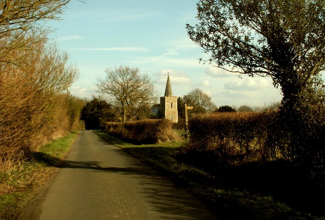
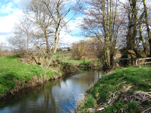
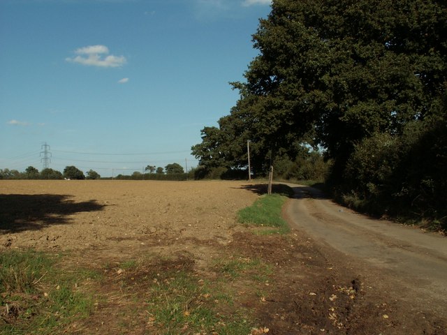
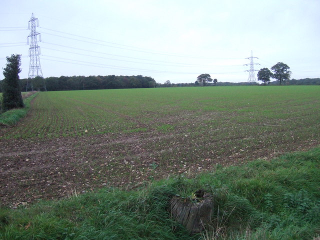
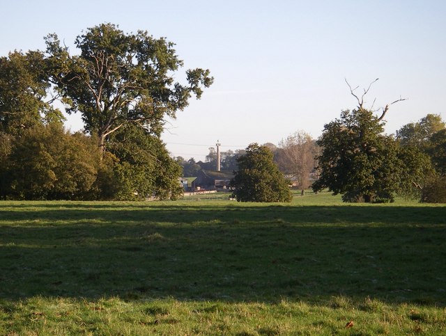
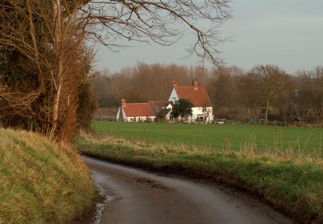
Chestnut Plantation is a beautiful woodland area located in Essex, England. Spanning across a vast expanse, it is known for its dense chestnut tree population, which gives the plantation its name. The woodland is situated in the heart of Essex, making it easily accessible to locals and visitors alike.

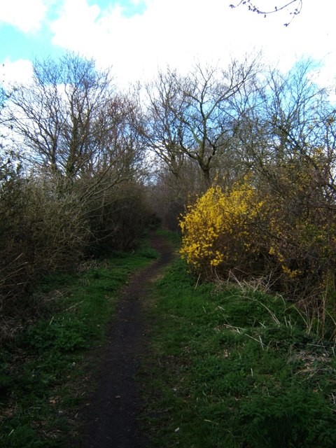
The plantation is a haven for nature enthusiasts, offering a tranquil and serene environment. The towering chestnut trees provide a shaded canopy, creating a cool and refreshing atmosphere, especially during the summer months. The forest floor is covered in a lush carpet of moss and ferns, adding to the enchanting ambiance.

Chestnut Plantation is home to a diverse range of flora and fauna. Besides the dominant chestnut trees, there are various other tree species like oak, beech, and birch. This variety of trees attracts an array of bird species, making it a popular spot for birdwatching. In addition to the avian residents, the woodland is also inhabited by small mammals such as squirrels, rabbits, and foxes.

For those interested in outdoor activities, Chestnut Plantation offers several walking trails, allowing visitors to explore the woodland at their own pace. These paths wind through the plantation, providing opportunities to admire the natural beauty and experience the tranquility of the surroundings. The plantation is also equipped with picnic areas, making it an ideal spot for families and friends to enjoy a day out in nature.

Overall, Chestnut Plantation is a picturesque woodland in Essex, providing a peaceful retreat from the hustle and bustle of everyday life. With its diverse flora and fauna, it offers a wonderful opportunity to connect with nature and enjoy the beauty of the English countryside.

If you have any feedback on the listing, please let us know in the comments section below.

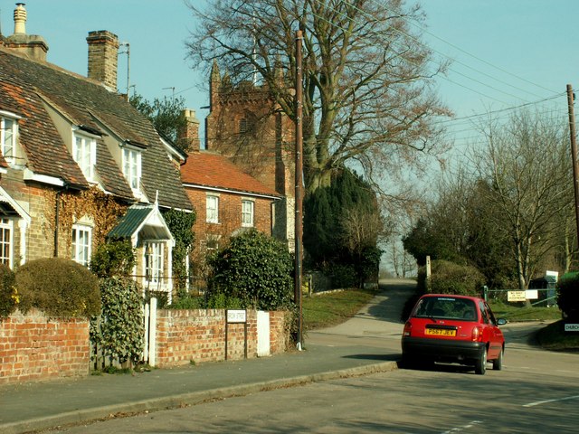
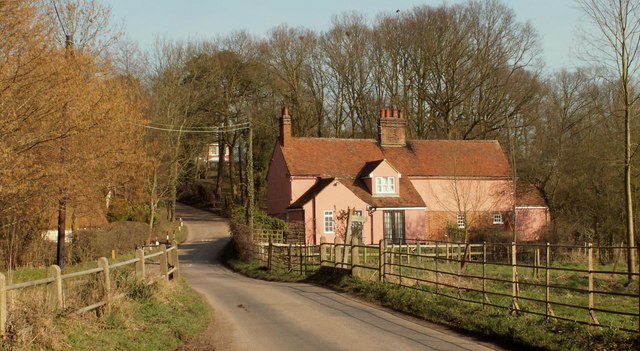
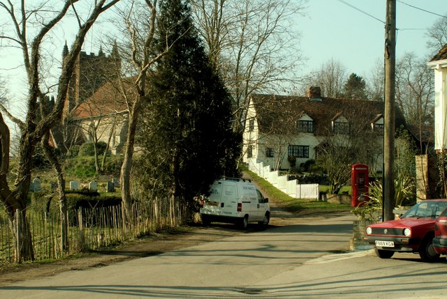
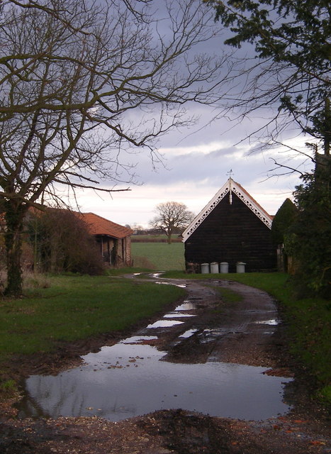
Chestnut Plantation Images

Images are sourced within 2km of 51.942868/0.70887375 or Grid Reference TL8630. Thanks to Geograph Open Source API. All images are credited.

Passing The Lion, Earls Colne – 1971 The Lion dates back to as early as the 14th century.

Hedingham and District bus L42 on a works service. This was a family business set up in 1960 in Sible Hedingham which survived the upheavals of the 1985 Transport Act to continue to provide local bus services in the area, finally selling to the Go-Ahead group in 2012. The Hedingham fleetname continues to be used.

Bus L42 is a Bristol LS with ECW body, originally new to Eastern National in 1955.

This is one of a series of views featuring buses in the 60s, 70s, and 80s. <a title="https://www.geograph.org.uk/search.php?i=137652761" href="https://www.geograph.org.uk/search.php?i=137652761">Link</a>
Passing The Lion, Earls Colne – 1971
The Lion dates back to as early as the 14th century. Hedingham and District bus L42 on a works service. This was a family business set up in 1960 in Sible Hedingham which survived the upheavals of the 1985 Transport Act to continue to provide local bus services in the area, finally selling to the Go-Ahead group in 2012. The Hedingham fleetname continues to be used. Bus L42 is a Bristol LS with ECW body, originally new to Eastern National in 1955. This is one of a series of views featuring buses in the 60s, 70s, and 80s. Link
Boley Road, White Colne, Essex St. Andrew's church can be seen in the distance.
Boley Road, White Colne, Essex
St. Andrew's church can be seen in the distance.
Earls Colne, Essex This part of the town shows St. Andrews church at the eastern end of the High Street. Earls Colne gets its name from the de Vere family, the Earls of Oxford, who owned land in the Colne valley and some areas of Suffolk.
Earls Colne, Essex
This part of the town shows St. Andrews church at the eastern end of the High Street. Earls Colne gets its name from the de Vere family, the Earls of Oxford, who owned land in the Colne valley and some areas of Suffolk.
The Lion, public house, Earls Colne, Essex This 14th century Tudor Style inn stands at the top of the High Street on the right hand side as you head towards Halstead. It hasn't always been an inn. At one time the public bar, which is at the front, was a stilted building and used to house the indoor market.
The Lion, public house, Earls Colne, Essex
This 14th century Tudor Style inn stands at the top of the High Street on the right hand side as you head towards Halstead. It hasn't always been an inn. At one time the public bar, which is at the front, was a stilted building and used to house the indoor market.
Colne Engaine village, Essex This village stands on high ground in the Colne Valley and there are nice views from the church.
Colne Engaine village, Essex
This village stands on high ground in the Colne Valley and there are nice views from the church.
Country lane, east of Colne Engaine, Essex The road from Colne Engaine to Countess Cross.
Country lane, east of Colne Engaine, Essex
The road from Colne Engaine to Countess Cross.
Colne Engaine village, Essex Village scene showing St.Andrew's church hidden behind the trees.
Colne Engaine village, Essex
Village scene showing St.Andrew's church hidden behind the trees.
Thin Reserve, White Colne This is a view along the old Colne Valley railway line looking westbound towards Earls Colne. The railway embankment ran from White Colne to where the line used to cross the river. At the time the photo was taken this was  a nature reserve managed by Essex Wildlife Trust <span class="nowrap"><a title="http://www.essexwt.org.uk/" rel="nofollow ugc noopener" href="http://www.essexwt.org.uk/">Link</a><img style="margin-left:2px;" alt="External link" title="External link - shift click to open in new window" src="https://s1.geograph.org.uk/img/external.png" width="10" height="10"/></span> however management has now passed back to the local authority. Continue on a virtual tour of Wildlife Trust Reserves in Essex by visiting a former reserve no longer in their care <a href="https://www.geograph.org.uk/photo/1059420">TQ8598 : Hall Wood</a>
Thin Reserve, White Colne
This is a view along the old Colne Valley railway line looking westbound towards Earls Colne. The railway embankment ran from White Colne to where the line used to cross the river. At the time the photo was taken this was a nature reserve managed by Essex Wildlife Trust LinkExternal link however management has now passed back to the local authority. Continue on a virtual tour of Wildlife Trust Reserves in Essex by visiting a former reserve no longer in their care TQ8598 : Hall Wood
Bridge Out! This picture shows what is left of a bridge on the Colne Valley railway. The railway embankment to the right as far as White Colne was a nature reserve managed by Essex wildlife Trust <span class="nowrap"><a title="http://www.essexwt.org.uk/" rel="nofollow ugc noopener" href="http://www.essexwt.org.uk/">Link</a><img style="margin-left:2px;" alt="External link" title="External link - shift click to open in new window" src="https://s1.geograph.org.uk/img/external.png" width="10" height="10"/></span> however management has now passed back to the local authority. The photo was taken looking upstream.
Bridge Out!
This picture shows what is left of a bridge on the Colne Valley railway. The railway embankment to the right as far as White Colne was a nature reserve managed by Essex wildlife Trust LinkExternal link however management has now passed back to the local authority. The photo was taken looking upstream.
Field near Countess Cross, Essex
Bures Field, Bramble Farm Straw bales after harvest.
Bures Field, Bramble Farm
Straw bales after harvest.
Overshot mill - Colne Engaine A beautifully restored watermill in a rural location
Overshot mill - Colne Engaine
A beautifully restored watermill in a rural location
Pylons Near White Colne View across fields towards Colne Park near White Colne
Pylons Near White Colne
View across fields towards Colne Park near White Colne
Colne park monument
Colne park monument
Lych -gate st. Andrew's church, White Colne
Ford Mill in the Colne Valley, near Colne Engaine
St. Andrew's church, Earls Colne, Essex This church stands at the east end of the village High Street. Parts of the church date back to the 14th century, such as the beautiful tower, but the church is also a result of much Victorian rebuilding. The battlements, with flushwork decoration dated 1534, bear the de Vere arms. The de Veres were the Earls of Oxford, hence the village name, who lived at nearby Castle Hedingham and owned much of the surrounding land.
St. Andrew's church, Earls Colne, Essex
This church stands at the east end of the village High Street. Parts of the church date back to the 14th century, such as the beautiful tower, but the church is also a result of much Victorian rebuilding. The battlements, with flushwork decoration dated 1534, bear the de Vere arms. The de Veres were the Earls of Oxford, hence the village name, who lived at nearby Castle Hedingham and owned much of the surrounding land.
"Barge boarding" Barge boarding on farm buildings at Countess Cross
"Barge boarding"
Barge boarding on farm buildings at Countess Cross
Show me another place!

Chestnut Plantation is located at Grid Ref: TL8630 (Lat: 51.942868, Lng: 0.70887375)

Administrative County: Essex

District: Braintree

Police Authority: Essex

What 3 Words

///loudness.inner.charmingly. Near Earls Colne, Essex

Related Wikis

Countess Cross

Countess Cross is a hamlet in the civil parish of Colne Engaine, near the town of Halstead in the Braintree district, in the English county of Essex....

Colne Valley, Essex

Colne Valley is a 5.1 hectare Local Nature Reserve north and east of Earls Colne in Essex. It is owned and managed by Colchester Borough Council.The site...

Colne Engaine

Colne Engaine is a village and a civil parish in Essex, England, situated just north of the River Colne and of the larger village of Earls Colne, approximately...

White Colne

White Colne is a village and parish in Essex, England, on the north side of the River Colne, opposite Earls Colne, and on the Colchester road, 4 miles...

Nearby Amenities

Located within 500m of 51.942868,0.70887375
Fixme: incomplete
Lat/Long: 51.9440421/0.7135507
The data included in this document is from www.openstreetmap.org. The data is made available under ODbL.

Have you been to Chestnut Plantation?

Leave your review of Chestnut Plantation below (or comments, questions and feedback).