Flitton

Settlement in Bedfordshire

England

Flitton

The A507, Ampthill Looking towards Maulden Road
The A507, Ampthill Credit: David Howard

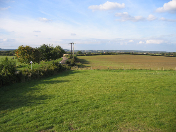
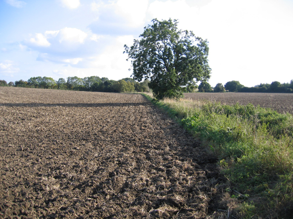
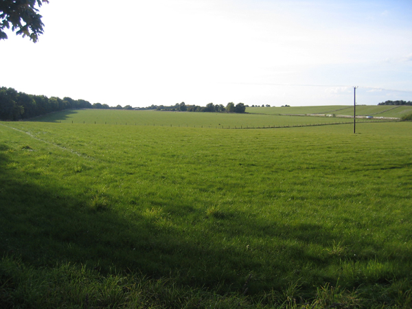
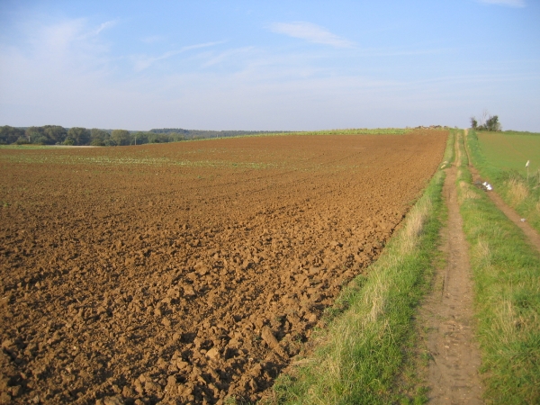
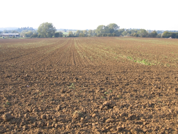
Flitton is a small village located in the county of Bedfordshire, England. It is situated approximately 6 miles south-west of the town of Bedford and lies within the Central Bedfordshire district. The village is nestled in a picturesque rural setting, surrounded by rolling countryside and farmland.

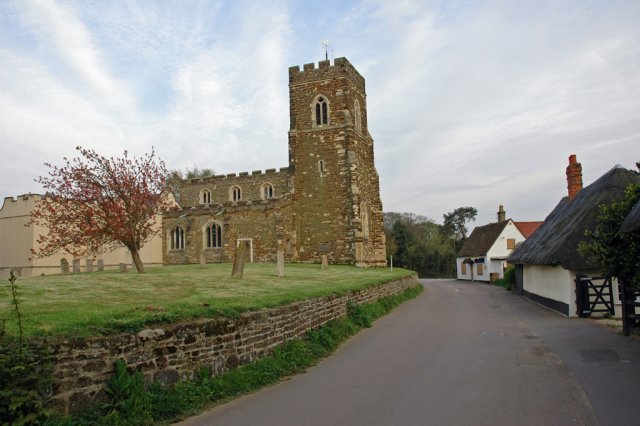
Flitton is home to a population of around 500 residents, giving it a close-knit community feel. The village itself is characterized by its charming traditional cottages and historic buildings, which add to its overall appeal. The St. John the Baptist Church, a 12th-century Norman church, stands as a prominent and historic landmark in the village.

Amenities in Flitton include a village hall, which serves as a hub for community events and gatherings. There is also a local pub, The White Hart, which provides a welcoming atmosphere for both residents and visitors alike.

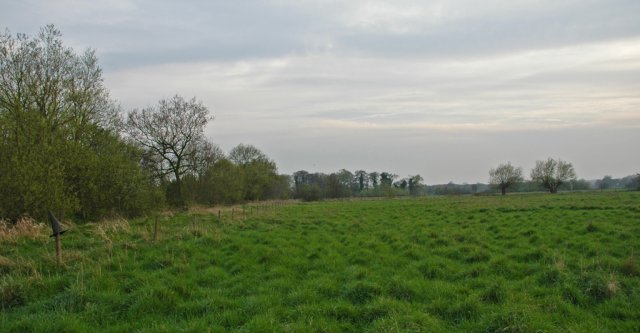
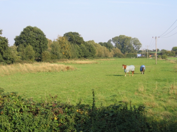
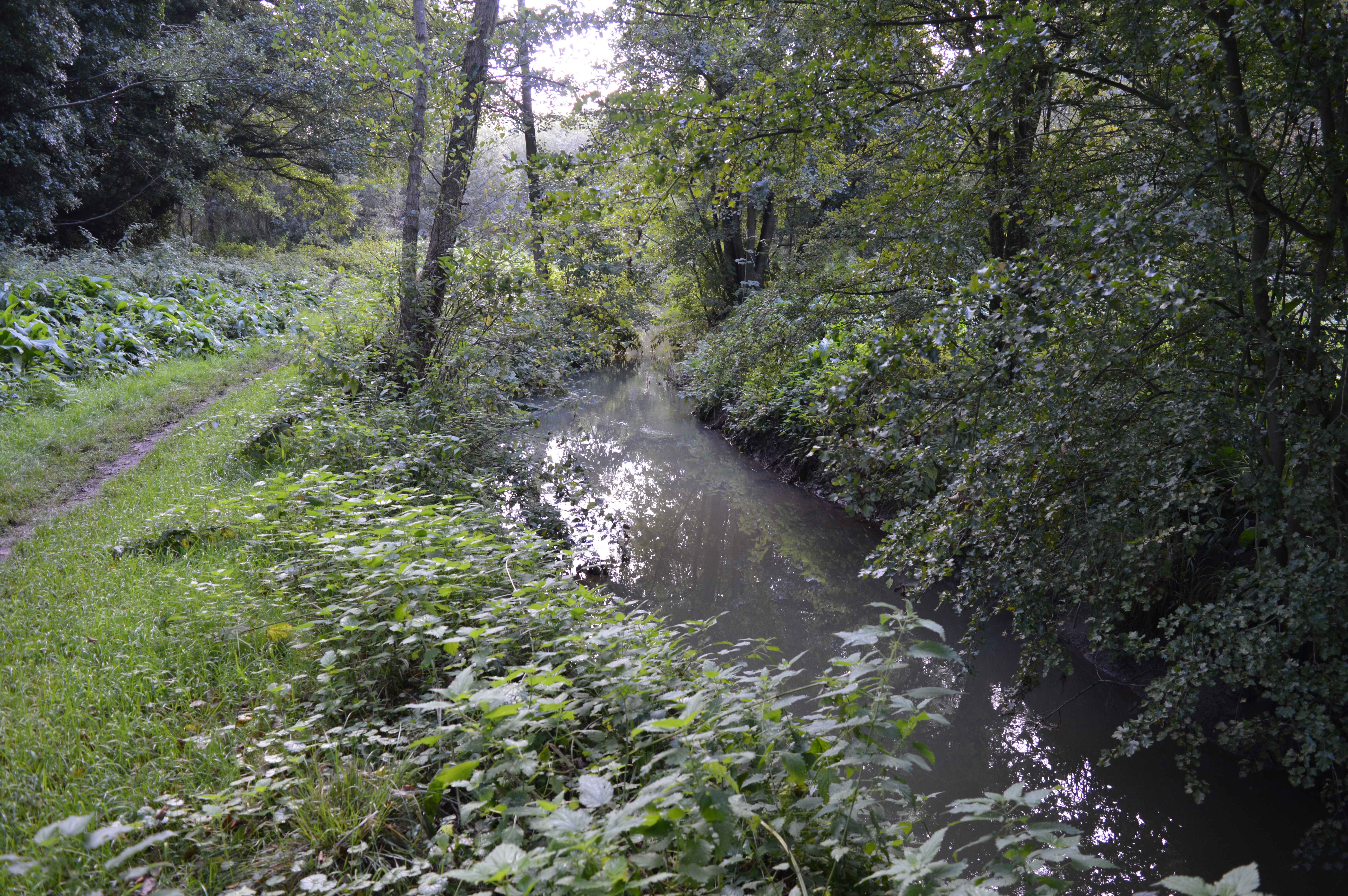
The village benefits from its proximity to the surrounding countryside, offering opportunities for outdoor activities such as walking, cycling, and horse riding. The nearby Flitton Moor nature reserve provides a haven for wildlife enthusiasts, with various bird species and other wildlife to be observed.

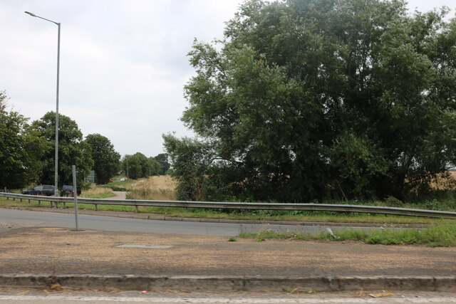
Flitton's location provides convenient access to larger towns and cities in the region, with Bedford and Luton both within easy reach. The village is well-connected by road, with the A6 passing nearby, offering links to the wider road network.

Overall, Flitton offers a peaceful and idyllic setting for those seeking a rural retreat while still being within easy reach of essential amenities and nearby urban centers.

If you have any feedback on the listing, please let us know in the comments section below.

Flitton Images

Images are sourced within 2km of 52.009748/-0.457706 or Grid Reference TL0535. Thanks to Geograph Open Source API. All images are credited.

The A507, Ampthill Looking towards Maulden Road
The A507, Ampthill
Looking towards Maulden Road
The De Grey Mausoleum, Flitton Mausoleum of the De Grey family, Flitton Church. Memorial to the 6th Earl of Kent.
The De Grey Mausoleum, Flitton
Mausoleum of the De Grey family, Flitton Church. Memorial to the 6th Earl of Kent.
The Compasses, Greenfield I assume this was a 'pub' but it is now a 'craft bar & restaurant.
The Compasses, Greenfield
I assume this was a 'pub' but it is now a 'craft bar & restaurant.
Platinum Jubilee bunting on Barton Road, Pulloxhill
The Cross Keys public house, Pulloxhill
Flitton Church and surrounds Flitton church has an attached mausoleum (visible on the left) for the de Grey family of Wrest Park, Silsoe.
Flitton Church and surrounds
Flitton church has an attached mausoleum (visible on the left) for the de Grey family of Wrest Park, Silsoe.
Flitton Nature Reserve Part of Flitton Nature Reserve, bordered to the right by the A507.
Flitton Nature Reserve
Part of Flitton Nature Reserve, bordered to the right by the A507.
Parish church, Pulloxhill, Beds Dedicated to St James the Apostle.
Parish church, Pulloxhill, Beds
Dedicated to St James the Apostle.
Rushy Meade ancient meadow, Pulloxhill, Beds View ESE across the square, towards the chalk escarpment N of Barton-le-Clay.
Rushy Meade ancient meadow, Pulloxhill, Beds
View ESE across the square, towards the chalk escarpment N of Barton-le-Clay.
Flitton Road, Pulloxhill, Beds View N towards Flitton.
Flitton Road, Pulloxhill, Beds
View N towards Flitton.
Farmland, Flitton, Beds View SE from Silsoe Road.
Farmland, Flitton, Beds
View SE from Silsoe Road.
Farmland, Silsoe, Beds View W from the Ampthill Road-Silsoe Road junction, towards Wardhedges.
Farmland, Silsoe, Beds
View W from the Ampthill Road-Silsoe Road junction, towards Wardhedges.
River Flit meadows, Flitton, Beds – the river flows through the trees on the left.
River Flit meadows, Flitton, Beds
– the river flows through the trees on the left.
Farmland NW of Silsoe, Beds View NE from near the Ampthill Road.
Farmland NW of Silsoe, Beds
View NE from near the Ampthill Road.
Farmland NW of Silsoe, Beds View NW from near the Ampthill Road.
Farmland NW of Silsoe, Beds
View NW from near the Ampthill Road.
Farmland SW of Pulloxhill, Beds View NW towards the Flit valley.
Farmland SW of Pulloxhill, Beds
View NW towards the Flit valley.
View N from Greenfield Road, Pulloxhill, Beds
Greenfield Road, Flitwick, Beds View NW towards Flitwick from Westoning Road, Greenfield.
Greenfield Road, Flitwick, Beds
View NW towards Flitwick from Westoning Road, Greenfield.
Show me another place!

Flitton is located at Grid Ref: TL0535 (Lat: 52.009748, Lng: -0.457706)

Unitary Authority: Central Bedfordshire

Police Authority: Bedfordshire

What 3 Words

///edits.dislikes.placidly. Near Greenfield, Bedfordshire

Nearby Locations

Flitton Moor Flitton

Related Wikis

Flitton

Flitton (Flichtam, Fllite, Flute) is a village and former civil parish, now in the parish of Flitton and Greenfield, in the Central Bedfordshire district...
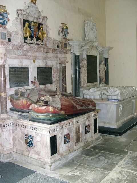
De Grey Mausoleum

The de Grey Mausoleum in Flitton, Bedfordshire, England, is one of the largest sepulchral chapels in the country. The mausoleum contains over twenty monuments...
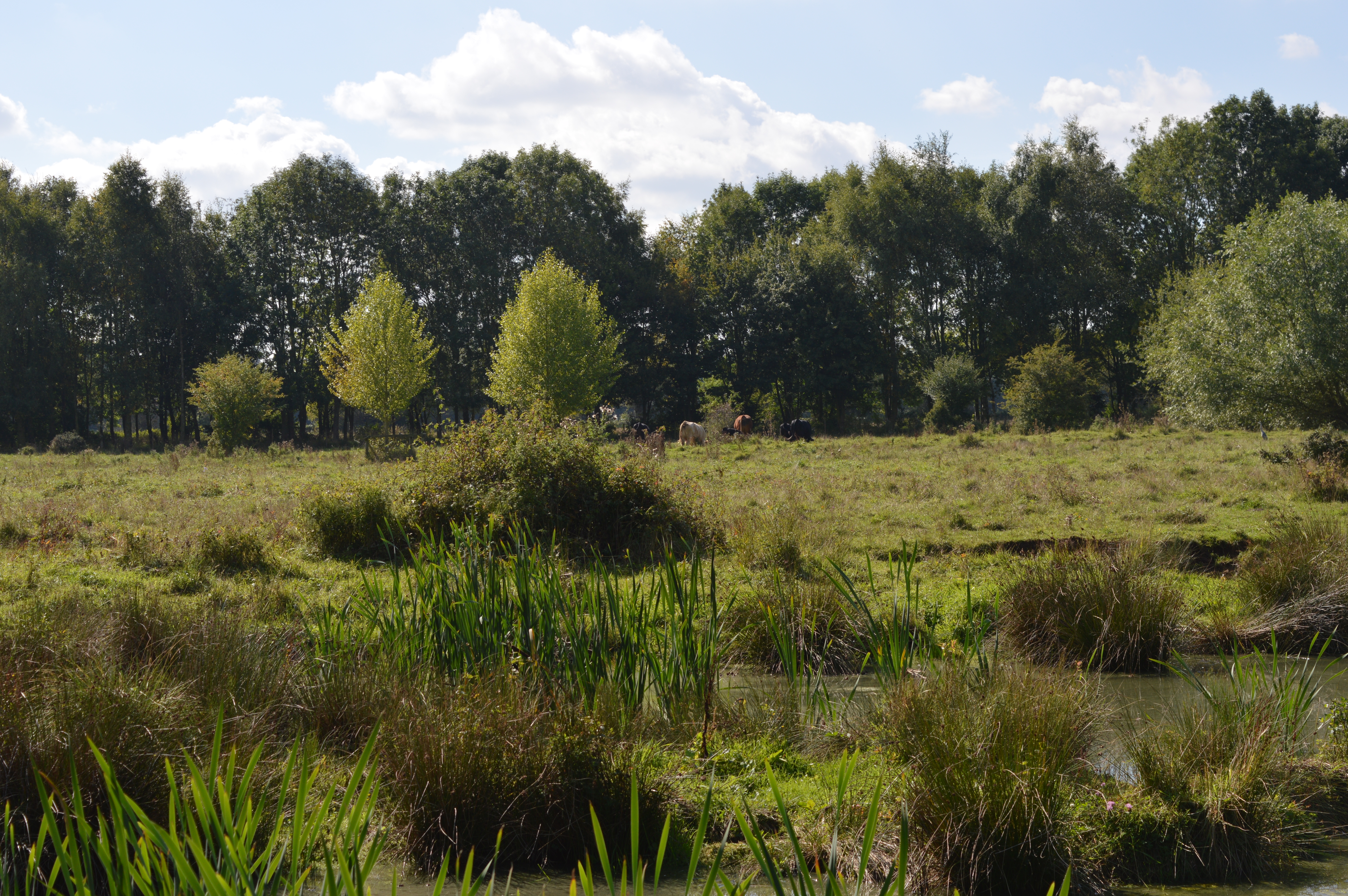
Flitton Moor

Flitton Moor is a 6.9 hectare Local Nature Reserve and County Wildlife Site in Flitton in Bedfordshire. It is owned by Central Bedfordshire Council and...

Greenfield, Bedfordshire

Greenfield is a small village about 2 km (1.2 mi) from the town of Flitwick in Bedfordshire, England. It lies across Flitwick Moor from the larger settlement...

Ruxox Cell

Ruxox Cell (sometimes spelled Rokesac) was a moated chapel, or monastic cell, established in the twelfth century in the parish of Flitwick in Bedfordshire...

Flitwick Moor

Flitwick Moor is a 59.8-hectare (148-acre) biological Site of Special Scientific Interest between Flitwick and Greenfield in Bedfordshire. It was notified...

Flitton and Greenfield

Flitton and Greenfield is a civil parish in Bedfordshire, England. It consists of Flitton and Greenfield. Flitton and Greenfield are two small hamlets...

Pulloxhill Grange

Pulloxhill Grange was a priory in Bedfordshire, England. It is a Grade II listed building.In 1535, Dunstable Priory received from Woburn Abbey 5s. for...

Nearby Amenities

Located within 500m of 52.009748,-0.457706
Flitton
Place: village
Wikidata: Q1521049
Lat/Long: 52.0110651/-0.4568284
Pub
The White Hart
Addr City: Flitton
Addr Country: GB
Addr Postcode: MK45 5EJ
Addr Street: Brook Lane
Fhrs Authority: Central Bedfordshire
Fhrs Id: 450350
Fhrs Local Authority Id: 1827
Lat/Long: 52.0108024/-0.4581367
Traffic Calming: table
Lat/Long: 52.0064513/-0.4604085
Turning Circle
Turning Circle: square
Lat/Long: 52.0109709/-0.451771
Turning Circle
Lat/Long: 52.0093741/-0.452032
Addr Housenumber: 102
Addr Street: Green Field Road
Lat/Long: 52.0063872/-0.459902
Addr Housenumber: 94
Addr Street: Green Field Road
Lat/Long: 52.0067522/-0.4592019
Addr Housenumber: 98
Addr Street: Green Field Road
Lat/Long: 52.0065523/-0.4595882
Addr Housenumber: 96
Addr Street: Green Field Road
Lat/Long: 52.0066695/-0.4594299
Addr Housenumber: 100
Addr Street: Green Field Road
Lat/Long: 52.0064598/-0.4597464
Post Box
Brand: Royal Mail
Brand Wikidata: Q638098
Brand Wikipedia: en:Royal Mail
Collection Times: Mo-Fr 16:00; Sa 10:30
Operator: Royal Mail
Operator Wikidata: Q638098
Post Box Type: lamp
Ref: MK45 322
Royal Cypher: EIIR
Royal Cypher Wikidata: Q33102113
Source: survey
Survey Date: 2016-12-23
Lat/Long: 52.0072049/-0.4589321
Post Box
Brand: Royal Mail
Brand Wikidata: Q638098
Brand Wikipedia: en:Royal Mail
Collection Times: Mo-Fr 09:00; Sa 07:00
Operator: Royal Mail
Operator Wikidata: Q638098
Post Box Type: lamp
Ref: MK45 218D
Royal Cypher: EIIR
Royal Cypher Wikidata: Q33102113
Source: survey
Survey Date: 2016-12-23
Lat/Long: 52.0105336/-0.4579162
Barrier: stile
Foot: designated
Lat/Long: 52.0064615/-0.4532366
Public Bookcase
Booth: K6
Disused Amenity: telephone
Man Made: telephone_box
Public Bookcase Type: phone_box
Lat/Long: 52.01058/-0.4579291
The De Grey Mausoleum
Historic: memorial
Wikidata: Q5244391
Wikipedia: en:De Grey Mausoleum
Lat/Long: 52.0110618/-0.4577283
Turning Circle
Turning Circle: knuckle
Lat/Long: 52.0064524/-0.4573576
Direction: 130
Generator Method: photovoltaic
Generator Output Electricity: yes
Generator Solar Modules: 16
Generator Source: solar
Generator Type: solar_photovoltaic_panel
Location: roof
Power: generator
Lat/Long: 52.0081507/-0.4581103
Parking
Lat/Long: 52.0105875/-0.4583678
Direction: 250
Generator Method: photovoltaic
Generator Output Electricity: yes
Generator Solar Modules: 15
Generator Source: solar
Generator Type: solar_photovoltaic_panel
Location: roof
Power: generator
Lat/Long: 52.0109859/-0.4553666
Direction: 200
Generator Method: photovoltaic
Generator Output Electricity: yes
Generator Solar Modules: 10
Generator Source: solar
Generator Type: solar_photovoltaic_panel
Location: roof
Power: generator
Lat/Long: 52.0115484/-0.4519765
Traffic Calming: table
Lat/Long: 52.0116821/-0.4521982
Turning Circle
Turning Circle: knuckle
Lat/Long: 52.0106263/-0.452102
Parking Space
Capacity: 6
Lat/Long: 52.0107617/-0.4521878
Defibrillator
Defibrillator Location: attached to gatepost between old red phone box and church hall in Flitton
Emergency: defibrillator
Indoor: no
Lat/Long: 52.0105932/-0.4579568
Advertising: board
Lat/Long: 52.010561/-0.4579173
Bench
Lat/Long: 52.010514/-0.4579159
Bicycle Parking
Bicycle Parking: stands
Capacity: 6
Covered: no
Lat/Long: 52.0104896/-0.4579166
Inscription: Flitton
Man Made: village_sign
Lat/Long: 52.0105474/-0.4579166
The data included in this document is from www.openstreetmap.org. The data is made available under ODbL.

Have you been to Flitton?

Leave your review of Flitton below (or comments, questions and feedback).