Warren Strip

Wood, Forest in Norfolk Breckland

England

Warren Strip

Sluice at Mill Carr, part of the River Wissey The River Wissey  rises at Shipdham, and flows for nearly 31 miles (50 km) to join the River Great Ouse at Fordham. Its course takes it under the road at Mundford, through the weir and on to Wittington and Northwold, over the aqueduct before reaching Stoke Ferry. From there through Hilgay and on to Denver Sluice where it joins the relief channel before flowing into the Great Ouse.
Sluice at Mill Carr, part of the River Wissey Credit: Adrian S Pye

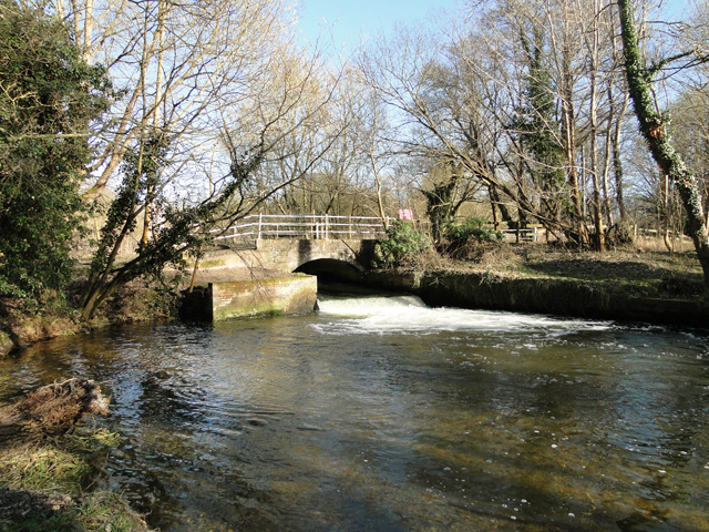
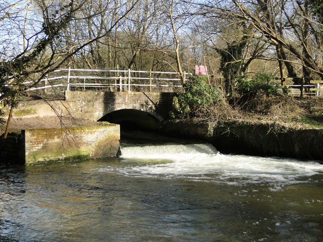
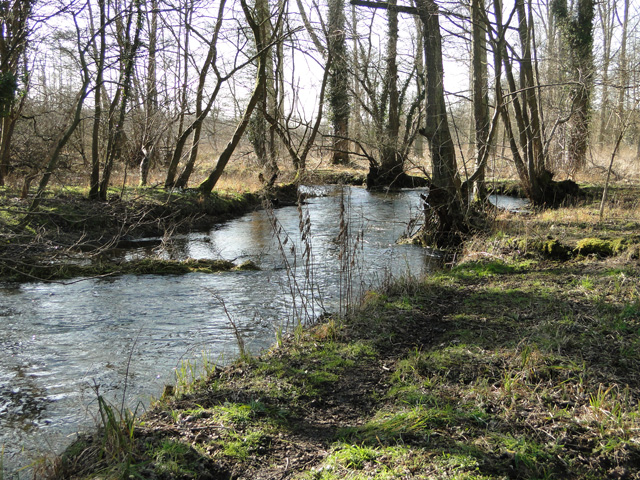
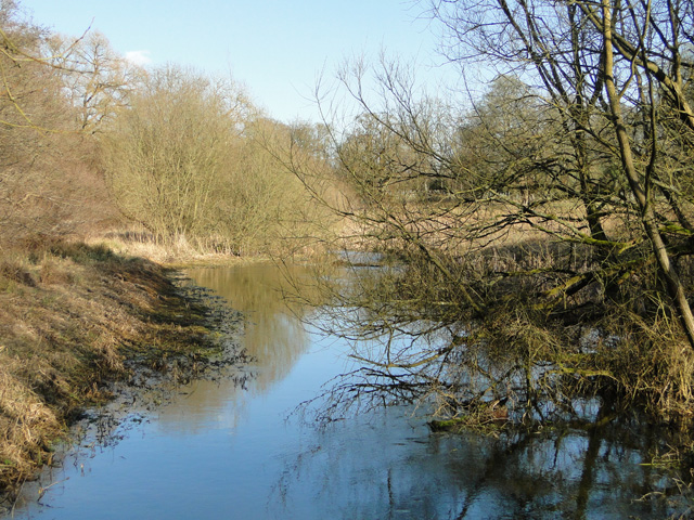
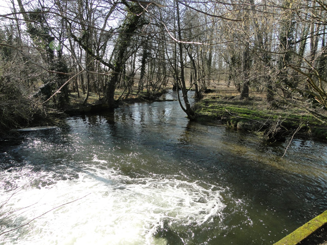
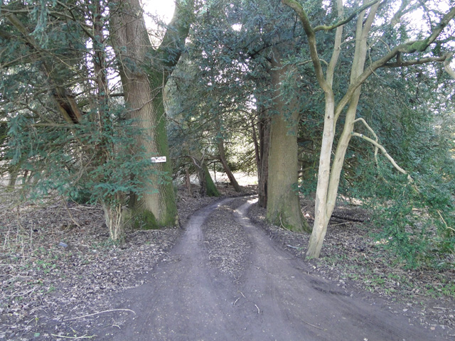
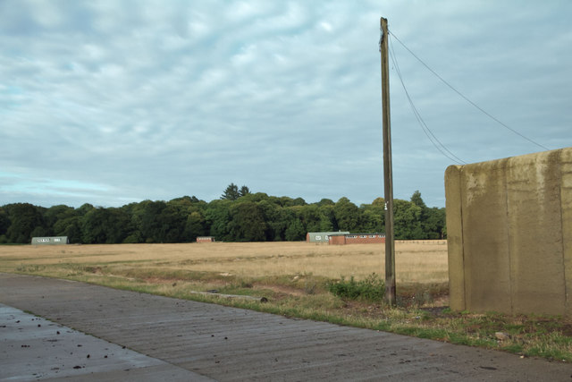
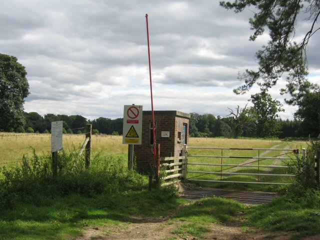
Warren Strip, located in Norfolk County, England, is a picturesque woodland area renowned for its natural beauty and diverse flora and fauna. Covering approximately 200 acres, this enchanting forest is a haven for nature enthusiasts and hikers alike.

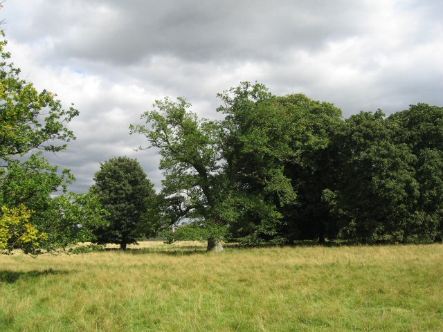
The forest is largely composed of a mix of deciduous and coniferous trees, creating a rich tapestry of colors throughout the seasons. Majestic oak, beech, and birch trees dominate the landscape, interspersed with the vibrant greens of pine and spruce trees. This combination provides a varied habitat for a wide range of wildlife, including deer, rabbits, squirrels, and a multitude of bird species.

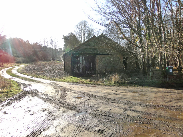
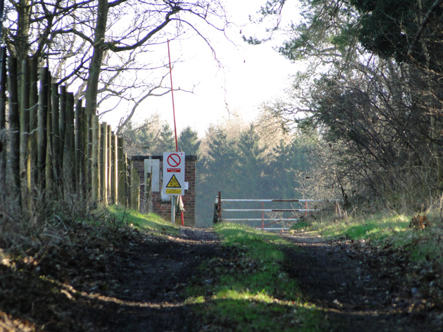
Visitors to Warren Strip can explore a network of well-maintained walking trails that wind through the forest, offering opportunities for peaceful strolls and invigorating hikes. These trails cater to all levels of fitness and offer breathtaking views of the surrounding countryside. Along the way, nature enthusiasts may encounter wildflowers, ferns, and mushrooms, adding to the area's natural charm.

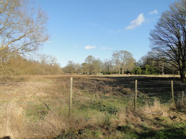
The forest is also home to several picnic areas, providing visitors with a chance to relax and enjoy the tranquil surroundings. Families often flock to Warren Strip, taking advantage of the ample space for outdoor activities such as ball games or kite flying.

Warren Strip is a haven for wildlife and a sanctuary for those seeking respite from the hustle and bustle of everyday life. Its idyllic setting and abundance of natural wonders make it a must-visit destination for nature lovers and those looking to reconnect with the great outdoors.

If you have any feedback on the listing, please let us know in the comments section below.
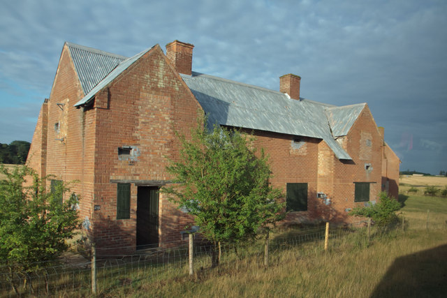
Warren Strip Images

Images are sourced within 2km of 52.525424/0.72489548 or Grid Reference TL8495. Thanks to Geograph Open Source API. All images are credited.

Sluice at Mill Carr, part of the River Wissey The River Wissey  rises at Shipdham, and flows for nearly 31 miles (50 km) to join the River Great Ouse at Fordham. Its course takes it under the road at Mundford, through the weir and on to Wittington and Northwold, over the aqueduct before reaching Stoke Ferry. From there through Hilgay and on to Denver Sluice where it joins the relief channel before flowing into the Great Ouse.
Sluice at Mill Carr, part of the River Wissey
The River Wissey rises at Shipdham, and flows for nearly 31 miles (50 km) to join the River Great Ouse at Fordham. Its course takes it under the road at Mundford, through the weir and on to Wittington and Northwold, over the aqueduct before reaching Stoke Ferry. From there through Hilgay and on to Denver Sluice where it joins the relief channel before flowing into the Great Ouse.
The River Wissey flowing towards Ickburgh Norfolk has nearly 40 rivers and becks as well as the Norfolk Broads. The primary rivers are the River Waveney which with the River Little Ouse create the boundary between Norfolk and Suffolk. The Yare rises south of Dereham and runs into Breydon Water and discharges into the North Sea at Great Yarmouth. The River Wensum is a tributary of the River Yare, despite being the larger of the two rivers. The River Bure rises near Melton Constable, flows as far as through Runham and Great Yarmouth where it meets Breydon Water and flows into the sea at Gorleston. The River Great Ouse only enters Norfolk at Brandon Creek, Norfolk.  The River Tud has its source just south of East Dereham and it flows in an easterly direction for 27 kilometres (17 mi) to its confluence with the Wensum below Hellesdon mill. The River Nar is a  tributary of the River Great Ouse. It rises at Mileham  in Norfolk and flows 15 miles west through Castle Acre and Narborough (the latter giving the Nar its name), joining the Ouse at King's Lynn. The River Chet at Loddon Marina.
The River Wissey flowing towards Ickburgh
Norfolk has nearly 40 rivers and becks as well as the Norfolk Broads. The primary rivers are the River Waveney which with the River Little Ouse create the boundary between Norfolk and Suffolk. The Yare rises south of Dereham and runs into Breydon Water and discharges into the North Sea at Great Yarmouth. The River Wensum is a tributary of the River Yare, despite being the larger of the two rivers. The River Bure rises near Melton Constable, flows as far as through Runham and Great Yarmouth where it meets Breydon Water and flows into the sea at Gorleston. The River Great Ouse only enters Norfolk at Brandon Creek, Norfolk. The River Tud has its source just south of East Dereham and it flows in an easterly direction for 27 kilometres (17 mi) to its confluence with the Wensum below Hellesdon mill. The River Nar is a  tributary of the River Great Ouse. It rises at Mileham  in Norfolk and flows 15 miles west through Castle Acre and Narborough (the latter giving the Nar its name), joining the Ouse at King's Lynn. The River Chet at Loddon Marina.
River Wissey before the sluice at Mill Carr The River Wissey  rises at Shipdham, and flows for nearly 31 miles (50 km) to join the River Great Ouse at Fordham. Its course takes it under the road at Mundford, through the weir and on to Wittington and Northwold, over the aqueduct before reaching Stoke Ferry. From there through Hilgay and on to Denver Sluice where it joins the relief channel before flowing into the Great Ouse.
River Wissey before the sluice at Mill Carr
The River Wissey rises at Shipdham, and flows for nearly 31 miles (50 km) to join the River Great Ouse at Fordham. Its course takes it under the road at Mundford, through the weir and on to Wittington and Northwold, over the aqueduct before reaching Stoke Ferry. From there through Hilgay and on to Denver Sluice where it joins the relief channel before flowing into the Great Ouse.
White water coming from the sluice on the River Wissey The River Wissey  rises at Shipdham, and flows for nearly 31 miles (50 km) to join the River Great Ouse at Fordham. Its course takes it under the road at Mundford, through the weir and on to Wittington and Northwold, over the aqueduct before reaching Stoke Ferry. From there through Hilgay and on to Denver Sluice where it joins the relief channel before flowing into the Great Ouse.
White water coming from the sluice on the River Wissey
The River Wissey rises at Shipdham, and flows for nearly 31 miles (50 km) to join the River Great Ouse at Fordham. Its course takes it under the road at Mundford, through the weir and on to Wittington and Northwold, over the aqueduct before reaching Stoke Ferry. From there through Hilgay and on to Denver Sluice where it joins the relief channel before flowing into the Great Ouse.
Old ex-military building
Heathland on the STANTA firing range STANTA stands for STANford Training Area situated roughly TL 8495. 
The area was established in 1942 when a battle training area was required and a 'Nazi village' established. Military exercises were already taking place in the area; tanks had deployed to Thetford in the First World War. The complete takeover involved the complete evacuation of the villages of Buckenham Tofts, Langford, Stanford, Sturston, Tottington and West Tofts. The occupants of the houses were all rehoused in the belief that they would be allowed to return after the war. However the site was so valuable to the military that they have taken up permanent occupancy.  
The area was used during the run-up to the D-Day invasion and since then has hosted many exercises. 
The battle area includes four historic churches; the one at West Tofts was restored by Pugin and a new "church" forms part of the specially constructed village of Eastmere. Eastmere was originally built to give soldiers experience of fighting on the northern European plains.
There is a short landing strip for Harrier aircraft at TL 8332 9704
As a live firing area, access is not allowed without special permission from the Army. In the main this is limited to a number of tours a year and compassionate grounds for former residents of the villages or their relatives.
The area forms part of the distinctive Breckland landscape region, a gorse-covered sandy heath which offers poor agricultural opportunities but farms are still active and sheep graze within its confines. Arguably, its use as a military training area has safeguarded a substantial archaeological landscape. It is the home of a wealth of rare species of flora and fauna already lost in other parts of the country. Parts of the training area are designated Site of Special Scientific Interest (SSSI).
The battle area was used in the filming of many of the episodes of the TV comedy series, Dad's Army.
Heathland on the STANTA firing range
STANTA stands for STANford Training Area situated roughly TL 8495. The area was established in 1942 when a battle training area was required and a 'Nazi village' established. Military exercises were already taking place in the area; tanks had deployed to Thetford in the First World War. The complete takeover involved the complete evacuation of the villages of Buckenham Tofts, Langford, Stanford, Sturston, Tottington and West Tofts. The occupants of the houses were all rehoused in the belief that they would be allowed to return after the war. However the site was so valuable to the military that they have taken up permanent occupancy. The area was used during the run-up to the D-Day invasion and since then has hosted many exercises. The battle area includes four historic churches; the one at West Tofts was restored by Pugin and a new "church" forms part of the specially constructed village of Eastmere. Eastmere was originally built to give soldiers experience of fighting on the northern European plains. There is a short landing strip for Harrier aircraft at TL 8332 9704 As a live firing area, access is not allowed without special permission from the Army. In the main this is limited to a number of tours a year and compassionate grounds for former residents of the villages or their relatives. The area forms part of the distinctive Breckland landscape region, a gorse-covered sandy heath which offers poor agricultural opportunities but farms are still active and sheep graze within its confines. Arguably, its use as a military training area has safeguarded a substantial archaeological landscape. It is the home of a wealth of rare species of flora and fauna already lost in other parts of the country. Parts of the training area are designated Site of Special Scientific Interest (SSSI). The battle area was used in the filming of many of the episodes of the TV comedy series, Dad's Army.
Guarded entrance to the STANTA firing range STANTA stands for STANford Training Area situated roughly TL 8495. 
The area was established in 1942 when a battle training area was required and a 'Nazi village' established. Military exercises were already taking place in the area; tanks had deployed to Thetford in the First World War. The complete takeover involved the complete evacuation of the villages of Buckenham Tofts, Langford, Stanford, Sturston, Tottington and West Tofts. The occupants of the houses were all rehoused in the belief that they would be allowed to return after the war. However the site was so valuable to the military that they have taken up permanent occupancy.  
The area was used during the run-up to the D-Day invasion and since then has hosted many exercises. 
The battle area includes four historic churches; the one at West Tofts was restored by Pugin and a new "church" forms part of the specially constructed village of Eastmere. Eastmere was originally built to give soldiers experience of fighting on the northern European plains.
There is a short landing strip for Harrier aircraft at TL 8332 9704
As a live firing area, access is not allowed without special permission from the Army. In the main this is limited to a number of tours a year and compassionate grounds for former residents of the villages or their relatives.
The area forms part of the distinctive Breckland landscape region, a gorse-covered sandy heath which offers poor agricultural opportunities but farms are still active and sheep graze within its confines. Arguably, its use as a military training area has safeguarded a substantial archaeological landscape. It is the home of a wealth of rare species of flora and fauna already lost in other parts of the country. Parts of the training area are designated Site of Special Scientific Interest (SSSI).
The battle area was used in the filming of many of the episodes of the TV comedy series, Dad's Army.
Guarded entrance to the STANTA firing range
STANTA stands for STANford Training Area situated roughly TL 8495. The area was established in 1942 when a battle training area was required and a 'Nazi village' established. Military exercises were already taking place in the area; tanks had deployed to Thetford in the First World War. The complete takeover involved the complete evacuation of the villages of Buckenham Tofts, Langford, Stanford, Sturston, Tottington and West Tofts. The occupants of the houses were all rehoused in the belief that they would be allowed to return after the war. However the site was so valuable to the military that they have taken up permanent occupancy. The area was used during the run-up to the D-Day invasion and since then has hosted many exercises. The battle area includes four historic churches; the one at West Tofts was restored by Pugin and a new "church" forms part of the specially constructed village of Eastmere. Eastmere was originally built to give soldiers experience of fighting on the northern European plains. There is a short landing strip for Harrier aircraft at TL 8332 9704 As a live firing area, access is not allowed without special permission from the Army. In the main this is limited to a number of tours a year and compassionate grounds for former residents of the villages or their relatives. The area forms part of the distinctive Breckland landscape region, a gorse-covered sandy heath which offers poor agricultural opportunities but farms are still active and sheep graze within its confines. Arguably, its use as a military training area has safeguarded a substantial archaeological landscape. It is the home of a wealth of rare species of flora and fauna already lost in other parts of the country. Parts of the training area are designated Site of Special Scientific Interest (SSSI). The battle area was used in the filming of many of the episodes of the TV comedy series, Dad's Army.
Keep Clear, the rear entrance
Afghan village, STANTA "Shops" in the village used for troop training prior to deployment
Afghan village, STANTA
"Shops" in the village used for troop training prior to deployment
Afghan village, STANTA A "family compound". The buildings are made from shipping containers covered with wood and then sprayed with concrete.
Afghan village, STANTA
A "family compound". The buildings are made from shipping containers covered with wood and then sprayed with concrete.
Afghan village, STANTA The compound walls are about seven feet high, with single storey buildings within.  The compounds are separated by tracks about ten feet wide, which make excellent killing zones.
Afghan village, STANTA
The compound walls are about seven feet high, with single storey buildings within. The compounds are separated by tracks about ten feet wide, which make excellent killing zones.
View North West from Afghan village The buildings are facilities for a former airstrip and are now used for ablutions etc
View North West from Afghan village
The buildings are facilities for a former airstrip and are now used for ablutions etc
Derelict council houses
Watermanship Training at Buckenham Tofts Lake Instructors and cadets trying to tip each other out of their kayaks at the end of a long training session at the Stanford Training Area.
Watermanship Training at Buckenham Tofts Lake
Instructors and cadets trying to tip each other out of their kayaks at the end of a long training session at the Stanford Training Area.
Shooting practice Another range on the Stanford Training Area.   You can just see the top of the tower of Stanford village church, one of the last remaining buildings from the long abandoned village, above the trees on the right hand side of the image.
Shooting practice
Another range on the Stanford Training Area. You can just see the top of the tower of Stanford village church, one of the last remaining buildings from the long abandoned village, above the trees on the right hand side of the image.
Hands Up! Passage along this lane is prohibited as it becomes part of the Firing area.
Hands Up!
Passage along this lane is prohibited as it becomes part of the Firing area.
Parkland? These beautiful trees are situated in part of the firing area.
Parkland?
These beautiful trees are situated in part of the firing area.
Show me another place!

Warren Strip is located at Grid Ref: TL8495 (Lat: 52.525424, Lng: 0.72489548)

Administrative County: Norfolk

District: Breckland

Police Authority: Norfolk

What 3 Words

///regal.changes.dark. Near Mundford, Norfolk

Related Wikis

Stanford, Norfolk

Stanford is a deserted village and civil parish in the English county of Norfolk. It is situated 7+1⁄2 miles (12 km) north of the town of Thetford and...

Buckenham Tofts

Buckenham Tofts (or Buckenham Parva; Little Buckenham) is a former civil parish, now in the parish of Stanford, in the Breckland district, in the county...

Langford, Norfolk

Langford is a village and former civil parish, now in the parish of Ickburgh, in the Breckland district, in the county of Norfolk, England. The village...

Stanford Training Area

The Stanford Training Area (STANTA), originally known as the Stanford Battle Area, is a British Army training area situated in the English county of Norfolk...

Have you been to Warren Strip?

Leave your review of Warren Strip below (or comments, questions and feedback).