Duval's Plantation

Wood, Forest in Suffolk West Suffolk

England

Duval's Plantation

West Stow: Field used for grazing
West Stow: Field used for grazing Credit: Michael Garlick

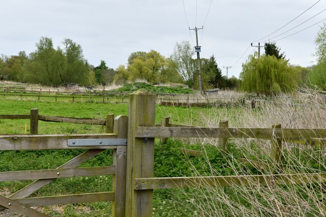
Duval's Plantation is a historic woodland located in Suffolk, England. Covering a vast area of lush greenery and towering trees, this plantation is a significant natural landmark within the region. Originally established as a working plantation in the 17th century, Duval's Plantation has a rich history that dates back several centuries.

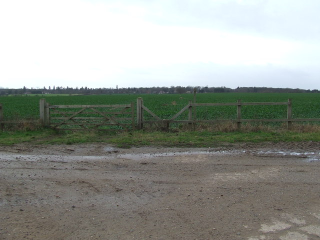
The plantation is known for its dense forest, which is dominated by a variety of tree species such as oak, beech, and pine. These trees provide a habitat for a diverse range of wildlife, including deer, squirrels, and numerous bird species. The woodland is also home to several rare and endangered plant species, making it a site of great ecological importance.

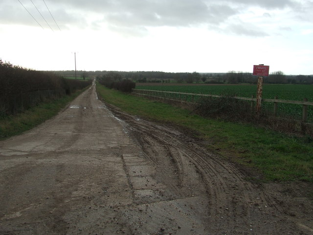
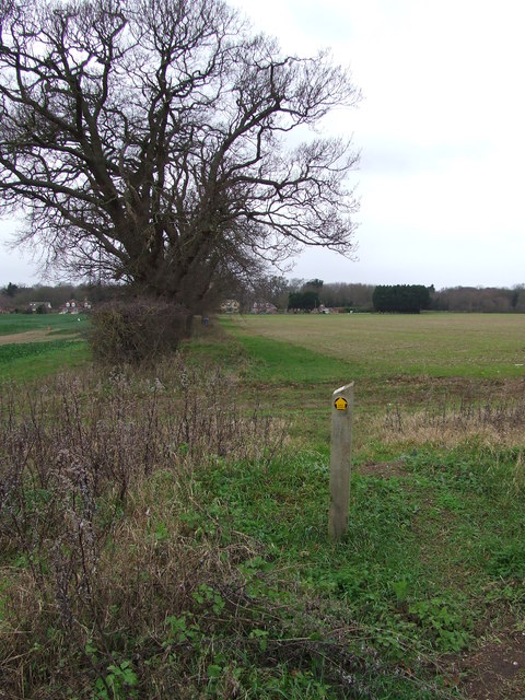
Duval's Plantation offers visitors a tranquil and scenic environment, making it a popular destination for nature enthusiasts and hikers. The woodland features numerous walking trails, allowing visitors to explore its beauty at their own pace. The plantation also offers designated picnic areas, where visitors can relax and enjoy the peaceful surroundings.

In addition to its natural beauty, Duval's Plantation holds historical significance. The plantation's name is derived from its original owner, a wealthy landowner named Duval. It was once a working estate that produced timber and other agricultural products. Today, remnants of the plantation's past can still be seen, including the ruins of an old manor house and a small chapel.

Duval's Plantation is a cherished part of Suffolk's heritage, offering a serene escape from the bustling city life. With its stunning woodland, diverse wildlife, and rich history, it continues to captivate visitors and locals alike.

If you have any feedback on the listing, please let us know in the comments section below.

Duval's Plantation Images

Images are sourced within 2km of 52.29485/0.68538491 or Grid Reference TL8369. Thanks to Geograph Open Source API. All images are credited.

West Stow: Field used for grazing
Culford War Memorial Culford War Memorial and village Hall.
Culford War Memorial
Culford War Memorial and village Hall.
Culford War Memorial
The War Memorial at Culford
The churchyard at St. Mary's church in Culford
View from Culford school building Culford School, clearly based on a former mansion and its parkland, is now big enough to be a village in itself, although it is actually in the middle of the village of Culford. This is the view from the old main building, from a large room that was perhaps a ballroom.
View from Culford school building
Culford School, clearly based on a former mansion and its parkland, is now big enough to be a village in itself, although it is actually in the middle of the village of Culford. This is the view from the old main building, from a large room that was perhaps a ballroom.
View from corridor end, Culford School A view across the very neat lawns and over the small valley containing the lake.
View from corridor end, Culford School
A view across the very neat lawns and over the small valley containing the lake.
Parkland at Culford School Viewed from just in front of the original old building, this gives an idea of a small part of the surroundings of this private school. 

I would have loved to attend a school with these kind of facilities - I wonder if the current pupils appreciate what they have got. However it must be a nightmare for staff if pupils decide to wander off.

There are cars parked on the grass due to the high attendance at one of the regular Art Deco and Retro fairs.
Parkland at Culford School
Viewed from just in front of the original old building, this gives an idea of a small part of the surroundings of this private school. I would have loved to attend a school with these kind of facilities - I wonder if the current pupils appreciate what they have got. However it must be a nightmare for staff if pupils decide to wander off. There are cars parked on the grass due to the high attendance at one of the regular Art Deco and Retro fairs.
Art Deco and Retro Fair in school building While one might be envious of having spectacular buildings like this for a school room, it has to be admitted that Culford School have done a very good job of keeping it in good condition.
Art Deco and Retro Fair in school building
While one might be envious of having spectacular buildings like this for a school room, it has to be admitted that Culford School have done a very good job of keeping it in good condition.
Ceiling detail, Culford School A spectacular ceiling in perfect condition. With very neat uplighting to show it off. Photographed during an Art Deco and Retro Fair.
Ceiling detail, Culford School
A spectacular ceiling in perfect condition. With very neat uplighting to show it off. Photographed during an Art Deco and Retro Fair.
Wall decorations, Culford School Really impressive decoration in perfect state of preservation. 

Photo taken during an Art Deco and Retro fair.
Wall decorations, Culford School
Really impressive decoration in perfect state of preservation. Photo taken during an Art Deco and Retro fair.
River Lark, West Stow The diminutive River Lark, seen from West Stow Road bridge. It is a tributary of the River Great Ouse, joining it just north of Ely.
River Lark, West Stow
The diminutive River Lark, seen from West Stow Road bridge. It is a tributary of the River Great Ouse, joining it just north of Ely.
River Lark, West Stow The bridge carries West Stow Road over the narrow river.
River Lark, West Stow
The bridge carries West Stow Road over the narrow river.
Drive to West Stow Lodge Despite appearances this driveway also serves as a public footpath leading to West Stow Road.
Drive to West Stow Lodge
Despite appearances this driveway also serves as a public footpath leading to West Stow Road.
Gate And Stile Gate stile and footpath with the path leading to Culford as seen from near to Ingham, Suffolk.
Gate And Stile
Gate stile and footpath with the path leading to Culford as seen from near to Ingham, Suffolk.
Farm Track Farm track looking south near to Ingham, Suffolk.
Farm Track
Farm track looking south near to Ingham, Suffolk.
Footpath Footpath near to Culford, Suffolk.
Footpath
Footpath near to Culford, Suffolk.
Entering Culford Entering Culford, Suffolk on the B1106.
Entering Culford
Entering Culford, Suffolk on the B1106.
Show me another place!

Duval's Plantation is located at Grid Ref: TL8369 (Lat: 52.29485, Lng: 0.68538491)

Administrative County: Suffolk

District: West Suffolk

Police Authority: Suffolk

What 3 Words

///blog.canoe.butchers. Near Bury St Edmunds, Suffolk

Related Wikis

Culford

Culford is a village and civil parish about 4 miles (6 km) north of Bury St Edmunds and 62 miles (100 km) north east of London in the West Suffolk district...

Culford School

Culford School is a co-educational private boarding and day school for pupils age 1-18 in the village of Culford, 4 miles (6.4 km) miles north of Bury...
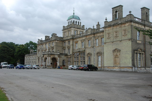
Culford Park

Culford Park in Culford, Suffolk, England, is a country house that is the former seat of the Bacon, Cornwallis and Cadogan families, and now it is the...

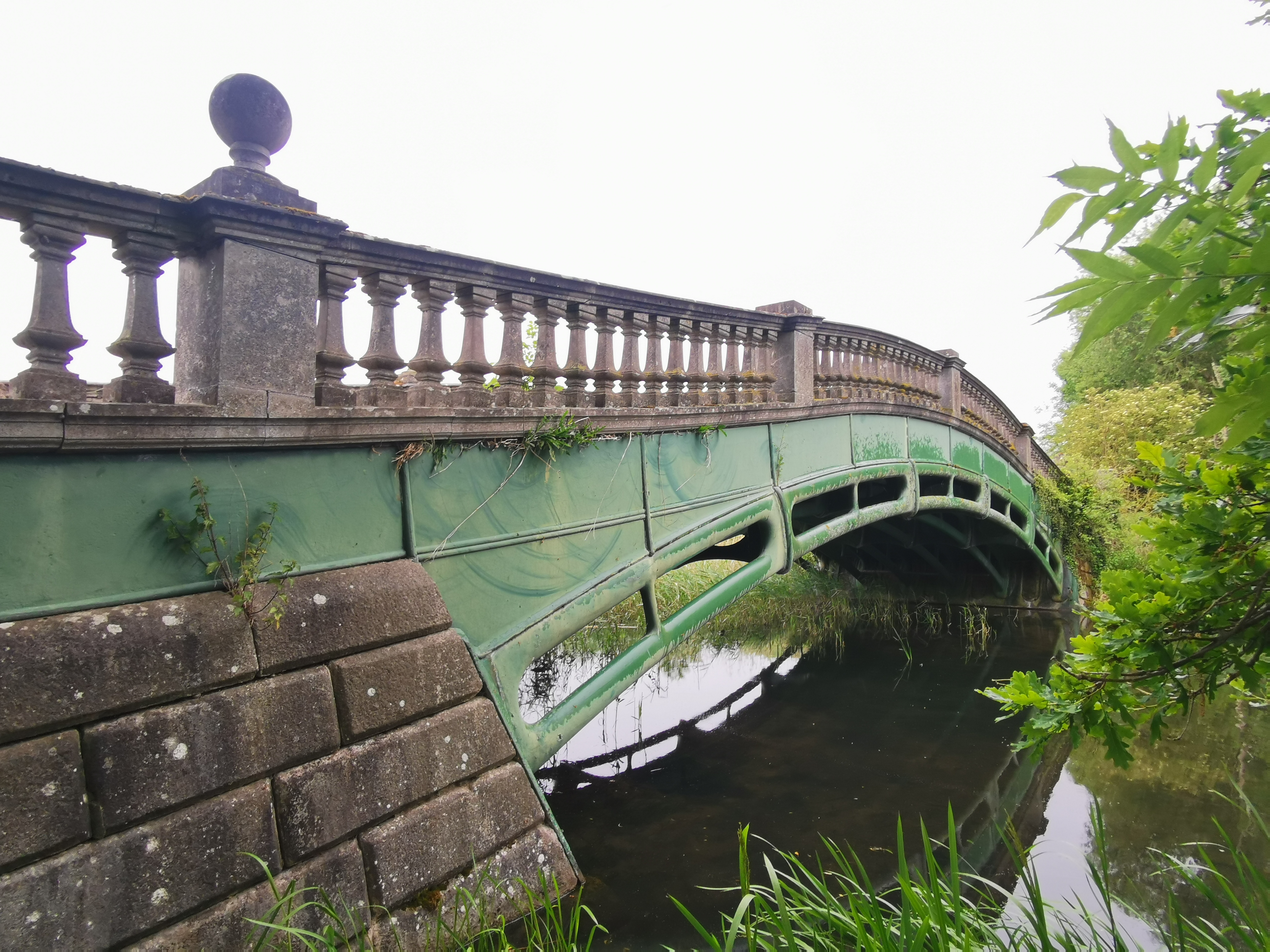
The Iron Bridge, Culford Park

The Iron Bridge is a grade I listed early cast iron bridge crossing a tributary of the River Lark in grounds of Culford Park in the village of Culford...
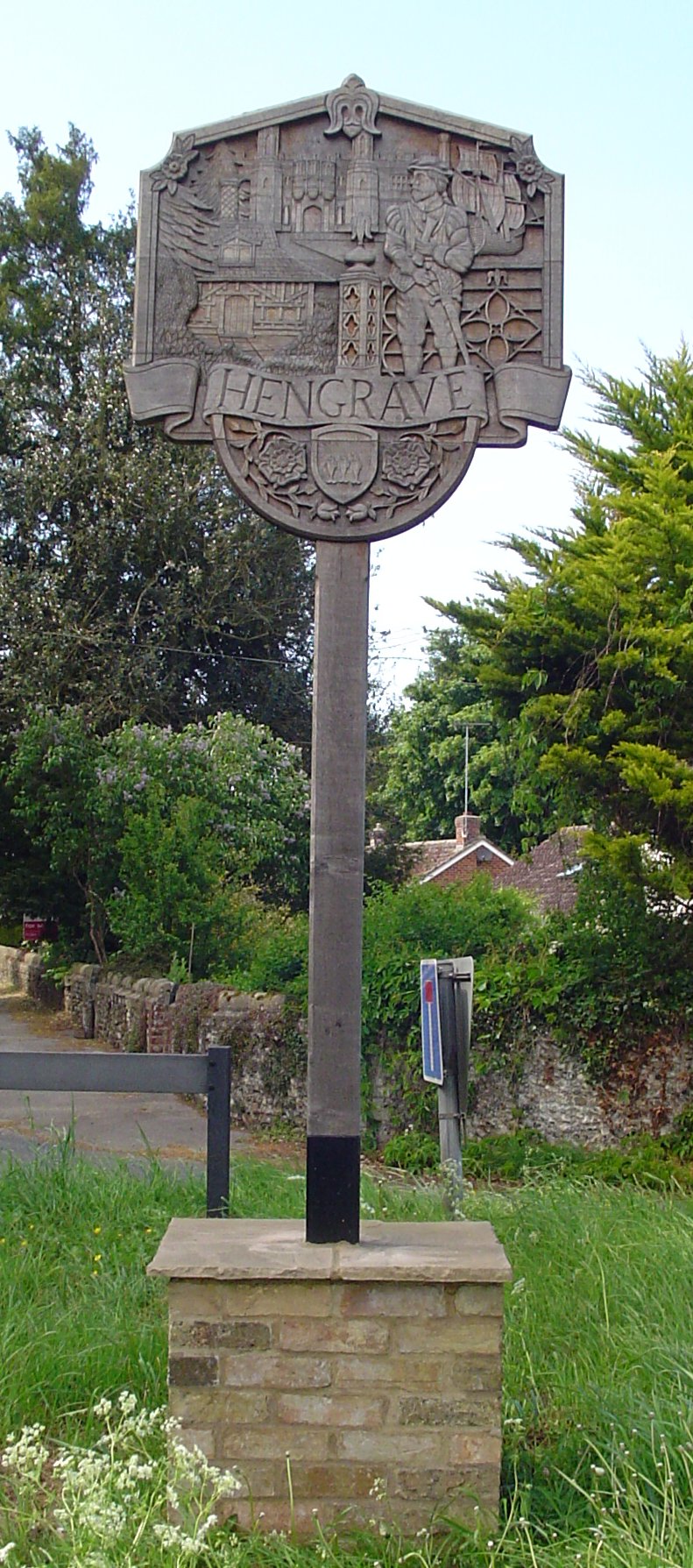
Hengrave

Hengrave is a small village and civil parish in the West Suffolk district, in the county of Suffolk, England. It is to the North the town of Bury St Edmunds...

Church of St John Lateran, Hengrave

The Church of St John Lateran, Hengrave is the former parish church of Hengrave, Suffolk. In 1589 this parish was consolidated with that of adjacent Flempton...
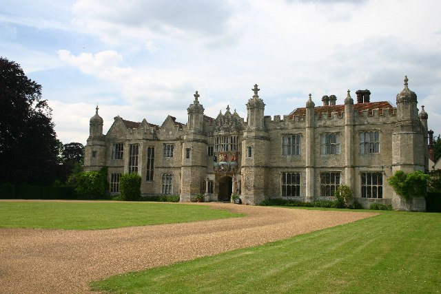
Hengrave Hall

Hengrave Hall is a Grade I listed Tudor manor house in Hengrave near Bury St. Edmunds in Suffolk, England and was the seat of the Kitson and Gage families...

West Stow

West Stow is a small village and civil parish in West Suffolk, England. The village lies north of Bury St. Edmunds, south of Mildenhall and Thetford and...

Nearby Amenities

Located within 500m of 52.29485,0.68538491
Fixme: incomplete
Lat/Long: 52.2928826/0.6876131
Generator Method: photovoltaic
Generator Solar Modules: 13
Generator Source: solar
Generator Type: solar_photovoltaic_panel
Location: ground
Orientation: 140
Power: generator
Lat/Long: 52.2945895/0.6924954
The data included in this document is from www.openstreetmap.org. The data is made available under ODbL.

Have you been to Duval's Plantation?

Leave your review of Duval's Plantation below (or comments, questions and feedback).