Folly Wood

Wood, Forest in Essex Rochford

England

Folly Wood

Arable field off Lower Road, Hullbridge
Arable field off Lower Road, Hullbridge Credit: Roger Jones

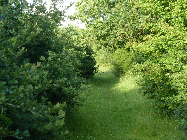
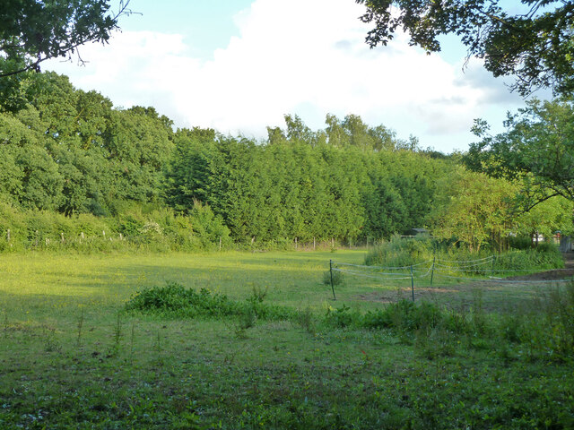
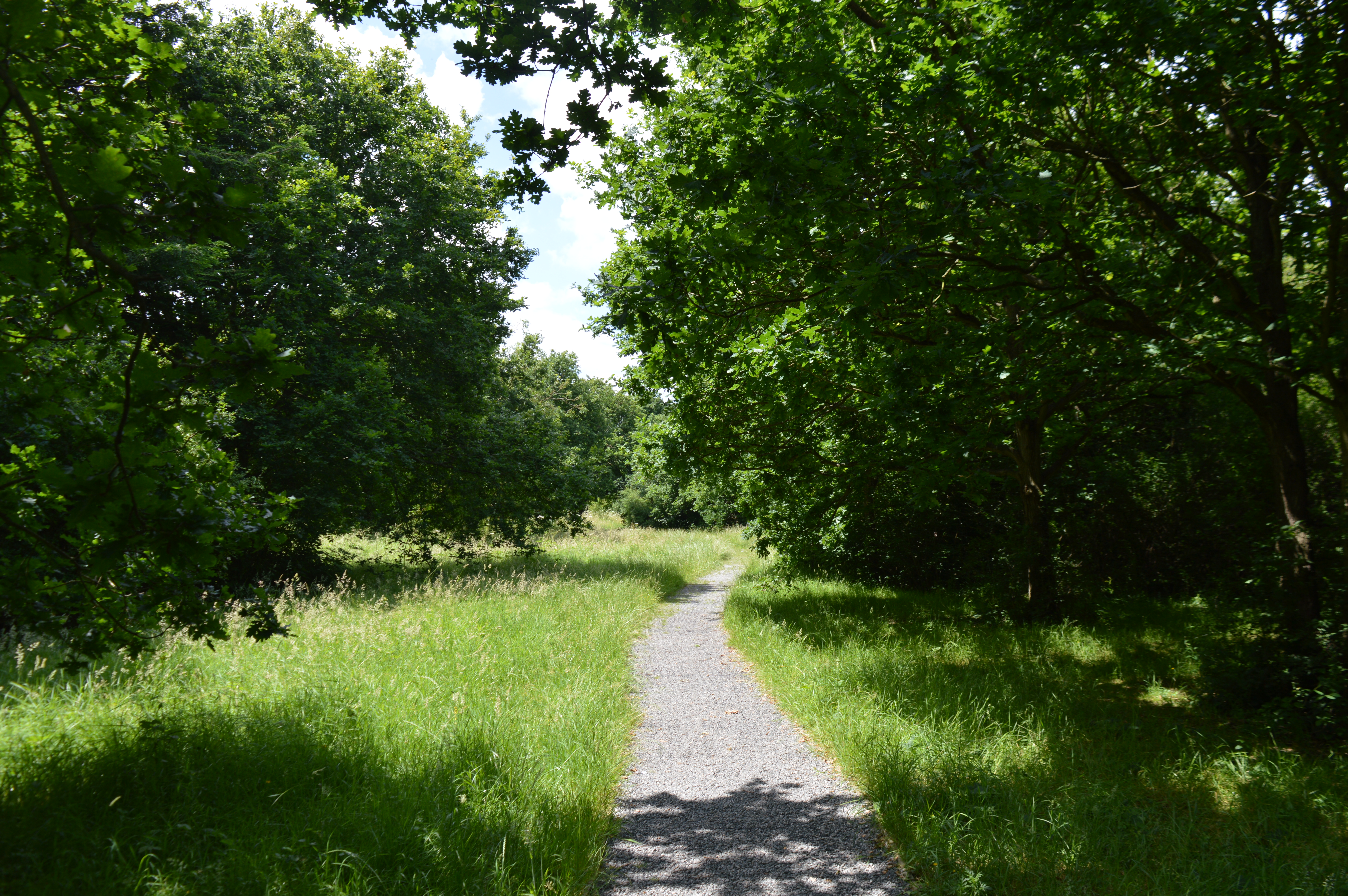
Folly Wood is a picturesque forest located in the county of Essex, England. Spread across an area of approximately 100 acres, this woodland is a popular destination for nature lovers and outdoor enthusiasts. Situated near the village of Folly Green, Folly Wood offers a tranquil and serene environment, making it an ideal place for relaxation and exploration.

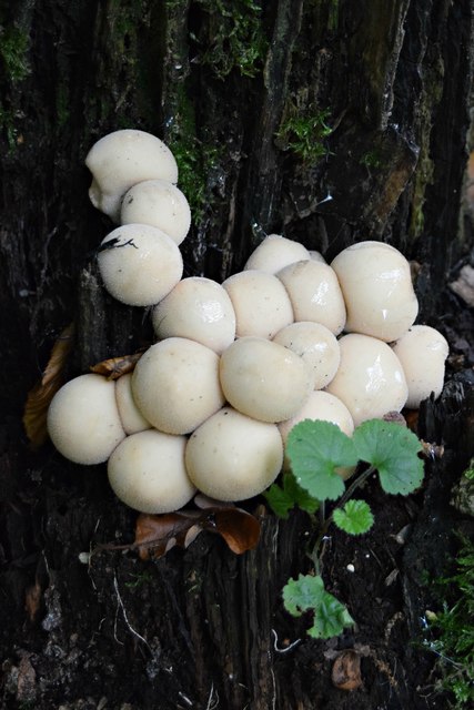
The woodland is predominantly composed of mature trees, including oak, birch, and beech, which create a dense and lush canopy. The forest floor is adorned with a variety of wildflowers, ferns, and mosses, adding to the enchanting atmosphere of the wood. Folly Wood is also home to a diverse range of wildlife, including squirrels, rabbits, and numerous species of birds.

For those who enjoy walking or hiking, Folly Wood offers a network of well-maintained trails that wind through the forest. These trails provide visitors with the opportunity to immerse themselves in the beauty of the natural surroundings while enjoying a peaceful stroll. Additionally, the forest is equipped with picnic areas, allowing visitors to enjoy a delightful outdoor meal amidst the tranquility of the wood.

Folly Wood is open to the public year-round, and there is no admission fee. It is advised to wear appropriate footwear and clothing, especially during wet or muddy conditions. The woodland is easily accessible by car or public transportation, with ample parking available nearby. Whether seeking solace in nature, engaging in outdoor activities, or simply enjoying a scenic walk, Folly Wood offers a charming and idyllic escape in the heart of Essex.

If you have any feedback on the listing, please let us know in the comments section below.

Folly Wood Images

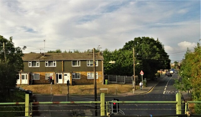
Images are sourced within 2km of 51.60303/0.64399383 or Grid Reference TQ8392. Thanks to Geograph Open Source API. All images are credited.

Arable field off Lower Road, Hullbridge
Path to Beckney Wood, Ashingdon
Railway to Hockley Looking towards Hockley station, this is on the Shenfield to Southend Line, built by the Great Eastern Railway in 1889.

Taken from the public footpath crossing.
Railway to Hockley
Looking towards Hockley station, this is on the Shenfield to Southend Line, built by the Great Eastern Railway in 1889. Taken from the public footpath crossing.
Glencroft Open Space, Hawkwell Glencroft Open Space is managed by Hawkwell Parish Council.
Glencroft Open Space, Hawkwell
Glencroft Open Space is managed by Hawkwell Parish Council.
Marylands Nature Reserve, Hockley View into a wooded section of Marylands Nature Reserve, which is managed by Hockley Parish Council: <span class="nowrap"><a title="https://www.hockley-essex.gov.uk/facilities/parks-and-open-spaces/marylands-nature-reserve/" rel="nofollow ugc noopener" href="https://www.hockley-essex.gov.uk/facilities/parks-and-open-spaces/marylands-nature-reserve/">Link</a><img style="margin-left:2px;" alt="External link" title="External link - shift click to open in new window" src="https://s1.geograph.org.uk/img/external.png" width="10" height="10"/></span>
Marylands Nature Reserve, Hockley
View into a wooded section of Marylands Nature Reserve, which is managed by Hockley Parish Council: LinkExternal link
Fence and hedge New "wildlife strip" bordering Bull Wood along the public footpath
Fence and hedge
New "wildlife strip" bordering Bull Wood along the public footpath
Footpath to Hockley Woods
Greensward Lane, Hockley
Bunker, Lords Golf and Country Club
Path towards golf course Not a public route.
Path towards golf course
Not a public route.
Field behind house on Ferndale Road A sort of extended back garden, apparently grazing for something.
Field behind house on Ferndale Road
A sort of extended back garden, apparently grazing for something.
Hockley fingerpost Fingerpost with two remaining arms
Hockley fingerpost
Fingerpost with two remaining arms
Hockley Village Sign I have lived in the area for five years. Today is the first time I have noticed this village sign.
Hockley Village Sign
I have lived in the area for five years. Today is the first time I have noticed this village sign.
Hockley War Memorial Lists the fallen in WWI, WWII and the Afghanistan Campaign
Hockley War Memorial
Lists the fallen in WWI, WWII and the Afghanistan Campaign
Trompettes de la Morte Craterellus cornucopioides (aka Horn of Plenty, Black Chanterelle)  I came upon a large patch of these fungi freshly sprung from the forest floor in Hockley Woods. And very tasty they were too, despite the French name, Trumpet of Death!
Trompettes de la Morte
Craterellus cornucopioides (aka Horn of Plenty, Black Chanterelle) I came upon a large patch of these fungi freshly sprung from the forest floor in Hockley Woods. And very tasty they were too, despite the French name, Trumpet of Death!
Stump Puffballs Lycoperdon pyriforme (aka Pear-shaped Puffball). Young specimens on oak stump, Hockley Woods
Stump Puffballs
Lycoperdon pyriforme (aka Pear-shaped Puffball). Young specimens on oak stump, Hockley Woods
Infested oak stump Honey Fungus (Armillaria mellea)
Infested oak stump
Honey Fungus (Armillaria mellea)
Show me another place!

Folly Wood is located at Grid Ref: TQ8392 (Lat: 51.60303, Lng: 0.64399383)

Administrative County: Essex

District: Rochford

Police Authority: Essex

What 3 Words

///downward.campfires.mountain. Near Rayleigh, Essex

Related Wikis

Hockley

Hockley is a large village and civil parish in Essex in the East of England located between Chelmsford and Southend-on-Sea, or, more specifically, between...

Marylands Nature Reserve

Marylands is a 3.7 hectare Local Nature Reserve in Hockley in Essex. It is owned by Rochford District Council and managed by Hockley Parish Council.The...

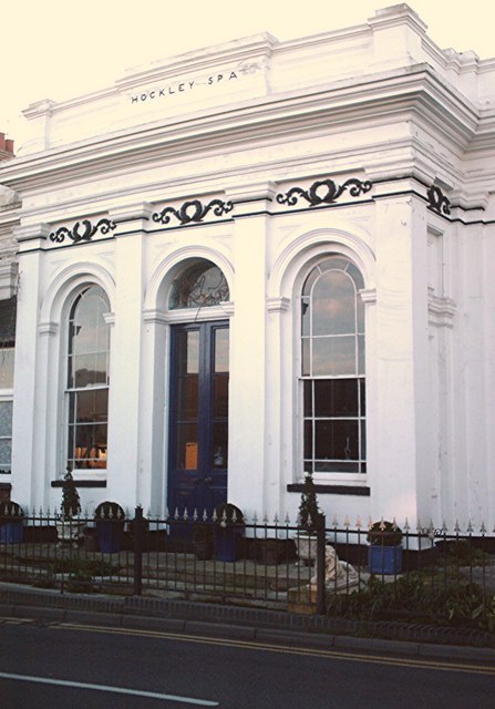
Spa Pump Room, Hockley

The Spa Pump Room is a Grade II listed, early Victorian building in Hockley, Essex. It was built to the designs of James Lockyer in 1842 after a medicinal...

Hockley Woods

Hockley Woods is a large woodland in south-east Essex. It is a Local Nature Reserve, and parts are a Site of Special Scientific Interest. It is owned and...

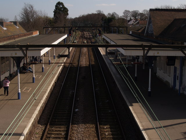
Hockley railway station (Essex)

Hockley railway station is on the Shenfield to Southend Line in the East of England, serving the village of Hockley, Essex. It is 36 miles 1 chain (57...

HM Prison Bullwood Hall

HM Prison Bullwood Hall is a former Category C women's prison and Young Offenders Institution, located in Hockley, Essex, England. The prison was operated...

Greensward Academy

Greensward Academy is a comprehensive school and academy for 11- to 18-year-olds, located in Hockley, Essex.Greensward has approximately 200 staff and...

Rayleigh (UK Parliament constituency)

Rayleigh was a parliamentary constituency in Essex represented in the House of Commons of the Parliament of the United Kingdom. It elected one Member of...

Nearby Amenities

Located within 500m of 51.60303,0.64399383
Crossing
Crossing: zebra
Source: bing
Lat/Long: 51.6010176/0.6411299
Bus Stop
Folly Lane
Naptan AtcoCode: 15001100216
Naptan Bearing: W
Naptan CommonName: Folly Lane
Naptan Crossing: Folly Lane
Naptan Indicator: Opp
Naptan Landmark: Folly Lane
Naptan NaptanCode: esxagjpg
Naptan PlusbusZoneRef: RAYLEGH;STHCENT
Naptan Street: Aldermans Hill
Naptan Verified: no
Public Transport: platform
Source: naptan_import
Lat/Long: 51.6008066/0.6402746
Bus Stop
Folly Lane
Naptan AtcoCode: 15001100217
Naptan Bearing: E
Naptan CommonName: Folly Lane
Naptan Crossing: Folly Lane
Naptan Indicator: Adj
Naptan Landmark: Folly Lane
Naptan NaptanCode: esxagjpd
Naptan PlusbusZoneRef: RAYLEGH;STHCENT
Naptan Street: Aldermans Hill
Naptan Verified: no
Public Transport: platform
Source: naptan_import
Lat/Long: 51.6010731/0.6406501
Bus Stop
The Bull
Bus: yes
Naptan AtcoCode: 15001100218
Naptan Bearing: E
Naptan CommonName: The Bull
Naptan Crossing: Bull Lane
Naptan Indicator: Opp
Naptan Landmark: The Bull
Naptan NaptanCode: esxagjpj
Naptan PlusbusZoneRef: RAYLEGH;STHCENT
Naptan Street: Main Road
Naptan Verified: no
Public Transport: platform
Source: naptan_import
Lat/Long: 51.6007974/0.6447848
Bus Stop
The Bull
Bench: yes
Bus: yes
Naptan AtcoCode: 15001100219
Naptan Bearing: SW
Naptan CommonName: The Bull
Naptan Crossing: Bull Lane
Naptan Indicator: o/s
Naptan Landmark: The Bull
Naptan NaptanCode: esxagjpm
Naptan PlusbusZoneRef: RAYLEGH;STHCENT
Naptan Street: Main Road
Naptan Verified: no
Public Transport: platform
Shelter: yes
Source: naptan_import
Lat/Long: 51.6009195/0.6456219
Bus Stop
SEETEC
Bench: yes
Bin: yes
Bus: yes
Naptan AtcoCode: 15001100220
Naptan Bearing: W
Naptan CommonName: SEETEC
Naptan Indicator: o/s
Naptan Landmark: SEETEC
Naptan NaptanCode: esxagjpt
Naptan PlusbusZoneRef: RAYLEGH;STHCENT
Naptan Street: Main Road
Naptan Verified: no
Public Transport: platform
Shelter: yes
Source: naptan_import
Lat/Long: 51.6015793/0.6480311
Bus Stop
SEETEC
Bench: yes
Bin: yes
Bus: yes
Naptan AtcoCode: 15001100221
Naptan Bearing: E
Naptan CommonName: SEETEC
Naptan Indicator: Opp
Naptan Landmark: SEETEC
Naptan NaptanCode: esxagjpw
Naptan PlusbusZoneRef: RAYLEGH;STHCENT
Naptan Street: Main Road
Naptan Verified: no
Public Transport: platform
Shelter: yes
Source: naptan_import
Lat/Long: 51.6016966/0.6483331
Mini Roundabout
Direction: clockwise
Lat/Long: 51.6016648/0.648739
Noexit: yes
Lat/Long: 51.6019295/0.6466804
Turning Circle
Lat/Long: 51.6019726/0.648227
Traffic Calming: choker
Lat/Long: 51.6024999/0.6486203
Noexit: yes
Lat/Long: 51.6023115/0.6499482
Noexit: yes
Lat/Long: 51.6019911/0.6467543
Barrier: bollard
Bicycle: yes
Foot: yes
Lat/Long: 51.6023081/0.6498831
Pub
The Bull
Addr Housenumber: 99
Addr Postcode: SS5 4RN
Addr Street: Main Road
Brand: Chef & Brewer
Brand Wikidata: Q5089491
Fhrs Id: 155574
Operator: Chef & Brewer
Source Addr: FHRS Open Data
Website: https://www.chefandbrewer.com/pubs/essex/bull
Wikidata: Q26440787
Lat/Long: 51.6007035/0.6453625
Community Centre
Hockley Community Centre
Addr Postcode: SS5 4XD
Addr Street: Westminster Drive
Fhrs Id: 936510
Source Addr: FHRS Open Data
Lat/Long: 51.6057486/0.6461937
Barrier: bollard
Bicycle: yes
Foot: yes
Lat/Long: 51.6022956/0.6498989
Barrier: bollard
Bicycle: yes
Foot: yes
Lat/Long: 51.6022828/0.6499149
Noexit: yes
Lat/Long: 51.6009534/0.6479573
Noexit: yes
Lat/Long: 51.6009629/0.6484205
Traffic Calming: island
Lat/Long: 51.6017643/0.648741
Crossing
Crossing: unmarked
Crossing Island: yes
Crossing Markings: no
Tactile Paving: yes
Lat/Long: 51.6016588/0.6485901
Give Way
Direction: forward
Lat/Long: 51.6014909/0.650086
Entrance: main
Lat/Long: 51.6046374/0.6506799
Crossing
Crossing: unmarked
Crossing Island: no
Crossing Markings: no
Tactile Paving: no
Lat/Long: 51.6049999/0.6494153
Natural: shrub
Lat/Long: 51.6018041/0.6488443
Entrance: main
Lat/Long: 51.6021561/0.6466084
Waste Basket
Lat/Long: 51.6015552/0.6479643
Bench
Lat/Long: 51.6015569/0.6471098
Entrance: main
Lat/Long: 51.6024476/0.6482236
Entrance: main
Lat/Long: 51.6025402/0.6482942
Entrance: main
Lat/Long: 51.6024291/0.6482359
Entrance: main
Lat/Long: 51.6027797/0.6472789
Entrance: main
Lat/Long: 51.6028527/0.6471126
Entrance: main
Lat/Long: 51.6028008/0.6472471
Entrance: main
Lat/Long: 51.6027182/0.6471239
Advertising: board
Lat/Long: 51.6029715/0.6457211
Post Box
Operator: Royal Mail
Operator Wikidata: Q638098
Post Box Type: pillar
Royal Cypher: EIIR
Lat/Long: 51.6031968/0.648043
Entrance: main
Lat/Long: 51.6034918/0.6465576
Entrance: main
Lat/Long: 51.6035132/0.6464176
Entrance: main
Lat/Long: 51.6035302/0.6464051
Entrance: main
Lat/Long: 51.6022764/0.6465212
Entrance: main
Lat/Long: 51.6021912/0.646439
Entrance: main
Lat/Long: 51.602177/0.6464695
The data included in this document is from www.openstreetmap.org. The data is made available under ODbL.

Have you been to Folly Wood?

Leave your review of Folly Wood below (or comments, questions and feedback).