North Heath Belt

Wood, Forest in Suffolk West Suffolk

England

North Heath Belt

Elveden: One of many entrances to the King's Forest
Elveden: One of many entrances to the King's Forest Credit: Michael Garlick

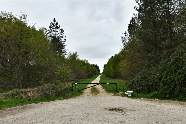
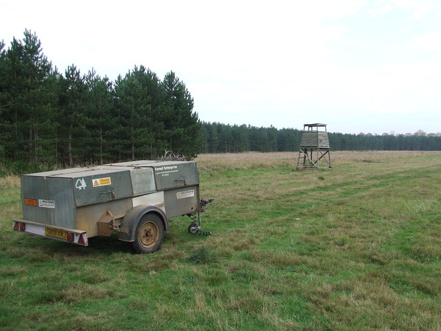
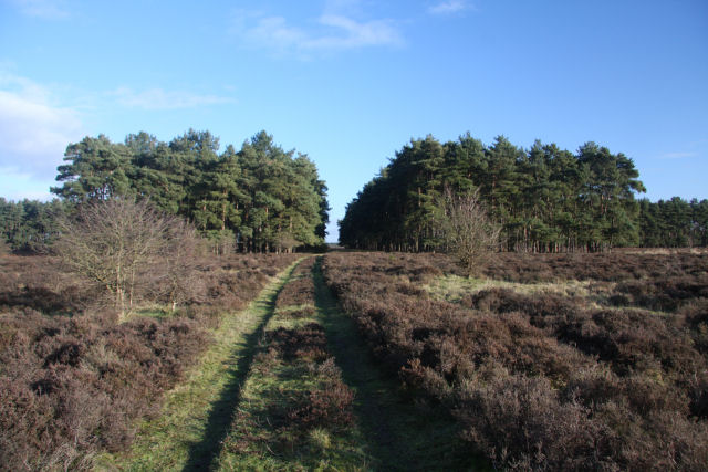
The North Heath Belt in Suffolk, England, is a picturesque woodland area known for its natural beauty and rich wildlife. Spanning over an expansive area, this forested region is characterized by dense clusters of trees, creating a serene and tranquil environment.

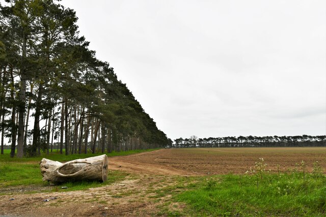
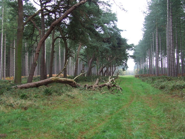
The woodlands of North Heath Belt are predominantly composed of deciduous and coniferous trees, including oak, beech, pine, and spruce. These trees form a dense canopy that provides shade and shelter to various flora and fauna species. The forest floor is adorned with a carpet of ferns, mosses, and wildflowers, creating a vibrant and diverse ecosystem.

The North Heath Belt is a haven for wildlife enthusiasts, offering a sanctuary for a wide variety of animals. Visitors may catch glimpses of deer, foxes, badgers, and a plethora of bird species, including woodpeckers, owls, and various songbirds. The forest's diverse habitats, such as ponds and wetlands, also attract amphibians, reptiles, and insects, adding to the overall biodiversity of the area.

Access to the North Heath Belt is facilitated by well-maintained footpaths and trails that wind through the forest, allowing visitors to explore its natural wonders. These paths offer opportunities for hiking, walking, and birdwatching, making the area a popular destination for outdoor enthusiasts and nature lovers.

In addition to its natural beauty, the North Heath Belt is also of historical significance. Remnants of ancient settlements and archaeological sites can be found within the forest, providing a glimpse into the area's past.

Overall, the North Heath Belt in Suffolk is a captivating woodland area that offers a unique blend of natural splendor, biodiversity, and historical intrigue, making it a must-visit destination for those seeking a connection with nature and a sense of tranquility.

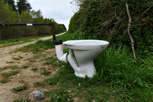
If you have any feedback on the listing, please let us know in the comments section below.

North Heath Belt Images

Images are sourced within 2km of 52.350345/0.66070029 or Grid Reference TL8175. Thanks to Geograph Open Source API. All images are credited.

Elveden: One of many entrances to the King's Forest
Elveden: One of many entrances to the King's Forest A discarded toilet.
Elveden: One of many entrances to the King's Forest
A discarded toilet.
Elveden: Shelterhouse Corner
Wordwell: The King's Forest
Forest Track Forest track near to Icklingham, Suffolk.
Forest Track
Forest track near to Icklingham, Suffolk.
Forest View Forest commission trailer and tower in the forest near to Icklingham, Suffolk.
Forest View
Forest commission trailer and tower in the forest near to Icklingham, Suffolk.
Telegraph wires on Berner's Heath Looking south-westwards across Open Access land on Berner's Heath. The opposite view can be seen at <a href="https://www.geograph.org.uk/photo/276092">TL7976 : Berner's Heath</a>.
Telegraph wires on Berner's Heath
Looking south-westwards across Open Access land on Berner's Heath. The opposite view can be seen at TL7976 : Berner's Heath.
Depression on Berner's Heath The origin of this depression on Berner's Heath is not known. It appears to be a regular-shaped crater, possibly man-made. Alternatively, it may be a dry pingo pond, formed when an ice mound in the topsoil melted and collapsed to form pools at the end of the last Ice Age.
Depression on Berner's Heath
The origin of this depression on Berner's Heath is not known. It appears to be a regular-shaped crater, possibly man-made. Alternatively, it may be a dry pingo pond, formed when an ice mound in the topsoil melted and collapsed to form pools at the end of the last Ice Age.
Benjamin's Hurst This unusual cross-shaped woodland is situated on Berner's Heath. Each of the four 'arms' of the cross are clearings, which are not shown on the OS map.
Benjamin's Hurst
This unusual cross-shaped woodland is situated on Berner's Heath. Each of the four 'arms' of the cross are clearings, which are not shown on the OS map.
Benjamin's Hurst Looking south-eastwards through the trees from the centre of the cross-shaped plantation known as Benjamin's Hurst.
Benjamin's Hurst
Looking south-eastwards through the trees from the centre of the cross-shaped plantation known as Benjamin's Hurst.
Track to Benjamin's Hurst This track crosses Berner's Heath. The plantation ahead is in the form of a cross, with clearings on the NW-SE and NE-SW diagonals.
Track to Benjamin's Hurst
This track crosses Berner's Heath. The plantation ahead is in the form of a cross, with clearings on the NW-SE and NE-SW diagonals.
Picnic Area nr B1106, Thetford Forest View taken from parking area towards information boards
Picnic Area nr B1106, Thetford Forest
View taken from parking area towards information boards
Queen Mary's Avenue and monument, King's Forest The inscription on the monument states, "This stone commemorates the Silver Jubilee of King George V.  The Forestry Commissioners began in 1935 to afforest the King's Forest and to plant with beeches Queen Mary's Avenue which follows the course of the Icknield Way."
Queen Mary's Avenue and monument, King's Forest
The inscription on the monument states, "This stone commemorates the Silver Jubilee of King George V. The Forestry Commissioners began in 1935 to afforest the King's Forest and to plant with beeches Queen Mary's Avenue which follows the course of the Icknield Way."
Track crossing at North Stow In the heart of The King's Forest, a track crosses the B1106 Culford to Elveden road.
Track crossing at North Stow
In the heart of The King's Forest, a track crosses the B1106 Culford to Elveden road.
Icknield Way This ancient trackway cuts diagonally across The King's Forest.  Here at North Stow the sandy soil of the byway is rutted with the marks of 4x4 vehicles.
Icknield Way
This ancient trackway cuts diagonally across The King's Forest. Here at North Stow the sandy soil of the byway is rutted with the marks of 4x4 vehicles.
Icknield Way The trackway crosses the B1106 just beyond this point.  The trees ahead are known as the Icklingham Belt.  The crop is sugar beet.
Icknield Way
The trackway crosses the B1106 just beyond this point. The trees ahead are known as the Icklingham Belt. The crop is sugar beet.
The King's Forest from Icklingham Belt This track leads south through trees planted within the past thirty years.
The King's Forest from Icklingham Belt
This track leads south through trees planted within the past thirty years.
Water shortage? Here at Hall Heath, just north of The King's Forest, water seems to be in plentiful supply.  The sugar beet certainly needs it.
Water shortage?
Here at Hall Heath, just north of The King's Forest, water seems to be in plentiful supply. The sugar beet certainly needs it.
Show me another place!

North Heath Belt is located at Grid Ref: TL8175 (Lat: 52.350345, Lng: 0.66070029)

Administrative County: Suffolk

District: West Suffolk

Police Authority: Suffolk

What 3 Words

///starters.responds.screaming. Near Thetford, Norfolk

Nearby Locations

North Heath Belt

Related Wikis

Berner's Heath

Berner's Heath is a 236.9-hectare (585-acre) biological Site of Special Scientific Interest north-east of Icklingham in Suffolk. It is a Nature Conservation...

Weather and Horn Heaths, Eriswell

Weather and Horn Heaths, Eriswell is a 133.3-hectare (329-acre) biological Site of Special Scientific Interest east of Eriswell in Suffolk. It is a Nature...

Deadman's Grave, Icklingham

Deadman's Grave, Icklingham is a 127.3-hectare (315-acre) biological Site of Special Scientific Interest north-east of Icklingham in Suffolk. It is a Nature...

Wordwell

Wordwell is a small village and civil parish in Suffolk, England, about five miles North of Bury St Edmunds. The village was hit by the Black Death in...

All Saints Church, Wordwell

All Saints Church is a redundant Anglican church in the village of Wordwell, Suffolk, England. It is recorded in the National Heritage List for England...

Elveden Hall

Elveden Hall is a large stately home on the Elveden Estate in Elveden, Suffolk, England. The seat of the Earls of Iveagh, it is a Grade II* listed building...

Elveden

Elveden is a village and civil parish in the West Suffolk district of Suffolk in eastern England. In 2005 it had a population of 270. The village is bypassed...

Little Heath, Barnham

Little Heath, Barnham lies south-west of Barnham, Suffolk. Much of the area is now a Site of Special Scientific Interest, which almost surrounds the former...

Have you been to North Heath Belt?

Leave your review of North Heath Belt below (or comments, questions and feedback).