Gilly Wood

Wood, Forest in Sussex Rother

England

Gilly Wood

Path to Powdermill A public footpath runs along the outside of Rafters Wood towards Powdermill Bridge.  Walkers also have the choice of two flower-rich paths through the woods now owned by the Woodlands Trust.
Path to Powdermill Credit: David M Clark

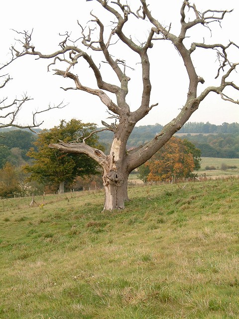
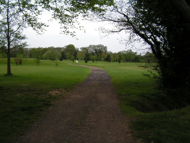
Gilly Wood is a picturesque forest located in the county of Sussex, England. Nestled within the South Downs National Park, it covers an area of approximately 500 acres and is renowned for its natural beauty and diverse wildlife.

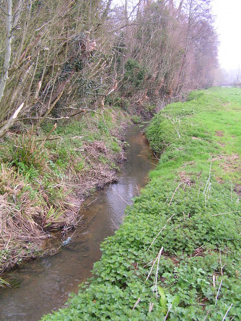
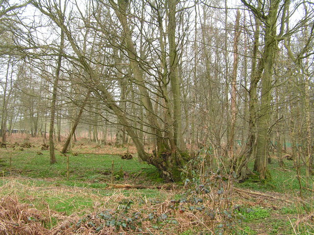
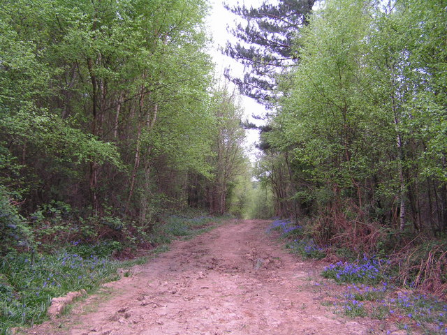
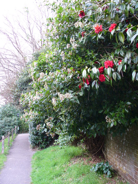
The forest is predominantly made up of broad-leaved trees, including oak, beech, and ash, which create a dense canopy that provides shade and shelter to the woodland floor below. The forest floor is covered in a thick carpet of ferns, bluebells, and other wildflowers, adding to the enchanting atmosphere of the wood.

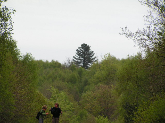
Gilly Wood is a haven for wildlife enthusiasts, as it is home to a variety of animals and birds. Visitors may spot deer, foxes, and badgers roaming freely in their natural habitat. The forest is also a haven for birdwatchers, with species such as woodpeckers, owls, and warblers frequently seen and heard in the area.

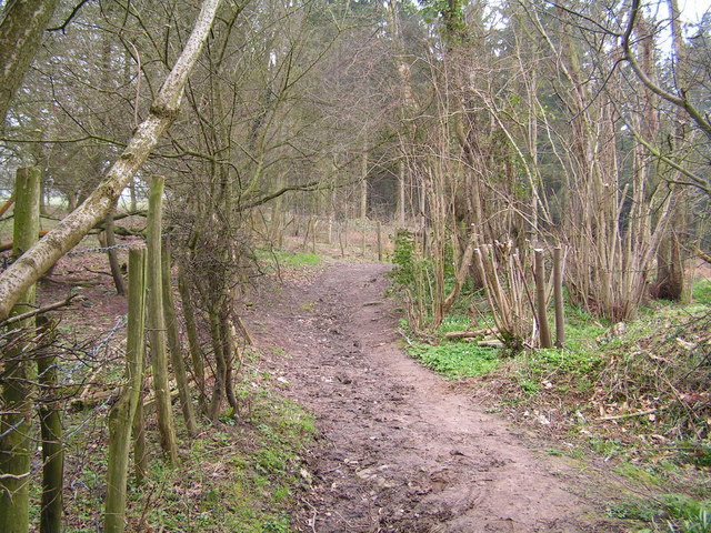
The wood offers a range of walking trails, allowing visitors to explore its beauty at their leisure. There are also designated picnic areas and benches, providing a perfect spot for visitors to relax and enjoy the tranquil surroundings. The forest is well-maintained, with clearly marked paths and informative signposts providing interesting facts about the local flora and fauna.

Gilly Wood is a popular destination for nature lovers, photographers, and families seeking a peaceful retreat in nature. Its idyllic setting, combined with its rich biodiversity and accessibility, make it a must-visit location for anyone looking to immerse themselves in the beauty of Sussex's woodlands.

If you have any feedback on the listing, please let us know in the comments section below.

Gilly Wood Images

Images are sourced within 2km of 50.92797/0.54140522 or Grid Reference TQ7817. Thanks to Geograph Open Source API. All images are credited.

Path to Powdermill A public footpath runs along the outside of Rafters Wood towards Powdermill Bridge.  Walkers also have the choice of two flower-rich paths through the woods now owned by the Woodlands Trust.
Path to Powdermill
A public footpath runs along the outside of Rafters Wood towards Powdermill Bridge. Walkers also have the choice of two flower-rich paths through the woods now owned by the Woodlands Trust.
Lower Brook The name of the field according to Brede's 1840 tithe map bounded by Horn's Wood to the east and Brede Lane to the south.
Lower Brook
The name of the field according to Brede's 1840 tithe map bounded by Horn's Wood to the east and Brede Lane to the south.
Brede Lane A country lane that links Sedlescombe to Brede. Here it skirts the southern side of Horn's Wood.
Brede Lane
A country lane that links Sedlescombe to Brede. Here it skirts the southern side of Horn's Wood.
Loanham Field The name of the field according to Brede's 1840 tithe map located to the south of Brede Lane
Loanham Field
The name of the field according to Brede's 1840 tithe map located to the south of Brede Lane
Shirke Shaw The shaw can be found on the southern side of Cottage Lane with this view of the eastern most section. ON Westfield's 1841 tithe survey it was called The Sturt Shaw.
Shirke Shaw
The shaw can be found on the southern side of Cottage Lane with this view of the eastern most section. ON Westfield's 1841 tithe survey it was called The Sturt Shaw.
The Little Deans The name of the former field according to Westfield's 1841 tithe map that is now part of neighbouring Deans Wood. Located on the northern side of Cottage Lane.
The Little Deans
The name of the former field according to Westfield's 1841 tithe map that is now part of neighbouring Deans Wood. Located on the northern side of Cottage Lane.
Cottage Lane The country lane links Sedlescombe to Westfield
Cottage Lane
The country lane links Sedlescombe to Westfield
Orchard Field The name of the field according to Westfield's 1841 tithe map bounded by Cottage Lane to the south and Deans Wood to the east. Brook Lodge Farm, across the Brede valley can be seen in the distance.
Orchard Field
The name of the field according to Westfield's 1841 tithe map bounded by Cottage Lane to the south and Deans Wood to the east. Brook Lodge Farm, across the Brede valley can be seen in the distance.
Barn Field The name of the field according to Westfield's 1841 tithe map bounded by Cottage lane to the south and Brassets Wood to the west and north.
Barn Field
The name of the field according to Westfield's 1841 tithe map bounded by Cottage lane to the south and Brassets Wood to the west and north.
Dead Oak tree at Pestalozzi A rather sculptural moribund oak tree on the drive to Pestalozzi Village, near Sedlescombe
Dead Oak tree at Pestalozzi
A rather sculptural moribund oak tree on the drive to Pestalozzi Village, near Sedlescombe
Entering the Great Wood near Battle Part of a large forestry commission forest East of Battle
Entering the Great Wood near Battle
Part of a large forestry commission forest East of Battle
R. Brede running along the edge of Petley Woods A very clear Wealden stream
R. Brede running along the edge of Petley Woods
A very clear Wealden stream
Petley Woods Typical Wealden woodland of mixed trees
Petley Woods
Typical Wealden woodland of mixed trees
Footpath across Sedlescombe Golf Course Sedlescombe Golf Club offers excellent golf, hotel & conference facilities for the golfer and non golfer alike.
The parkland golf course measures 6269 yards and with a variety of obstacles including ponds and deep fairway bunkers, provides an enjoyable challenge to golfers of all abilities. 
Website: <span class="nowrap"><a title="http://www.sedlescombegolfclub.co.uk/" rel="nofollow ugc noopener" href="http://www.sedlescombegolfclub.co.uk/">Link</a><img style="margin-left:2px;" alt="External link" title="External link - shift click to open in new window" src="https://s1.geograph.org.uk/img/external.png" width="10" height="10"/></span>
Footpath across Sedlescombe Golf Course
Sedlescombe Golf Club offers excellent golf, hotel & conference facilities for the golfer and non golfer alike. The parkland golf course measures 6269 yards and with a variety of obstacles including ponds and deep fairway bunkers, provides an enjoyable challenge to golfers of all abilities. Website: LinkExternal link
Distinctive tree in the Great Wood, Battle
Bluebells by the track in the Great Wood
Sedlescombe Parish Church The parish church of St John the Baptist dates from the 13th Century but the west tower seen here dates from 15th Century. Spanish chestnuts flank the entrance while there are, naturally, yews in the churchyard.
Sedlescombe Parish Church
The parish church of St John the Baptist dates from the 13th Century but the west tower seen here dates from 15th Century. Spanish chestnuts flank the entrance while there are, naturally, yews in the churchyard.
Footpath at Sedlescombe Church The path parallels the village street which follows the ridge line between the River Line and another tributary of the River Brede. Rhododendrons and skimmia lining the churchyard are blooming in February.
Footpath at Sedlescombe Church
The path parallels the village street which follows the ridge line between the River Line and another tributary of the River Brede. Rhododendrons and skimmia lining the churchyard are blooming in February.
Show me another place!

Gilly Wood is located at Grid Ref: TQ7817 (Lat: 50.92797, Lng: 0.54140522)

Administrative County: East Sussex

District: Rother

Police Authority: Sussex

What 3 Words

///notched.resources.forwarded. Near Battle, East Sussex

Related Wikis

Sedlescombe

Sedlescombe is a village and civil parish in the Rother district of East Sussex, England. The village is on the B2244 road, about 6 miles (10 km) north...

Durhamford Manor

Durhamford Manor is a Grade II* listed country house in the parish of Sedlescombe, East Sussex, England. The timber-framed, close-studded house dates to...

Whatlington

Whatlington is a village and civil parish in the Rother district of East Sussex, England. The village is seven miles (11 km) north of Hastings, just off...

Powdermill Reservoir

Powdermill Reservoir lies to the east of Sedlescombe, East Sussex, England. The reservoir provides water for Southern Water customers. == History == Originally...

Brede Waterworks

Brede Waterworks (grid reference TQ 813 178) is a waterworks at Brede, East Sussex, England. It was built to supply Hastings with drinking water. The waterworks...

Hemingfold Meadow

Hemingfold Meadow is a 4.9-hectare (12-acre) biological Site of Special Scientific Interest west of Battle in East Sussex.This site consists of two adjacent...

Westfield, East Sussex

Westfield is a village and civil parish in the Rother district of East Sussex. It is one of the largest villages in the area with a population of around...

Sedlescombe vineyard

Sedlescombe organic vineyard is an English vineyard located in Robertsbridge, just outside Sedlescombe in East Sussex.It is one of the few British vineyards...

Nearby Amenities

Located within 500m of 50.92797,0.54140522
Oaklands
Building: yes
Source: npe
Lat/Long: 50.9291861/0.5452467
Power: pole
Lat/Long: 50.9244429/0.5386257
The data included in this document is from www.openstreetmap.org. The data is made available under ODbL.

Have you been to Gilly Wood?

Leave your review of Gilly Wood below (or comments, questions and feedback).