Little Gilly Wood

Wood, Forest in Sussex Rother

England

Little Gilly Wood

The Little Deans The name of the former field according to Westfield's 1841 tithe map that is now part of neighbouring Deans Wood. Located on the northern side of Cottage Lane.
The Little Deans Credit: Simon Carey

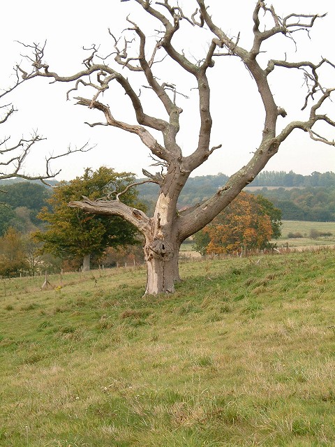
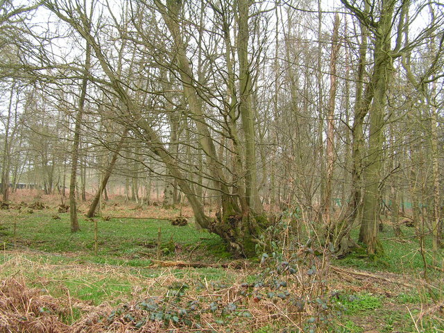
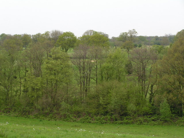
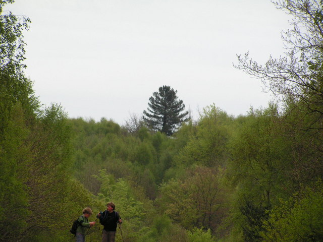
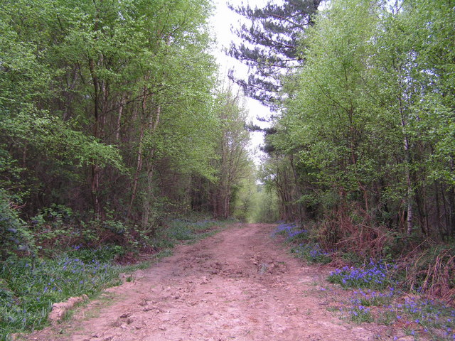
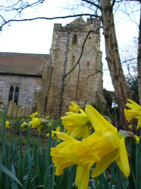
Little Gilly Wood is a small woodland located in the county of Sussex, England. Situated near the village of Gilly, it covers an area of around 20 acres. The wood is a mix of both deciduous and coniferous trees, creating a diverse and picturesque landscape.

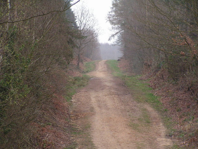
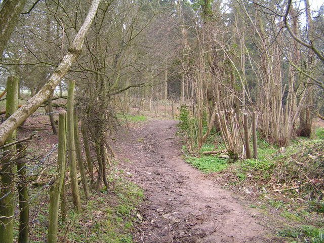
The woodland is known for its tranquil atmosphere and natural beauty, making it a popular destination for nature lovers and hikers. The dense tree canopy provides shade and shelter, and the forest floor is carpeted with moss and wildflowers, adding to its enchanting appeal.

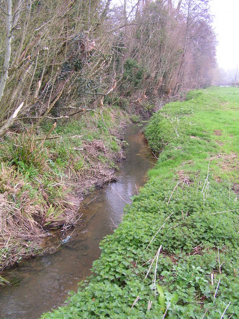
Little Gilly Wood is home to a variety of wildlife, including deer, foxes, and a wide range of bird species. Birdwatchers frequent the area to observe and listen to the calls of these feathered inhabitants. The wood is also filled with the sound of rustling leaves and the soothing trickle of a small stream that runs through it.

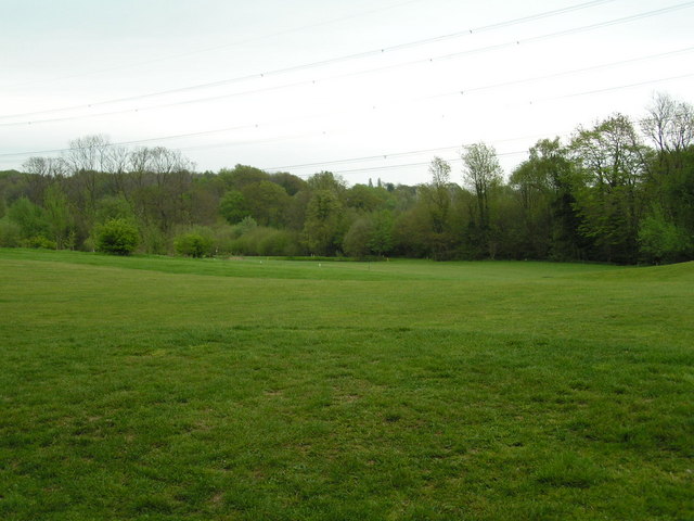
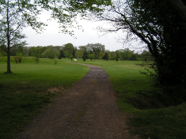
Visitors to the wood can enjoy leisurely walks along its well-maintained paths, immersing themselves in the serene surroundings. The wood is particularly captivating during the autumn months when the leaves change color, creating a vibrant display of reds, oranges, and yellows.

Little Gilly Wood is easily accessible and is located close to several other attractions in Sussex. It provides a peaceful retreat from the hustle and bustle of everyday life, allowing visitors to connect with nature and enjoy the tranquility of this idyllic woodland setting.

If you have any feedback on the listing, please let us know in the comments section below.

Little Gilly Wood Images

Images are sourced within 2km of 50.927306/0.53883585 or Grid Reference TQ7817. Thanks to Geograph Open Source API. All images are credited.

The Little Deans The name of the former field according to Westfield's 1841 tithe map that is now part of neighbouring Deans Wood. Located on the northern side of Cottage Lane.
The Little Deans
The name of the former field according to Westfield's 1841 tithe map that is now part of neighbouring Deans Wood. Located on the northern side of Cottage Lane.
Cottage Lane The country lane links Sedlescombe to Westfield
Cottage Lane
The country lane links Sedlescombe to Westfield
Orchard Field The name of the field according to Westfield's 1841 tithe map bounded by Cottage Lane to the south and Deans Wood to the east. Brook Lodge Farm, across the Brede valley can be seen in the distance.
Orchard Field
The name of the field according to Westfield's 1841 tithe map bounded by Cottage Lane to the south and Deans Wood to the east. Brook Lodge Farm, across the Brede valley can be seen in the distance.
Barn Field The name of the field according to Westfield's 1841 tithe map bounded by Cottage lane to the south and Brassets Wood to the west and north.
Barn Field
The name of the field according to Westfield's 1841 tithe map bounded by Cottage lane to the south and Brassets Wood to the west and north.
Dead Oak tree at Pestalozzi A rather sculptural moribund oak tree on the drive to Pestalozzi Village, near Sedlescombe
Dead Oak tree at Pestalozzi
A rather sculptural moribund oak tree on the drive to Pestalozzi Village, near Sedlescombe
Track through the great wood, Battle
Entering the Great Wood near Battle Part of a large forestry commission forest East of Battle
Entering the Great Wood near Battle
Part of a large forestry commission forest East of Battle
R. Brede running along the edge of Petley Woods A very clear Wealden stream
R. Brede running along the edge of Petley Woods
A very clear Wealden stream
Petley Woods Typical Wealden woodland of mixed trees
Petley Woods
Typical Wealden woodland of mixed trees
Sedlescombe Golf Course through the trees Sedlescombe Golf Club offers excellent golf, hotel & conference facilities for the golfer and non golfer alike.
The parkland golf course measures 6269 yards and with a variety of obstacles including ponds and deep fairway bunkers, provides an enjoyable challenge to golfers of all abilities. 
Website: <span class="nowrap"><a title="http://www.sedlescombegolfclub.co.uk/" rel="nofollow ugc noopener" href="http://www.sedlescombegolfclub.co.uk/">Link</a><img style="margin-left:2px;" alt="External link" title="External link - shift click to open in new window" src="https://s1.geograph.org.uk/img/external.png" width="10" height="10"/></span>
Sedlescombe Golf Course through the trees
Sedlescombe Golf Club offers excellent golf, hotel & conference facilities for the golfer and non golfer alike. The parkland golf course measures 6269 yards and with a variety of obstacles including ponds and deep fairway bunkers, provides an enjoyable challenge to golfers of all abilities. Website: LinkExternal link
Sedlescombe Golf Course Sedlescombe Golf Club offers excellent golf, hotel & conference facilities for the golfer and non golfer alike.
The parkland golf course measures 6269 yards and with a variety of obstacles including ponds and deep fairway bunkers, provides an enjoyable challenge to golfers of all abilities. 
Website: <span class="nowrap"><a title="http://www.sedlescombegolfclub.co.uk/" rel="nofollow ugc noopener" href="http://www.sedlescombegolfclub.co.uk/">Link</a><img style="margin-left:2px;" alt="External link" title="External link - shift click to open in new window" src="https://s1.geograph.org.uk/img/external.png" width="10" height="10"/></span>
Sedlescombe Golf Course
Sedlescombe Golf Club offers excellent golf, hotel & conference facilities for the golfer and non golfer alike. The parkland golf course measures 6269 yards and with a variety of obstacles including ponds and deep fairway bunkers, provides an enjoyable challenge to golfers of all abilities. Website: LinkExternal link
Footpath across Sedlescombe Golf Course Sedlescombe Golf Club offers excellent golf, hotel & conference facilities for the golfer and non golfer alike.
The parkland golf course measures 6269 yards and with a variety of obstacles including ponds and deep fairway bunkers, provides an enjoyable challenge to golfers of all abilities. 
Website: <span class="nowrap"><a title="http://www.sedlescombegolfclub.co.uk/" rel="nofollow ugc noopener" href="http://www.sedlescombegolfclub.co.uk/">Link</a><img style="margin-left:2px;" alt="External link" title="External link - shift click to open in new window" src="https://s1.geograph.org.uk/img/external.png" width="10" height="10"/></span>
Footpath across Sedlescombe Golf Course
Sedlescombe Golf Club offers excellent golf, hotel & conference facilities for the golfer and non golfer alike. The parkland golf course measures 6269 yards and with a variety of obstacles including ponds and deep fairway bunkers, provides an enjoyable challenge to golfers of all abilities. Website: LinkExternal link
Distinctive tree in the Great Wood, Battle
Bluebells by the track in the Great Wood
Sedlescombe Parish Church The parish church of St John the Baptist dates from the 13th Century but the west tower seen here dates from 15th Century. Spanish chestnuts flank the entrance while there are, naturally, yews in the churchyard.
Sedlescombe Parish Church
The parish church of St John the Baptist dates from the 13th Century but the west tower seen here dates from 15th Century. Spanish chestnuts flank the entrance while there are, naturally, yews in the churchyard.
Footpath at Sedlescombe Church The path parallels the village street which follows the ridge line between the River Line and another tributary of the River Brede. Rhododendrons and skimmia lining the churchyard are blooming in February.
Footpath at Sedlescombe Church
The path parallels the village street which follows the ridge line between the River Line and another tributary of the River Brede. Rhododendrons and skimmia lining the churchyard are blooming in February.
Daffodil in Sedlescombe Churchyard Early blooms in beside the 15th Century church tower. The Sackvilles were the local landowners here.
Daffodil in Sedlescombe Churchyard
Early blooms in beside the 15th Century church tower. The Sackvilles were the local landowners here.
Pond, Shirke Shaw Taken from the footpath that links Cottage Lane and Westbrook Lane via Forge Stream. There are three ponds here suggesting previous use as either marl pits or iron ore mining.
Pond, Shirke Shaw
Taken from the footpath that links Cottage Lane and Westbrook Lane via Forge Stream. There are three ponds here suggesting previous use as either marl pits or iron ore mining.
Show me another place!

Little Gilly Wood is located at Grid Ref: TQ7817 (Lat: 50.927306, Lng: 0.53883585)

Administrative County: East Sussex

District: Rother

Police Authority: Sussex

What 3 Words

///waged.scrubbing.good. Near Battle, East Sussex

Related Wikis

Sedlescombe

Sedlescombe is a village and civil parish in the Rother district of East Sussex, England. The village is on the B2244 road, about 6 miles (10 km) north...

Durhamford Manor

Durhamford Manor is a Grade II* listed country house in the parish of Sedlescombe, East Sussex, England. The timber-framed, close-studded house dates to...

Whatlington

Whatlington is a village and civil parish in the Rother district of East Sussex, England. The village is seven miles (11 km) north of Hastings, just off...

Hemingfold Meadow

Hemingfold Meadow is a 4.9-hectare (12-acre) biological Site of Special Scientific Interest west of Battle in East Sussex.This site consists of two adjacent...

Powdermill Reservoir

Powdermill Reservoir lies to the east of Sedlescombe, East Sussex, England. The reservoir provides water for Southern Water customers. == History == Originally...

Brede Waterworks

Brede Waterworks (grid reference TQ 813 178) is a waterworks at Brede, East Sussex, England. It was built to supply Hastings with drinking water. The waterworks...

Battle railway station

Battle railway station is on the Hastings line in the south of England and serves the town of Battle, East Sussex. It is 55 miles 46 chains (89.4 km) down...

Westfield, East Sussex

Westfield is a village and civil parish in the Rother district of East Sussex. It is one of the largest villages in the area with a population of around...

Nearby Amenities

Located within 500m of 50.927306,0.53883585
Oaklands
Building: yes
Source: npe
Lat/Long: 50.9291861/0.5452467
Traffic Calming: island
Lat/Long: 50.9249392/0.5331456
Give Way
Direction: forward
Lat/Long: 50.9249026/0.5330688
Give Way
Direction: forward
Lat/Long: 50.9248053/0.5329443
Power: pole
Lat/Long: 50.923376/0.5376438
Power: pole
Lat/Long: 50.9238739/0.5381024
Power: pole
Lat/Long: 50.9244429/0.5386257
The data included in this document is from www.openstreetmap.org. The data is made available under ODbL.

Have you been to Little Gilly Wood?

Leave your review of Little Gilly Wood below (or comments, questions and feedback).