Alder Shaw

Wood, Forest in Sussex Rother

England

Alder Shaw

Track through the great wood, Battle A large forestry commission forest East of Battle
Track through the great wood, Battle Credit: N Chadwick

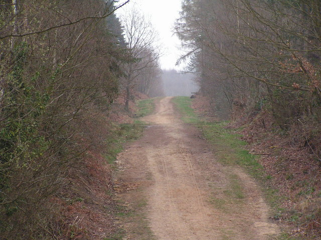
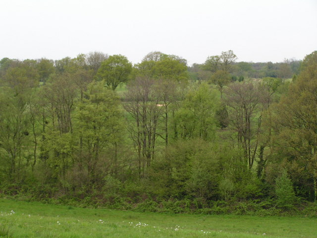
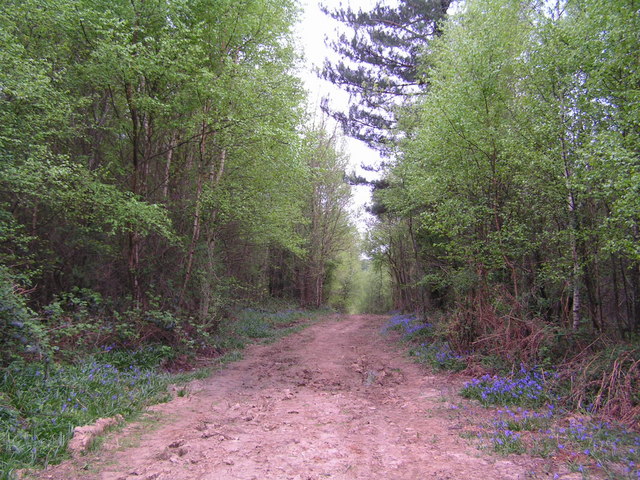
Alder Shaw, Sussex (Wood, Forest) is a picturesque and tranquil location situated in the county of Sussex, England. Nestled amidst the rolling hills and verdant landscapes, this wooded area is known for its dense population of alder trees, which lend the area its name.

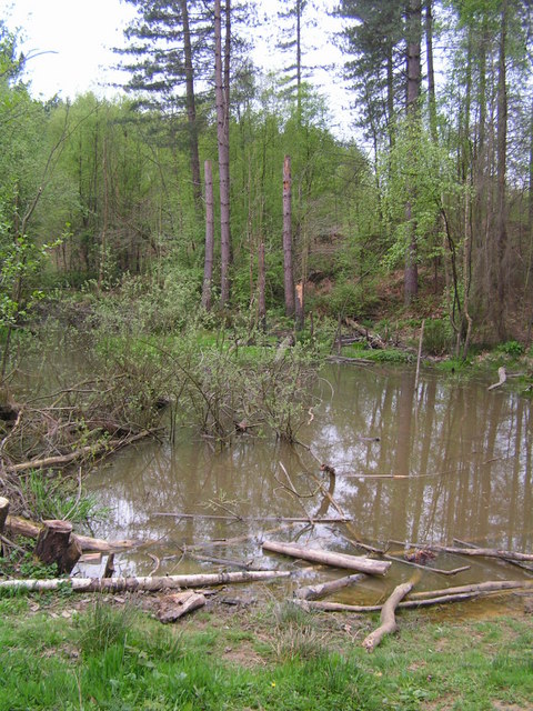
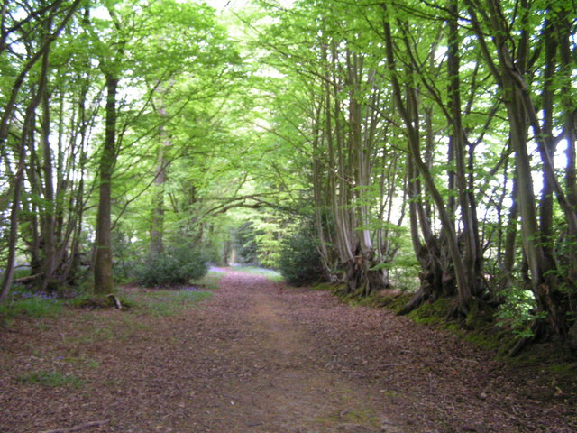
Covering an expansive area, Alder Shaw boasts a diverse ecosystem, providing a habitat for an array of flora and fauna. The woodland is characterized by its tall, slender alder trees, which create a canopy that filters sunlight, casting a soothing green hue over the forest floor. The forest is also home to a variety of other tree species, such as oak, birch, and beech, adding to the richness and diversity of the area.

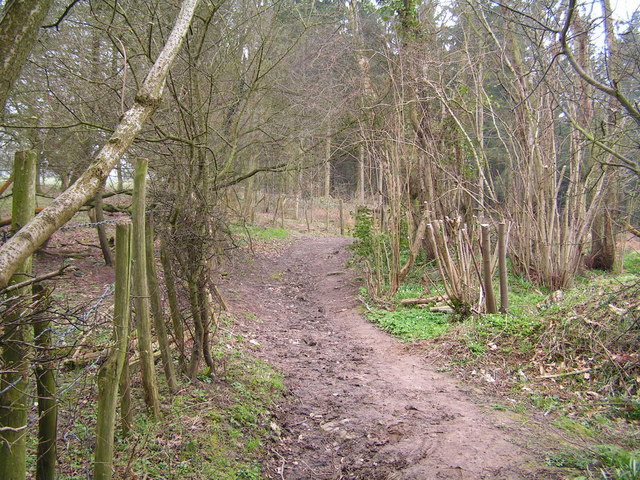
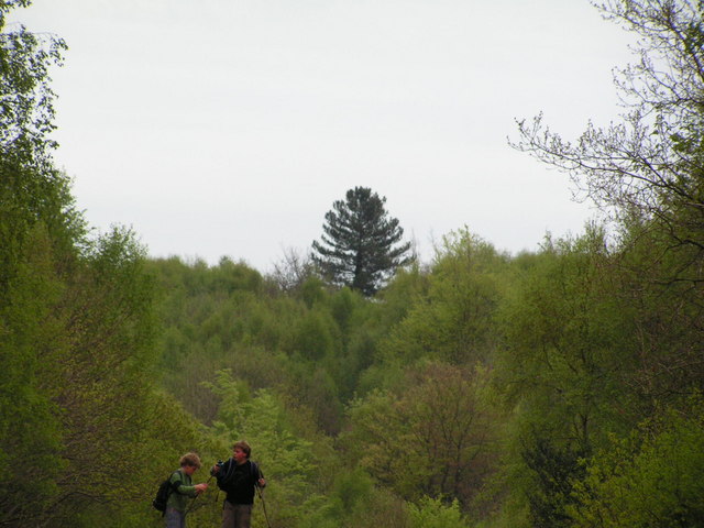
The forest floor is carpeted with a lush undergrowth of ferns, mosses, and wildflowers, creating a vibrant and enchanting atmosphere. It is a haven for wildlife, with numerous species of birds, including woodpeckers and songbirds, making it their home. Small mammals like squirrels and rabbits can also be spotted darting among the trees, while the occasional deer can be glimpsed gracefully traversing through the woodland.

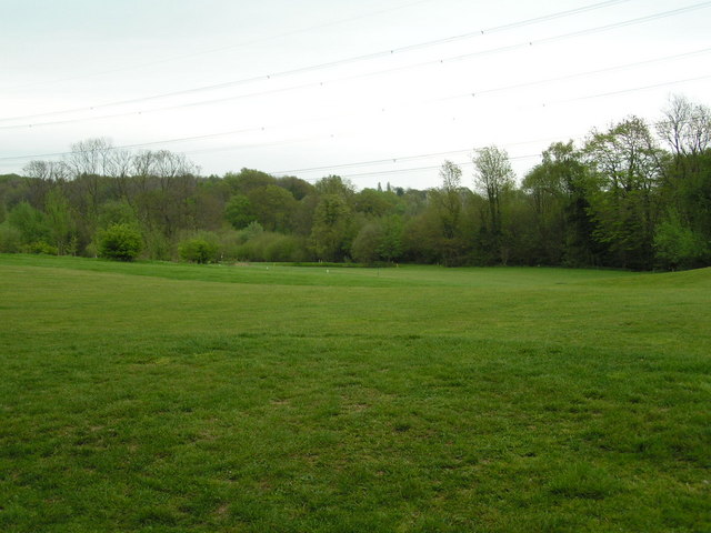
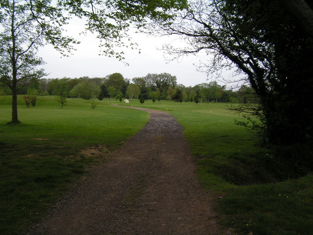
Alder Shaw offers a tranquil retreat for nature lovers and outdoor enthusiasts, providing ample opportunities for walking, hiking, and exploring. A network of well-maintained trails crisscrosses the forest, allowing visitors to immerse themselves in the natural beauty of the area. The dense foliage also provides a welcome respite from the summer heat, making it an ideal spot for picnics and leisurely strolls.

Overall, Alder Shaw, Sussex (Wood, Forest) is a captivating woodland, offering a serene and rejuvenating escape from the hustle and bustle of everyday life.

If you have any feedback on the listing, please let us know in the comments section below.

Alder Shaw Images

Images are sourced within 2km of 50.910182/0.53592624 or Grid Reference TQ7815. Thanks to Geograph Open Source API. All images are credited.

Track through the great wood, Battle A large forestry commission forest East of Battle
Track through the great wood, Battle
A large forestry commission forest East of Battle
Clearing in the Great Wood
Track through the great wood, Battle
Track through the Great Wood, Battle
Entering the Great Wood near Battle Part of a large forestry commission forest East of Battle
Entering the Great Wood near Battle
Part of a large forestry commission forest East of Battle
A2100 Main Battle to Hastings road through village of Telham
A2100
Main Battle to Hastings road through village of Telham
Pond in the Great Wood
Telham Church
Telham Church
Black Horse Inn, Telham Roadside inn, which holds music festivals.
Black Horse Inn, Telham
Roadside inn, which holds music festivals.
Footpath through the Woods This woodland is on the edge of Beauport park & Hastings Golf Club
Footpath through the Woods
This woodland is on the edge of Beauport park & Hastings Golf Club
Sedlescombe Golf Course through the trees Sedlescombe Golf Club offers excellent golf, hotel & conference facilities for the golfer and non golfer alike.
The parkland golf course measures 6269 yards and with a variety of obstacles including ponds and deep fairway bunkers, provides an enjoyable challenge to golfers of all abilities. 
Website: <span class="nowrap"><a title="http://www.sedlescombegolfclub.co.uk/" rel="nofollow ugc noopener" href="http://www.sedlescombegolfclub.co.uk/">Link</a><img style="margin-left:2px;" alt="External link" title="External link - shift click to open in new window" src="https://s1.geograph.org.uk/img/external.png" width="10" height="10"/></span>
Sedlescombe Golf Course through the trees
Sedlescombe Golf Club offers excellent golf, hotel & conference facilities for the golfer and non golfer alike. The parkland golf course measures 6269 yards and with a variety of obstacles including ponds and deep fairway bunkers, provides an enjoyable challenge to golfers of all abilities. Website: LinkExternal link
Sedlescombe Golf Course Sedlescombe Golf Club offers excellent golf, hotel & conference facilities for the golfer and non golfer alike.
The parkland golf course measures 6269 yards and with a variety of obstacles including ponds and deep fairway bunkers, provides an enjoyable challenge to golfers of all abilities. 
Website: <span class="nowrap"><a title="http://www.sedlescombegolfclub.co.uk/" rel="nofollow ugc noopener" href="http://www.sedlescombegolfclub.co.uk/">Link</a><img style="margin-left:2px;" alt="External link" title="External link - shift click to open in new window" src="https://s1.geograph.org.uk/img/external.png" width="10" height="10"/></span>
Sedlescombe Golf Course
Sedlescombe Golf Club offers excellent golf, hotel & conference facilities for the golfer and non golfer alike. The parkland golf course measures 6269 yards and with a variety of obstacles including ponds and deep fairway bunkers, provides an enjoyable challenge to golfers of all abilities. Website: LinkExternal link
Footpath across Sedlescombe Golf Course Sedlescombe Golf Club offers excellent golf, hotel & conference facilities for the golfer and non golfer alike.
The parkland golf course measures 6269 yards and with a variety of obstacles including ponds and deep fairway bunkers, provides an enjoyable challenge to golfers of all abilities. 
Website: <span class="nowrap"><a title="http://www.sedlescombegolfclub.co.uk/" rel="nofollow ugc noopener" href="http://www.sedlescombegolfclub.co.uk/">Link</a><img style="margin-left:2px;" alt="External link" title="External link - shift click to open in new window" src="https://s1.geograph.org.uk/img/external.png" width="10" height="10"/></span>
Footpath across Sedlescombe Golf Course
Sedlescombe Golf Club offers excellent golf, hotel & conference facilities for the golfer and non golfer alike. The parkland golf course measures 6269 yards and with a variety of obstacles including ponds and deep fairway bunkers, provides an enjoyable challenge to golfers of all abilities. Website: LinkExternal link
Distinctive tree in the Great Wood, Battle
Bluebells by the track in the Great Wood
Oak Tree near Pestalozzi With views to Brede High Wood in the background.
Oak Tree near Pestalozzi
With views to Brede High Wood in the background.
Crazy Lane From the junction with Chapel Hill heading down towards the A21.
Crazy Lane
From the junction with Chapel Hill heading down towards the A21.
Orchard, Waydown Farm Taken from the footpath that links Whydown Hill to New England Lane. These trees are to the north of it.
Orchard, Waydown Farm
Taken from the footpath that links Whydown Hill to New England Lane. These trees are to the north of it.
Show me another place!

Alder Shaw is located at Grid Ref: TQ7815 (Lat: 50.910182, Lng: 0.53592624)

Administrative County: East Sussex

District: Rother

Police Authority: Sussex

What 3 Words

///flirts.anode.haystack. Near Battle, East Sussex

Related Wikis

Hemingfold Meadow

Hemingfold Meadow is a 4.9-hectare (12-acre) biological Site of Special Scientific Interest west of Battle in East Sussex.This site consists of two adjacent...

Beauport Park

Beauport Park is a house near Hastings, East Sussex, England. It is located at the western end of the ridge of hills sheltering Hastings from the north...

Blackhorse Quarry

Blackhorse Quarry is a 0.2-hectare (0.49-acre) geological Site of Special Scientific Interest south-east of Battle in East Sussex. It is a Geological Conservation...

Sedlescombe

Sedlescombe is a village and civil parish in the Rother district of East Sussex, England. The village is on the B2244 road, about 6 miles (10 km) north...

Baldslow

Baldslow is a suburb in the north of Hastings, East Sussex, England. It is sometimes considered part of Conquest as Bohemia and Silverhill. The area lies...

Battle railway station

Battle railway station is on the Hastings line in the south of England and serves the town of Battle, East Sussex. It is 55 miles 46 chains (89.4 km) down...

Maplehurst Wood

Maplehurst Wood is a 31.6-hectare (78-acre) biological Site of Special Scientific Interest on the northern outskirts of Hastings in East Sussex.This wood...

Westfield, East Sussex

Westfield is a village and civil parish in the Rother district of East Sussex. It is one of the largest villages in the area with a population of around...

Nearby Amenities

Located within 500m of 50.910182,0.53592624
Power: tower
Lat/Long: 50.911281/0.5390865
Power: tower
Lat/Long: 50.9087252/0.5355896
Power: tower
Lat/Long: 50.9066639/0.5326479
Screen Wood
Natural: wood
Lat/Long: 50.9084707/0.5369796
Aldershaw Handmade Tiles
Shop: tiles
Lat/Long: 50.9102952/0.5406947
Lane Wood
Natural: wood
Lat/Long: 50.9063179/0.5343429
Golf: pin
Lat/Long: 50.9136368/0.5314989
Golf: pin
Lat/Long: 50.91232/0.5317108
Golf: pin
Lat/Long: 50.9102156/0.5296502
Golf: pin
Lat/Long: 50.9130039/0.5323884
Golf: pin
Lat/Long: 50.9143242/0.5368805
Golf: pin
Lat/Long: 50.9125293/0.5330158
Golf: pin
Lat/Long: 50.9102824/0.5338858
Golf: pin
Lat/Long: 50.9100521/0.5317638
Golf: pin
Lat/Long: 50.9091976/0.5338384
Golf: pin
Lat/Long: 50.9104424/0.5377226
Golf: pin
Lat/Long: 50.9098411/0.5346163
Golf: pin
Lat/Long: 50.9128897/0.5342232
The data included in this document is from www.openstreetmap.org. The data is made available under ODbL.

Have you been to Alder Shaw?

Leave your review of Alder Shaw below (or comments, questions and feedback).