Church Field Grove
Wood, Forest in Essex Braintree
England
Church Field Grove

Church Field Grove is a picturesque woodland located in Essex, England. Situated in the heart of the county, this wooded area is renowned for its natural beauty and tranquil atmosphere. Covering an expansive area, Church Field Grove is a haven for nature lovers and outdoor enthusiasts.
The grove is characterized by its dense forest of towering trees, predominantly consisting of oak, beech, and birch. These majestic trees create a dense canopy that provides shelter and shade for a plethora of wildlife species. The forest floor is adorned with a rich carpet of vibrant wildflowers, adding to the area's charm and biodiversity.
The grove is intersected by several enchanting footpaths, which meander through the woodland, offering visitors the opportunity to explore and admire the natural wonders it has to offer. As visitors stroll along the well-maintained trails, they may encounter an array of wildlife, including squirrels, rabbits, and various bird species.
Church Field Grove also boasts a small stream that gently winds its way through the woods. This babbling brook adds to the overall serenity of the grove, providing a soothing soundtrack to accompany one's walk.
The grove is a popular destination for those seeking a peaceful retreat from the hustle and bustle of everyday life. It offers a variety of recreational activities, such as hiking, birdwatching, and photography. Additionally, the grove is a favored spot for picnics and family outings, with designated areas providing ample space for visitors to relax and enjoy the natural surroundings.
Overall, Church Field Grove is an idyllic woodland sanctuary, offering a glimpse into the beauty and tranquility of nature in Essex.
If you have any feedback on the listing, please let us know in the comments section below.
Church Field Grove Images
Images are sourced within 2km of 51.995457/0.59684154 or Grid Reference TL7836. Thanks to Geograph Open Source API. All images are credited.


Church Field Grove is located at Grid Ref: TL7836 (Lat: 51.995457, Lng: 0.59684154)
Administrative County: Essex
District: Braintree
Police Authority: Essex
What 3 Words
///cherish.searches.fruits. Near Castle Hedingham, Essex
Nearby Locations
Related Wikis
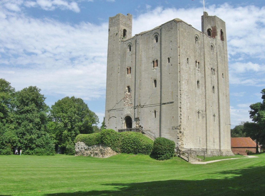
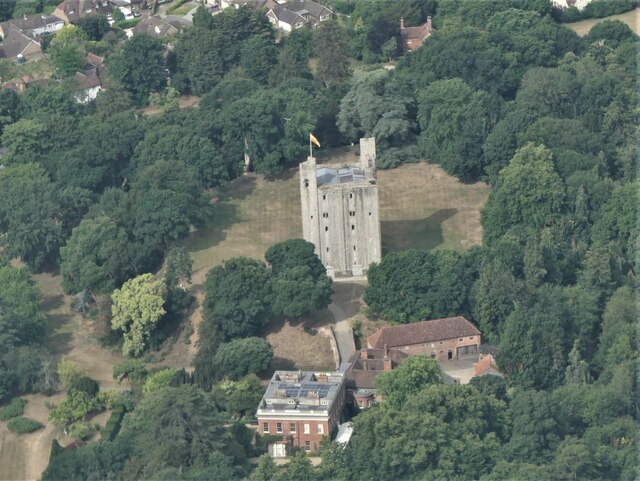
Hedingham Castle
Hedingham Castle, in the village of Castle Hedingham, Essex, is arguably the best preserved Norman keep in England. The castle fortifications and outbuildings...

Halstead Rural District
Halstead was a rural district in Essex, England from 1894 to 1974. It was created by the Local Government Act 1894 as a successor to the Halstead rural...

Castle Hedingham
Castle Hedingham is a village in northern Essex, England, located four miles west of Halstead and 3 miles southeast of Great Yeldham in the Colne Valley...
Castle Hedingham Priory
Hedingham Priory was a Benedictine nunnery in Castle Hedingham, Essex, founded in or before 1190 by Aubrey de Vere, 1st Earl of Oxford, perhaps in partnership...
Nearby Amenities
Located within 500m of 51.995457,0.59684154Have you been to Church Field Grove?
Leave your review of Church Field Grove below (or comments, questions and feedback).