Park Wood

Wood, Forest in Sussex Hastings

England

Park Wood

Combe Valley
Combe Valley Credit: N Chadwick

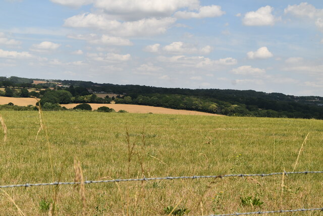
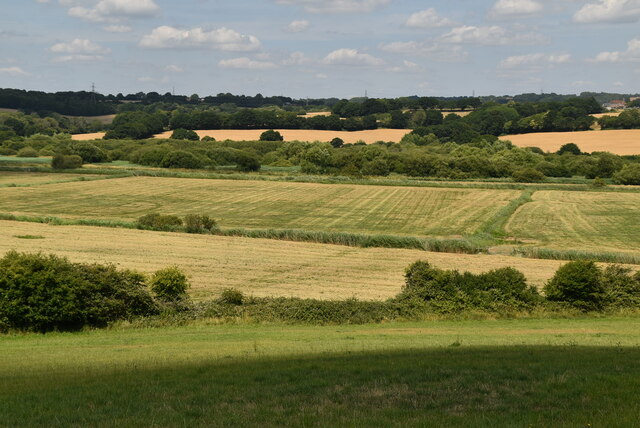
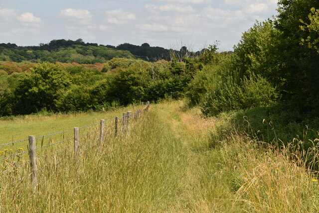
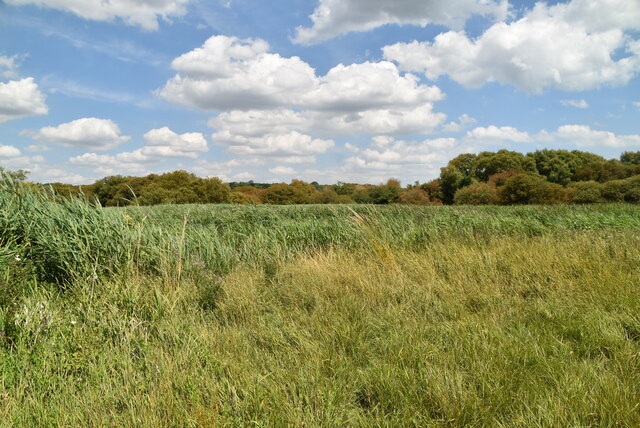
Park Wood is a picturesque woodland located in Sussex, England. Covering an area of approximately 100 acres, it is known for its natural beauty and diverse range of wildlife. The wood is predominantly composed of native broadleaf trees, including oak, beech, ash, and birch, which form a dense canopy overhead, creating a tranquil and shaded environment.

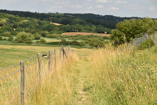
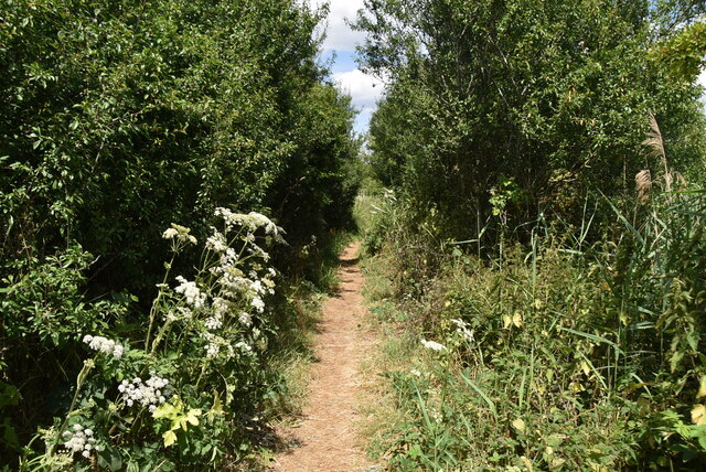
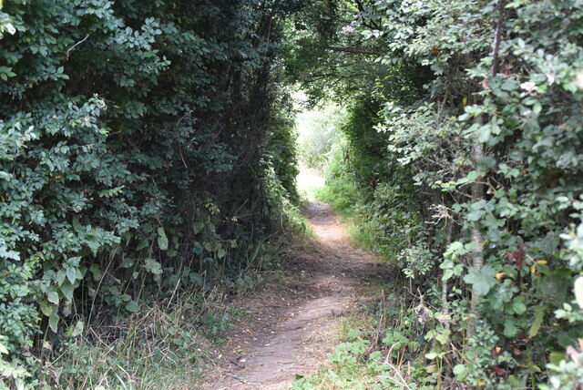
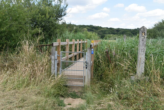
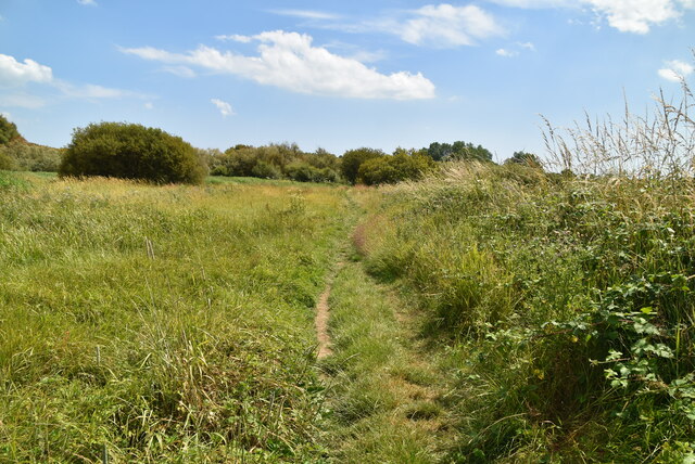
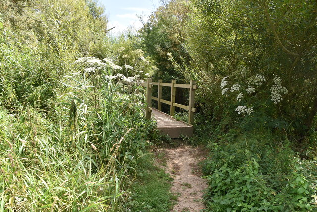
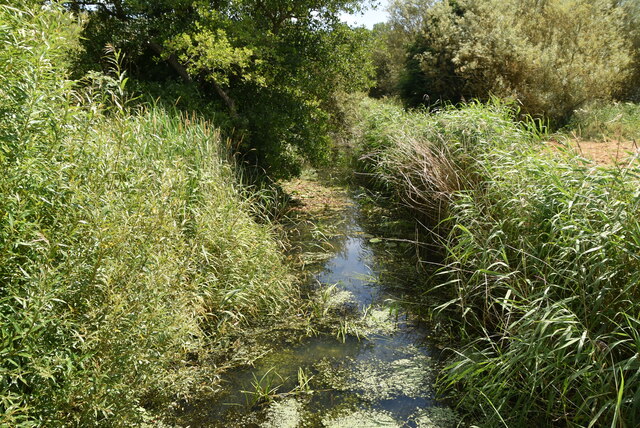
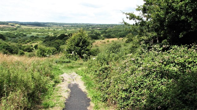
The wood is crisscrossed by a network of well-maintained footpaths, allowing visitors to explore its many hidden corners and enjoy the peaceful surroundings. These paths wind through a variety of habitats, such as open glades, dense thickets, and small streams, offering a rich tapestry of flora and fauna.

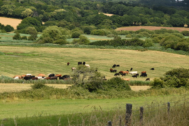
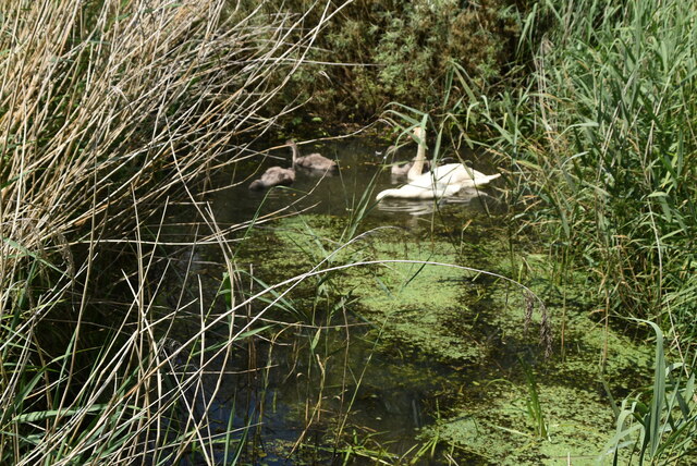
Park Wood is home to a wide range of wildlife, making it a popular spot for nature enthusiasts. Visitors may encounter woodland birds such as great spotted woodpeckers, nuthatches, and tawny owls, while lucky observers might even spot elusive mammals like badgers, foxes, and deer. The wood is also an important habitat for numerous insect species, including butterflies, beetles, and dragonflies.

Managed by a local conservation organization, Park Wood is carefully looked after to maintain its natural beauty and protect its biodiversity. Regular maintenance work, such as tree planting, clearing invasive species, and creating wildlife habitats, ensures the wood remains a haven for wildlife and an enjoyable place for visitors.

Overall, Park Wood in Sussex offers a peaceful retreat from the hustle and bustle of everyday life, providing a chance to reconnect with nature and appreciate the beauty of the British woodland ecosystem.

If you have any feedback on the listing, please let us know in the comments section below.

Park Wood Images

Images are sourced within 2km of 50.876374/0.52176487 or Grid Reference TQ7711. Thanks to Geograph Open Source API. All images are credited.

Combe Valley
Combe Valley
Footpath to Combe Haven
Combe Haven valley
Combe Haven valley
Cattle, Combe Haven Valley
Grass footpath
Grass footpath
Narrow footpath
Narrow footpath
Wooded footpath
Wooded footpath
Footbridge, Combe Haven
Filsham Reedbeds Combe Valley Countryside Park is an 600 acre area of marshlands, woodland and beach between Bexhill and St Leonards.

Originally called the Pebsham Countryside Park, the park was first mooted in 1993 as part of the North Bexhill Strategic Framework. 

In 2008 the Pebsham Countryside Park Project Management Board was formed comprising representatives from Hastings Borough Council, Rother District Council, East Sussex County Council and Crowhurst Parish Council.

In 2012 the Management Board renamed the park Combe Valley Countryside Park following feedback from the public that the name Pebsham did not reflect the full extent of the greenspace within the Combe Haven area. The proposed Countryside Park covers an area of 600 hectares within Rother District and Hastings Borough. 

The Hastings to Bexhill link road, Combe Valley Way construction, started in 2013 to the north of the park area, which cuts through the park.
Filsham Reedbeds
Combe Valley Countryside Park is an 600 acre area of marshlands, woodland and beach between Bexhill and St Leonards. Originally called the Pebsham Countryside Park, the park was first mooted in 1993 as part of the North Bexhill Strategic Framework. In 2008 the Pebsham Countryside Park Project Management Board was formed comprising representatives from Hastings Borough Council, Rother District Council, East Sussex County Council and Crowhurst Parish Council. In 2012 the Management Board renamed the park Combe Valley Countryside Park following feedback from the public that the name Pebsham did not reflect the full extent of the greenspace within the Combe Haven area. The proposed Countryside Park covers an area of 600 hectares within Rother District and Hastings Borough. The Hastings to Bexhill link road, Combe Valley Way construction, started in 2013 to the north of the park area, which cuts through the park.
Footpath, Filsham Reedbeds
Footbridge, Combe Haven
Combe Haven
Combe Haven
Swan & Cygnets, Combe Haven Combe Valley Countryside Park is an 600 acre area of marshlands, woodland and beach between Bexhill and St Leonards.

Originally called the Pebsham Countryside Park, the park was first mooted in 1993 as part of the North Bexhill Strategic Framework. 

In 2008 the Pebsham Countryside Park Project Management Board was formed comprising representatives from Hastings Borough Council, Rother District Council, East Sussex County Council and Crowhurst Parish Council.

In 2012 the Management Board renamed the park Combe Valley Countryside Park following feedback from the public that the name Pebsham did not reflect the full extent of the greenspace within the Combe Haven area. The proposed Countryside Park covers an area of 600 hectares within Rother District and Hastings Borough. 

The Hastings to Bexhill link road, Combe Valley Way construction, started in 2013 to the north of the park area, which cuts through the park.
Swan & Cygnets, Combe Haven
Combe Valley Countryside Park is an 600 acre area of marshlands, woodland and beach between Bexhill and St Leonards. Originally called the Pebsham Countryside Park, the park was first mooted in 1993 as part of the North Bexhill Strategic Framework. In 2008 the Pebsham Countryside Park Project Management Board was formed comprising representatives from Hastings Borough Council, Rother District Council, East Sussex County Council and Crowhurst Parish Council. In 2012 the Management Board renamed the park Combe Valley Countryside Park following feedback from the public that the name Pebsham did not reflect the full extent of the greenspace within the Combe Haven area. The proposed Countryside Park covers an area of 600 hectares within Rother District and Hastings Borough. The Hastings to Bexhill link road, Combe Valley Way construction, started in 2013 to the north of the park area, which cuts through the park.
Footpath by Combe Haven Combe Valley Countryside Park is an 600 acre area of marshlands, woodland and beach between Bexhill and St Leonards.

Originally called the Pebsham Countryside Park, the park was first mooted in 1993 as part of the North Bexhill Strategic Framework. 

In 2008 the Pebsham Countryside Park Project Management Board was formed comprising representatives from Hastings Borough Council, Rother District Council, East Sussex County Council and Crowhurst Parish Council.

In 2012 the Management Board renamed the park Combe Valley Countryside Park following feedback from the public that the name Pebsham did not reflect the full extent of the greenspace within the Combe Haven area. The proposed Countryside Park covers an area of 600 hectares within Rother District and Hastings Borough. 

The Hastings to Bexhill link road, Combe Valley Way construction, started in 2013 to the north of the park area, which cuts through the park.
Footpath by Combe Haven
Combe Valley Countryside Park is an 600 acre area of marshlands, woodland and beach between Bexhill and St Leonards. Originally called the Pebsham Countryside Park, the park was first mooted in 1993 as part of the North Bexhill Strategic Framework. In 2008 the Pebsham Countryside Park Project Management Board was formed comprising representatives from Hastings Borough Council, Rother District Council, East Sussex County Council and Crowhurst Parish Council. In 2012 the Management Board renamed the park Combe Valley Countryside Park following feedback from the public that the name Pebsham did not reflect the full extent of the greenspace within the Combe Haven area. The proposed Countryside Park covers an area of 600 hectares within Rother District and Hastings Borough. The Hastings to Bexhill link road, Combe Valley Way construction, started in 2013 to the north of the park area, which cuts through the park.
Footpath, Combe Haven Combe Valley Countryside Park is an 600 acre area of marshlands, woodland and beach between Bexhill and St Leonards.

Originally called the Pebsham Countryside Park, the park was first mooted in 1993 as part of the North Bexhill Strategic Framework. 

In 2008 the Pebsham Countryside Park Project Management Board was formed comprising representatives from Hastings Borough Council, Rother District Council, East Sussex County Council and Crowhurst Parish Council.

In 2012 the Management Board renamed the park Combe Valley Countryside Park following feedback from the public that the name Pebsham did not reflect the full extent of the greenspace within the Combe Haven area. The proposed Countryside Park covers an area of 600 hectares within Rother District and Hastings Borough. 

The Hastings to Bexhill link road, Combe Valley Way construction, started in 2013 to the north of the park area, which cuts through the park.
Footpath, Combe Haven
Combe Valley Countryside Park is an 600 acre area of marshlands, woodland and beach between Bexhill and St Leonards. Originally called the Pebsham Countryside Park, the park was first mooted in 1993 as part of the North Bexhill Strategic Framework. In 2008 the Pebsham Countryside Park Project Management Board was formed comprising representatives from Hastings Borough Council, Rother District Council, East Sussex County Council and Crowhurst Parish Council. In 2012 the Management Board renamed the park Combe Valley Countryside Park following feedback from the public that the name Pebsham did not reflect the full extent of the greenspace within the Combe Haven area. The proposed Countryside Park covers an area of 600 hectares within Rother District and Hastings Borough. The Hastings to Bexhill link road, Combe Valley Way construction, started in 2013 to the north of the park area, which cuts through the park.
Filsham Reedbed Board walk and hide in the Filsham Reedbed Nature Reserve of the Sussex Wildlife Trust
Filsham Reedbed
Board walk and hide in the Filsham Reedbed Nature Reserve of the Sussex Wildlife Trust
View of Combe Valley, St. Leonards-on-Sea An area of open countryside (now crossed by the new Hastings/Bexhill Link Road) to the west of Filsham Road, St. Leonards-on-Sea.
View of Combe Valley, St. Leonards-on-Sea
An area of open countryside (now crossed by the new Hastings/Bexhill Link Road) to the west of Filsham Road, St. Leonards-on-Sea.
Filsham Reedbeds - Combe Valley Countryside Park Combe Valley Countryside Park is an 600 acre area of marshlands, woodland and beach between Bexhill and St Leonards.

Originally called the Pebsham Countryside Park, the park was first mooted in 1993 as part of the North Bexhill Strategic Framework. 

In 2008 the Pebsham Countryside Park Project Management Board was formed comprising representatives from Hastings Borough Council, Rother District Council, East Sussex County Council and Crowhurst Parish Council.

In 2012 the Management Board renamed the park Combe Valley Countryside Park following feedback from the public that the name Pebsham did not reflect the full extent of the greenspace within the Combe Haven area. The proposed Countryside Park covers an area of 600 hectares within Rother District and Hastings Borough. 

The Hastings to Bexhill link road, Combe Valley Way construction, started in 2013 to the north of the park area, which cuts through the park.
Filsham Reedbeds - Combe Valley Countryside Park
Combe Valley Countryside Park is an 600 acre area of marshlands, woodland and beach between Bexhill and St Leonards. Originally called the Pebsham Countryside Park, the park was first mooted in 1993 as part of the North Bexhill Strategic Framework. In 2008 the Pebsham Countryside Park Project Management Board was formed comprising representatives from Hastings Borough Council, Rother District Council, East Sussex County Council and Crowhurst Parish Council. In 2012 the Management Board renamed the park Combe Valley Countryside Park following feedback from the public that the name Pebsham did not reflect the full extent of the greenspace within the Combe Haven area. The proposed Countryside Park covers an area of 600 hectares within Rother District and Hastings Borough. The Hastings to Bexhill link road, Combe Valley Way construction, started in 2013 to the north of the park area, which cuts through the park.
Show me another place!

Park Wood is located at Grid Ref: TQ7711 (Lat: 50.876374, Lng: 0.52176487)

Administrative County: East Sussex

District: Hastings

Police Authority: Sussex

What 3 Words

///impulsive.december.goofy. Near St Leonards-on-Sea, East Sussex

Related Wikis

Marline Valley Woods

Marline Valley Woods is a 55.1-hectare (136-acre) biological Site of Special Scientific Interest on the western outskirts of Hastings in East Sussex. An...

Church Wood and Robsack Wood

Church Wood and Robsack Wood is a 29.7-hectare (73-acre) Local Nature Reserve in Hastings in East Sussex. It is owned and managed by Hastings Borough...

Church in the Wood, Hollington

Church in the Wood, officially known as St Leonard's Church and originally as St Rumbold's Church, is an Anglican church in the Hollington area of the...

Combe Haven

Combe Haven is a 153-hectare (380-acre) biological Site of Special Scientific Interest between Hastings and Bexhill-on-Sea in East Sussex. An area of 18...

Filsham Reedbed

Filsham Reedbed is an 18.5-hectare (46-acre) Local Nature Reserve on the western outskirts of St Leonards-on-Sea in East Sussex. It is owned by Hastings...

Hollington, Hastings

Hollington is a council estate and local government ward in the northwest of Hastings, in the Hastings district, in the county of East Sussex, England...

Crowhurst railway station

Crowhurst railway station is on the Hastings line in the south of England and serves the village of Crowhurst, East Sussex. It is 57 miles 50 chains (92...

Crowhurst, East Sussex

Crowhurst is an isolated village situated five miles (8 km) north-west of Hastings in East Sussex. It has a parish council and is located within the Rother...

Nearby Amenities

Located within 500m of 50.876374,0.52176487
Power: tower
Lat/Long: 50.8773554/0.5172965
Power: tower
Lat/Long: 50.8786745/0.5217108
Crossing
Button Operated: yes
Crossing: traffic_signals
Crossing Island: no
Crossing Ref: pelican
Kerb: lowered
Tactile Paving: yes
Lat/Long: 50.871943/0.5229185
Bench
Lat/Long: 50.8784158/0.5271952
Access: yes
Barrier: cycle_barrier
Foot: designated
Lat/Long: 50.8720356/0.5229623
Traffic Signals
Traffic Signals: junction
Traffic Signals Direction: forward
Lat/Long: 50.8720818/0.5233155
Traffic Signals
Traffic Signals: junction
Traffic Signals Direction: forward
Lat/Long: 50.8719488/0.5228561
Generator Method: photovoltaic
Generator Output Electricity: yes
Generator Source: solar
Generator Type: solar_photovoltaic_panel
Location: roof
Power: generator
Lat/Long: 50.8740079/0.5274564
Generator Method: photovoltaic
Generator Output Electricity: yes
Generator Source: solar
Generator Type: solar_photovoltaic_panel
Location: roof
Power: generator
Lat/Long: 50.8735543/0.5267724
Generator Method: photovoltaic
Generator Output Electricity: yes
Generator Source: solar
Generator Type: solar_photovoltaic_panel
Location: roof
Power: generator
Lat/Long: 50.8736237/0.5268368
Generator Method: photovoltaic
Generator Output Electricity: yes
Generator Source: solar
Generator Type: solar_photovoltaic_panel
Location: roof
Power: generator
Lat/Long: 50.8737032/0.5271238
Generator Method: photovoltaic
Generator Output Electricity: yes
Generator Source: solar
Generator Type: solar_photovoltaic_panel
Location: roof
Power: generator
Lat/Long: 50.8737913/0.5273437
The data included in this document is from www.openstreetmap.org. The data is made available under ODbL.

Have you been to Park Wood?

Leave your review of Park Wood below (or comments, questions and feedback).