Alder Bog

Wood, Forest in Sussex Rother

England

Alder Bog

Wooded path
Wooded path Credit: N Chadwick

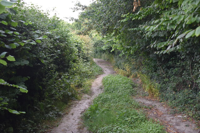
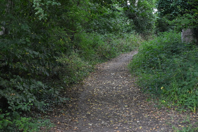
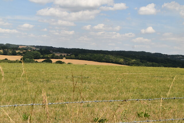
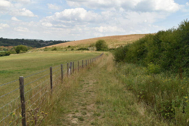
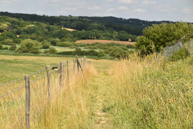
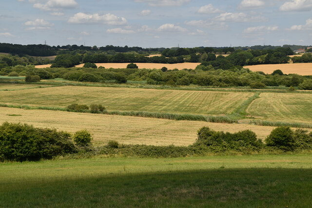
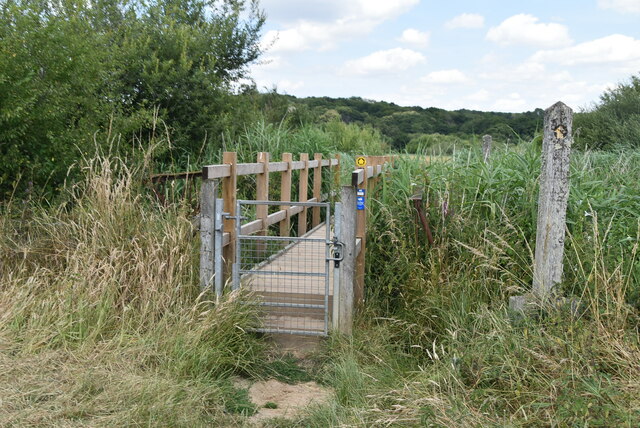
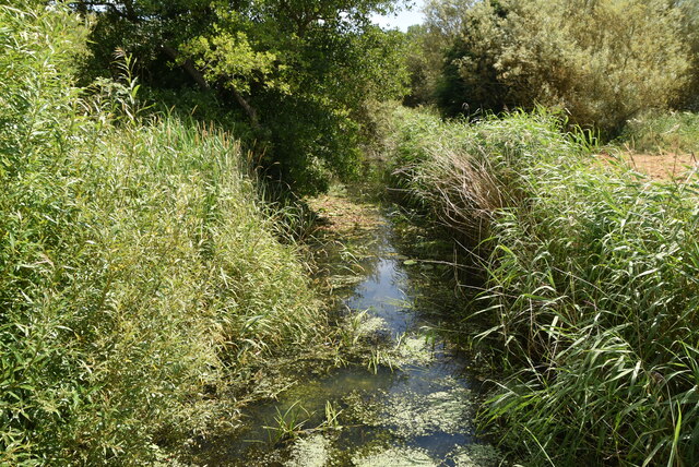
Alder Bog, located in Sussex, England, is a captivating wood and forest area that encompasses a diverse range of natural features. Spanning approximately 100 acres, it is characterized by its serene and tranquil atmosphere, making it a popular destination for nature enthusiasts and hikers.

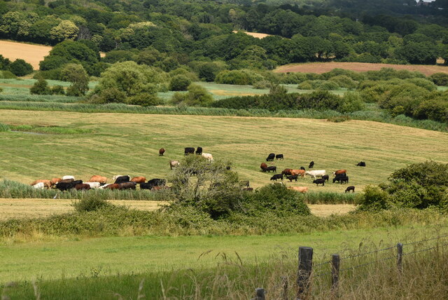
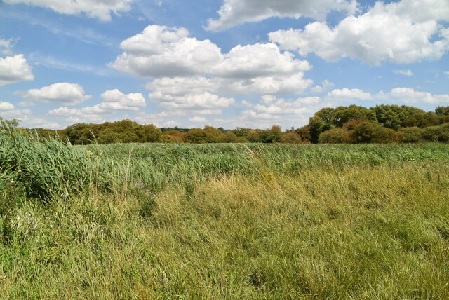
The bog is predominantly composed of Alder trees, which lend their name to the area. These trees thrive in the damp and marshy conditions that are prevalent in the region. Their dense foliage provides ample shade and creates a unique microclimate, fostering the growth of various mosses, ferns, and wildflowers. This rich and diverse plant life creates a vibrant and colorful ecosystem, attracting an array of bird species, insects, and small mammals.

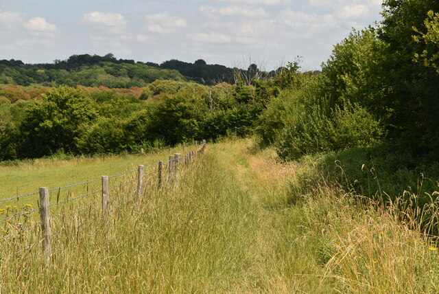
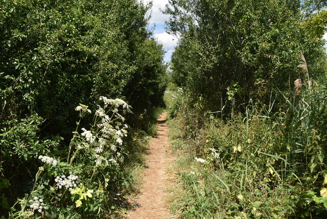
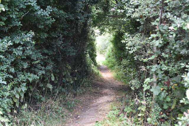
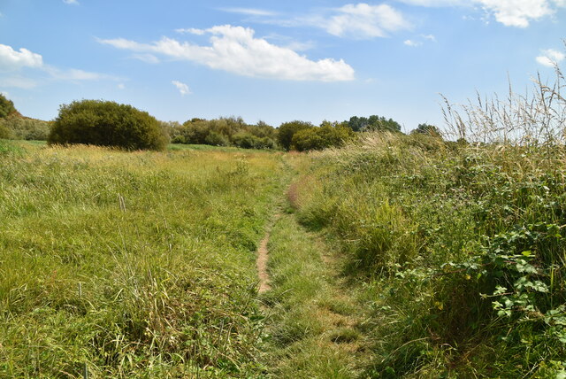
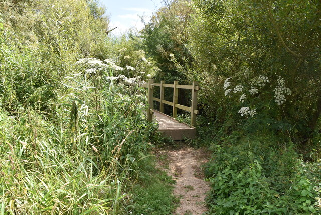
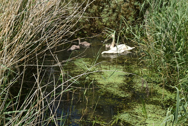
Visitors to Alder Bog can explore an extensive network of walking trails that wind through the forest. These paths offer breathtaking views of the surrounding landscape, including picturesque ponds and streams that meander through the bog. The area is also home to a diverse range of wildlife, with sightings of deer, badgers, and foxes being relatively common.

For those interested in birdwatching, Alder Bog provides an excellent opportunity to spot various species, such as woodpeckers, kingfishers, and herons. The tranquil atmosphere of the bog also makes it an ideal location for photography and nature observation.

Overall, Alder Bog in Sussex offers a captivating and immersive natural experience, with its lush vegetation, diverse wildlife, and scenic beauty. It is a must-visit destination for anyone seeking a peaceful retreat in the heart of nature.

If you have any feedback on the listing, please let us know in the comments section below.

Alder Bog Images

Images are sourced within 2km of 50.874386/0.51592882 or Grid Reference TQ7711. Thanks to Geograph Open Source API. All images are credited.

Wooded path
Wooded path
Wooded footpath
Wooded footpath
Arable land
Arable land
Arable land
Arable land
Combe Valley
Combe Valley
Footpath by old landfill site
Footpath to Combe Haven
Combe Haven valley
Combe Haven valley
Cattle, Combe Haven Valley
Grass footpath
Grass footpath
Narrow footpath
Narrow footpath
Wooded footpath
Wooded footpath
Footbridge, Combe Haven
Filsham Reedbeds Combe Valley Countryside Park is an 600 acre area of marshlands, woodland and beach between Bexhill and St Leonards.

Originally called the Pebsham Countryside Park, the park was first mooted in 1993 as part of the North Bexhill Strategic Framework. 

In 2008 the Pebsham Countryside Park Project Management Board was formed comprising representatives from Hastings Borough Council, Rother District Council, East Sussex County Council and Crowhurst Parish Council.

In 2012 the Management Board renamed the park Combe Valley Countryside Park following feedback from the public that the name Pebsham did not reflect the full extent of the greenspace within the Combe Haven area. The proposed Countryside Park covers an area of 600 hectares within Rother District and Hastings Borough. 

The Hastings to Bexhill link road, Combe Valley Way construction, started in 2013 to the north of the park area, which cuts through the park.
Filsham Reedbeds
Combe Valley Countryside Park is an 600 acre area of marshlands, woodland and beach between Bexhill and St Leonards. Originally called the Pebsham Countryside Park, the park was first mooted in 1993 as part of the North Bexhill Strategic Framework. In 2008 the Pebsham Countryside Park Project Management Board was formed comprising representatives from Hastings Borough Council, Rother District Council, East Sussex County Council and Crowhurst Parish Council. In 2012 the Management Board renamed the park Combe Valley Countryside Park following feedback from the public that the name Pebsham did not reflect the full extent of the greenspace within the Combe Haven area. The proposed Countryside Park covers an area of 600 hectares within Rother District and Hastings Borough. The Hastings to Bexhill link road, Combe Valley Way construction, started in 2013 to the north of the park area, which cuts through the park.
Footpath, Filsham Reedbeds
Footbridge, Combe Haven
Combe Haven
Combe Haven
Swan & Cygnets, Combe Haven Combe Valley Countryside Park is an 600 acre area of marshlands, woodland and beach between Bexhill and St Leonards.

Originally called the Pebsham Countryside Park, the park was first mooted in 1993 as part of the North Bexhill Strategic Framework. 

In 2008 the Pebsham Countryside Park Project Management Board was formed comprising representatives from Hastings Borough Council, Rother District Council, East Sussex County Council and Crowhurst Parish Council.

In 2012 the Management Board renamed the park Combe Valley Countryside Park following feedback from the public that the name Pebsham did not reflect the full extent of the greenspace within the Combe Haven area. The proposed Countryside Park covers an area of 600 hectares within Rother District and Hastings Borough. 

The Hastings to Bexhill link road, Combe Valley Way construction, started in 2013 to the north of the park area, which cuts through the park.
Swan & Cygnets, Combe Haven
Combe Valley Countryside Park is an 600 acre area of marshlands, woodland and beach between Bexhill and St Leonards. Originally called the Pebsham Countryside Park, the park was first mooted in 1993 as part of the North Bexhill Strategic Framework. In 2008 the Pebsham Countryside Park Project Management Board was formed comprising representatives from Hastings Borough Council, Rother District Council, East Sussex County Council and Crowhurst Parish Council. In 2012 the Management Board renamed the park Combe Valley Countryside Park following feedback from the public that the name Pebsham did not reflect the full extent of the greenspace within the Combe Haven area. The proposed Countryside Park covers an area of 600 hectares within Rother District and Hastings Borough. The Hastings to Bexhill link road, Combe Valley Way construction, started in 2013 to the north of the park area, which cuts through the park.
Show me another place!

Alder Bog is located at Grid Ref: TQ7711 (Lat: 50.874386, Lng: 0.51592882)

Administrative County: East Sussex

District: Rother

Police Authority: Sussex

What 3 Words

///trials.rubble.friend. Near St Leonards-on-Sea, East Sussex

Related Wikis

Marline Valley Woods

Marline Valley Woods is a 55.1-hectare (136-acre) biological Site of Special Scientific Interest on the western outskirts of Hastings in East Sussex. An...

Church Wood and Robsack Wood

Church Wood and Robsack Wood is a 29.7-hectare (73-acre) Local Nature Reserve in Hastings in East Sussex. It is owned and managed by Hastings Borough...

Combe Haven

Combe Haven is a 153-hectare (380-acre) biological Site of Special Scientific Interest between Hastings and Bexhill-on-Sea in East Sussex. An area of 18...

Church in the Wood, Hollington

Church in the Wood, officially known as St Leonard's Church and originally as St Rumbold's Church, is an Anglican church in the Hollington area of the...

Filsham Reedbed

Filsham Reedbed is an 18.5-hectare (46-acre) Local Nature Reserve on the western outskirts of St Leonards-on-Sea in East Sussex. It is owned by Hastings...

Bexhill West branch line

The Bexhill West branch line was a short double-track branch line which was opened on 1 June 1902. It was built by the Crowhurst, Sidley & Bexhill Railway...

Crowhurst railway station

Crowhurst railway station is on the Hastings line in the south of England and serves the village of Crowhurst, East Sussex. It is 57 miles 50 chains (92...

Crowhurst, East Sussex

Crowhurst is an isolated village situated five miles (8 km) north-west of Hastings in East Sussex. It has a parish council and is located within the Rother...

Related Videos

Haven Combe Haven, Hastings

Haven Combe Haven, Hastings In this video, we'll show you all the amazing things that were happening at Haven Combe Haven ...

_Combe Haven Holiday Park Hasting ( June 2 - 6 ) 2023

Learning places in Combe haven an ideal for family adventure.

Combe Haven Holiday Park in West Sussex near Hastings

Combe Haven's accommodation areas sweep the park's steep hill, and some are on the flat areas at the top and bottom. This park ...

SISTER HOLIDAY AT SAINT LEONARDS BY THE SEA - flight attendant on vacation pt 3 ✈️

My sister and I finish our English vacation exploring St Leonards, Hasting and the little town of Rye! We had the best time climbing ...

Nearby Amenities

Located within 500m of 50.874386,0.51592882
Power: tower
Lat/Long: 50.8761013/0.5130291
Power: tower
Lat/Long: 50.8773554/0.5172965
Access: yes
Barrier: swing_gate
Bicycle: yes
Foot: yes
Horse: yes
Swing Gate Type: single
Lat/Long: 50.8718486/0.5182276
Bicycle: yes
Hiking: yes
Horse: yes
Information: guidepost
Operator: CVCP
Ref: MP78
Tourism: information
Lat/Long: 50.8718409/0.5181605
The data included in this document is from www.openstreetmap.org. The data is made available under ODbL.

Have you been to Alder Bog?

Leave your review of Alder Bog below (or comments, questions and feedback).