Starven Wood

Wood, Forest in Sussex Rother

England

Starven Wood

Robertsbridge abbey (rems of) These are the remains of the cistercian abbey, now not visitable as part of a private house.
Robertsbridge abbey (rems of) Credit: N Chadwick

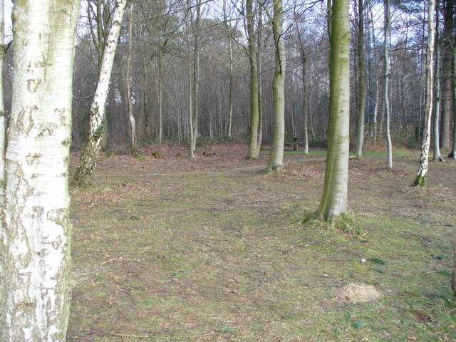
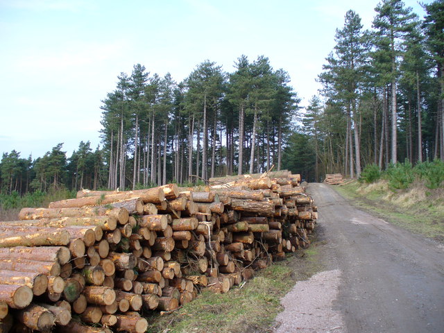
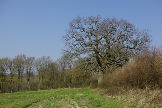
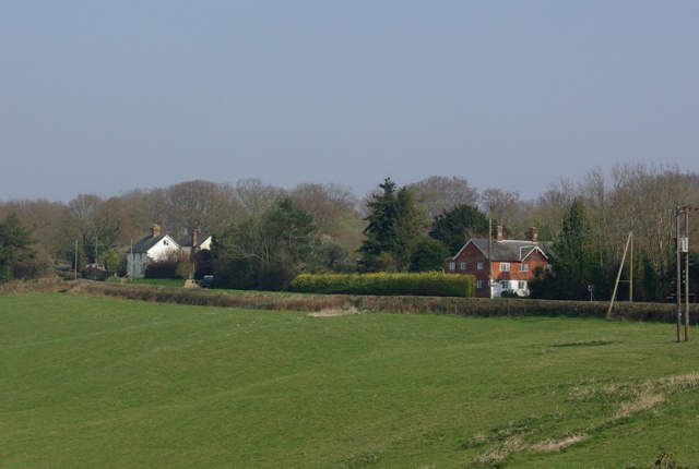
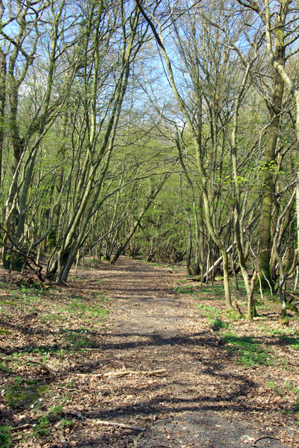
Starven Wood is a picturesque forest located in Sussex, England. Covering an area of approximately 500 acres, it is renowned for its natural beauty and diverse wildlife. The wood is predominantly composed of deciduous trees, including oak, beech, and birch, which create a stunning canopy during the summer months.

The woodland floor is adorned with a rich variety of flora, such as bluebells, wild garlic, and wood anemones, forming a beautiful carpet of color in the spring. This vibrant display attracts many visitors, including nature enthusiasts and photographers.

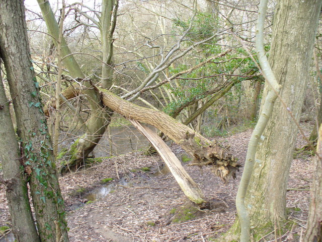
Starven Wood is home to a wide range of wildlife species, with notable inhabitants including deer, foxes, badgers, and various bird species. It serves as an important habitat for both resident and migratory birds, making it an excellent spot for birdwatching.

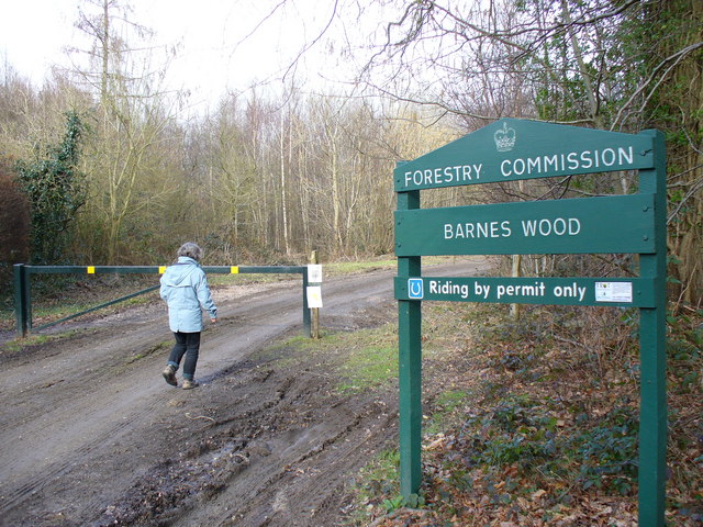
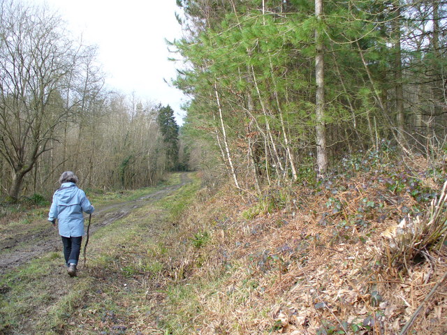
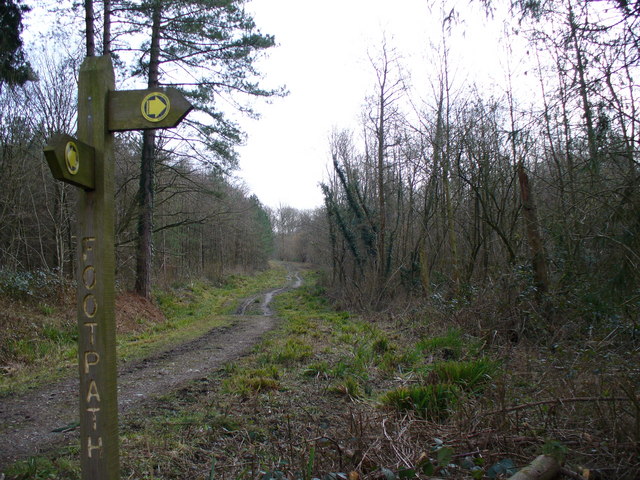
The forest offers a network of well-maintained trails, allowing visitors to explore its natural wonders at their own pace. These trails wind through the wood, providing glimpses of enchanting glades, babbling brooks, and ancient trees. There are also designated picnic areas and benches, perfect for those looking to enjoy a peaceful break surrounded by nature.

The wood is managed by a local conservation organization, which ensures that it remains a protected and well-preserved area. Educational programs and guided walks are regularly organized, aiming to raise awareness about the importance of preserving this natural habitat.

Overall, Starven Wood is a captivating destination for anyone seeking tranquility and a closer connection with nature.

If you have any feedback on the listing, please let us know in the comments section below.
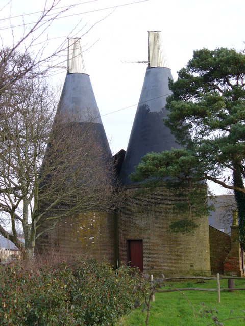
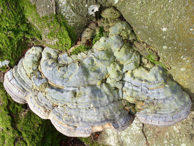
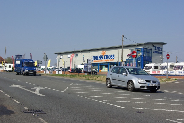
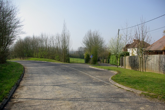
Starven Wood Images

Images are sourced within 2km of 50.969312/0.50034511 or Grid Reference TQ7521. Thanks to Geograph Open Source API. All images are credited.

Robertsbridge abbey (rems of) These are the remains of the cistercian abbey, now not visitable as part of a private house.
Robertsbridge abbey (rems of)
These are the remains of the cistercian abbey, now not visitable as part of a private house.
Barnes Wood A forest track leading into the wood where it was a busy day for foresters. A few sections of track were rendered nearly impassable by the deep ruts in the mud.
Barnes Wood
A forest track leading into the wood where it was a busy day for foresters. A few sections of track were rendered nearly impassable by the deep ruts in the mud.
Forest Track in Barnes Wood This wood has a number of tracks criss-crossing its small area. The tracks are clay surface and so are very prone to being very muddy after wet weather, and prone to having deep ruts caused by forestry vehicles.
Forest Track in Barnes Wood
This wood has a number of tracks criss-crossing its small area. The tracks are clay surface and so are very prone to being very muddy after wet weather, and prone to having deep ruts caused by forestry vehicles.
Picnic Site, Footland Wood Benches sit benow the birches by the large car park. This area is popular with dog-walkers and walkers.
Picnic Site, Footland Wood
Benches sit benow the birches by the large car park. This area is popular with dog-walkers and walkers.
Log Stack, Barnes Wood The output of winter forestry activity line a track in this Wealden wood.
Log Stack, Barnes Wood
The output of winter forestry activity line a track in this Wealden wood.
Path Junction, Barnes Wood Forestry land is crossed by clay-surfaced paths and tracks.
Path Junction, Barnes Wood
Forestry land is crossed by clay-surfaced paths and tracks.
Woodland near Vinehall Street A stream is lined by deciduous trees, like beech. Note the recently fallen tree here. The soil is mainly water-retaining clay.
Woodland near Vinehall Street
A stream is lined by deciduous trees, like beech. Note the recently fallen tree here. The soil is mainly water-retaining clay.
Wealden Landscape, Vinehall Street Grassy fields, woods and oast houses are typical of this area of the Weald. Across the view runs the A21 London - Hastings road.
Wealden Landscape, Vinehall Street
Grassy fields, woods and oast houses are typical of this area of the Weald. Across the view runs the A21 London - Hastings road.
Oasts, Vinehall Street Industrial relics from the East Sussex hop industry which have not yet been converted into a desirable country residence.
Oasts, Vinehall Street
Industrial relics from the East Sussex hop industry which have not yet been converted into a desirable country residence.
Fungus on a Beech Tree This one is about one foot wide, two or three inches thick, and solidly fixed to the tree trunk.
Fungus on a Beech Tree
This one is about one foot wide, two or three inches thick, and solidly fixed to the tree trunk.
Johns Cross motorcaravan and camping centre On the A21. It also seems to deal in ordinary caravans.
Johns Cross motorcaravan and camping centre
On the A21. It also seems to deal in ordinary caravans.
Poppinghole Lane near A21 The lane formerly went straight on to the right to meet the A21. It now sweeps round to the left to what is presumably a safer junction point.
Poppinghole Lane near A21
The lane formerly went straight on to the right to meet the A21. It now sweeps round to the left to what is presumably a safer junction point.
A handsome oak The hedgerow on the left has a couple of nice oaks. This is one. Birching Wood is ahead.
A handsome oak
The hedgerow on the left has a couple of nice oaks. This is one. Birching Wood is ahead.
Poppinghole Lane and Walters Farm The farm is rather hidden apart from the oasthouses.
Poppinghole Lane and Walters Farm
The farm is rather hidden apart from the oasthouses.
Poppinghole Lane and Newpond Farm The car is parked opposite a cottage hidden by the hedge.
Poppinghole Lane and Newpond Farm
The car is parked opposite a cottage hidden by the hedge.
Entrance, Vinehall Forest Forestry Commission with public access. A pity about the car.
Entrance, Vinehall Forest
Forestry Commission with public access. A pity about the car.
Swailes Green On the B2089 with Cripps Corner to the left.
Swailes Green
On the B2089 with Cripps Corner to the left.
Bridleway, Wellhead Wood West Wellhead Woods, West and East, are parts of Lordship Wood as a whole.
Bridleway, Wellhead Wood West
Wellhead Woods, West and East, are parts of Lordship Wood as a whole.
Show me another place!

Starven Wood is located at Grid Ref: TQ7521 (Lat: 50.969312, Lng: 0.50034511)

Administrative County: East Sussex

District: Rother

Police Authority: Sussex

What 3 Words

///sway.angers.jammy. Near Robertsbridge, East Sussex

Related Wikis

Vinehall School

Vinehall School is a co-educational day, boarding school and nursery located at Vinehall Street, near the town of Robertsbridge, East Sussex. It takes...

Vinehall Street

Vinehall Street (or Vinehall), is a linear settlement in the civil parishes of Mountfield and Whatlington, and the Rother district of East Sussex, England...

Mountfield, East Sussex

Mountfield is a village and civil parish in the Rother district of East Sussex, England, and three miles (5 km) north-west of Battle. It is mentioned in...

Cripps Corner

Cripps Corner is a village in the civil parish of Ewhurst and the Rother district of East Sussex, England. It is in the High Weald Area of Outstanding...

Sedlescombe vineyard

Sedlescombe organic vineyard is an English vineyard located in Robertsbridge, just outside Sedlescombe in East Sussex.It is one of the few British vineyards...

Salehurst Halt railway station

Salehurst Halt was a halt station on the Kent and East Sussex Railway which served the village of Salehurst in East Sussex, England. The station was reached...

Mountfield Halt railway station

Mountfield Halt (TQ 746 197 50°57′01″N 0°29′12″E) was situated on the Hastings Line between Robertsbridge and Battle. It opened in 1923 and was closed...
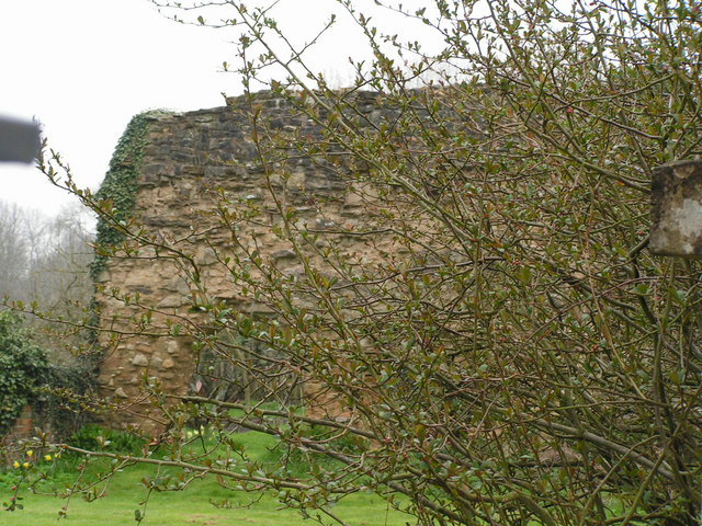
Robertsbridge Abbey

Robertsbridge Abbey was a Cistercian abbey in Robertsbridge, East Sussex, England. It was founded in 1176 by Alured and Alicia de St Martin. Due to its...

Nearby Amenities

Located within 500m of 50.969312,0.50034511
The data included in this document is from www.openstreetmap.org. The data is made available under ODbL.

Have you been to Starven Wood?

Leave your review of Starven Wood below (or comments, questions and feedback).