Abergwili

Settlement in Carmarthenshire

Wales

Abergwili

Dyfed-Powys Police HQ, Llangunnor, Carmarthen The building with the white garage doors on the far right has a heli-pad in front of it.
Dyfed-Powys is quite a large area. The Police and Fire Brigade still recognise Dyfed as an administrative area, despite it having been broken up into Carmarthenshire, Ceredigion and Pembrokeshire.
Dyfed-Powys Police HQ, Llangunnor, Carmarthen Credit: Nigel Davies

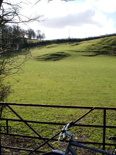
Abergwili is a small village located in the county of Carmarthenshire, Wales. Situated approximately 2 miles north of the town of Carmarthen, it is nestled in a picturesque valley along the River Towy. The village is known for its natural beauty, with rolling hills and lush green fields surrounding it.

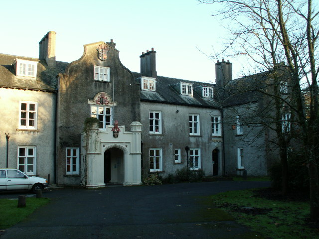
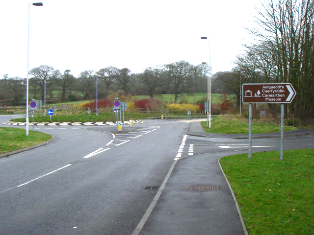
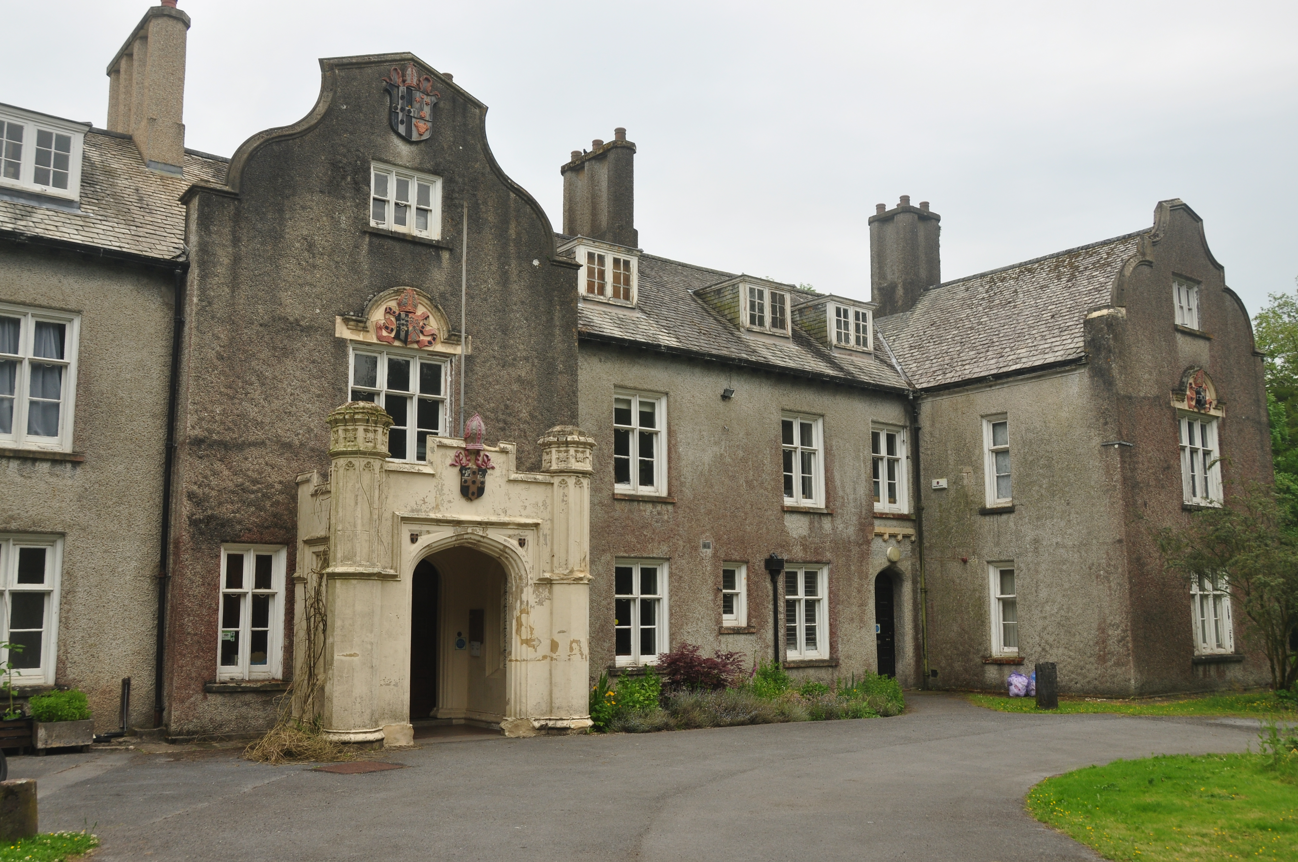
One of the prominent landmarks in Abergwili is Abergwili Palace, a former bishop's palace that dates back to the 16th century. The palace now serves as the Carmarthenshire County Museum, showcasing the rich history and heritage of the area. Visitors can explore the various exhibits, including archaeological finds, local artworks, and historical artifacts.

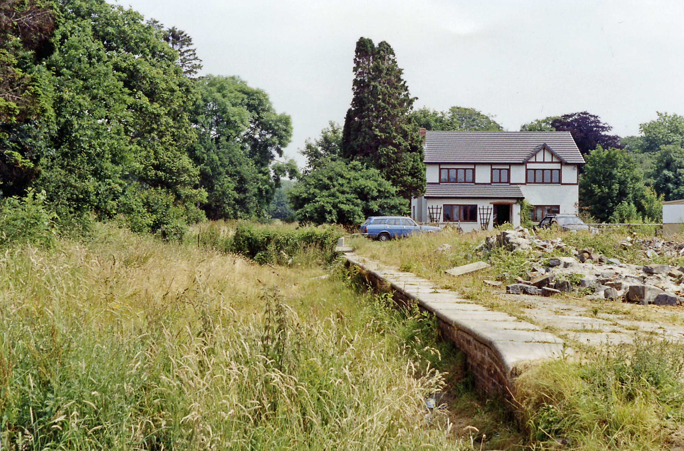
The village is also home to the Abergwili Railway Museum, which displays a collection of steam locomotives, carriages, and railway memorabilia. This museum offers visitors a fascinating insight into the railway heritage of the region.

Abergwili has a close-knit community, with a primary school, a village hall, and a church, St. David's, which dates back to the 12th century. The church is known for its beautiful stained glass windows and intricate carvings.

The surrounding countryside provides ample opportunities for outdoor activities such as hiking, cycling, and fishing. The Towy River is particularly popular among anglers, known for its abundance of salmon and trout.

Overall, Abergwili is a charming village that offers a combination of historical landmarks, natural beauty, and a warm community spirit. It is a popular destination for tourists seeking a tranquil escape in the heart of Carmarthenshire.

If you have any feedback on the listing, please let us know in the comments section below.

Abergwili Images

Images are sourced within 2km of 51.868503/-4.27224 or Grid Reference SN4321. Thanks to Geograph Open Source API. All images are credited.

Dyfed-Powys Police HQ, Llangunnor, Carmarthen The building with the white garage doors on the far right has a heli-pad in front of it.
Dyfed-Powys is quite a large area. The Police and Fire Brigade still recognise Dyfed as an administrative area, despite it having been broken up into Carmarthenshire, Ceredigion and Pembrokeshire.
Dyfed-Powys Police HQ, Llangunnor, Carmarthen
The building with the white garage doors on the far right has a heli-pad in front of it. Dyfed-Powys is quite a large area. The Police and Fire Brigade still recognise Dyfed as an administrative area, despite it having been broken up into Carmarthenshire, Ceredigion and Pembrokeshire.
Field The soil creep caught my eye as I was passing.
Field
The soil creep caught my eye as I was passing.
West Wales General Hospital, Glangwili, Carmarthen
Llangunnor Parish Church This church sits up high on the east face of the hill at Llangunnor. The graveyard opens up to the left of the church as pictured to afford a magnificent view of the Towy valley
Llangunnor Parish Church
This church sits up high on the east face of the hill at Llangunnor. The graveyard opens up to the left of the church as pictured to afford a magnificent view of the Towy valley
Roman Amphitheatre, Carmarthen Hidden in plain sight right next to Priory Street on the outskirts of town are the remains of a Roman amphitheatre.
Roman Amphitheatre, Carmarthen
Hidden in plain sight right next to Priory Street on the outskirts of town are the remains of a Roman amphitheatre.
Merlin's Hill near Carmarthen Rumours of Merlin persist about Carmarthen. Many believe the Welsh name of the town "Caer Myrddin" means the Fort of Merlin. In fact the name derives from Caer Moridunum - the fortress near the sea. 
However, this hill is called Merlin's Hill, and the map says there was a fort on it.
Merlin's Hill near Carmarthen
Rumours of Merlin persist about Carmarthen. Many believe the Welsh name of the town "Caer Myrddin" means the Fort of Merlin. In fact the name derives from Caer Moridunum - the fortress near the sea. However, this hill is called Merlin's Hill, and the map says there was a fort on it.
Carmarthen Museum, Abergwili The main Carmarthen Museum, in Abergwili, housed in the former palace of the Bishops of St Davids  (until 1974).
Carmarthen Museum, Abergwili
The main Carmarthen Museum, in Abergwili, housed in the former palace of the Bishops of St Davids (until 1974).
Capel Ebeneser Ebeneser, Capel yr Annibynwyr / Ebenezer Independent Chapel, Abergwili
Capel Ebeneser
Ebeneser, Capel yr Annibynwyr / Ebenezer Independent Chapel, Abergwili
Tywi in flood, nr Carmarthen. The Afon Tywi in flood, November 2005, looking SE from alongside the A40.
Tywi in flood, nr Carmarthen.
The Afon Tywi in flood, November 2005, looking SE from alongside the A40.
Abergwili roundabout Close to the southern edge of SN4421. 
Turn right for the museum.
Abergwili roundabout
Close to the southern edge of SN4421. Turn right for the museum.
Cement Factory Taken from the A40 looking south between Abergwili and Whitemill.
Cement Factory
Taken from the A40 looking south between Abergwili and Whitemill.
Carmarthen Reservoirs Looking down from a bridge over the dam of the upper reservoir down the stepped waterfall to the bridge at the back of the lower reservoir.
Carmarthen Reservoirs
Looking down from a bridge over the dam of the upper reservoir down the stepped waterfall to the bridge at the back of the lower reservoir.
Campsite Just in the southern part of this grid square.
Campsite
Just in the southern part of this grid square.
Crossroads Crossroads in the NE corner of grid SN4422.
Crossroads
Crossroads in the NE corner of grid SN4422.
Soil Creep Approaching a sharp bend in the road just off the A485 at SN 434 222.
Soil Creep
Approaching a sharp bend in the road just off the A485 at SN 434 222.
Rhes o dai ger Caerfyrddin. Rhes o dai ar ymyl ffordd brysur yr A484.
A terrace on the busy A484 close to Carmarthen.
Rhes o dai ger Caerfyrddin.
Rhes o dai ar ymyl ffordd brysur yr A484. A terrace on the busy A484 close to Carmarthen.
Ty Cymorth NHS hospice.
Ty Cymorth
NHS hospice.
Cottage with Tin Roof Old cottage with corrugated iron roof, built in eight planes.
Cottage with Tin Roof
Old cottage with corrugated iron roof, built in eight planes.
Show me another place!

Abergwili is located at Grid Ref: SN4321 (Lat: 51.868503, Lng: -4.27224)

Unitary Authority: Carmarthenshire

Police Authority: Dyfed Powys

What 3 Words

///reason.performed.flank. Near Carmarthen, Carmarthenshire

Nearby Locations

Abergwili

Related Wikis

Nearby Amenities

Located within 500m of 51.868503,-4.27224
Abergwili
Place: village
Wikidata: Q4667107
Lat/Long: 51.8655434/-4.2719009
Bus Stop
Crychiau
Lat/Long: 51.8715927/-4.2738709
Noexit: yes
Lat/Long: 51.8671852/-4.2720564
Place Of Worship
Capel Ebeneser
Religion: christian
Lat/Long: 51.8661817/-4.2713176
Abergwili
Abandoned Railway: station
Historic Railway: station
Railway: site
Wikidata: Q4667106
Wikipedia: en:Abergwili railway station
Lat/Long: 51.8669527/-4.2681996
Post Box
Collection Times: Mo-Fr 09:00; Sa 07:00
Old Ref: SA31 479
Post Box Type: lamp
Ref: SA31 479D
Royal Cypher: EIIR
Royal Cypher Wikidata: Q33102113
Lat/Long: 51.8658846/-4.270915
Barrier: kissing_gate
Lat/Long: 51.8694343/-4.2731378
Barrier: kissing_gate
Lat/Long: 51.8688051/-4.2738707
Access: no
Barrier: stile
Foot: yes
Material: wood
Maxwidth: 2
Vehicle: no
Wheelchair: no
Lat/Long: 51.8677996/-4.274729
Access: yes
Barrier: stile
Foot: yes
Material: wood
Maxwidth: 2
Vehicle: no
Wheelchair: no
Lat/Long: 51.8674427/-4.2748202
Barrier: kissing_gate
Lat/Long: 51.8667461/-4.2753024
Barrier: kissing_gate
Lat/Long: 51.8661312/-4.2754465
Barrier: kissing_gate
Lat/Long: 51.869231/-4.2665537
Waste Basket
Waste: trash
Lat/Long: 51.8694409/-4.2731502
Direction: 190
Generator Method: photovoltaic
Generator Output Electricity: yes
Generator Solar Modules: 16
Generator Source: solar
Generator Type: solar_photovoltaic_panel
Location: roof
Power: generator
Lat/Long: 51.8692682/-4.2662667
Direction: S
Generator Method: photovoltaic
Generator Output Electricity: yes
Generator Solar Modules: 13
Generator Source: solar
Generator Type: solar_photovoltaic_panel
Location: roof
Power: generator
Lat/Long: 51.8660328/-4.2696744
Direction: 260
Generator Method: photovoltaic
Generator Output Electricity: yes
Generator Solar Modules: 6
Generator Source: solar
Generator Type: solar_photovoltaic_panel
Location: roof
Power: generator
Lat/Long: 51.8692326/-4.2722198
Direction: 260
Generator Method: photovoltaic
Generator Output Electricity: yes
Generator Solar Modules: 6
Generator Source: solar
Generator Type: solar_photovoltaic_panel
Location: roof
Power: generator
Lat/Long: 51.8692947/-4.2722353
Direction: 150
Generator Method: photovoltaic
Generator Output Electricity: yes
Generator Solar Modules: 6
Generator Source: solar
Generator Type: solar_photovoltaic_panel
Location: roof
Power: generator
Lat/Long: 51.8722608/-4.2727456
Direction: 150
Generator Method: photovoltaic
Generator Output Electricity: yes
Generator Solar Modules: 6
Generator Source: solar
Generator Type: solar_photovoltaic_panel
Location: roof
Power: generator
Lat/Long: 51.8722236/-4.2728538
Direction: 165
Generator Method: photovoltaic
Generator Output Electricity: yes
Generator Solar Modules: 6
Generator Source: solar
Generator Type: solar_photovoltaic_panel
Location: roof
Power: generator
Lat/Long: 51.8718294/-4.273636
Direction: 165
Generator Method: photovoltaic
Generator Output Electricity: yes
Generator Solar Modules: 6
Generator Source: solar
Generator Type: solar_photovoltaic_panel
Location: roof
Power: generator
Lat/Long: 51.8718228/-4.2736951
Direction: SE
Generator Method: photovoltaic
Generator Output Electricity: yes
Generator Solar Modules: 16
Generator Source: solar
Generator Type: solar_photovoltaic_panel
Location: roof
Power: generator
Lat/Long: 51.8688741/-4.2697468
The data included in this document is from www.openstreetmap.org. The data is made available under ODbL.

Have you been to Abergwili?

Leave your review of Abergwili below (or comments, questions and feedback).