Abergwesyn
Settlement in Brecknockshire
Wales
Abergwesyn

Abergwesyn is a small village located in the historic county of Brecknockshire, Wales. Situated in the heart of the Cambrian Mountains, it is known for its stunning natural beauty and tranquility. The village is nestled in the upper valley of the River Irfon, surrounded by rolling hills and lush green forests.
Abergwesyn is a rural community with a population of around 100 people. It offers a peaceful and idyllic setting, making it an attractive destination for those seeking a retreat from the hustle and bustle of city life. The village is predominantly residential, with a scattering of traditional stone cottages and a few local amenities.
The surrounding area is a paradise for outdoor enthusiasts, with numerous walking and hiking trails that showcase the breathtaking scenery. One of the most popular routes is the Abergwesyn Pass, a scenic road that winds through the mountains and offers panoramic views of the landscape. The nearby Eppynt Range provides opportunities for mountain biking, birdwatching, and fishing.
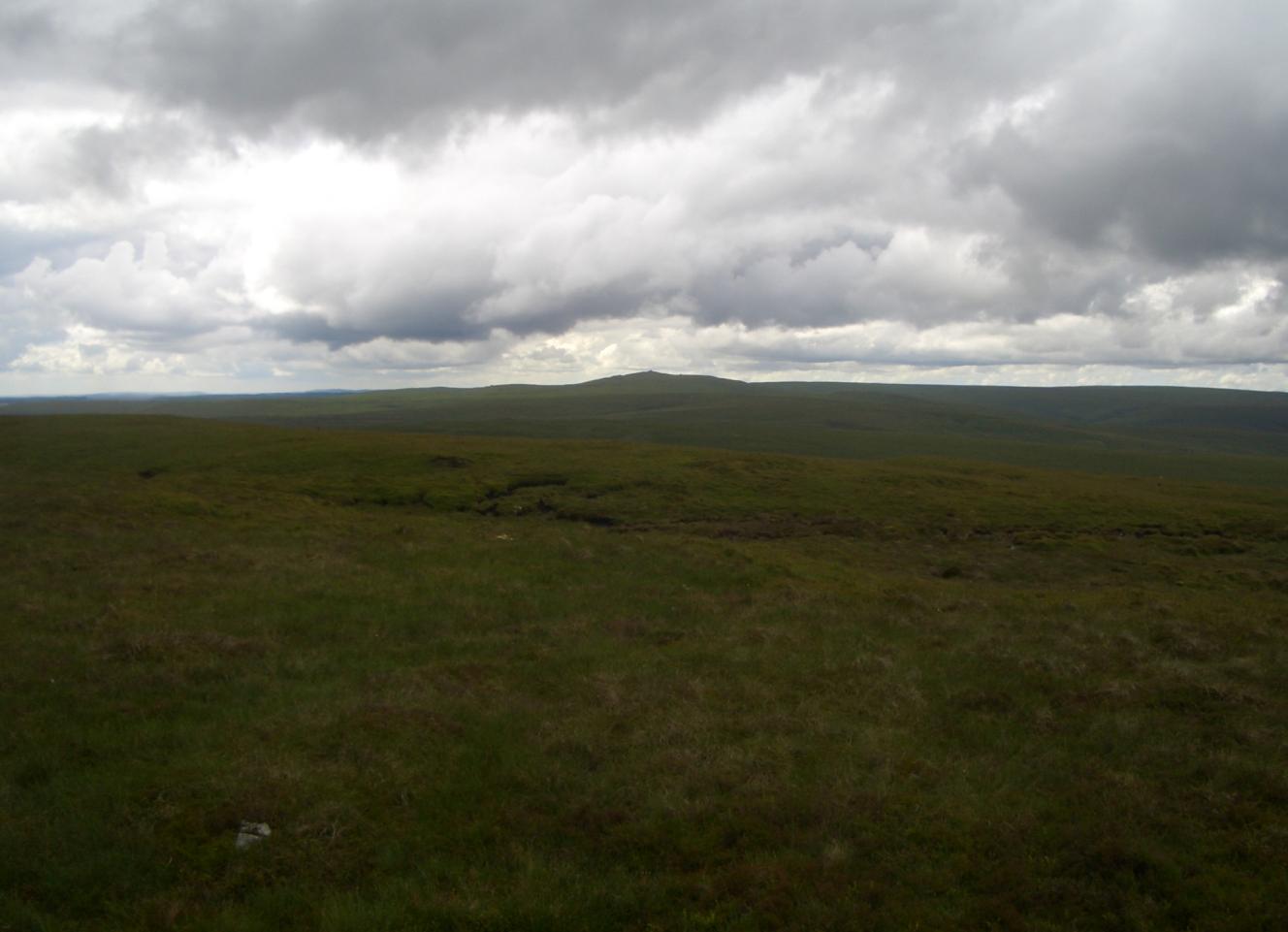
Despite its small size, Abergwesyn has a rich history. The village is home to the Grade II listed Abergwesyn Common, a vast area of open moorland that has been designated as a Site of Special Scientific Interest. This ancient common land is known for its diverse flora and fauna, including rare species such as the ring ouzel and the red grouse.
In summary, Abergwesyn is a charming village nestled in the picturesque Cambrian Mountains. With its stunning natural surroundings and peaceful atmosphere, it is the perfect destination for nature lovers and those seeking a tranquil retreat.
If you have any feedback on the listing, please let us know in the comments section below.
Abergwesyn Images
Images are sourced within 2km of 52.159651/-3.674425 or Grid Reference SN8552. Thanks to Geograph Open Source API. All images are credited.


Abergwesyn is located at Grid Ref: SN8552 (Lat: 52.159651, Lng: -3.674425)
Unitary Authority: Powys
Police Authority: Dyfed Powys
What 3 Words
///atomic.transcribes.libraries. Near Abergwesyn, Powys
Nearby Locations
Related Wikis
Abergwesyn
Abergwesyn is a village in the Welsh county of Powys, in mid-Wales, at the start of the Abergwesyn valley and at the confluence of the Afon Irfon and the...

Vicarage Meadows
Vicarage Meadows is a Site of Special Scientific Interest near Abergwesyn, Powys, Wales. The 3.6 hectares (8.9 acres) site, located close to the Nant Irfon...
Nant Irfon National Nature Reserve
Nant Irfon National Nature Reserve is a national nature reserve located high in the hills above the Afon Irfon valley near the village of Abergwesyn in...
Llanwrtyd
Llanwrtyd is a small settlement in Powys, mid-Wales, giving its name to a community, in the historic county of Brecknockshire (Breconshire), through which...
Treflys
Treflys is a community in the county of Powys, Wales, and is 49.9 miles (80.4 km) from Cardiff and 154.4 miles (248.5 km) from London. In 2011 the population...
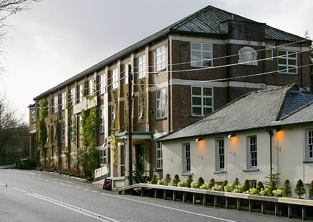
Cambrian Woollen Mill
Cambrian Woollen Mill, just north of Llanwrtyd Wells, Powys, is one of the few remaining operational woollen mills in Wales. It is known for its line of...
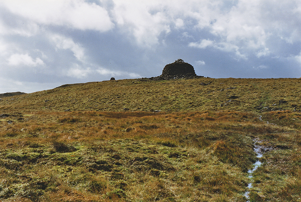
Drygarn Fawr
Drygarn Fawr is a mountain in the county of Powys, Wales. It is one of the highest summits in Mid Wales at 645 metres (2,116 ft) above sea level. It lies...
Gorllwyn
Gorllwyn is a subsidiary summit of Drygarn Fawr, located on a remote moorland plateau of the Cambrian Mountains. The summit is grassy and is surrounded...
Nearby Amenities
Located within 500m of 52.159651,-3.674425Have you been to Abergwesyn?
Leave your review of Abergwesyn below (or comments, questions and feedback).