Astrope

Settlement in Hertfordshire Dacorum

England

Astrope

Cheddington Lane, Long Marston
Cheddington Lane, Long Marston Credit: David Howard

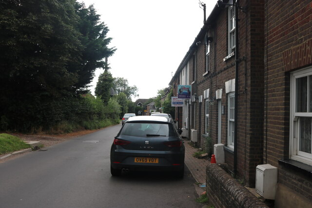
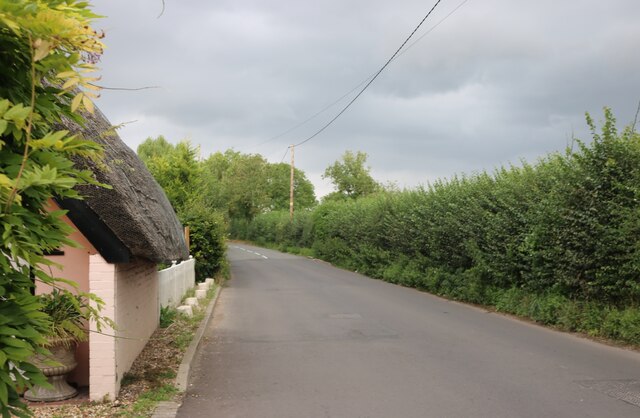
Astrope is a small village located in the county of Hertfordshire, England. Situated approximately 3 miles southwest of the town of Tring, Astrope is nestled in a picturesque rural setting, surrounded by rolling hills and farmland.

The village has a rich history dating back many centuries. It is mentioned in the Domesday Book of 1086, where it is referred to as "Estrope." Over the years, Astrope has been a predominantly agricultural community, with farming playing a significant role in its economy.

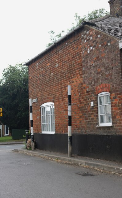
Today, Astrope retains its quaint and charming character, with a handful of traditional cottages and farmhouses dotting its landscape. It is a close-knit community, with a small population that values the tranquility and natural beauty of the area.

While Astrope itself may not have extensive amenities, it benefits from its proximity to nearby towns and villages. Residents have easy access to the amenities and services available in Tring, such as shops, supermarkets, schools, and healthcare facilities.

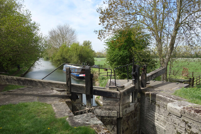
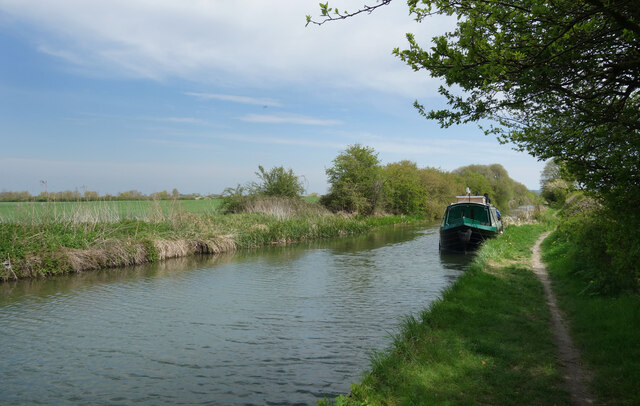
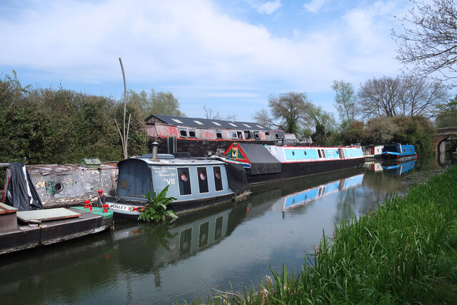
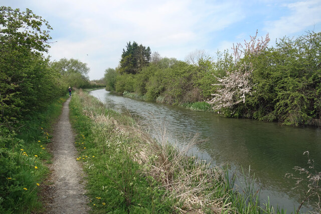
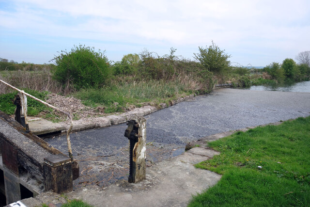
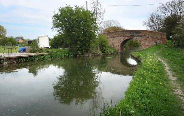
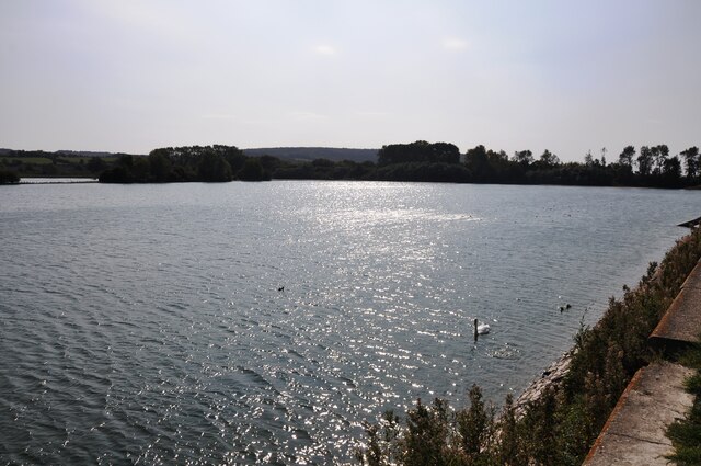
The surrounding countryside is a haven for outdoor enthusiasts, offering ample opportunities for walking, cycling, and exploring the scenic beauty of the Hertfordshire landscape. Nearby attractions include the Ashridge Estate, a vast expanse of woodlands and meadows, and the Grand Union Canal, offering peaceful walks along its towpaths.

Astrope is a place where residents and visitors can enjoy a peaceful and rural lifestyle, while still being within reach of larger towns and amenities. Its historical significance, natural beauty, and sense of community make it a charming destination in Hertfordshire.

If you have any feedback on the listing, please let us know in the comments section below.
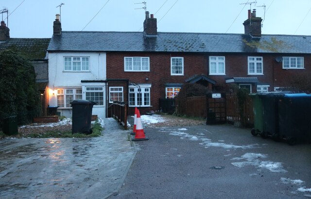
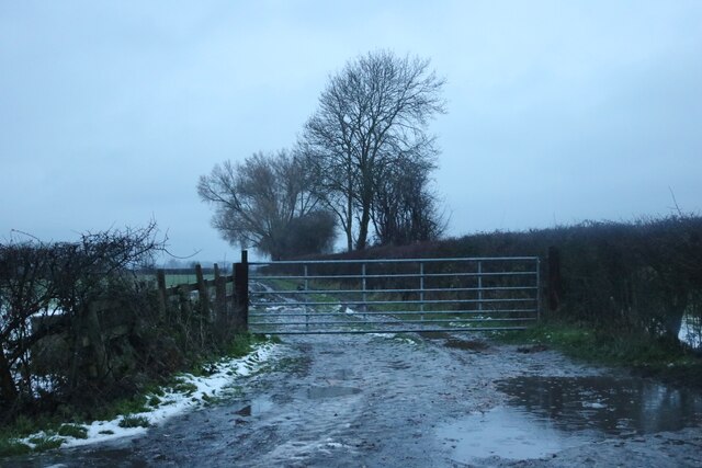
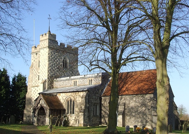
Astrope Images

Images are sourced within 2km of 51.825548/-0.705645 or Grid Reference SP8914. Thanks to Geograph Open Source API. All images are credited.

Cheddington Lane, Long Marston
Cheddington Lane, Long Marston This is the last house in the small village
Cheddington Lane, Long Marston
This is the last house in the small village
Stripy poles on Cheddington Lane, Long Marston These are on both sides of the roads to protect the buildings from traffic. They clearly work well as none have been damaged.
Stripy poles on Cheddington Lane, Long Marston
These are on both sides of the roads to protect the buildings from traffic. They clearly work well as none have been damaged.
Tring Road, Long Marston
All Saints' Church, Long Marston
Pylon on Station Road, Long Marston
Lock No. 10, Aylesbury Canal It looks really flat around here but the canal locks are not far apart, so there is quite a slope down into the Vale of Aylesbury.
Lock No. 10, Aylesbury Canal
It looks really flat around here but the canal locks are not far apart, so there is quite a slope down into the Vale of Aylesbury.
A Quiet Mooring In fact the whole canal is very quiet.
A Quiet Mooring
In fact the whole canal is very quiet.
Awaiting Restoration at Bates Boatyard Bates Boatyard specialises in restoring traditional and vintage canal boats. Some of the ones moored here look to be in a very challenging state. The little boat "Bosley"  could do with some weeding to start with. The writing on the side says
"Victorian Iron Icebreaker. Gorton Works, Manchester 1860"
Awaiting Restoration at Bates Boatyard
Bates Boatyard specialises in restoring traditional and vintage canal boats. Some of the ones moored here look to be in a very challenging state. The little boat "Bosley" could do with some weeding to start with. The writing on the side says "Victorian Iron Icebreaker. Gorton Works, Manchester 1860"
Bates Boatyard, Puttenham Bates Boatyard specialises in the restoration of vintage canal boats.
Bates Boatyard, Puttenham
Bates Boatyard specialises in the restoration of vintage canal boats.
Flying Ploughshares In a yard amongst other old farm junk these ploughshares on their side seem to resemble some sort of creatures flying or maybe swimming.
In the background is Kingspan's glass fibre factory.
Flying Ploughshares
In a yard amongst other old farm junk these ploughshares on their side seem to resemble some sort of creatures flying or maybe swimming. In the background is Kingspan's glass fibre factory.
Bend in the Canal Going through a flat farming landscape the canal heads towards Aylesbury without the need for any great change in direction. This gentle curve is the first bend there has been for some distance.
Bend in the Canal
Going through a flat farming landscape the canal heads towards Aylesbury without the need for any great change in direction. This gentle curve is the first bend there has been for some distance.
Stuff in the water at Buckland Lock The same scene at every top lock gate today. It looks messy but it's fairly harmless. With a strong east wind, floating plant debris gets blown along the canal until it all collects at lock gates. The canal isn't heavily used and so this happens.
Here is the same place looking cleaner. <a href="https://www.geograph.org.uk/photo/1442984">SP8713 : Aylesbury Arm: Buckland Lock (No 12)</a>
Stuff in the water at Buckland Lock
The same scene at every top lock gate today. It looks messy but it's fairly harmless. With a strong east wind, floating plant debris gets blown along the canal until it all collects at lock gates. The canal isn't heavily used and so this happens. Here is the same place looking cleaner. SP8713 : Aylesbury Arm: Buckland Lock (No 12)
Buckland Bridge A traditional brick arch canal bridge. The surfaced road from Buckland ends just past here and continues as a farm track.
Buckland Bridge
A traditional brick arch canal bridge. The surfaced road from Buckland ends just past here and continues as a farm track.
Wilstone reservoir looking west A view of Wilstone Reservoir from the footpath bordering it.  The reservoir was built to provide water for the nearby Grand Union Canal and is now a haven for wildlife.
Wilstone reservoir looking west
A view of Wilstone Reservoir from the footpath bordering it. The reservoir was built to provide water for the nearby Grand Union Canal and is now a haven for wildlife.
Old cottages on Wilstone Green
Field entrance on Lower Icknield Way, Wilstone
Lower Icknield Way, Wilstone
Show me another place!

Astrope is located at Grid Ref: SP8914 (Lat: 51.825548, Lng: -0.705645)

Administrative County: Hertfordshire

District: Dacorum

Police Authority: Hertfordshire

What 3 Words

///case.takeovers.originals. Near Aston Clinton, Buckinghamshire

Nearby Locations

Astrope

Related Wikis

Astrope

Astrope is a village in Hertfordshire, England. It is in the civil parish of Tring Rural. == External links == Media related to Astrope at Wikimedia Commons

Puttenham, Hertfordshire

Puttenham is a village and former civil parish, now in the parish of Tring Rural, in the Dacorum district, in north west Hertfordshire, England. In 1961...

Long Marston, Hertfordshire

Long Marston is a small village to the north of Tring in Hertfordshire, in the Tring Rural parish council area. It is in the Borough of Dacorum, Tring...

Tring Rural

Tring Rural is a civil parish in Hertfordshire, England. It includes the villages of Long Marston, Wilstone, Puttenham, and the hamlets of Gubblecote and...
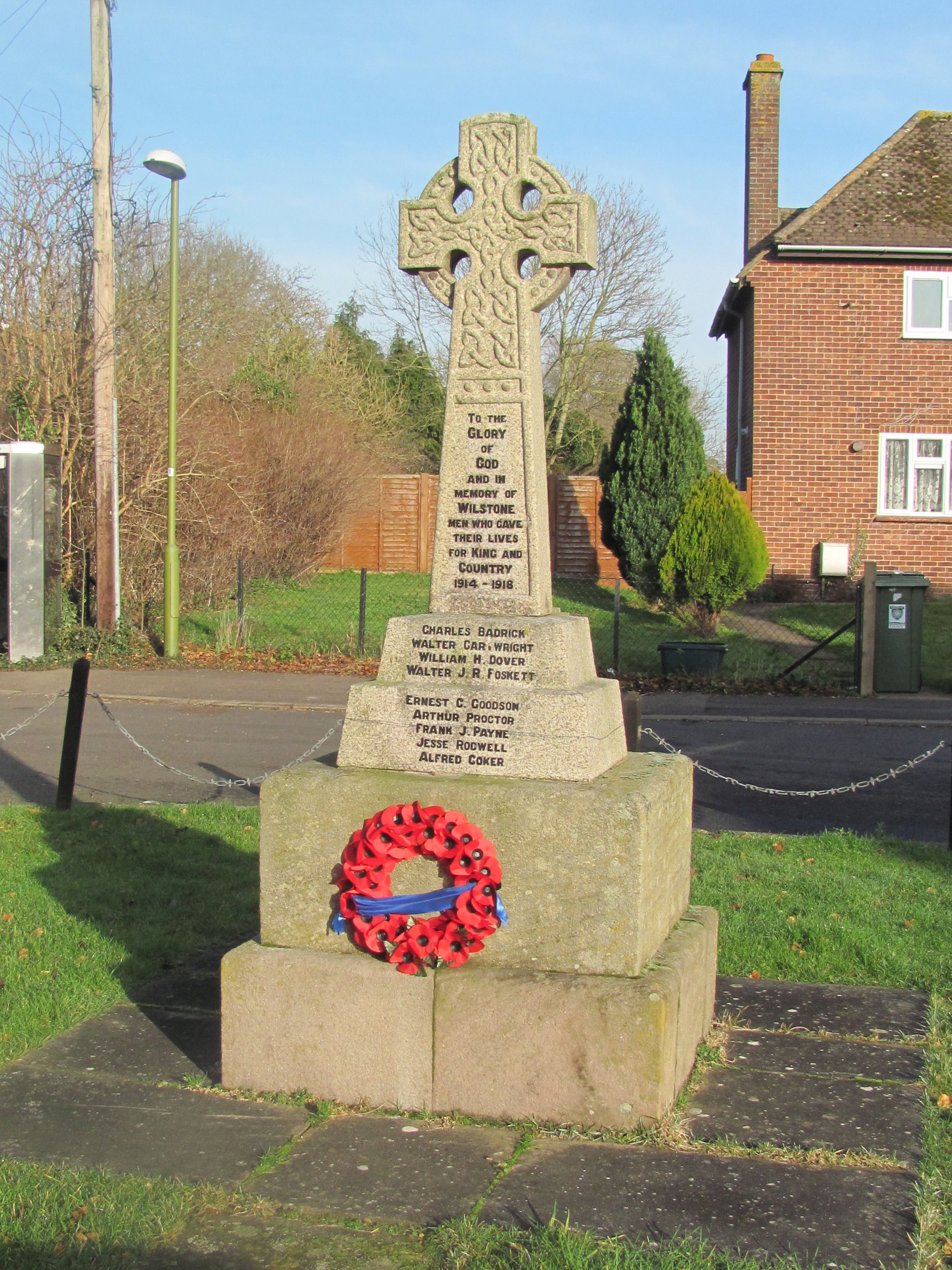
Wilstone

Wilstone is the name of an English village and a reservoir approximately two miles north-west of Tring, Hertfordshire. The village lies within the civil...

Marston Gate railway station

Marston Gate Railway station was a station on the London and North Western Railway - Aylesbury Branch serving the nearby village of Long Marston, Hertfordshire...

RAF Cheddington

Royal Air Force Cheddington or more simply RAF Cheddington (also known as RAF Marsworth) is a former Royal Air Force station located 1 mile (1.6 km) south...

Arla Aylesbury

Arla Aylesbury is the largest dairy in the UK; at opening it was the world's biggest dairy, processing over 1.75 billion pints (1 billion litres) of milk...

Related Videos

Sunset Ambience Canal Nature Walk, English Countryside, Nature Sounds [4K]

Embark on a captivating journey through the enchanting English countryside with our relaxing nature sunset nature walk in 4K.

#54 Yet Another Canal Arm Restoration Towpath Walk

Yet Another Canal Arm Restoration Towpath Walk On our walk back to the boat from the Wilstone Reservoir, we take a look at ...

#48 Yet Another Mini Epic Adventure

Yet Another Mini Epic Adventure We start our adventure at Wilstone and head to the very start of the Aylesbury Arm at Startop's ...

I'd Just Like To Know What Business You Have Filming Into Here! 😆🎥✔

Today we take a look at Kingspan Klargester, College Rd N, Aston Clinton, Aylesbury HP22 5EW. We speak to many people ...

Nearby Amenities

Located within 500m of 51.825548,-0.705645
Astrope
Fixme: ?place?;?house?
Place: residence
Lat/Long: 51.825427/-0.7113681
Fixme: ?building?
Source: npe
Lat/Long: 51.8291423/-0.7021856
Astrope
Place: hamlet
Lat/Long: 51.8268838/-0.703548
Barrier: stile
Lat/Long: 51.8261482/-0.7024164
Barrier: stile
Lat/Long: 51.8259062/-0.7047285
Barrier: stile
Lat/Long: 51.8256807/-0.7053561
Barrier: stile
Lat/Long: 51.8256807/-0.7054956
Post Box
Collection Times: Mo-Fr 16:00; Sa 08:15
Operator: Royal Mail
Post Box Type: wall
Ref: HP23 109
Royal Cypher: VR
Royal Cypher Wikidata: Q33102356
Source: survey
Lat/Long: 51.8265041/-0.7040527
Power: pole
Lat/Long: 51.8295263/-0.7023525
Power: pole
Lat/Long: 51.8292776/-0.7018523
Power: pole
Lat/Long: 51.8288632/-0.7009819
Power: pole
Lat/Long: 51.8295404/-0.7046244
Power: pole
Lat/Long: 51.8289519/-0.7036561
Power: pole
Lat/Long: 51.828758/-0.703302
Power: pole
Lat/Long: 51.8280518/-0.7021058
Power: pole
Lat/Long: 51.827218/-0.7005394
Power: pole
Lat/Long: 51.8264703/-0.6995147
Power: pole
Lat/Long: 51.8257012/-0.6983694
Direction: 150
Generator Method: photovoltaic
Generator Output Electricity: yes
Generator Solar Modules: 8
Generator Source: solar
Generator Type: solar_photovoltaic_panel
Location: roof
Power: generator
Lat/Long: 51.8237281/-0.7011101
Direction: 240
Generator Method: photovoltaic
Generator Output Electricity: yes
Generator Solar Modules: 8
Generator Source: solar
Generator Type: solar_photovoltaic_panel
Location: roof
Power: generator
Lat/Long: 51.8236276/-0.7012509
Direction: 155
Generator Method: photovoltaic
Generator Output Electricity: yes
Generator Solar Modules: 6
Generator Source: solar
Generator Type: solar_photovoltaic_panel
Location: roof
Power: generator
Lat/Long: 51.8251049/-0.70113
Direction: 150
Generator Method: photovoltaic
Generator Output Electricity: yes
Generator Solar Modules: 16
Generator Source: solar
Generator Type: solar_photovoltaic_panel
Location: roof
Power: generator
Lat/Long: 51.8259321/-0.7056873
Direction: 145
Generator Method: photovoltaic
Generator Output Electricity: yes
Generator Solar Modules: 10
Generator Source: solar
Generator Type: solar_photovoltaic_panel
Location: roof
Power: generator
Lat/Long: 51.825243/-0.7068901
The data included in this document is from www.openstreetmap.org. The data is made available under ODbL.

Have you been to Astrope?

Leave your review of Astrope below (or comments, questions and feedback).