Aston-on-Trent

Settlement in Derbyshire South Derbyshire

England

Aston-on-Trent

Water point, Weston Lock, Trent & Mersey canal Where you can fill a boat's water tank.
Water point, Weston Lock, Trent & Mersey canal Credit: Christine Johnstone

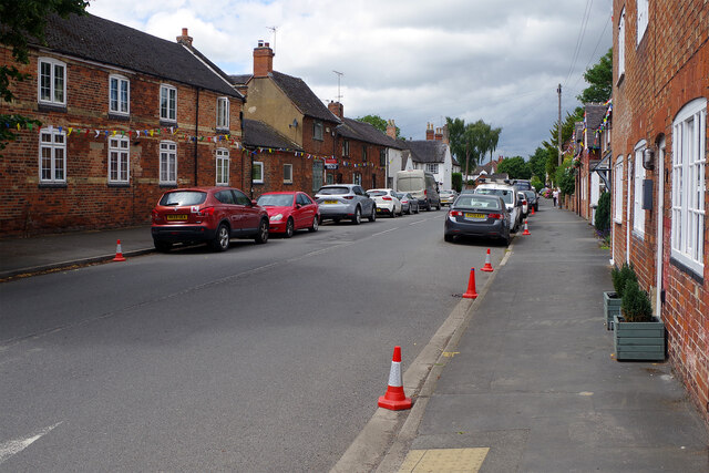
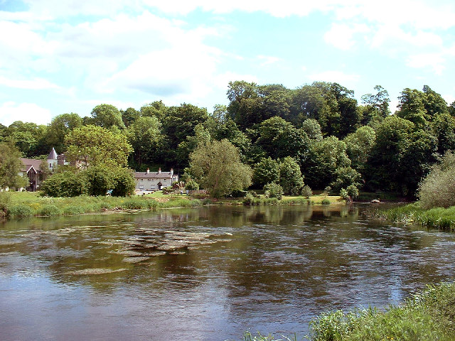
Aston-on-Trent is a village located in the southern part of Derbyshire, England. Situated about 8 miles southeast of the city of Derby, it is nestled along the banks of the River Trent. With a population of around 1,500 residents, Aston-on-Trent is a small, close-knit community that offers a peaceful countryside setting.

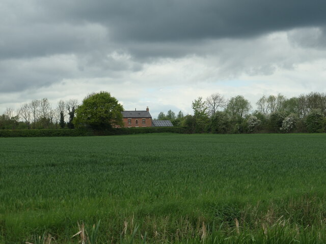
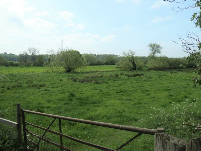
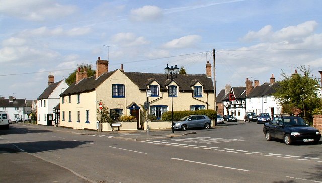
The village is known for its picturesque surroundings, boasting lush green fields, charming cottages, and beautiful views of the Trent Valley. It is a popular destination for nature lovers and outdoor enthusiasts, with numerous walking trails and cycling routes that wind through the countryside.

Aston-on-Trent has a rich history that can be traced back to the medieval period. The village is home to several historic buildings, including St. Michael and All Angels Church, which dates back to the 12th century and features stunning architecture and stained glass windows. The village also has a collection of well-preserved thatched-roof cottages, adding to its traditional charm.

In terms of amenities, Aston-on-Trent offers a range of facilities to cater to its residents' needs. These include a primary school, a village hall, a community center, and a local pub. There are also a few shops and businesses, providing essentials to the local community.

Transport links to Aston-on-Trent are convenient, with easy access to major roads such as the A50 and A5111, connecting the village to nearby towns and cities. The village also has regular bus services, making it easily accessible for visitors.

Overall, Aston-on-Trent is a tranquil and idyllic village, offering a peaceful retreat for residents and visitors alike. Its natural beauty, rich history, and community spirit make it a hidden gem in the heart of Derbyshire.

If you have any feedback on the listing, please let us know in the comments section below.

Aston-on-Trent Images

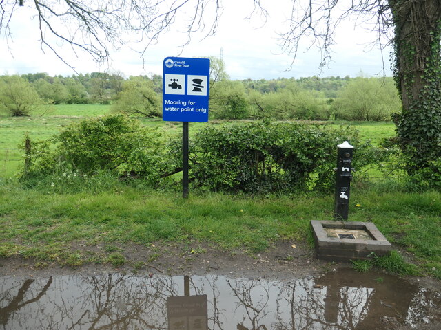
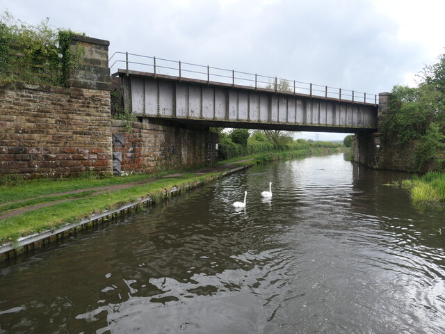
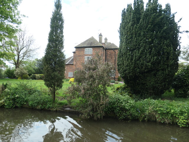
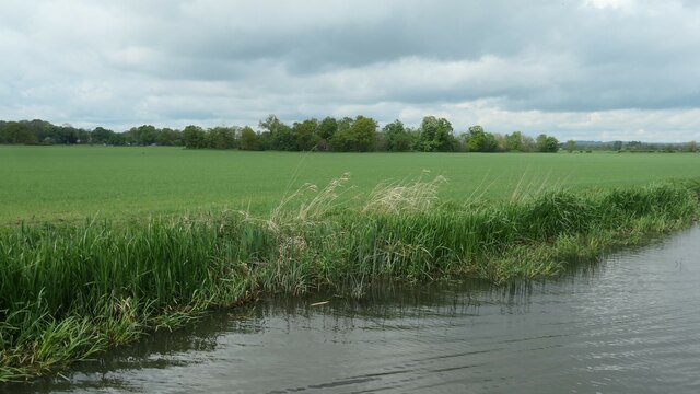
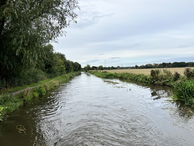
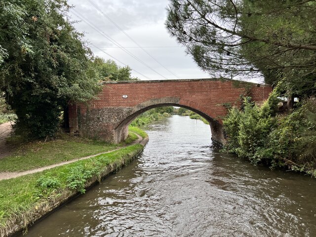
Images are sourced within 2km of 52.859996/-1.379864 or Grid Reference SK4129. Thanks to Geograph Open Source API. All images are credited.
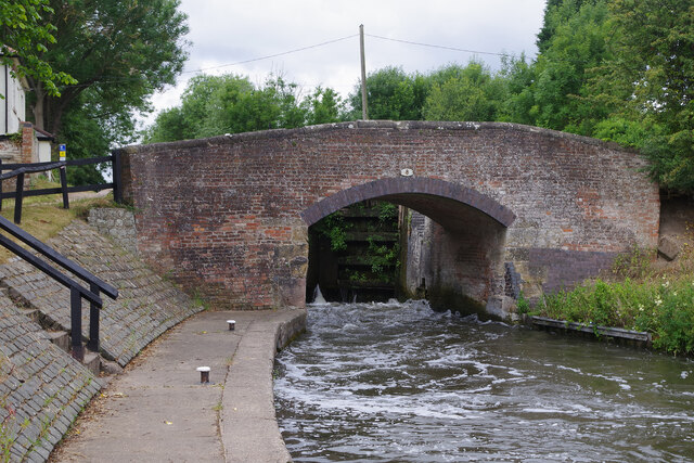
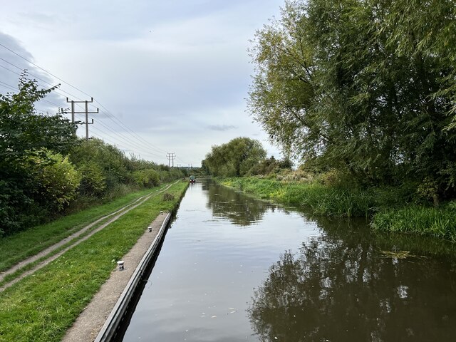
Water point, Weston Lock, Trent & Mersey canal Where you can fill a boat's water tank.
Water point, Weston Lock, Trent & Mersey canal
Where you can fill a boat's water tank.
Trees on a former field boundary On the north bank of the Trent & Mersey canal, just east of Weston-on-Trent.
Trees on a former field boundary
On the north bank of the Trent & Mersey canal, just east of Weston-on-Trent.
Willow on the bank of the Trent & Mersey canal Not yet a hazard to boaters.
Willow on the bank of the Trent & Mersey canal
Not yet a hazard to boaters.
Bridge 7B, Trent & Mersey canal A railway bridge, east of Weston-on-Trent.
Bridge 7B, Trent & Mersey canal
A railway bridge, east of Weston-on-Trent.
Cow Pasture Bridge [no 7], from the east Carrying a bridleway over the Trent & Mersey canal.
Cow Pasture Bridge [no 7], from the east
Carrying a bridleway over the Trent & Mersey canal.
Weston Grange On the canal bank, east of Weston-on-Trent.  This may be the site of a medieval grange of Chester Abbey. The house is at the south corner of a farmyard, which it was separated from in 1980.
Weston Grange
On the canal bank, east of Weston-on-Trent. This may be the site of a medieval grange of Chester Abbey. The house is at the south corner of a farmyard, which it was separated from in 1980.
Birdcage Wood, from the south A small triangular wood on the boundary between Weston-on-Trent and Aston-on-Trent civil parishes.
Birdcage Wood, from the south
A small triangular wood on the boundary between Weston-on-Trent and Aston-on-Trent civil parishes.
Dark clouds over Moorland House Not generating much energy on the panels at the moment.
Dark clouds over Moorland House
Not generating much energy on the panels at the moment.
Sheepfield, off Kings Mill Lane At the eastern edge of Weston-on-Trent.
Sheepfield, off Kings Mill Lane
At the eastern edge of Weston-on-Trent.
Willows along a drain, west of King's Mills Lane The flat and floodable floor of the Trent valley.
Willows along a drain, west of King's Mills Lane
The flat and floodable floor of the Trent valley.
Weston Lock The locks at the eastern end of the Trent & Mersey Canal are all broad, allowing widebeam vessels to travel up to Burton on Trent. Most of them are deep - in this case with a fall of 10ft 11in - making them slow to fill and empty with stiff paddles and heavy gates; they therefore tend to be unpopular with boaters. Here the lock is being emptied causing a lot of turbulence by the lock landing.
Weston Lock
The locks at the eastern end of the Trent & Mersey Canal are all broad, allowing widebeam vessels to travel up to Burton on Trent. Most of them are deep - in this case with a fall of 10ft 11in - making them slow to fill and empty with stiff paddles and heavy gates; they therefore tend to be unpopular with boaters. Here the lock is being emptied causing a lot of turbulence by the lock landing.
Hicken's Bridge The A50 bridge over the Trent and Mersey Canal.
Hicken's Bridge
The A50 bridge over the Trent and Mersey Canal.
The Trent and Mersey Canal Near Shardlow
The Trent and Mersey Canal
Near Shardlow
The Trent and Mersey Canal Looking towards Aston-on-Trent.
The Trent and Mersey Canal
Looking towards Aston-on-Trent.
The Trent and Mersey Canal Looking towards Aston-on-Trent.
The Trent and Mersey Canal
Looking towards Aston-on-Trent.
Bridge 7 on the Trent and Mersey Canal Near Weston Grange.
Bridge 7 on the Trent and Mersey Canal
Near Weston Grange.
Weston Grange From the Trent and Mersey Canal.
Weston Grange
From the Trent and Mersey Canal.
Weston Road, Aston-on-Trent Aston-on-Trent has a population of about 1,700 (2011 census) making it slightly larger than its neighbour Weston-on-Trent. It is not particularly close to the River Trent, having been established away from the flood plain. In this Sunday lunchtime view traffic cones were in place in connection with the village well-dressing festival which was taking place over the weekend. Wandering around, several of the locals could be heard complaining of a sore head, so it sounds as though a good time was had by all the previous evening.
Weston Road, Aston-on-Trent
Aston-on-Trent has a population of about 1,700 (2011 census) making it slightly larger than its neighbour Weston-on-Trent. It is not particularly close to the River Trent, having been established away from the flood plain. In this Sunday lunchtime view traffic cones were in place in connection with the village well-dressing festival which was taking place over the weekend. Wandering around, several of the locals could be heard complaining of a sore head, so it sounds as though a good time was had by all the previous evening.
Show me another place!

Aston-on-Trent is located at Grid Ref: SK4129 (Lat: 52.859996, Lng: -1.379864)

Administrative County: Derbyshire

District: South Derbyshire

Police Authority: Derbyshire

What 3 Words

///enhances.teacher.strumming. Near Aston-on-Trent, Derbyshire

Nearby Locations

Aston-on-Trent

Related Wikis

Aston-on-Trent

Aston-on-Trent is a village and civil parish in the South Derbyshire district, in the county of Derbyshire, England. The parish had a population of 1,682...

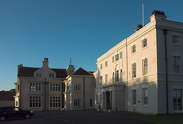
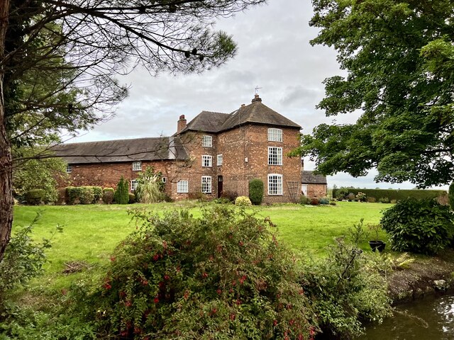
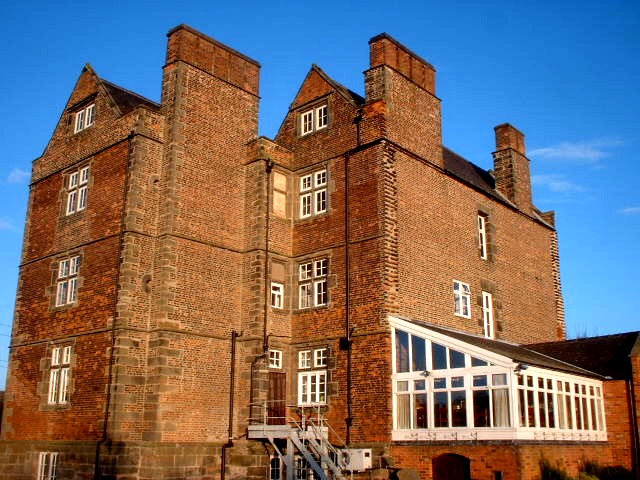
Aston Hall, Aston-on-Trent

Aston Hall is an 18th-century country house, now converted to residential apartments, at Aston-on-Trent, Derbyshire. It is a Grade II* listed building...

All Saints' Church, Aston-upon-Trent

All Saints’ Church, Aston upon Trent is a Grade I listed parish church in the Church of England in Aston-on-Trent, Derbyshire. == History == The church...

Hanson Log Boat

The Hanson Log Boat was a Bronze Age dugout boat found in a gravel pit in Shardlow in Derbyshire. The log boat is now in Derby Museum and Art Gallery....

Derby South services

The Derby South services are two service stations run by Welcome Break on either side of the A50 road. The services are located in South Derbyshire, near...

Shardlow

Shardlow is a village in Derbyshire, England about 6 miles (9.7 km) southeast of Derby and 11 miles (18 km) southwest of Nottingham. Part of the civil...

King's Mill, Castle Donington

King's Mill is the traditional crossing point of the River Trent between Castle Donington in Leicestershire and Weston-on-Trent in Derbyshire. The Mill...

Weston-on-Trent

Weston-on-Trent is a village and civil parish in the South Derbyshire district of Derbyshire. The population of the civil parish at the 2011 census was...

Nearby Amenities

Located within 500m of 52.859996,-1.379864
Aston-on-Trent
Is In Country: UK
Is In County: Derbyshire
Place: village
Wikidata: Q2000768
Wikipedia: en:Aston-on-Trent
Lat/Long: 52.8613422/-1.3840477
Entrance: main
Source: survey
Lat/Long: 52.8615393/-1.3844226
The Village Shop
Addr City: Derby
Addr Housenumber: 19A
Addr Postcode: DE72 2AS
Addr Street: Weston Road
Fhrs Id: 283214
Shop: convenience
Source: survey
Source Addr: FHRS open data
Wheelchair: yes
Lat/Long: 52.8611359/-1.3861177
Barrier: bollard
Lat/Long: 52.8621504/-1.3833201
Post Box
Collection Times: Mo-Fr 17:15; Sa 10:30
Operator: Royal Mail
Operator Wikidata: Q638098
Post Box Design: type_k
Post Box Type: pillar
Ref: DE72 245
Royal Cypher: EIIR
Royal Cypher Wikidata: Q33102113
Source: survey
Lat/Long: 52.8611226/-1.3851436
Telephone
Booth: KX100
Source: survey
Lat/Long: 52.8609207/-1.3851033
Post Office
Aston-on-Trent Post Office and Newsagents
Addr City: Derby
Addr Housenumber: 1
Addr Postcode: DE72 2AE
Addr Street: Derby Road
Fhrs Id: 595307
Ref Pol Id: 3648
Shop: newsagent
Source: survey
Source Addr: FHRS open data
Wheelchair: no
Lat/Long: 52.8613128/-1.3851641
Turning Circle
Lat/Long: 52.8622602/-1.3831063
Entrance: main
Lat/Long: 52.8601604/-1.3853117
Leisure: playground
Lat/Long: 52.8606447/-1.381342
Note: Greatorex Walk sign
Lat/Long: 52.8603786/-1.3830402
Turning Circle
Lat/Long: 52.8605132/-1.3842265
Barrier: cycle_barrier
Lat/Long: 52.8604417/-1.383219
Barrier: cycle_barrier
Lat/Long: 52.8604547/-1.3833825
Leisure: pitch
Sport: cricket
Lat/Long: 52.8601081/-1.3802178
Barrier: stile
Stile: stepover
Lat/Long: 52.86318/-1.3802074
The Salon
Addr City: Derby
Addr Housenumber: 12
Addr Postcode: DE72 2AS
Addr Street: Weston Road
Shop: hairdresser
Source: survey
Lat/Long: 52.8613101/-1.3855702
Bus Stop
White Hart
Bus: yes
Public Transport: platform
Route Ref: 73
Shelter: no
Lat/Long: 52.8616903/-1.3849851
Waste Basket
Colour: green
Operator: South Derbyshire District Council
Waste: dog_excrement
Lat/Long: 52.8616126/-1.3849515
Waste Basket
Colour: black
Material: metal
Operator: South Derbyshire District Council
Waste: trash
Lat/Long: 52.8615998/-1.3849515
Aston on Trent
Information: board
Tourism: information
Lat/Long: 52.8616264/-1.3849407
Advertising: board
Operator: Aston on Trent Parish Council
Lat/Long: 52.861806/-1.3849516
Entrance: main
Lat/Long: 52.8613972/-1.3846969
Addr City: Derby
Addr Housenumber: 3
Addr Postcode: DE72 2DH
Addr Street: Lodge Mews
Source: survey
Source Addr: interpolation
Source Addr Postcode: OS Opendata Codepoint
Lat/Long: 52.8602356/-1.3847536
Addr City: Derby
Addr Housenumber: 4
Addr Postcode: DE72 2DH
Addr Street: Lodge Mews
Source: survey
Source Addr: interpolation
Source Addr Postcode: OS Opendata Codepoint
Lat/Long: 52.8601878/-1.3847415
Addr City: Derby
Addr Housenumber: 5
Addr Postcode: DE72 2DH
Addr Street: Lodge Mews
Source: survey
Source Addr: interpolation
Source Addr Postcode: OS Opendata Codepoint
Lat/Long: 52.8601473/-1.3847281
Addr City: Derby
Addr Housenumber: 6
Addr Postcode: DE72 2DH
Addr Street: Lodge Mews
Source: survey
Source Addr: interpolation
Source Addr Postcode: OS Opendata Codepoint
Lat/Long: 52.8601052/-1.3847147
Addr City: Derby
Addr Housenumber: 8
Addr Postcode: DE72 2DH
Addr Street: Lodge Mews
Source: survey
Source Addr: interpolation
Source Addr Postcode: OS Opendata Codepoint
Lat/Long: 52.860034/-1.3847027
Addr City: Derby
Addr Housenumber: 7
Addr Postcode: DE72 2DH
Addr Street: Lodge Mews
Source: survey
Source Addr Postcode: OS Opendata Codepoint
Lat/Long: 52.8600753/-1.3847067
Addr City: Derby
Addr Housenumber: 9
Addr Postcode: DE72 2DH
Addr Street: Lodge Mews
Source: survey
Source Addr Postcode: OS Opendata Codepoint
Lat/Long: 52.8599919/-1.3846906
Addr City: Derby
Addr Housenumber: 10
Addr Postcode: DE72 2DH
Addr Street: Lodge Mews
Source Addr: interpolation
Source Addr Postcode: OS Opendata Codepoint
Lat/Long: 52.8600016/-1.3846101
Addr City: Derby
Addr Housenumber: 2
Addr Postcode: DE72 2DH
Addr Street: Lodge Mews
Source: survey
Source Addr Postcode: OS Opendata Codepoint
Lat/Long: 52.8602421/-1.3846571
Addr City: Derby
Addr Housenumber: 1
Addr Postcode: DE72 2DH
Addr Street: Lodge Mews
Source: survey
Source Addr Postcode: OS Opendata Codepoint
Lat/Long: 52.8602469/-1.3845913
Waste Basket
Colour: black
Material: metal
Operator: South Derbyshire District Council
Waste: trash
Lat/Long: 52.860758/-1.3850685
Bench
Lat/Long: 52.8607411/-1.3850681
Bench
Lat/Long: 52.8608537/-1.3850802
All Saints' Parish Church
Information: board
Tourism: information
Lat/Long: 52.8602839/-1.3852509
Entrance: main
Lat/Long: 52.8603079/-1.38527
Bench
Lat/Long: 52.8599211/-1.3852589
Entrance: service
Lat/Long: 52.8599592/-1.3853199
Barrier: stile
Lat/Long: 52.8593233/-1.3809797
Addr City: Derby
Addr Housename: The Manor
Addr Postcode: DE72 2DB
Addr Street: Manor Farm Mews
Source Addr: survey
Source Addr Postcode: OS Opendata Codepoint
Lat/Long: 52.8623212/-1.3839813
Addr City: Derby
Addr Housename: The Stables
Addr Housenumber: 1
Addr Postcode: DE72 2DB
Addr Street: Manor Farm Mews
Source Addr: survey
Source Addr Postcode: OS Opendata Codepoint
Lat/Long: 52.8620864/-1.3841409
Addr City: Derby
Addr Housenumber: 5
Addr Postcode: DE72 2DB
Addr Street: Manor Farm Mews
Fixme: Confirm location
Source Addr: survey
Source Addr Postcode: OS Opendata Codepoint
Lat/Long: 52.8624305/-1.3837654
Addr City: Derby
Addr Housenumber: 4
Addr Postcode: DE72 2DB
Addr Street: Manor Farm Mews
Source Addr: survey
Source Addr Postcode: OS Opendata Codepoint
Lat/Long: 52.8623147/-1.3837976
Addr City: Derby
Addr Housename: The Steading
Addr Housenumber: 6
Addr Postcode: DE72 2DB
Addr Street: Manor Farm Mews
Source Addr: survey
Source Addr Postcode: OS Opendata Codepoint
Lat/Long: 52.8621491/-1.3836333
Addr City: Derby
Addr Housenumber: 7
Addr Postcode: DE72 2DB
Addr Street: Manor Farm Mews
Source Addr: survey
Source Addr Postcode: OS Opendata Codepoint
Lat/Long: 52.8620811/-1.3839042
Addr City: Derby
Addr Housenumber: 26
Addr Postcode: DE72 2AF
Addr Street: Derby Road
Source Addr: survey
Source Addr Postcode: OS Opendata Codepoint
Lat/Long: 52.8621658/-1.3850274
Addr City: Derby
Addr Housenumber: 24
Addr Postcode: DE72 2AF
Addr Street: Derby Road
Source Addr: survey
Source Addr Postcode: OS Opendata Codepoint
Lat/Long: 52.8621002/-1.385018
Addr City: Derby
Addr Housenumber: 22
Addr Postcode: DE72 2AF
Addr Street: Derby Road
Source Addr: survey
Source Addr Postcode: OS Opendata Codepoint
Lat/Long: 52.8620198/-1.3850076
Addr City: Derby
Addr Housenumber: 1A
Addr Postcode: DE72 2AE
Addr Street: Derby Road
Source Addr: survey
Source Addr Postcode: OS Opendata Codepoint
Lat/Long: 52.8614064/-1.3852228
Bar
Notsa
Addr City: Derby
Addr Housenumber: 7
Addr Postcode: DE72 2AE
Addr Street: Derby Road
Addr Village: Aston on Trent
Contact Facebook: https://www.facebook.com/notsa.DBC
Contact Instagram: https://www.instagram.com/notsa_dbc/
Contact Twitter: https://twitter.com/Notsa_DBC
Email: notsa@derbybrewing.co.uk
Fhrs Id: 1608768
Operator: Derby Brewing
Phone: +44 1332 479361
Real Ale: yes
Source Addr: survey
Source Addr Postcode: OS Opendata Codepoint
Website: https://www.notsa-dbc.co.uk/
Lat/Long: 52.8616631/-1.3851578
Addr City: Derby
Addr Housenumber: 3
Addr Postcode: DE72 2AE
Addr Street: Derby Road
Disused Shop: yes
Source Addr: survey
Source Addr Postcode: OS Opendata Codepoint
Lat/Long: 52.8615992/-1.3851573
Bus Stop
Moor Lane
Bench: no
Bus: yes
Public Transport: platform
Route Ref: 73
Shelter: no
Source: survey
Lat/Long: 52.8629457/-1.3849139
Bus Stop
White Hart
Bus: yes
Naptan AtcoCode: 1000DATD5088
Naptan NaptanCode: dbsagdtg
Public Transport: platform
Route Ref: 73
Shelter: no
Lat/Long: 52.8617265/-1.3851237
Addr City: Derby
Addr Housenumber: 26
Addr Postcode: DE72 2AS
Addr Street: Weston Road
Fixme: Confirm location
Source Addr: survey
Source Addr Postcode: OS Opendata Codepoint
Lat/Long: 52.8616467/-1.3863477
Addr City: Derby
Addr Housenumber: 28B
Addr Postcode: DE72 2AS
Addr Street: Weston Road
Fixme: Confirm location
Source Addr: survey
Source Addr Postcode: OS Opendata Codepoint
Lat/Long: 52.8615678/-1.3863778
Addr City: Derby
Addr Housename: The Willows
Addr Housenumber: 28A
Addr Postcode: DE72 2AS
Addr Street: Weston Road
Fixme: Confirm location
Source Addr: survey
Source Addr Postcode: OS Opendata Codepoint
Lat/Long: 52.861418/-1.386284
Addr City: Derby
Addr Housenumber: 28
Addr Postcode: DE72 2AS
Addr Street: Weston Road
Source Addr: survey
Source Addr Postcode: OS Opendata Codepoint
Lat/Long: 52.8613014/-1.3862947
Addr City: Derby
Addr Housenumber: 34
Addr Postcode: DE72 2AS
Addr Street: Weston Road
Fixme: Number needs confirming (looks like two dwellings that have been combined)
Source Addr: survey
Source Addr Postcode: OS Opendata Codepoint
Lat/Long: 52.8613161/-1.3868503
Addr City: Derby
Addr Housenumber: 36
Addr Postcode: DE72 2AS
Addr Street: Weston Road
Source Addr: survey
Source Addr Postcode: OS Opendata Codepoint
Lat/Long: 52.8613113/-1.3869602
Addr City: Derby
Addr Housenumber: 14
Addr Postcode: DE72 2AS
Addr Street: Weston Road
Source Addr: survey
Source Addr Postcode: OS Opendata Codepoint
Lat/Long: 52.8613098/-1.3856314
Addr City: Derby
Addr Housenumber: 23
Addr Postcode: DE72 2AS
Addr Street: Weston Road
Source Addr: survey
Source Addr Postcode: OS Opendata Codepoint
Lat/Long: 52.8609315/-1.3863132
Addr City: Derby
Addr Housename: Ledmore
Addr Housenumber: 21
Addr Postcode: DE72 2AS
Addr Street: Weston Road
Source Addr: survey
Source Addr Postcode: OS Opendata Codepoint
Lat/Long: 52.8611221/-1.3864962
Addr City: Derby
Addr Housenumber: 5
Addr Postcode: DE72 2DD
Addr Street: Aston Hall Drive
Fixme: Confirm location
Source Addr: survey
Source Addr Postcode: OS Opendata Codepoint
Lat/Long: 52.859253/-1.3849663
Addr City: Derby
Addr Housenumber: 7
Addr Postcode: DE72 2DD
Addr Street: Aston Hall Drive
Source Addr: survey
Source Addr Postcode: OS Opendata Codepoint
Lat/Long: 52.8592408/-1.3847637
Addr City: Derby
Addr Housenumber: 9
Addr Postcode: DE72 2DD
Addr Street: Aston Hall Drive
Source Addr: survey
Source Addr Postcode: OS Opendata Codepoint
Lat/Long: 52.8591364/-1.3847839
Addr City: Derby
Addr Housenumber: 11
Addr Postcode: DE72 2DD
Addr Street: Aston Hall Drive
Source Addr: survey
Source Addr Postcode: OS Opendata Codepoint
Lat/Long: 52.8590246/-1.384808
Addr City: Derby
Addr Housenumber: 15
Addr Postcode: DE72 2DD
Addr Street: Aston Hall Drive
Source Addr: survey
Source Addr Postcode: OS Opendata Codepoint
Lat/Long: 52.8589614/-1.384926
Addr City: Derby
Addr Housenumber: 17
Addr Postcode: DE72 2DD
Addr Street: Aston Hall Drive
Source Addr: survey
Source Addr Postcode: OS Opendata Codepoint
Lat/Long: 52.858976/-1.3851433
Addr City: Derby
Addr Housenumber: 19
Addr Postcode: DE72 2DD
Addr Street: Aston Hall Drive
Source Addr: survey
Source Addr Postcode: OS Opendata Codepoint
Lat/Long: 52.8588056/-1.3854323
Addr City: Derby
Addr Housenumber: 21
Addr Postcode: DE72 2DD
Addr Street: Aston Hall Drive
Source Addr: survey
Source Addr Postcode: OS Opendata Codepoint
Lat/Long: 52.8587108/-1.3853545
Addr City: Derby
Addr Housenumber: 23
Addr Postcode: DE72 2DD
Addr Street: Aston Hall Drive
Source Addr: survey
Source Addr Postcode: OS Opendata Codepoint
Lat/Long: 52.8586388/-1.3854417
Power: pole
Lat/Long: 52.8639289/-1.3831985
Generator Method: photovoltaic
Generator Output Electricity: yes
Generator Source: solar
Generator Type: solar_photovoltaic_panel
Location: roof
Power: generator
Lat/Long: 52.8633929/-1.3838005
Generator Method: solar_thermal
Generator Output Hot Water: yes
Generator Source: solar
Generator Type: solar_thermal_collector
Location: roof
Power: generator
Lat/Long: 52.8633096/-1.3843748
Generator Method: solar_thermal
Generator Output Hot Water: yes
Generator Source: solar
Generator Type: solar_thermal_collector
Location: roof
Power: generator
Lat/Long: 52.8633011/-1.3845562
Generator Method: photovoltaic
Generator Output Electricity: yes
Generator Source: solar
Generator Type: solar_photovoltaic_panel
Location: roof
Power: generator
Lat/Long: 52.861779/-1.3831507
Generator Method: photovoltaic
Generator Output Electricity: yes
Generator Source: solar
Generator Type: solar_photovoltaic_panel
Location: roof
Power: generator
Lat/Long: 52.8627571/-1.3815481
Generator Method: photovoltaic
Generator Output Electricity: yes
Generator Source: solar
Generator Type: solar_photovoltaic_panel
Location: roof
Power: generator
Lat/Long: 52.8602809/-1.3844158
Generator Method: photovoltaic
Generator Output Electricity: yes
Generator Source: solar
Generator Type: solar_photovoltaic_panel
Location: roof
Power: generator
Lat/Long: 52.8611293/-1.384554
Generator Method: photovoltaic
Generator Output Electricity: yes
Generator Source: solar
Generator Type: solar_photovoltaic_panel
Location: roof
Power: generator
Lat/Long: 52.8600503/-1.3868285
Generator Method: photovoltaic
Generator Output Electricity: yes
Generator Source: solar
Generator Type: solar_photovoltaic_panel
Location: roof
Power: generator
Lat/Long: 52.8599693/-1.3857851
Generator Method: photovoltaic
Generator Output Electricity: yes
Generator Source: solar
Generator Type: solar_photovoltaic_panel
Location: roof
Power: generator
Lat/Long: 52.8624122/-1.3858629
Defibrillator
Access: yes
Defibrillator Location: outside Aston Recreation Centre - facing car park
Emergency: defibrillator
Indoor: no
Ref GB The Circuit: 224023F7-6562-407C-B74D-ADDD00F1E412
Lat/Long: 52.8594967/-1.3802384
Waste Basket
Colour: blue
Material: plastic
Operator: South Derbyshire District Council
Waste: trash
Lat/Long: 52.8593955/-1.3810343
Waste Basket
Colour: blue
Material: plastic
Operator: South Derbyshire District Council
Waste: trash
Lat/Long: 52.8606877/-1.3804818
Waste Basket
Colour: black
Material: plastic
Operator: South Derbyshire District Council
Waste: trash
Lat/Long: 52.8605719/-1.3813214
Waste Basket
Colour: brown
Material: plastic
Operator: South Derbyshire District Council
Waste: trash
Lat/Long: 52.8606156/-1.3816624
Waste Basket
Colour: green
Material: plastic
Operator: South Derbyshire District Council
Waste: trash
Lat/Long: 52.860675/-1.3811993
Waste Basket
Colour: black
Material: metal
Operator: South Derbyshire District Council
Waste: trash
Lat/Long: 52.8604579/-1.3851215
Waste Basket
Colour: black
Material: metal
Operator: South Derbyshire District Council
Waste: trash
Lat/Long: 52.8617207/-1.3851235
Waste Basket
Colour: red
Operator: South Derbyshire District Council
Waste: dog_excrement
Lat/Long: 52.8572211/-1.3851695
Waste Basket
Colour: red
Operator: South Derbyshire District Council
Waste: dog_excrement
Lat/Long: 52.8593484/-1.3808564
Waste Basket
Colour: red
Operator: South Derbyshire District Council
Waste: dog_excrement
Lat/Long: 52.8605126/-1.381748
Waste Basket
Colour: red
Operator: South Derbyshire District Council
Waste: dog_excrement
Lat/Long: 52.8604461/-1.3830516
The data included in this document is from www.openstreetmap.org. The data is made available under ODbL.

Have you been to Aston-on-Trent?

Leave your review of Aston-on-Trent below (or comments, questions and feedback).