Aston-By-Stone

Settlement in Staffordshire Stafford

England

Aston-By-Stone

Upper Burston Bridge 86 Trent and Mersey Canal near Burston
Upper Burston Bridge 86 Credit: Mike Todd

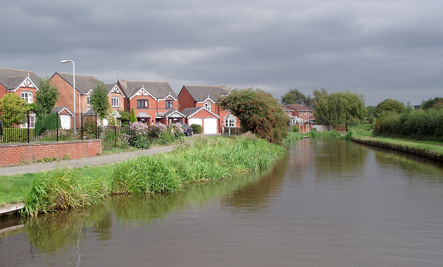
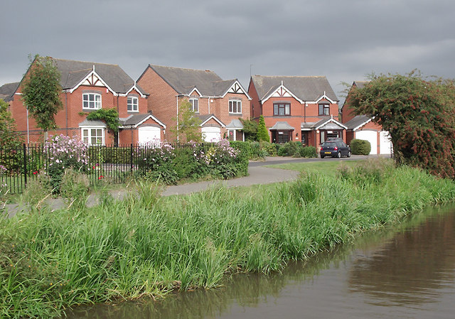
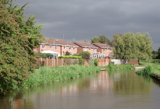
Aston-By-Stone is a small village located in the county of Staffordshire, England. It lies approximately 6 miles southeast of the town of Stafford and is situated on the banks of the River Trent. The village is known for its picturesque rural setting and historic charm.

The origins of Aston-By-Stone can be traced back to the Anglo-Saxon period, with evidence of human settlement in the area dating back over a thousand years. The village was mentioned in the Domesday Book of 1086, highlighting its significance in medieval times.

Today, Aston-By-Stone retains much of its traditional character, with a mix of historic buildings and newer developments. The village center features a charming church, St. Saviour's, which dates back to the 12th century. The church is known for its impressive architecture and serves as a focal point for the local community.

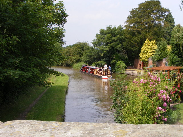
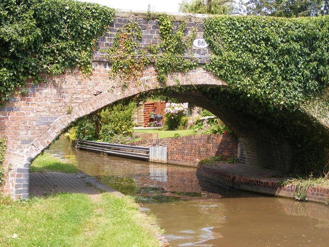
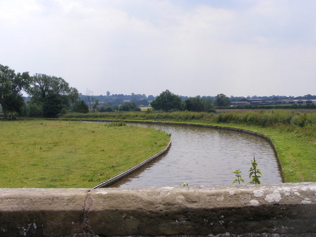
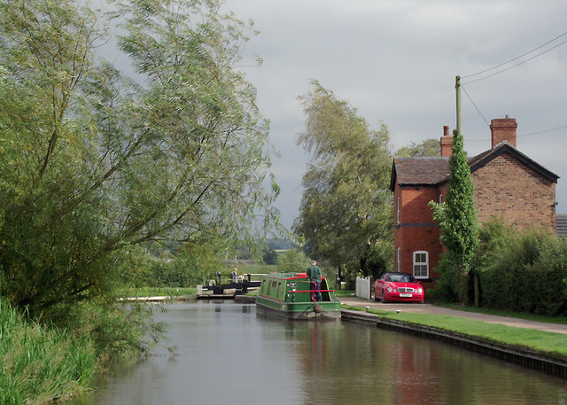
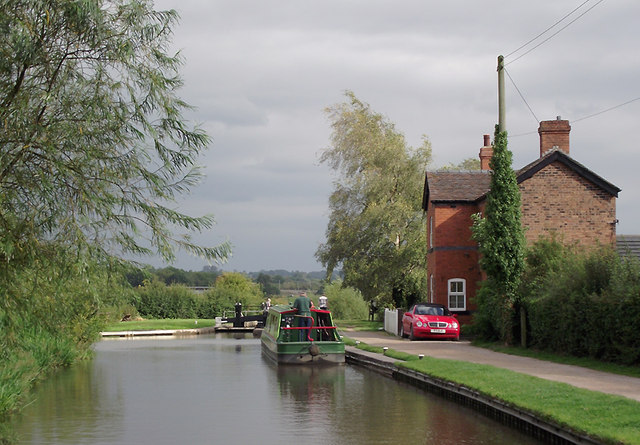
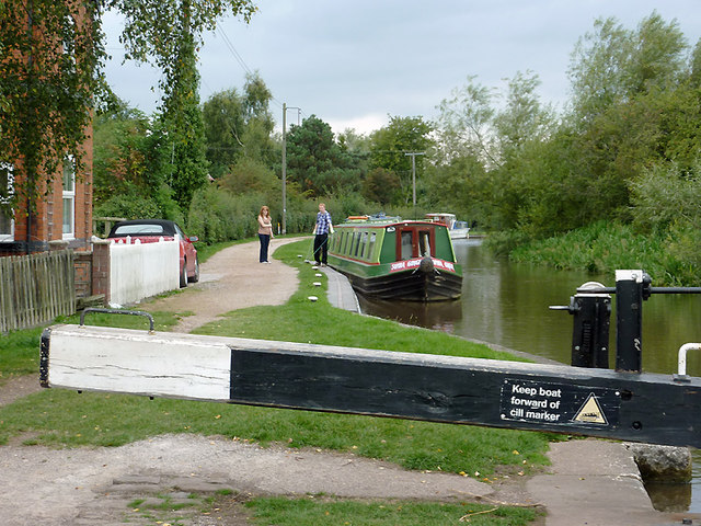
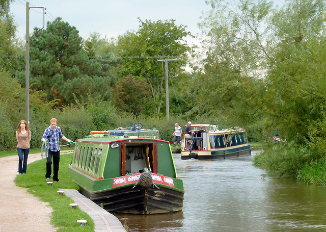
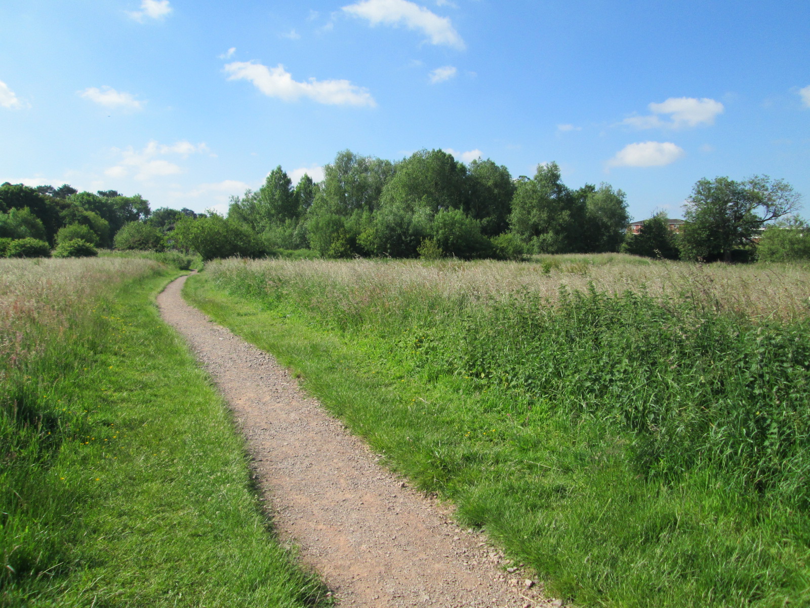
The surrounding countryside offers beautiful views and ample opportunities for outdoor activities. The River Trent, which runs alongside the village, is a popular spot for fishing and boating enthusiasts. The nearby Cannock Chase, an Area of Outstanding Natural Beauty, provides ample opportunities for hiking, cycling, and wildlife spotting.

Aston-By-Stone is a close-knit community, with a range of amenities including a village hall, a primary school, and a few local shops and pubs. It offers a peaceful and tranquil setting, making it an ideal place for those seeking a quieter, rural lifestyle while still being within easy reach of larger towns and cities.

If you have any feedback on the listing, please let us know in the comments section below.

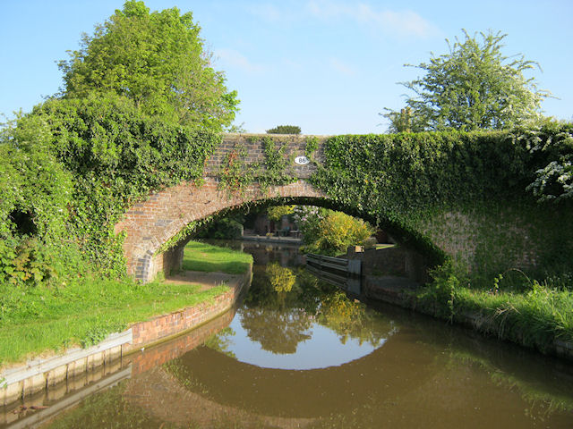
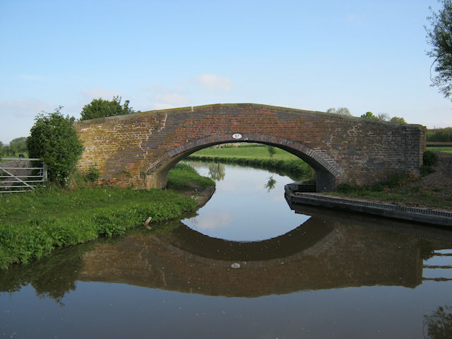
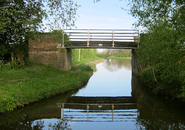
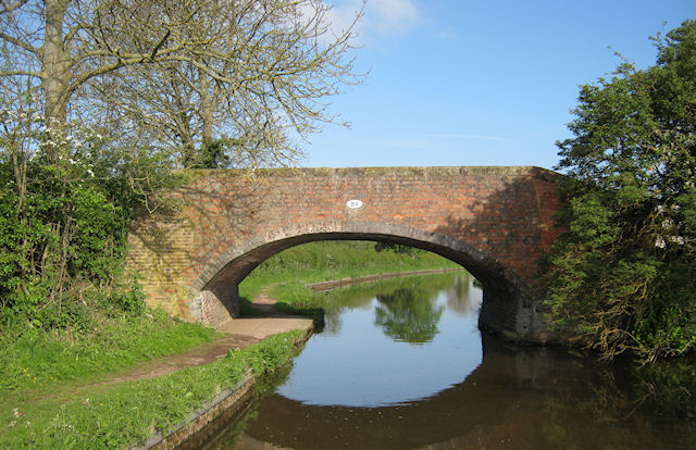
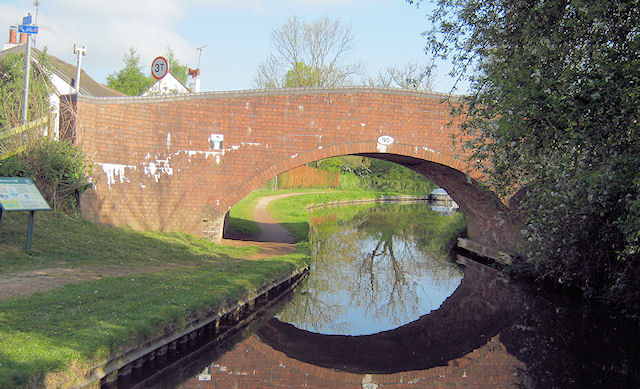
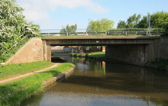
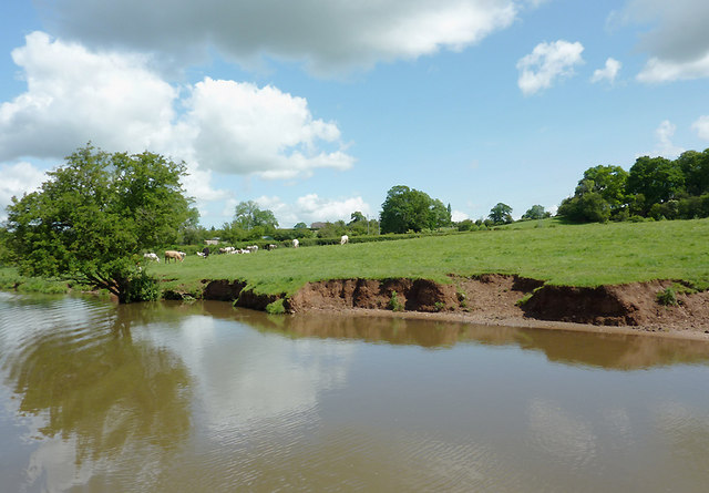
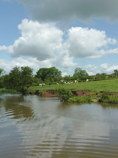
Aston-By-Stone Images

Images are sourced within 2km of 52.871849/-2.1302343 or Grid Reference SJ9130. Thanks to Geograph Open Source API. All images are credited.

Upper Burston Bridge 86 Trent and Mersey Canal near Burston
Upper Burston Bridge 86
Trent and Mersey Canal near Burston
Long Meadow Bridge 87 Trent and Mersey Canal, south of Stone
Long Meadow Bridge 87
Trent and Mersey Canal, south of Stone
Iron Bridge 88 Trent and Mersey Canal, south of Stone
Iron Bridge 88
Trent and Mersey Canal, south of Stone
Carr House Bridge 89 Trent and Mersey Canal, south of Stone
Carr House Bridge 89
Trent and Mersey Canal, south of Stone
Aston Bridge 90 Trent and mersey Canal, south of Stone
Aston Bridge 90
Trent and mersey Canal, south of Stone
Bridge 90A - A51 Trent and Mersey Canal, south of Stone. New road bridge for A51
Bridge 90A - A51
Trent and Mersey Canal, south of Stone. New road bridge for A51
Canal-side pasture south-east of Stone, Staffordshire Trent and Mersey Canal.
The canal was fully opened by 1777, engineered by James Brindley. It is 93 miles in length between Preston Brook and Derwent Mouth (Shardlow).

Erosion of the banks here can be exacerbated by cattle coming for water, and by boat crews who cause a wash by excess speed. Dredging and piling will probably be attended to before long.
Canal-side pasture south-east of Stone, Staffordshire
Trent and Mersey Canal. The canal was fully opened by 1777, engineered by James Brindley. It is 93 miles in length between Preston Brook and Derwent Mouth (Shardlow). Erosion of the banks here can be exacerbated by cattle coming for water, and by boat crews who cause a wash by excess speed. Dredging and piling will probably be attended to before long.
Trent and Mersey Canal south-east of Stone, Staffordshire The canal was fully opened by 1777, engineered by James Brindley. It is 93 miles in length between Preston Brook and Derwent Mouth (Shardlow).

Erosion of the banks here can be exacerbated by cattle coming for water, and by boat crews who cause a wash by excess speed. Dredging and piling will probably be attended to before long.
Trent and Mersey Canal south-east of Stone, Staffordshire
The canal was fully opened by 1777, engineered by James Brindley. It is 93 miles in length between Preston Brook and Derwent Mouth (Shardlow). Erosion of the banks here can be exacerbated by cattle coming for water, and by boat crews who cause a wash by excess speed. Dredging and piling will probably be attended to before long.
Passing Bridge 86 The view of the Trent and Mersey Canal from the Upper Burston Bridge.
Passing Bridge 86
The view of the Trent and Mersey Canal from the Upper Burston Bridge.
Bridge 86 The view of the Trent and Mersey Canal and the Upper Burston Bridge.
Bridge 86
The view of the Trent and Mersey Canal and the Upper Burston Bridge.
Canal Bridge View The view of the Trent and Mersey Canal from the Upper Burston Bridge.
Canal Bridge View
The view of the Trent and Mersey Canal from the Upper Burston Bridge.
Trent and Mersey Canal near Aston-by-Stone, Staffordshire Aston Lock is Lock No 26 on the Trent and Mersey Canal. The Trent and Mersey Canal is 93.5 miles in length from Derwent Mouth to Preston Brook. The first sod was cut by Josiah Wedgwood in July 1766 at Middleport (Stoke-on-Trent) and the whole canal was open for business by 1777.
Trent and Mersey Canal near Aston-by-Stone, Staffordshire
Aston Lock is Lock No 26 on the Trent and Mersey Canal. The Trent and Mersey Canal is 93.5 miles in length from Derwent Mouth to Preston Brook. The first sod was cut by Josiah Wedgwood in July 1766 at Middleport (Stoke-on-Trent) and the whole canal was open for business by 1777.
Waiting at Aston Lock, Staffordshire Most hire boats begin their week's journey on a Saturday afternoon, so the mass exodus from Stone can result in a queue of vessels here soon after.

The Trent and Mersey Canal is 93.5 miles in length from Derwent Mouth to Preston Brook. The first sod was cut by Josiah Wedgwood in July 1766 at Middleport (Stoke-on-Trent) and the whole canal was open for business by 1777.
Waiting at Aston Lock, Staffordshire
Most hire boats begin their week's journey on a Saturday afternoon, so the mass exodus from Stone can result in a queue of vessels here soon after. The Trent and Mersey Canal is 93.5 miles in length from Derwent Mouth to Preston Brook. The first sod was cut by Josiah Wedgwood in July 1766 at Middleport (Stoke-on-Trent) and the whole canal was open for business by 1777.
Waiting at Aston Lock, Staffordshire Most hire boats begin their week's journey on a Saturday afternoon, so the mass exodus from Stone can result in a queue of vessels here soon after. Here, at 16:30 GMT, narrowboat Sophia Ginger with somewhat matching crew, will have waited about an hour to descend Lock No 26 on the Trent and Mersey Canal about a mile south-east of Stone.

The Trent and Mersey Canal is 93.5 miles in length from Derwent Mouth to Preston Brook. The first sod was cut by Josiah Wedgwood in July 1766 at Middleport (Stoke-on-Trent) and the whole canal was open for business by 1777.
Waiting at Aston Lock, Staffordshire
Most hire boats begin their week's journey on a Saturday afternoon, so the mass exodus from Stone can result in a queue of vessels here soon after. Here, at 16:30 GMT, narrowboat Sophia Ginger with somewhat matching crew, will have waited about an hour to descend Lock No 26 on the Trent and Mersey Canal about a mile south-east of Stone. The Trent and Mersey Canal is 93.5 miles in length from Derwent Mouth to Preston Brook. The first sod was cut by Josiah Wedgwood in July 1766 at Middleport (Stoke-on-Trent) and the whole canal was open for business by 1777.
Trent and Mersey Canal at Little Stoke, Staffordshire This smart late twentieth century housing development by the Trent and Mersey Canal is at the south-eastern limit of Stone's residential area. Colours often seem to be enhanced when bright sunlight in the foreground is backed by stormy rain clouds.
Trent and Mersey Canal at Little Stoke, Staffordshire
This smart late twentieth century housing development by the Trent and Mersey Canal is at the south-eastern limit of Stone's residential area. Colours often seem to be enhanced when bright sunlight in the foreground is backed by stormy rain clouds.
Canalside housing at Little Stoke, Staffordshire This smart late twentieth century housing development by the Trent and Mersey Canal is at the south-eastern limit of Stone's residential area.
Canalside housing at Little Stoke, Staffordshire
This smart late twentieth century housing development by the Trent and Mersey Canal is at the south-eastern limit of Stone's residential area.
Trent and Mersey Canal at Little Stoke, Staffordshire This late twentieth century housing development by the Trent and Mersey Canal is at the south-eastern limit of Stone's residential area. Colours often seem to be enhanced when bright sunlight in the foreground is backed by stormy rain clouds.
Trent and Mersey Canal at Little Stoke, Staffordshire
This late twentieth century housing development by the Trent and Mersey Canal is at the south-eastern limit of Stone's residential area. Colours often seem to be enhanced when bright sunlight in the foreground is backed by stormy rain clouds.
Show me another place!

Aston-By-Stone is located at Grid Ref: SJ9130 (Lat: 52.871849, Lng: -2.1302343)

Administrative County: Staffordshire

District: Stafford

Police Authority: Staffordshire

What 3 Words

///courts.lateral.purified. Near Stone, Staffordshire

Nearby Locations

Aston-By-Stone

Related Wikis

Aston-By-Stone

Aston-By-Stone is a village and civil parish in the Borough of Stafford in Staffordshire, England. It is close to the town of Stone and city of Stoke-on...

Yarlet School

Yarlet School, formerly Yarlet Hall, is a coeducational preparatory school located in the district of Yarlet, 3 miles (4.8 km) north of the county town...

Aston-by-Stone railway station

Aston-by-Stone railway station is a disused railway station in the village of Aston, Staffordshire, England. == History == Opened by the North Staffordshire...

Whitgreave

Whitgreave is a very small village a few miles to the NNW of Stafford situated midway between the M6 motorway to the west and the A34 trunk road to the...

Lichfield Road, Stone

Lichfield Road is a cricket ground in Stone, Staffordshire. The ground was established in 1948, when Staffordshire played Buckinghamshire in the grounds...

Marston, Milwich

Marston is a village and civil parish 12 miles (19 km) south of Stoke-on-Trent, in the Stafford district, in the county of Staffordshire, England. In 2011...

Stafford services

Stafford services is a pair of motorway service stations on the M6 motorway near Stone, Staffordshire, England. In August 2011 it was rated as 4 stars...

Stone Meadows

Stone Meadows is a local nature reserve adjacent to Stone, in Staffordshire, England. There are three separate meadows by the River Trent. Goodall Meadow...

Nearby Amenities

Located within 500m of 52.871849,-2.1302343
Aston Garage
Historic Amenity: fuel
Lat/Long: 52.8762449/-2.1304378
Bus Stop
Crown Inn PH
Bus: yes
Naptan AtcoCode: 3800C737201
Naptan Bearing: S
Naptan CommonName: Crown Inn PH
Naptan Indicator: Opp
Naptan Landmark: Crown Inn PH
Naptan Street: Stafford Rd
Naptan Verified: no
Public Transport: platform
Source: naptan_import
Lat/Long: 52.8752623/-2.1303876
Bus Stop
Enson Lane
Bus: yes
Naptan AtcoCode: 3800C738501
Naptan Bearing: S
Naptan CommonName: Enson Lane
Naptan Indicator: Adj
Naptan Landmark: Enson Lane
Naptan Street: Stafford Road
Naptan Verified: no
Public Transport: platform
Source: naptan_import
Lat/Long: 52.871377/-2.1301836
Bus Stop
Astonhill Farm
Bus: yes
Naptan AtcoCode: 3800C738502
Naptan Bearing: N
Naptan CommonName: Astonhill Farm
Naptan Indicator: Adj
Naptan Landmark: Astonhill Farm
Naptan Street: Stafford Rd
Naptan Verified: no
Public Transport: platform
Source: naptan_import
Lat/Long: 52.8727154/-2.1305944
Barrier: stile
Lat/Long: 52.8695477/-2.136498
Barrier: stile
Lat/Long: 52.8707959/-2.1349379
Barrier: stile
Lat/Long: 52.8713355/-2.134148
Barrier: stile
Lat/Long: 52.8749193/-2.1331634
Crown Inn
Addr Postcode: ST15 0BH
Addr Street: Stafford Road
Historic Amenity: pub
Lat/Long: 52.8759068/-2.1311119
Noexit: yes
Lat/Long: 52.8740092/-2.1296355
Noexit: yes
Lat/Long: 52.8736223/-2.1298447
Power: pole
Lat/Long: 52.8728129/-2.1293056
Power: pole
Lat/Long: 52.8731694/-2.1300435
Power: pole
Lat/Long: 52.8722385/-2.1292952
Power: pole
Lat/Long: 52.8733912/-2.1295232
Power: pole
Lat/Long: 52.8730285/-2.1280614
Power: pole
Lat/Long: 52.8733863/-2.1306336
Power: pole
Lat/Long: 52.8747543/-2.1250117
Power: pole
Lat/Long: 52.8740258/-2.1257868
Marker: yes
Utility: yes
Lat/Long: 52.8698452/-2.1300988
Parking
Lat/Long: 52.8692287/-2.1305412
Power: pole
Lat/Long: 52.8735296/-2.1269524
Power: pole
Lat/Long: 52.8698922/-2.1289606
Addr Housename: Crown Cottage
Addr Street: Crown Inn Lane
Lat/Long: 52.8756678/-2.1320132
Addr Housename: Well Cottage
Addr Street: Crown Inn Lane
Lat/Long: 52.8756064/-2.1321426
Addr Housename: Bungalow
Addr Street: Crown Inn Lane
Lat/Long: 52.8752048/-2.1326355
The data included in this document is from www.openstreetmap.org. The data is made available under ODbL.

Have you been to Aston-By-Stone?

Leave your review of Aston-By-Stone below (or comments, questions and feedback).