Foxburrow Plantation

Wood, Forest in Norfolk King's Lynn and West Norfolk

England

Foxburrow Plantation

Carrstone cottages in Crimplesham Typical building material in the area.
Carrstone cottages in Crimplesham Credit: Hugh Venables

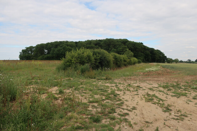
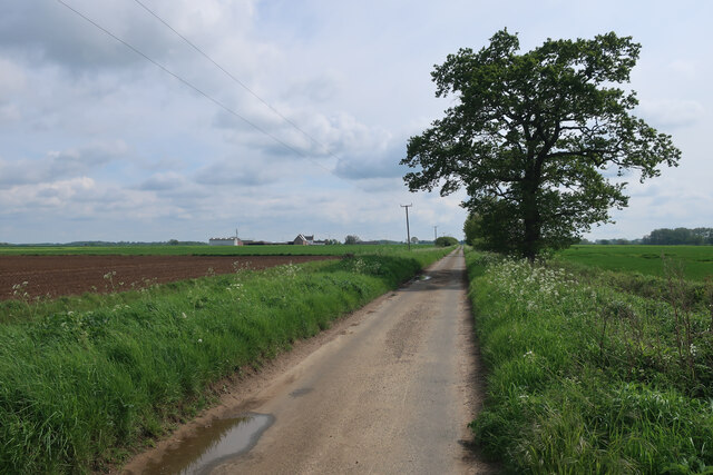
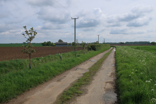
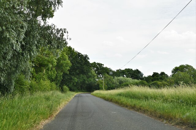
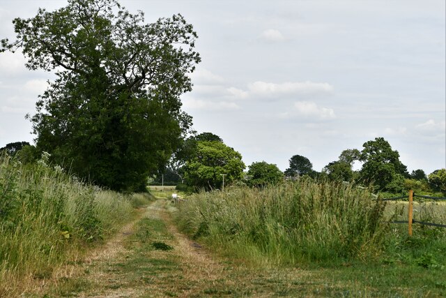
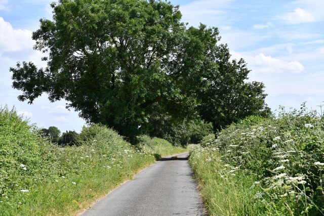
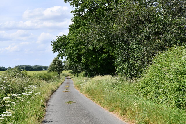
Foxburrow Plantation is a stunning woodland located in Norfolk, England. Situated in the heart of the county, this enchanting forest spans over 200 acres and offers a tranquil escape for nature enthusiasts and outdoor lovers alike.

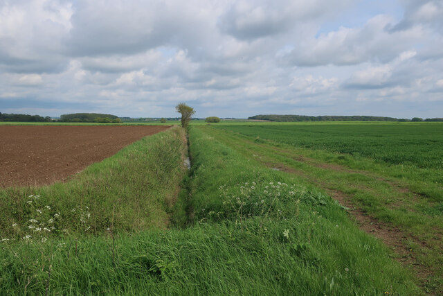
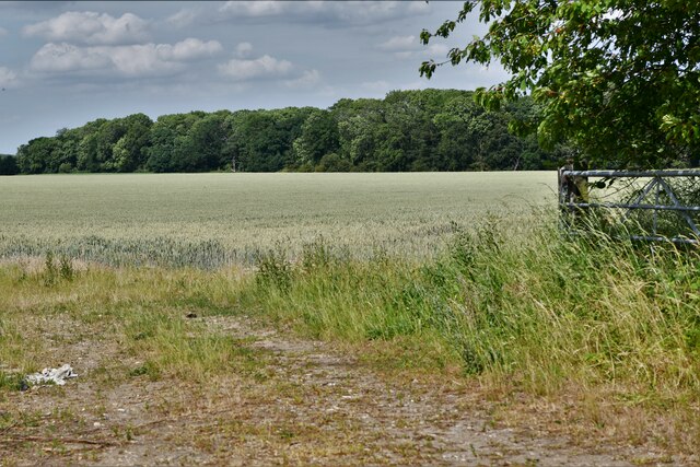
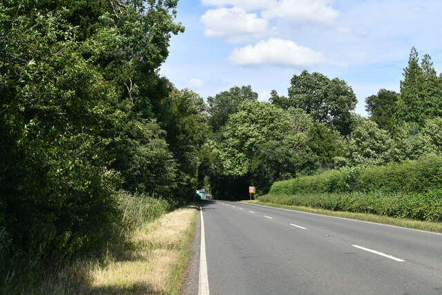
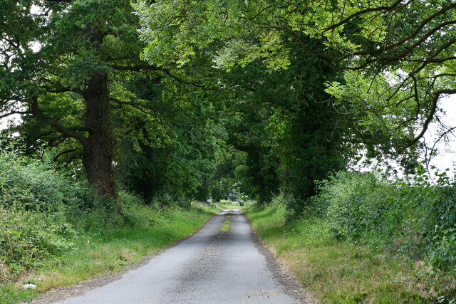
The plantation is characterized by its dense and mature woodlands, which are predominantly composed of native tree species such as oak, beech, and birch. Towering trees form a lush canopy that provides shade and seclusion, creating a serene and peaceful atmosphere. The forest floor is covered in a rich carpet of ferns, wildflowers, and mosses, adding to the beauty and biodiversity of the area.

Foxburrow Plantation is home to a diverse range of wildlife, making it a haven for nature lovers. Visitors may spot a variety of bird species, including woodpeckers, owls, and warblers, as well as small mammals like foxes, badgers, and rabbits. The plantation's secluded location and abundance of natural resources also attract a wide array of insects, butterflies, and reptiles.

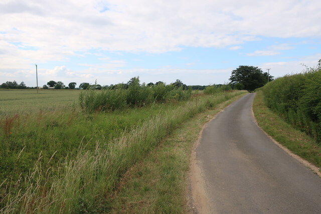
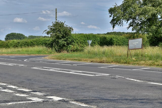
For those looking to explore the plantation, a network of well-maintained walking trails meander through the woodland, allowing visitors to discover its hidden gems at their own pace. These trails offer breathtaking views of the surrounding countryside and provide an opportunity to immerse oneself in the peacefulness of nature.

Foxburrow Plantation is not only a place of natural beauty but also holds historical significance. Its long-standing presence dates back centuries, and remnants of old structures can still be found within the woodland, offering glimpses into its past.

Whether seeking solace in nature, observing wildlife, or delving into history, Foxburrow Plantation is an idyllic destination that showcases the beauty and diversity of Norfolk's woodlands.

If you have any feedback on the listing, please let us know in the comments section below.

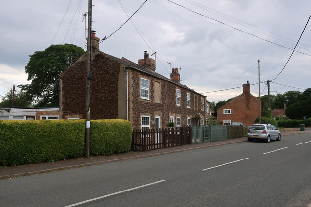
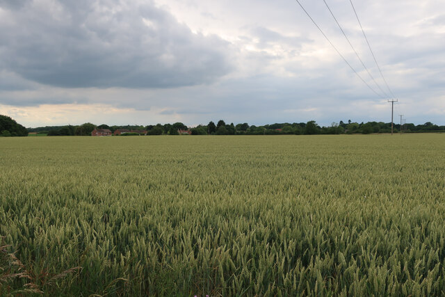
Foxburrow Plantation Images

Images are sourced within 2km of 52.617159/0.45337123 or Grid Reference TF6604. Thanks to Geograph Open Source API. All images are credited.

Carrstone cottages in Crimplesham Typical building material in the area.
Carrstone cottages in Crimplesham
Typical building material in the area.
Wood by Willow Heath Road
Willow Heath Road
Willow Heath Road
Wheat field by Willow Heath Road
Black Drove
Black Drove
Footpath from Black Drove
Black Drove towards Besenel Farm
Crimplesham: Where Main Road joins the A134
Stow Bardolph: Fincham Road
Stow Bardolph, Fincham Road: Track
Crimplesham: Stow Barn Road
Crimplesham: Downham Road
Crimplesham: Crop with Crimplesham Wood beyond
Stradsett: A1122 with Foxburrow Plantation and Rose's Wood On the left and right of the photo respectively.
Stradsett: A1122 with Foxburrow Plantation and Rose's Wood
On the left and right of the photo respectively.
Stradsett: Lynn Road
Stradsett: Christabel Plantation entrance
Stradsett: Lynn Road
Show me another place!

Foxburrow Plantation is located at Grid Ref: TF6604 (Lat: 52.617159, Lng: 0.45337123)

Administrative County: Norfolk

District: King's Lynn and West Norfolk

Police Authority: Norfolk

What 3 Words

///infringe.transmits.outline. Near Downham Market, Norfolk

Related Wikis

Stradsett

Stradsett is a village and civil parish in the English county of Norfolk The village is 40.8 miles (65.7 km) west of Norwich, 11.3 miles (18.2 km) south...

Crimplesham

Crimplesham is a village and civil parish in the English county of Norfolk. It is situated 2.5 miles (4.0 km) east of the small town of Downham Market...

Fincham

Fincham is a village and civil parish the English county of Norfolk. The village is located 9.4 miles (15.1 km) south of King's Lynn and 34 miles (55 km...

Winnold House

Winnold House, formerly the Benedictine Priory of St Winwaloe, is a country house in the parish of Wereham in Norfolk, England. The house is constructed...

Shouldham Thorpe

Shouldham Thorpe is a village and civil parish in the English county of Norfolk. It covers an area of 5.87 km2 (2.27 sq mi) and had a population of 157...

RAF Downham Market

Royal Air Force Downham Market, or more simply RAF Downham Market, was a Royal Air Force station in the west of the county of Norfolk, England which operated...

Stow Bardolph

Stow Bardolph, sometimes simply referred to as Stow, is an estate and civil parish in the English county of Norfolk, lying between King's Lynn and Downham...

Wereham

Wereham is a small village and civil parish in the English county of Norfolk. == Location == Wereham lies in the Wissey valley and is on the main A134...

Nearby Amenities

Located within 500m of 52.617159,0.45337123
Oak Farm
Landuse: farm
Note Retag: CS #48756035
Lat/Long: 52.6153417/0.4579044
Stradsett
Place: hamlet
Lat/Long: 52.6169599/0.4588366
Bus Stop
Rose's Wood Layby, adj
Bus: yes
Naptan AtcoCode: 2900S534
Naptan Bearing: N
Naptan BusStopType: CUS
Naptan CommonName: Rose's Wood Layby
Naptan Indicator: adj
Naptan Landmark: Rose's Wood Layby
Naptan Locality: Stradsett
Naptan NaptanCode: nfodwawt
Naptan Street: A134
Physically Present: yes
Public Transport: platform
Shelter: no
Source: naptan_import;survey
Lat/Long: 52.6174263/0.4580165
Bus Stop
Home Farm, adj
Bus: yes
Naptan AtcoCode: 2900S532
Naptan Bearing: NE
Naptan BusStopType: CUS
Naptan CommonName: Home Farm
Naptan Indicator: adj
Naptan Locality: Stradsett
Naptan NaptanCode: nfodwawm
Naptan Street: Downham Road
Naptan Verified: no
Public Transport: platform
Source: naptan_import
Lat/Long: 52.6179613/0.4585248
Bus Stop
Home Farm, opp
Bus: yes
Naptan AtcoCode: 2900S533
Naptan Bearing: SW
Naptan BusStopType: CUS
Naptan CommonName: Home Farm
Naptan Indicator: opp
Naptan Locality: Stradsett
Naptan NaptanCode: nfodwawp
Naptan Street: Downham Road
Naptan Verified: no
Public Transport: platform
Source: naptan_import
Lat/Long: 52.6178613/0.4585783
Bus Stop
Rose's Wood Layby, opp
Bus: yes
Naptan AtcoCode: 2900S535
Naptan Bearing: S
Naptan BusStopType: CUS
Naptan CommonName: Rose's Wood Layby
Naptan Indicator: opp
Naptan Landmark: Rose's Wood Layby
Naptan Locality: Stradsett
Naptan NaptanCode: nfodwdad
Naptan Street: A134
Naptan Verified: no
Public Transport: platform
Source: naptan_import
Lat/Long: 52.6173105/0.4582519
Bus Stop
The Foldgate, adj
Bus: yes
Naptan AtcoCode: 2900S536
Naptan Bearing: S
Naptan BusStopType: CUS
Naptan CommonName: The Foldgate
Naptan Indicator: adj
Naptan Landmark: The Foldgate Inn Public House
Naptan Locality: Stradsett
Naptan NaptanCode: nfodwdag
Naptan Street: Lynn Road
Naptan Verified: no
Public Transport: platform
Source: naptan_import
Lat/Long: 52.6179655/0.4565896
Bus Stop
The Foldgate, opp
Bus: yes
Naptan AtcoCode: 2900S537
Naptan Bearing: N
Naptan BusStopType: CUS
Naptan CommonName: The Foldgate
Naptan Indicator: opp
Naptan Landmark: The Foldgate Inn Public House
Naptan Locality: Stradsett
Naptan NaptanCode: nfodwdaj
Naptan Street: Lynn Road
Naptan Verified: no
Public Transport: platform
Source: naptan_import
Lat/Long: 52.6179141/0.4564685
Traffic Calming: island
Lat/Long: 52.6176573/0.4567906
Give Way
Direction: forward
Lat/Long: 52.617595/0.4568475
Traffic Calming: island
Lat/Long: 52.6176529/0.4580188
Give Way
Direction: backward
Lat/Long: 52.6177278/0.4579794
The data included in this document is from www.openstreetmap.org. The data is made available under ODbL.

Have you been to Foxburrow Plantation?

Leave your review of Foxburrow Plantation below (or comments, questions and feedback).