Felmore

Settlement in Essex Basildon

England

Felmore

TSB Bank, Pitsea
TSB Bank, Pitsea Credit: JThomas

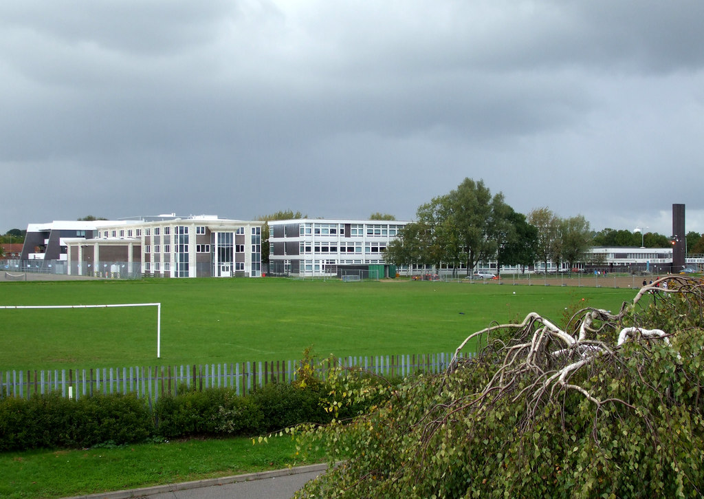
Felmore is a small suburban area located in Basildon, a district in the county of Essex, England. Situated approximately 30 miles east of London, this residential community is part of the larger Basildon borough. Felmore is primarily characterized by its housing estates, which consist mainly of low-rise apartment buildings and row houses.

The area is known for its peaceful and family-friendly atmosphere, making it a popular choice for residents looking for a quiet suburban lifestyle. The housing developments are surrounded by green spaces and parks, offering ample opportunities for outdoor activities and recreation. Felmore is also well-served by a range of amenities, including local shops, supermarkets, and a community center, providing convenient access to everyday necessities and leisure facilities.

Transportation in Felmore is mainly provided by bus services, connecting the area to neighboring towns and Basildon town center, which offers a wider range of amenities and transport links, including a train station with direct services to London. Additionally, Felmore benefits from its proximity to major road networks, such as the A13 and A127, making it easily accessible by car.

Overall, Felmore is a peaceful residential area within the larger Basildon district, offering a tranquil suburban lifestyle with convenient access to amenities and transport links.

If you have any feedback on the listing, please let us know in the comments section below.
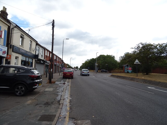
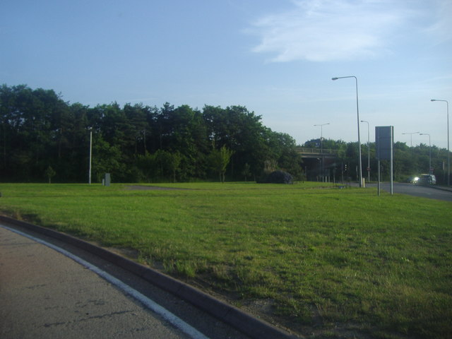
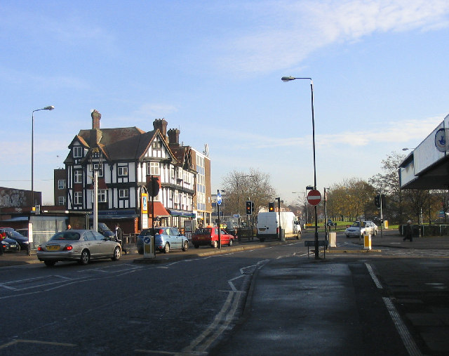
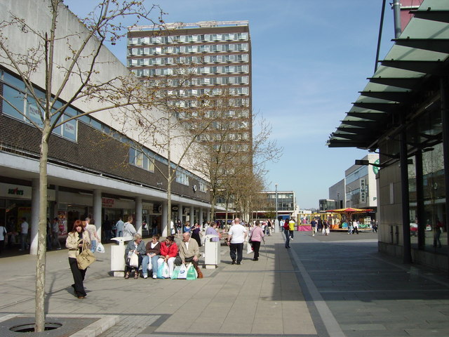
Felmore Images

Images are sourced within 2km of 51.579947/0.508778 or Grid Reference TQ7389. Thanks to Geograph Open Source API. All images are credited.

TSB Bank, Pitsea
TSB Bank, Pitsea
Aldi supermarket, Pitsea, Basildon
B1464, Pitsea, Basildon
Post Office and shop, Pitsea, Basildon
Houses on London Road, Basildon
London Road (B1464), Basildon Towards Southend.
London Road (B1464), Basildon
Towards Southend.
The Gun Pub, Bowers Gifford On London Road.
The Gun Pub, Bowers Gifford
On London Road.
Paycocke Road, Cranes, Basildon Cranes is an area of light industrial units, offices and outlets on the eastern side of Basildon.
Paycocke Road, Cranes, Basildon
Cranes is an area of light industrial units, offices and outlets on the eastern side of Basildon.
The A132 exit on Southend Arterial Road
Playing Field near Montague Street, Basildon
Footbridge over A132 East Mayne, Basildon
A127 Southend Arterial Road Towards Southend, a 1930s state-of-the-art trunk road, rather modified now - e.g. deceleration lanes.
A127 Southend Arterial Road
Towards Southend, a 1930s state-of-the-art trunk road, rather modified now - e.g. deceleration lanes.
A127 Southend Arterial Road Towards Southend, a 1930s state-of-the-art trunk road.
A127 Southend Arterial Road
Towards Southend, a 1930s state-of-the-art trunk road.
ITEC offices on Burnt Mills Road ITEC Learning Technologies offices in Basildon.
ITEC offices on Burnt Mills Road
ITEC Learning Technologies offices in Basildon.
Burnt Mills Road Leading from Basildon towards North Benfleet.
Fast two way traffic, blind bends, no pavements or verges. A really bad place for an evening stroll.
Burnt Mills Road
Leading from Basildon towards North Benfleet. Fast two way traffic, blind bends, no pavements or verges. A really bad place for an evening stroll.
The A127, Nevendon This is the main road from East London to Southend, now a full dual carriageway for the whole length.
The A127, Nevendon
This is the main road from East London to Southend, now a full dual carriageway for the whole length.
Nevendon Road approaching the A127 intersection
A127 - turn-off for A132 The junction here has been rebuilt as a grade-segregated intersection. It used to be a crossroads with traffic lights, which caused a lot of congestion.
A127 - turn-off for A132
The junction here has been rebuilt as a grade-segregated intersection. It used to be a crossroads with traffic lights, which caused a lot of congestion.
Show me another place!

Felmore is located at Grid Ref: TQ7389 (Lat: 51.579947, Lng: 0.508778)

Administrative County: Essex

District: Basildon

Police Authority: Essex

What 3 Words

///poet.device.moth. Near Pitsea, Essex

Nearby Locations

Felmore Basildon

Related Wikis

Northlands Park, Basildon

Northlands Park is a park in Basildon, Essex, England. == History of the park == Basildon Northlands Park was created by Basildon Development Corporation...

Hashtag United F.C.

Hashtag United Football Club is a semi-professional football club based in Essex, England. They are currently members of the Isthmian League Premier Division...

Bowers & Pitsea F.C.

Bowers & Pitsea Football Club is a football club based in Pitsea, Essex, England. The club are currently members of the Isthmian League North Division...

Pitsea

Pitsea is a town and former civil parish in the Borough of Basildon in south Essex, England. It comprises five sub-districts: Eversley, Northlands Park...

Basildon

Basildon ( BAZ-il-dən) is the largest town in the borough of Basildon, within the county of Essex, England. It had a recorded population of 115,955 at...

Chalvedon School

Chalvedon School and 6th Form College was a Specialist Technology College in Pitsea, Essex, England. It was a comprehensive school educating pupils aged...

Barstable School

The Barstable School was a mixed intake secondary school in Basildon, Essex. It closed in 2009 to become a founding member of the Basildon Academies....

Fryerns Comprehensive School

Fryerns Comprehensive School , also known as Fryerns Community School, was a mixed intake secondary school in Basildon, Essex that opened in 1956. The...

Nearby Amenities

Located within 500m of 51.579947,0.508778
Bus Stop
Burlington Court
Bus: yes
Naptan AtcoCode: 150036032019
Naptan Bearing: N
Naptan CommonName: Burlington Court
Naptan Crossing: The Gables
Naptan Indicator: o/s
Naptan Landmark: Burlington Court
Naptan NaptanCode: esxdmpjd
Naptan PlusbusZoneRef: BASILDN
Naptan Street: Davenants
Naptan Verified: no
Public Transport: platform
Source: naptan_import
Lat/Long: 51.5812726/0.5084625
Bus Stop
Loxford
Bus: yes
Naptan AtcoCode: 150036033003
Naptan Bearing: W
Naptan CommonName: Loxford
Naptan Crossing: Loxford
Naptan Indicator: Opp
Naptan Landmark: Loxford
Naptan NaptanCode: esxdmpjp
Naptan PlusbusZoneRef: BASILDN
Naptan Street: Felmores
Naptan Verified: no
Public Transport: platform
Source: naptan_import
Lat/Long: 51.5793712/0.5019054
Bus Stop
Loxford
Bus: yes
Naptan AtcoCode: 150036033004
Naptan Bearing: E
Naptan CommonName: Loxford
Naptan Crossing: Loxford
Naptan Indicator: Adj
Naptan Landmark: Loxford
Naptan NaptanCode: esxdmpjt
Naptan PlusbusZoneRef: BASILDN
Naptan Street: Felmores
Naptan Verified: no
Public Transport: platform
Source: naptan_import
Lat/Long: 51.5794382/0.5025586
Bus Stop
Tenterfields
Bus: yes
Naptan AtcoCode: 150036033007
Naptan Bearing: SE
Naptan CommonName: Tenterfields
Naptan Crossing: Tenterfields
Naptan Indicator: Adj
Naptan Landmark: Tenterfields
Naptan NaptanCode: esxdmpmd
Naptan PlusbusZoneRef: BASILDN
Naptan Street: Lanhams
Naptan Verified: no
Public Transport: platform
Source: naptan_import
Lat/Long: 51.580213/0.5125902
Bus Stop
Great Ranton
Bus: yes
Naptan AtcoCode: 150036033008
Naptan Bearing: W
Naptan CommonName: Great Ranton
Naptan Crossing: Rushley
Naptan Indicator: W-bound
Naptan Landmark: Great Ranton
Naptan NaptanCode: esxdmpmg
Naptan PlusbusZoneRef: BASILDN
Naptan Street: Lanhams
Naptan Verified: no
Public Transport: platform
Source: naptan_import
Lat/Long: 51.5800422/0.5155256
Bus Stop
Davenants
Bus: yes
Naptan AtcoCode: 1500AA107B
Naptan Bearing: E
Naptan CommonName: Davenants
Naptan Crossing: Great Leighs Way
Naptan Indicator: Opp
Naptan Landmark: Davenants
Naptan NaptanCode: esxdmpgt
Naptan PlusbusZoneRef: BASILDN
Naptan Street: Burnt Mills Road
Naptan Verified: no
Public Transport: platform
Source: naptan_import
Lat/Long: 51.5838097/0.5101036
Bus Stop
Voysey Gardens
Bus: yes
Naptan AtcoCode: 1500DAVE1
Naptan Bearing: N
Naptan CommonName: Voysey Gardens
Naptan Crossing: Voysey Gardens
Naptan Indicator: Adj
Naptan Landmark: Voysey Gardens
Naptan NaptanCode: esxgwdjm
Naptan PlusbusZoneRef: BASILDN
Naptan Street: Davenants
Naptan Verified: no
Public Transport: platform
Source: naptan_import
Lat/Long: 51.5835327/0.5087602
Bus Stop
Shops
Bus: yes
Naptan AtcoCode: 1500IM509
Naptan Bearing: E
Naptan CommonName: Shops
Naptan Crossing: Davenants
Naptan Indicator: Opp
Naptan Landmark: Shops
Naptan NaptanCode: esxdmpma
Naptan PlusbusZoneRef: BASILDN
Naptan Street: Lanhams
Naptan Verified: no
Public Transport: platform
Source: naptan_import
Lat/Long: 51.5798041/0.508165
Bus Stop
Shops
Bus: yes
Naptan AtcoCode: 1500IM509B
Naptan Bearing: SW
Naptan CommonName: Shops
Naptan Crossing: Davenants
Naptan Indicator: o/s
Naptan Landmark: Shops
Naptan NaptanCode: esxdmpjw
Naptan PlusbusZoneRef: BASILDN
Naptan Street: Lanhams
Naptan Verified: no
Public Transport: platform
Source: naptan_import
Lat/Long: 51.5794824/0.5078263
Bus Stop
Tenterfields
Bus: yes
Naptan AtcoCode: 1500TENTER
Naptan Bearing: W
Naptan CommonName: Tenterfields
Naptan Crossing: Tenterfields
Naptan Indicator: Opp
Naptan Landmark: Tenterfields
Naptan NaptanCode: esxgwdjd
Naptan PlusbusZoneRef: BASILDN
Naptan Street: Lanhams
Naptan Verified: no
Public Transport: platform
Source: naptan_import
Lat/Long: 51.5804316/0.5112021
Turning Circle
Lat/Long: 51.5832778/0.5058205
Barrier: bollard
Bicycle: yes
Foot: yes
Lat/Long: 51.5828987/0.5128394
Mini Roundabout
Direction: clockwise
Lat/Long: 51.5792561/0.5059533
Traffic Calming: choker
Lat/Long: 51.579357/0.5065711
Crossing
Crossing: uncontrolled
Crossing Ref: zebra
Lat/Long: 51.5798946/0.5085838
Mini Roundabout
Direction: clockwise
Lat/Long: 51.5800018/0.5087928
Turning Circle
Lat/Long: 51.582696/0.5057083
Barrier: bollard
Bicycle: yes
Foot: yes
Motor Vehicle: no
Lat/Long: 51.5790576/0.5111935
Northlands Park Neighbourhood
Place: locality
Lat/Long: 51.5820133/0.5105003
Crossing
Crossing: uncontrolled
Crossing Ref: zebra
Traffic Calming: choker
Lat/Long: 51.5796514/0.5078182
Crossing
Lat/Long: 51.5801253/0.5085993
Turning Circle
Lat/Long: 51.5816395/0.5065488
Turning Circle
Lat/Long: 51.5820383/0.5058693
239 Rectory Road
Tourism: hostel
Lat/Long: 51.5782656/0.5110134
Generator Method: photovoltaic
Generator Output Electricity: yes
Generator Source: solar
Generator Type: solar_photovoltaic_panel
Location: roof
Power: generator
Lat/Long: 51.5803649/0.5107838
Generator Method: photovoltaic
Generator Output Electricity: yes
Generator Source: solar
Generator Type: solar_photovoltaic_panel
Location: roof
Power: generator
Lat/Long: 51.5794915/0.5132943
Generator Method: photovoltaic
Generator Output Electricity: yes
Generator Source: solar
Generator Type: solar_photovoltaic_panel
Location: roof
Power: generator
Lat/Long: 51.5800282/0.5124548
Generator Method: photovoltaic
Generator Output Electricity: yes
Generator Source: solar
Generator Type: solar_photovoltaic_panel
Location: roof
Power: generator
Lat/Long: 51.5798465/0.5143431
Generator Method: photovoltaic
Generator Output Electricity: yes
Generator Source: solar
Generator Type: solar_photovoltaic_panel
Location: roof
Power: generator
Lat/Long: 51.5788014/0.5142814
Generator Method: photovoltaic
Generator Output Electricity: yes
Generator Source: solar
Generator Type: solar_photovoltaic_panel
Location: roof
Power: generator
Lat/Long: 51.5776513/0.5085924
Generator Method: photovoltaic
Generator Output Electricity: yes
Generator Source: solar
Generator Type: solar_photovoltaic_panel
Location: roof
Power: generator
Lat/Long: 51.5776563/0.5086353
Generator Method: photovoltaic
Generator Output Electricity: yes
Generator Source: solar
Generator Type: solar_photovoltaic_panel
Location: roof
Power: generator
Lat/Long: 51.5771929/0.5106577
Generator Method: photovoltaic
Generator Output Electricity: yes
Generator Source: solar
Generator Type: solar_photovoltaic_panel
Location: roof
Power: generator
Lat/Long: 51.5769379/0.5112344
Generator Method: photovoltaic
Generator Output Electricity: yes
Generator Source: solar
Generator Type: solar_photovoltaic_panel
Location: roof
Power: generator
Lat/Long: 51.5769412/0.5112773
Generator Method: photovoltaic
Generator Output Electricity: yes
Generator Source: solar
Generator Type: solar_photovoltaic_panel
Location: roof
Power: generator
Lat/Long: 51.5776279/0.5120873
Generator Method: photovoltaic
Generator Output Electricity: yes
Generator Source: solar
Generator Type: solar_photovoltaic_panel
Location: roof
Power: generator
Lat/Long: 51.5776363/0.5121866
Generator Method: photovoltaic
Generator Output Electricity: yes
Generator Source: solar
Generator Type: solar_photovoltaic_panel
Location: roof
Power: generator
Lat/Long: 51.5768512/0.5047461
Generator Method: photovoltaic
Generator Output Electricity: yes
Generator Source: solar
Generator Type: solar_photovoltaic_panel
Location: roof
Power: generator
Lat/Long: 51.5822466/0.5094373
Generator Method: photovoltaic
Generator Output Electricity: yes
Generator Source: solar
Generator Type: solar_photovoltaic_panel
Location: roof
Power: generator
Lat/Long: 51.5822433/0.5094936
Generator Method: photovoltaic
Generator Output Electricity: yes
Generator Source: solar
Generator Type: solar_photovoltaic_panel
Location: roof
Power: generator
Lat/Long: 51.5823266/0.5095366
Generator Method: photovoltaic
Generator Output Electricity: yes
Generator Source: solar
Generator Type: solar_photovoltaic_panel
Location: roof
Power: generator
Lat/Long: 51.5821033/0.5108938
Generator Method: photovoltaic
Generator Output Electricity: yes
Generator Source: solar
Generator Type: solar_photovoltaic_panel
Location: roof
Power: generator
Lat/Long: 51.5820966/0.5112585
Generator Method: photovoltaic
Generator Output Electricity: yes
Generator Source: solar
Generator Type: solar_photovoltaic_panel
Location: roof
Power: generator
Lat/Long: 51.5829033/0.5120927
Generator Method: photovoltaic
Generator Output Electricity: yes
Generator Source: solar
Generator Type: solar_photovoltaic_panel
Location: roof
Power: generator
Lat/Long: 51.5826183/0.508925
Generator Method: photovoltaic
Generator Output Electricity: yes
Generator Source: solar
Generator Type: solar_photovoltaic_panel
Location: roof
Power: generator
Lat/Long: 51.5833649/0.5090162
Generator Method: photovoltaic
Generator Output Electricity: yes
Generator Source: solar
Generator Type: solar_photovoltaic_panel
Location: roof
Power: generator
Lat/Long: 51.5834099/0.5051431
Generator Method: photovoltaic
Generator Output Electricity: yes
Generator Source: solar
Generator Type: solar_photovoltaic_panel
Location: roof
Power: generator
Lat/Long: 51.5827316/0.5066934
Generator Method: photovoltaic
Generator Output Electricity: yes
Generator Source: solar
Generator Type: solar_photovoltaic_panel
Location: roof
Power: generator
Lat/Long: 51.5827049/0.5067363
Generator Method: photovoltaic
Generator Output Electricity: yes
Generator Source: solar
Generator Type: solar_photovoltaic_panel
Location: roof
Power: generator
Lat/Long: 51.5829049/0.5070904
Generator Method: photovoltaic
Generator Output Electricity: yes
Generator Source: solar
Generator Type: solar_photovoltaic_panel
Location: roof
Power: generator
Lat/Long: 51.5829933/0.5072433
Generator Method: photovoltaic
Generator Output Electricity: yes
Generator Source: solar
Generator Type: solar_photovoltaic_panel
Location: roof
Power: generator
Lat/Long: 51.5832216/0.5060551
Generator Method: photovoltaic
Generator Output Electricity: yes
Generator Source: solar
Generator Type: solar_photovoltaic_panel
Location: roof
Power: generator
Lat/Long: 51.5831849/0.505996
Generator Method: photovoltaic
Generator Output Electricity: yes
Generator Source: solar
Generator Type: solar_photovoltaic_panel
Location: roof
Power: generator
Lat/Long: 51.5831316/0.5059129
Generator Method: photovoltaic
Generator Output Electricity: yes
Generator Source: solar
Generator Type: solar_photovoltaic_panel
Location: roof
Power: generator
Lat/Long: 51.5831649/0.50587
Generator Method: photovoltaic
Generator Output Electricity: yes
Generator Source: solar
Generator Type: solar_photovoltaic_panel
Location: roof
Power: generator
Lat/Long: 51.5817449/0.5024958
Generator Method: photovoltaic
Generator Output Electricity: yes
Generator Source: solar
Generator Type: solar_photovoltaic_panel
Location: roof
Power: generator
Lat/Long: 51.5782655/0.5057734
Generator Method: photovoltaic
Generator Output Electricity: yes
Generator Source: solar
Generator Type: solar_photovoltaic_panel
Location: roof
Power: generator
Lat/Long: 51.578343/0.5052584
Generator Method: photovoltaic
Generator Output Electricity: yes
Generator Source: solar
Generator Type: solar_photovoltaic_panel
Location: roof
Power: generator
Lat/Long: 51.5783364/0.5053604
Generator Method: photovoltaic
Generator Output Electricity: yes
Generator Source: solar
Generator Type: solar_photovoltaic_panel
Location: roof
Power: generator
Lat/Long: 51.5781513/0.5038905
Generator Method: photovoltaic
Generator Output Electricity: yes
Generator Source: solar
Generator Type: solar_photovoltaic_panel
Location: roof
Power: generator
Lat/Long: 51.5795148/0.5103895
Generator Method: photovoltaic
Generator Output Electricity: yes
Generator Source: solar
Generator Type: solar_photovoltaic_panel
Location: roof
Power: generator
Lat/Long: 51.5795331/0.5103466
Generator Method: photovoltaic
Generator Output Electricity: yes
Generator Source: solar
Generator Type: solar_photovoltaic_panel
Location: roof
Power: generator
Lat/Long: 51.5795448/0.5104499
Generator Method: photovoltaic
Generator Output Electricity: yes
Generator Source: solar
Generator Type: solar_photovoltaic_panel
Location: roof
Power: generator
Lat/Long: 51.5796381/0.5105169
Generator Method: photovoltaic
Generator Output Electricity: yes
Generator Source: solar
Generator Type: solar_photovoltaic_panel
Location: roof
Power: generator
Lat/Long: 51.579639/0.5105679
Crossing
Lat/Long: 51.579888/0.5147022
Crossing
Lat/Long: 51.5796154/0.5151234
The data included in this document is from www.openstreetmap.org. The data is made available under ODbL.

Have you been to Felmore?

Leave your review of Felmore below (or comments, questions and feedback).